GR20 Trek – Complete Guide
Table of contents [Show]
- 1. Understanding the GR20 Trail and the Corsica Mountain Region
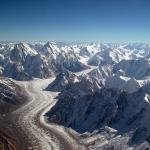
- 2. Geography and Landscape of the Corsican Mountains
- 3. Cultural and Historical Context of the GR20
- 4. Where the GR20 Fits in Global Trekking
- 5. Access and Logistics
- 6. Access to the GR20 Starting Point
- 7. Visa and Entry Requirements for International Travelers
- 8. Travel Insurance Requirements
- 9. Accommodation Before and After the Trek
- 10. Transportation on the Island
- 11. Planning Strategy for International Trekkers
-
12. Complete GR20 Trek Itinerary – Day by Day Route Breakdown
- Day 1 – Calenzana to Refuge d’Ortu di u Piobbu
- Day 2 – Ortu di u Piobbu to Refuge de Carrozzu
- Day 3 – Carrozzu to Refuge d’Asco Stagnu
- Day 4 – Asco Stagnu to Refuge de Tighjettu
- Day 5 – Tighjettu to Refuge de Ciottulu di i Mori
- Day 6 – Ciottulu di i Mori to Refuge de Manganu
- Day 7 – Manganu to Refuge de Petra Piana
- Day 8 – Petra Piana to Vizzavona
- Southern GR20 Section
- Typical Trekking Duration
- 13. Difficulty Level and Physical Preparation for the GR20
- 14. Gear and Equipment Strategy
- 15. Best Time to Trek the GR20 and Seasonal Weather Conditions
- 16. Objective Risks and Mountain Safety
- 17. Food and Water Strategy on the GR20
- 18. Permits and Refuge Reservation System
- 19. Cost Breakdown – Budget Planning
- 20. Route Maps, Navigation, and Altitude Profile
- 21. Final Professional Assessment
1. Understanding the GR20 Trail and the Corsica Mountain Region
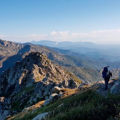
The GR20 (Grande Randonnée 20) is one of the most demanding long-distance trekking routes in Europe. The trail crosses the mountainous interior of the island of Corsica from north to south, linking the village of Calenzana in the northwest with Conca on the southeastern coast.
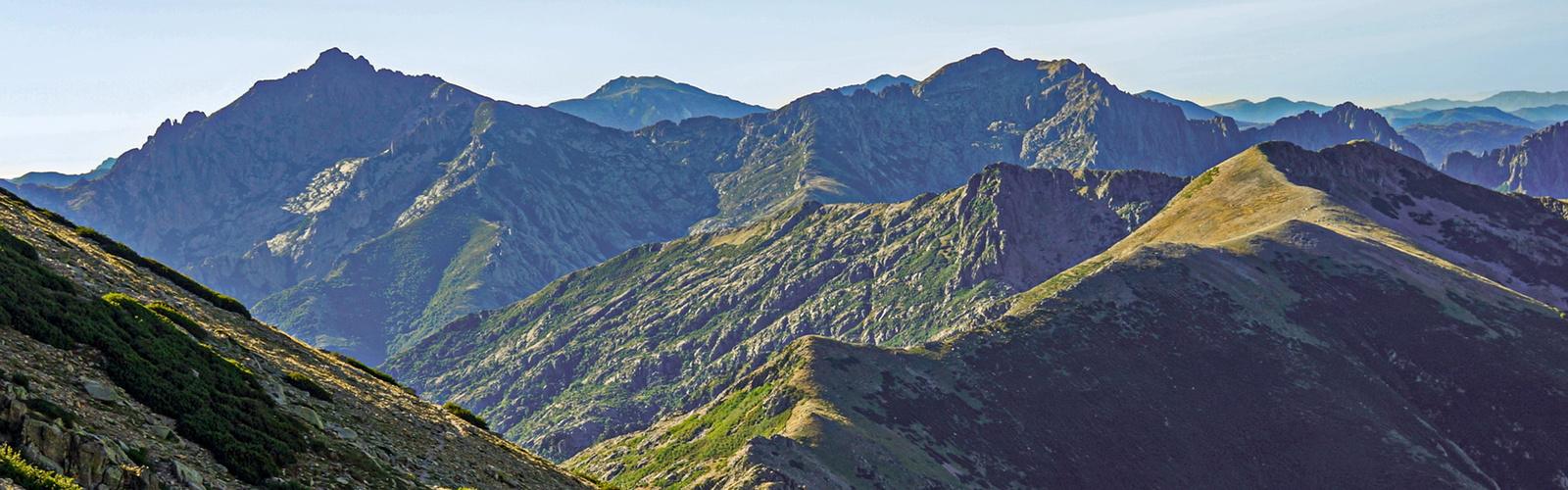
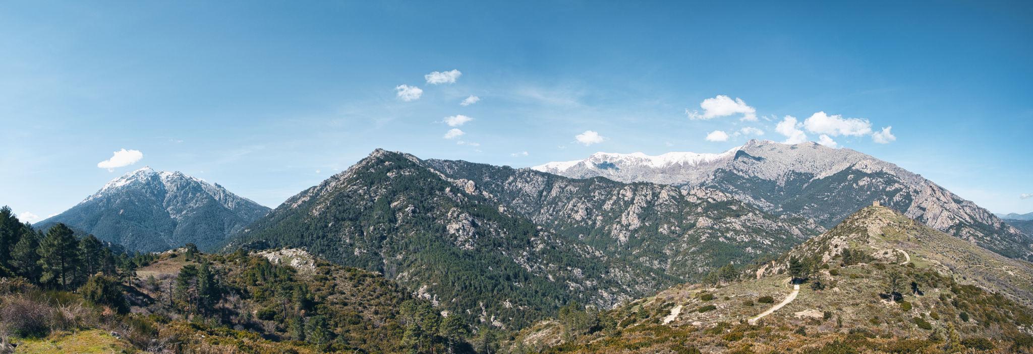
Corsica is a French Mediterranean island located between mainland France and Italy. Despite its coastal reputation, the island contains a rugged central mountain spine that rises sharply from sea level to peaks exceeding 2,700 meters. The GR20 follows this mountainous backbone and exposes hikers to some of the most dramatic alpine terrain in southern Europe.
The trail covers approximately 180 kilometers and typically requires 14 to 16 days to complete in full. The route is traditionally divided into two main sections.
Northern Section (Calenzana to Vizzavona)
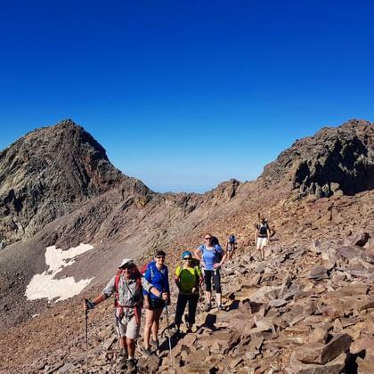
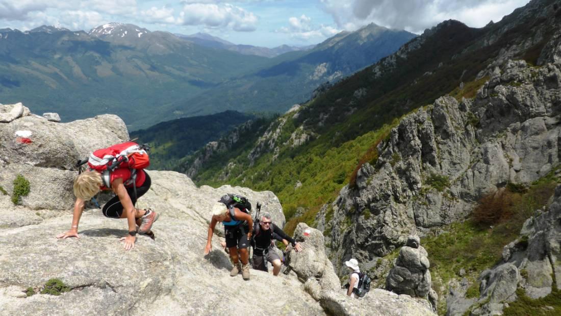
This section is widely considered the most difficult. The terrain includes steep rock slabs, narrow ridgelines, exposed traverses, and significant elevation gain. Daily stages are physically demanding and require good balance and endurance.
Southern Section (Vizzavona to Conca)
The southern half is less technical but still physically demanding. The terrain transitions into rolling ridges, forests, and open mountain plateaus.
Throughout the route, hikers pass through landscapes that include:
- granite mountain ridges
- alpine lakes
- glacial valleys
- pine forests
- Mediterranean scrublands
The GR20 is not simply a scenic trail. It is a serious alpine trekking route that requires preparation, endurance, and careful planning.
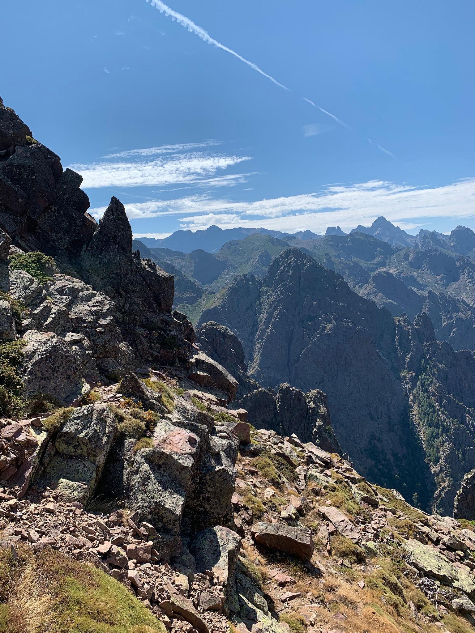
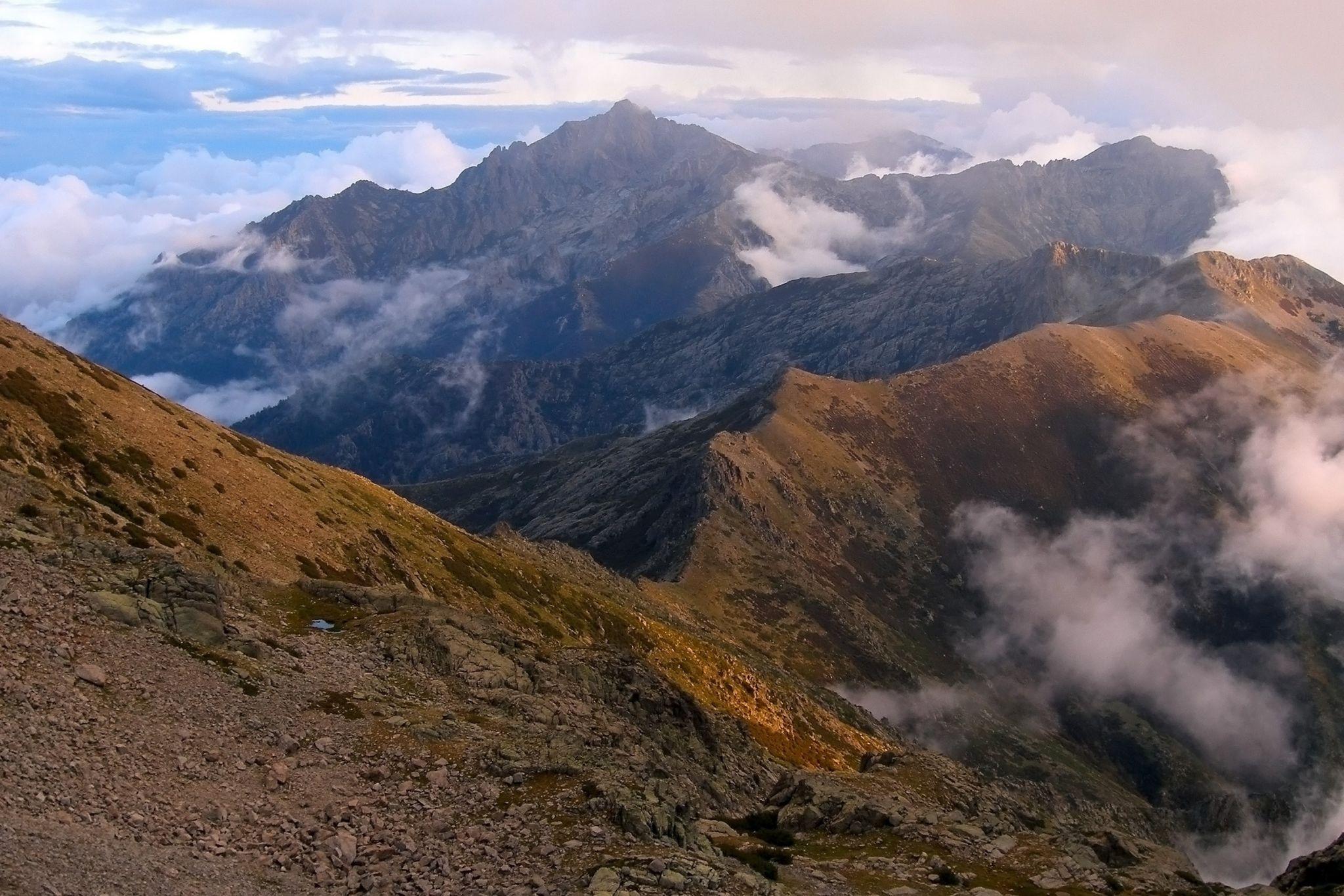
2. Geography and Landscape of the Corsican Mountains
Corsica's mountains form the backbone of the island and dominate its geography. The GR20 runs along this spine, linking a series of ridges, passes, and high valleys.
The island's highest mountain is Monte Cinto (2,706 m), located in the northern range. While the GR20 does not summit Monte Cinto directly, it passes close to the massif.
The Corsican mountains differ from many Alpine ranges in several ways.
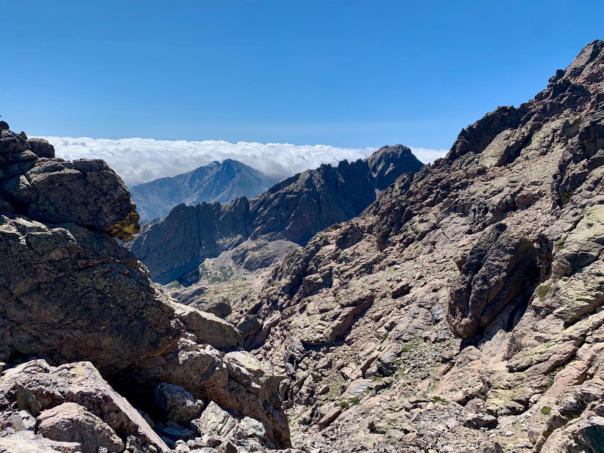
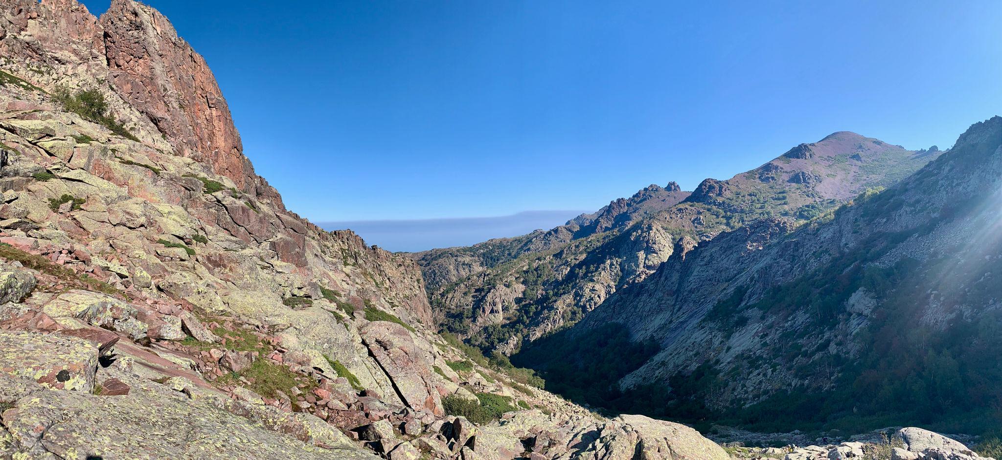
First, the terrain is largely composed of granite formations. Over millions of years, erosion has sculpted these granite rocks into sharp ridges, towers, and slabs. This produces the distinctive rugged appearance of the GR20 route.
Second, the climate combines Mediterranean and alpine influences. Summers can be hot at lower elevations while high ridges experience rapid weather changes.
Third, the island's geography creates dramatic elevation contrasts. Coastal towns lie near sea level, while mountain peaks rise sharply inland.
These characteristics produce a trekking environment where hikers may begin the day in forested valleys and end the day crossing exposed mountain passes.
3. Cultural and Historical Context of the GR20
The GR20 trail was established in the early 1970s as part of the French Grande Randonnée network, a system of long-distance hiking routes across France and Europe.
The purpose of the route was to connect Corsica's mountain refuges and create a continuous north-south trekking path.
Over time, the GR20 developed a reputation as one of Europe's most challenging long-distance hikes. Experienced hikers from across the world now travel to Corsica specifically to attempt the route.
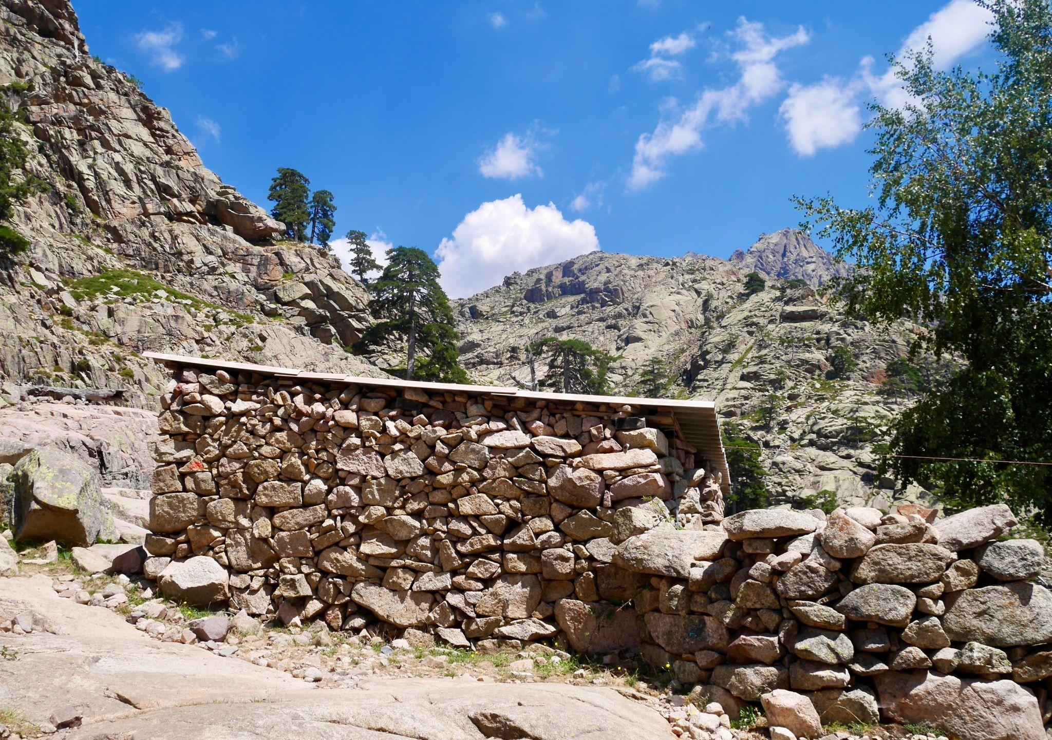
Corsican culture itself has been shaped by centuries of isolation in mountainous terrain. Many villages developed in remote valleys where agriculture and livestock farming dominated traditional life.
Shepherding remains an important part of the mountain economy. During summer months, livestock such as goats and sheep graze in high alpine pastures.
While hiking the GR20, trekkers often encounter:
- traditional stone shepherd huts
- mountain cheese production
- remote villages connected by historic footpaths
These cultural elements add depth to the trekking experience beyond the physical challenge.
4. Where the GR20 Fits in Global Trekking
The GR20 is frequently compared with other famous long-distance trekking routes.
Examples include:
- Tour du Mont Blanc in the Alps
- John Muir Trail in the United States
- Alta Via routes in the Italian Dolomites
However, the GR20 differs in several key ways.
Many famous trekking routes rely on well-engineered paths and established infrastructure. The GR20, in contrast, often involves scrambling over rock slabs, chains, and exposed ridges.
Daily elevation gain can exceed 1,000 meters, and the terrain often demands careful foot placement.
For this reason, the GR20 is frequently described as one of the most physically demanding trekking routes in Europe.
5. Access and Logistics
International Access to Corsica
Corsica is part of France and lies in the Mediterranean Sea west of Italy.
International travelers typically reach Corsica through mainland Europe.
Primary access routes include:
Flights
Major Corsican airports include:
- Ajaccio Napoleon Bonaparte Airport
- Bastia Poretta Airport
- Figari South Corsica Airport
- Calvi Sainte-Catherine Airport
Flights connect Corsica with cities such as Paris, Marseille, Nice, Milan, and other European hubs.
Ferry Routes
Regular ferry services connect Corsica with several Mediterranean ports including:
- Marseille (France)
- Nice (France)
- Toulon (France)
- Genoa (Italy)
- Livorno (Italy)
Travelers arriving by ferry may bring vehicles, which can simplify transport within the island.
6. Access to the GR20 Starting Point
The northern trailhead of the GR20 is located in Calenzana, a village near the town of Calvi.
Common access route:
- Fly into Calvi Airport or Bastia Airport
- Travel by bus or rental car to Calenzana
Calenzana is well known as the traditional starting point for north-south GR20 trekkers.
Some hikers begin the route in the opposite direction at Conca, the southern terminus.
7. Visa and Entry Requirements for International Travelers
Since Corsica is part of France, entry requirements follow French immigration regulations.
Travelers from the European Union
EU citizens can travel freely within France and Corsica without visa requirements.
Travelers from the United States, Canada, UK, Australia
Citizens from these countries can enter France visa-free for short stays up to 90 days within the Schengen Area.
Travelers from South Asia, Africa, and other regions
Visitors from countries such as Pakistan, India, Bangladesh, and many African states generally require a Schengen visa before traveling to France.
The Schengen visa allows travel across multiple European countries within a 90-day period.
Travelers should apply through the French embassy or consulate in their home country.
8. Travel Insurance Requirements
Although not legally required for all travelers, travel insurance is strongly recommended for the GR20.
The route involves alpine terrain where accidents, weather disruptions, or evacuation may occur.
Recommended coverage should include:
- high-altitude trekking coverage
- emergency medical evacuation
- trip cancellation protection
Some Schengen visa applicants must provide proof of medical insurance during the visa process.
9. Accommodation Before and After the Trek
Most trekkers spend one night in Calvi or Calenzana before starting the GR20.
Accommodation options include:
- small guesthouses
- local hotels
- mountain lodges
At the southern end of the route, many hikers spend a final night in Conca or Porto-Vecchio.
These coastal towns provide transportation connections back to airports and ferry ports.
10. Transportation on the Island
Corsica has limited rail infrastructure and mountain areas are not heavily served by public transport.
Most transport between towns occurs through:
- regional buses
- rental cars
- taxi transfers
Because the GR20 crosses remote mountain terrain, hikers generally rely on refuges along the route rather than returning to towns each day.
11. Planning Strategy for International Trekkers
International hikers traveling to Corsica should plan their journey carefully.
Key preparation steps include:
- booking flights or ferries well in advance during summer season
- reserving refuge accommodation early
- arranging insurance coverage
- preparing physical conditioning months before arrival
Because the GR20 has limited infrastructure and high demand during peak months, planning ahead significantly improves the trekking experience.
12. Complete GR20 Trek Itinerary – Day by Day Route Breakdown
The GR20 is traditionally completed in 14 to 16 stages. Most trekkers follow the north to south direction, beginning in Calenzana and finishing in Conca. The northern stages are significantly more technical and physically demanding, so starting in the north allows hikers to tackle the hardest terrain early while energy levels are high.
Distances may appear moderate on paper, but the terrain makes progress slow. Many sections involve scrambling over rock slabs, steep ascents, and narrow ridgelines.
Below is a standard 16-stage itinerary used by most trekkers.
Day 1 – Calenzana to Refuge d’Ortu di u Piobbu
Distance: approximately 12 km
Elevation gain: about 1,300 m ascent
The GR20 begins in the village of Calenzana, located above the coastal town of Calvi. The first stage immediately introduces hikers to the physical demands of the trail.
The path climbs steeply through Mediterranean scrubland before entering pine forest. The ascent continues for several hours as the trail rises toward the foothills of the Corsican mountains.
This stage is entirely uphill and often considered a difficult introduction to the route. However, it provides expansive views toward the Mediterranean coastline behind you.
The stage ends at Refuge d’Ortu di u Piobbu, one of the highest refuges on the trail.
Day 2 – Ortu di u Piobbu to Refuge de Carrozzu
Distance: approximately 8 km
Elevation gain: around 700 m ascent
This stage introduces trekkers to the rugged granite terrain that defines the northern GR20.
The trail crosses several rocky ridges and descends steeply toward the Spasimata Valley. Hikers must navigate large granite slabs and narrow passages.
One of the highlights of the day is the Spasimata Footbridge, a dramatic suspension bridge crossing a deep gorge.
The day ends at Refuge de Carrozzu, located near a mountain stream in a forested valley.
Day 3 – Carrozzu to Refuge d’Asco Stagnu
Distance: approximately 6 km
Elevation gain: about 800 m ascent
Although shorter in distance, this stage is technically demanding.
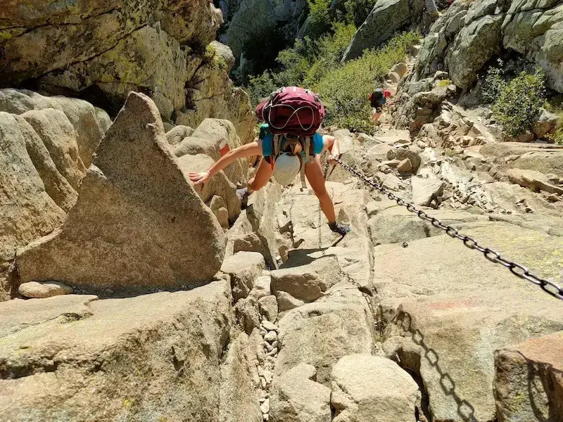
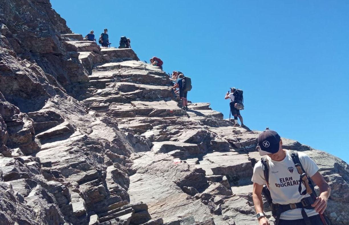
The route climbs toward Bocca di Stagnu, one of the highest passes along the GR20. This section includes chains and metal fixtures installed to assist hikers across exposed rock faces.
Weather conditions can change rapidly at these elevations.
After crossing the pass, the trail descends toward Asco Stagnu, a ski station area where accommodation and supplies are available.
Day 4 – Asco Stagnu to Refuge de Tighjettu
Distance: approximately 9 km
Elevation gain: around 1,200 m ascent
This stage crosses some of the most dramatic mountain terrain in Corsica.
The trail climbs steeply toward Monte Cinto massif, the highest mountain range on the island. Although the route does not summit Monte Cinto itself, the surrounding landscapes are among the most impressive on the entire trek.
Trekkers cross Bocca Minuta Pass before descending into the Tighjettu Valley.
The refuge is located beneath towering granite peaks.
Day 5 – Tighjettu to Refuge de Ciottulu di i Mori
Distance: approximately 8 km
Elevation gain: around 800 m ascent
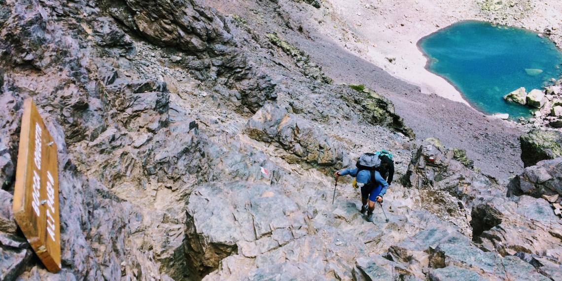
This stage crosses the Cirque de la Solitude, historically considered the most technically difficult section of the GR20.
Note: In recent years the original Cirque route has occasionally been modified due to rockfall risk. Alternate paths may be used depending on current conditions.
The route involves steep rocky descents and ascents assisted by chains and ladders.
The stage finishes at Refuge de Ciottulu di i Mori, one of the highest refuges in Corsica.
Day 6 – Ciottulu di i Mori to Refuge de Manganu
Distance: approximately 22 km
Elevation gain: moderate
This is one of the longest stages of the trek.
The terrain transitions into open alpine plateaus and grassy valleys. Trekkers pass through high mountain meadows and cross several streams.
The route gradually descends toward Refuge de Manganu, located near alpine lakes.
Many hikers consider this stage a welcome break from the steep technical terrain of earlier days.
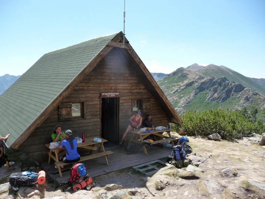
Day 7 – Manganu to Refuge de Petra Piana
Distance: approximately 10 km
Elevation gain: around 900 m ascent
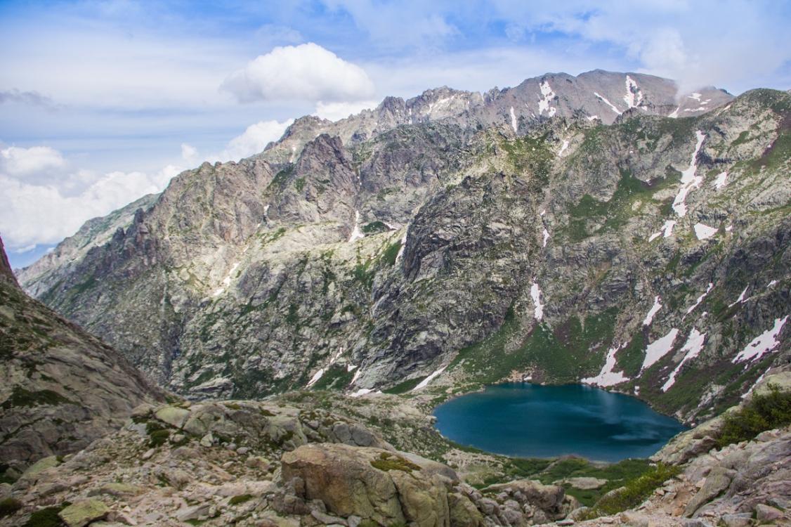
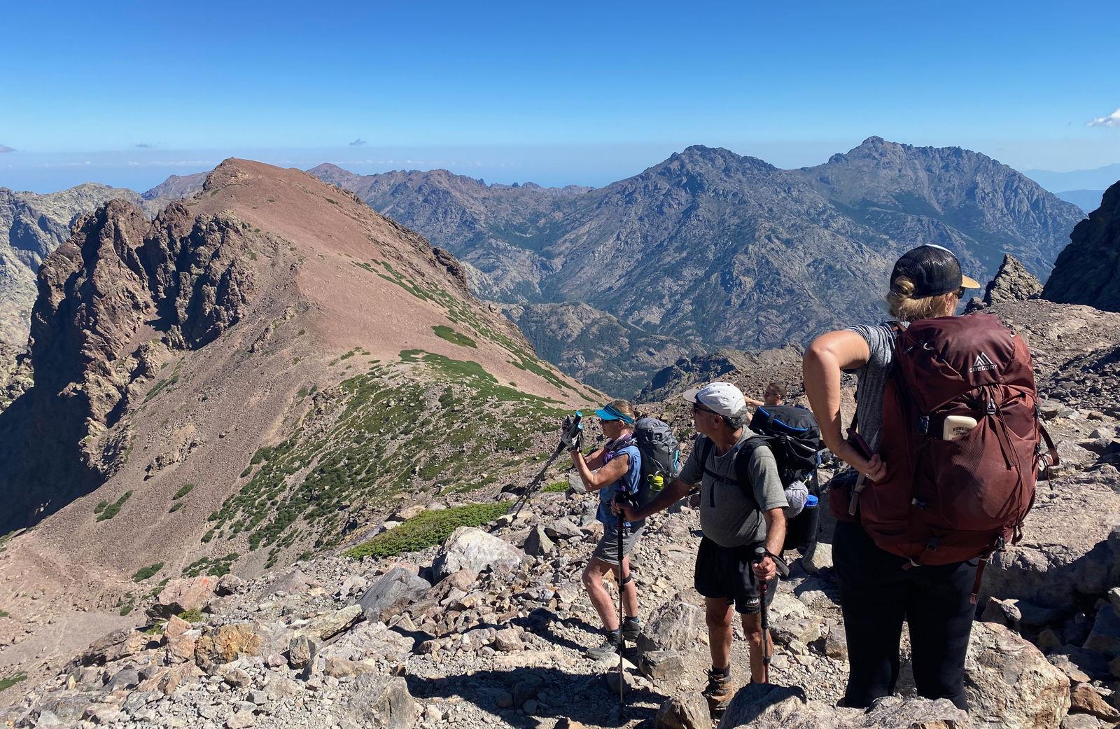
The trail climbs toward the Brèche de Capitellu, a dramatic mountain pass overlooking two glacial lakes: Lac de Capitellu and Lac de Melo.
This stage provides some of the most impressive views on the GR20.
After crossing the pass, the trail follows a high ridge toward Refuge de Petra Piana.
Day 8 – Petra Piana to Vizzavona
Distance: approximately 10 km
Elevation gain: moderate
The trail descends gradually through forested slopes toward Vizzavona, located near the center of Corsica.
Vizzavona is an important midpoint of the GR20.
Many trekkers take a rest day here because the location offers:
- hotels and guesthouses
- restaurants
- small shops
It is also accessible by road and railway, making it a logistical resupply point.
Southern GR20 Section
The southern half of the trail is generally considered less technical, though still physically demanding.
Day 9 – Vizzavona to Refuge de Capannelle
Distance: approximately 16 km
This stage climbs through dense pine forests and crosses the Bocca Palmente Pass.
From the pass, hikers enjoy wide views across Corsica's interior mountains.
The stage ends at Capannelle, which offers refuge accommodation and a nearby mountain lodge.
Day 10 – Capannelle to Refuge de Prati
Distance: approximately 19 km
The trail follows a long mountain ridge offering expansive views toward both the eastern and western sides of Corsica.
The terrain alternates between rocky sections and grassy highlands.
The day ends at Refuge de Prati, located on a high ridge.
Day 11 – Prati to Refuge d’Usciolu
Distance: approximately 10 km
This stage continues along narrow ridgelines.
Several sections include exposed paths with steep drop-offs on both sides. Weather conditions can influence safety in this area.
The refuge at Usciolu sits at a high altitude and offers panoramic views.
Day 12 – Usciolu to Refuge d’Asinau
Distance: approximately 14 km
The trail descends gradually into forested valleys before climbing again toward Refuge d’Asinau.
Along the way, trekkers pass traditional Corsican shepherd huts.
The surrounding landscapes combine forests, rocky ridges, and open grasslands.
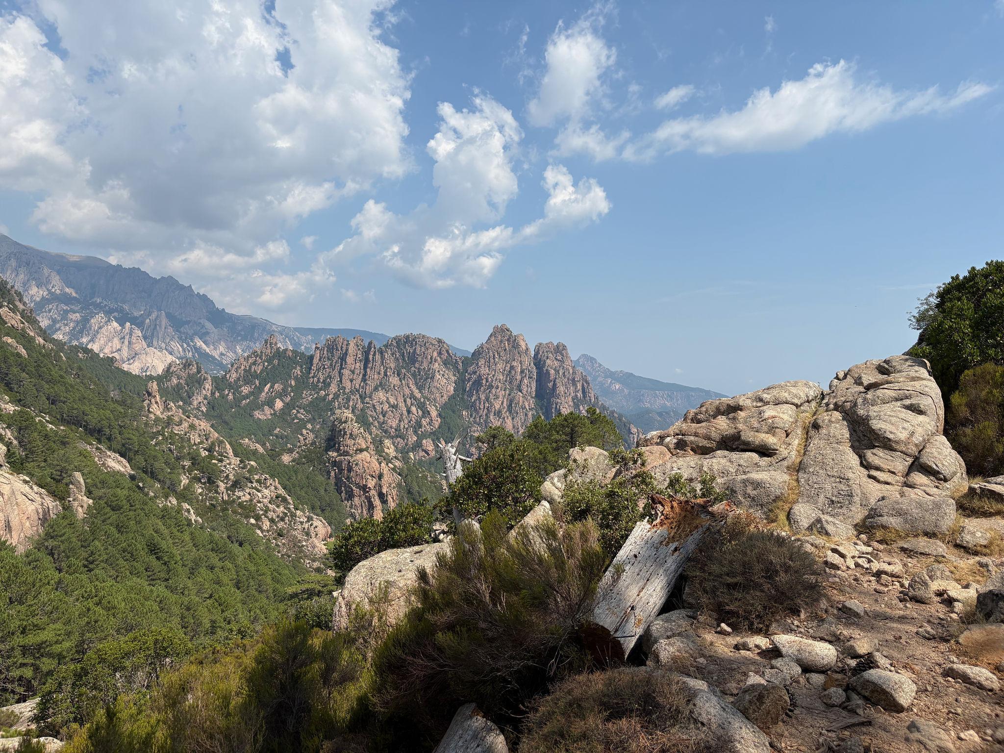
Day 13 – Asinau to Bavella Pass
Distance: approximately 13 km
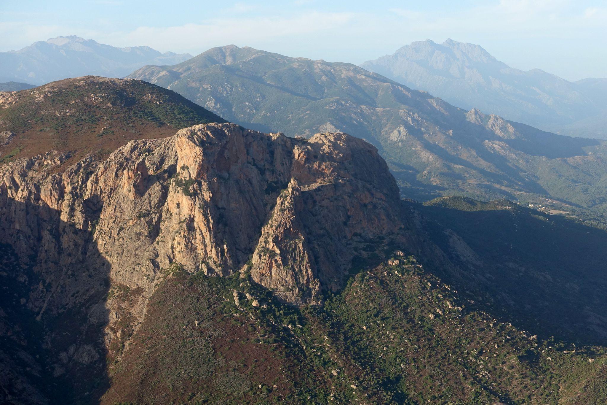
This stage includes a route beneath the dramatic Aiguilles de Bavella, a series of sharp granite spires that dominate the skyline.
The Bavella region is famous for its climbing routes and distinctive rock formations.
Accommodation is available at mountain lodges near Bavella Pass.
Day 14 – Bavella to Conca
Distance: approximately 20 km
The final stage descends gradually toward the southeastern coast of Corsica.
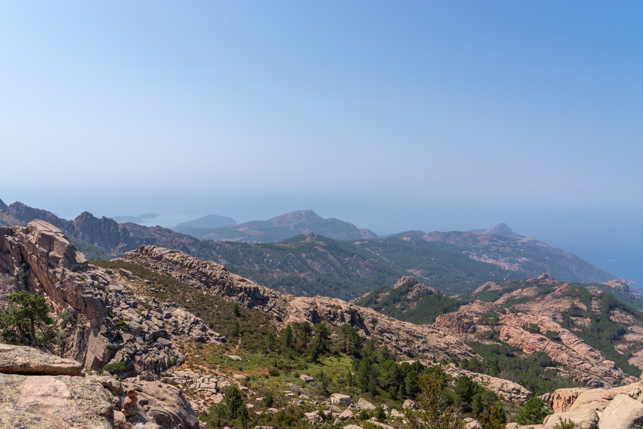
The terrain becomes more Mediterranean with forests, shrubs, and lower mountains.
After nearly two weeks in the mountains, trekkers reach the village of Conca, the official southern terminus of the GR20.
The trail ends near a stone marker indicating completion of the route.
Typical Trekking Duration
Most hikers complete the GR20 in:
- 14 days standard pace
- 16 days relaxed pace
- 10–12 days fast hikers
The demanding terrain means even experienced hikers must pace themselves carefully.
13. Difficulty Level and Physical Preparation for the GR20
The GR20 is widely regarded as one of the most difficult long-distance trekking routes in Europe. Although the total distance of approximately 180 kilometers is not extreme compared with some global trekking routes, the terrain, elevation gain, and technical sections significantly increase the physical demands.
Many experienced hikers compare the GR20 difficulty with alpine trekking routes in the European Alps rather than traditional hiking trails.
Terrain Characteristics
Several factors contribute to the trail's difficulty.
First, the route frequently crosses granite mountain ridges where the path is uneven and rocky. Large boulders, exposed slabs, and steep ascents require careful foot placement.
Second, certain sections involve scrambling rather than simple walking. Chains, ladders, and fixed cables have been installed in some locations to assist hikers across steep rock faces.
Third, daily elevation gain is substantial. On several stages hikers climb 800 to 1,200 meters in a single day.
Finally, the trail crosses remote mountainous terrain with limited escape routes. This means hikers must be prepared to complete each stage safely.
Northern Section Difficulty
The northern GR20, between Calenzana and Vizzavona, contains the most technical terrain.
Typical challenges include:
- steep rock slabs requiring scrambling
- narrow ridgelines with exposure
- long ascents and descents
- unpredictable mountain weather
These stages often require slower movement than typical hiking routes.
Southern Section Difficulty
The southern GR20 remains physically demanding but is less technical.
The terrain includes:
- forest trails
- rolling mountain ridges
- alpine meadows
Although easier than the northern half, long distances and elevation changes still require strong endurance.
Who Should Attempt the GR20
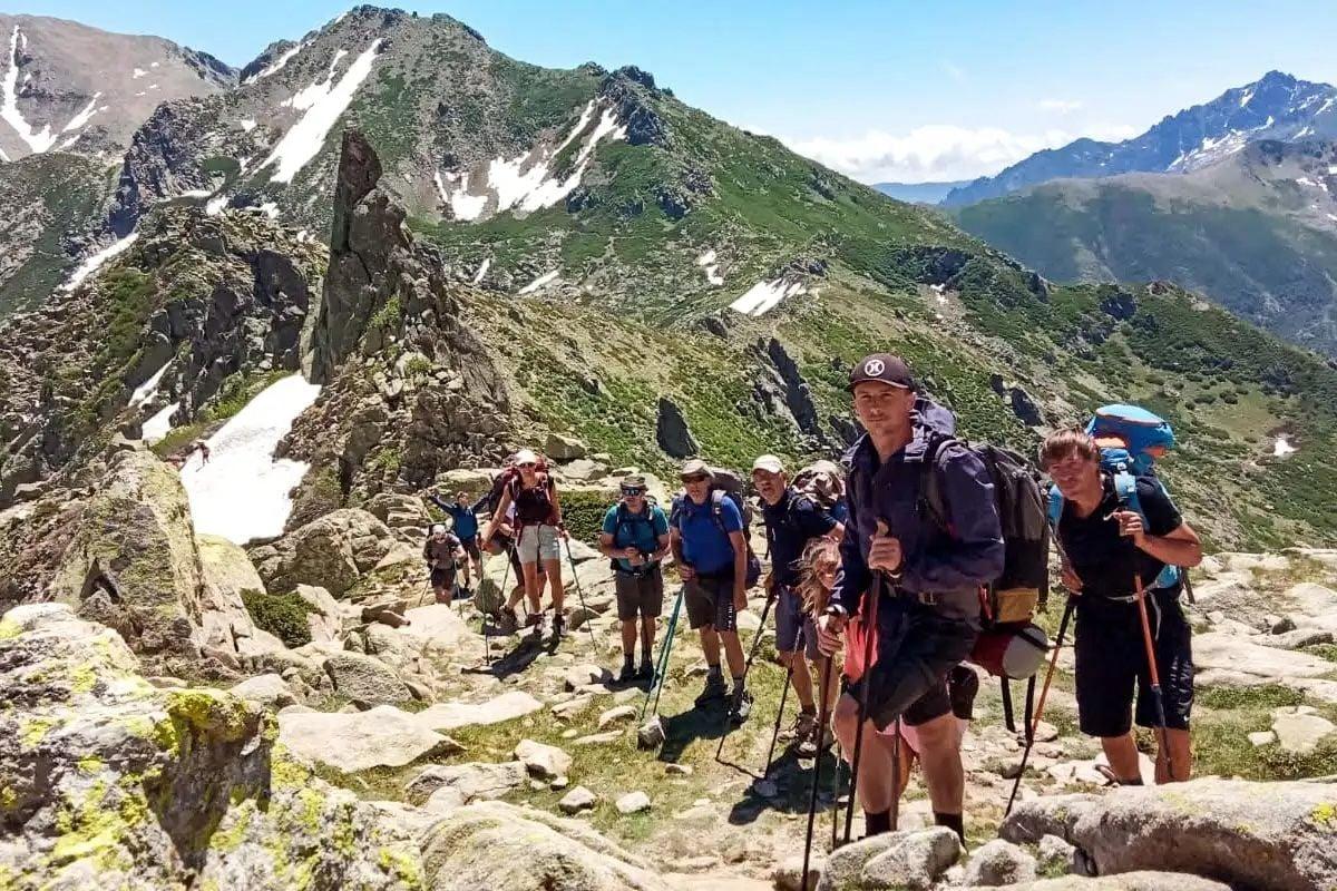
The route is most suitable for hikers who already have experience with:
- multi-day trekking with backpacks
- mountain terrain navigation
- long daily elevation gain
Previous experience in alpine environments is beneficial.
Beginners without prior trekking experience may find the route extremely challenging.
Physical Conditioning
Preparation for the GR20 should begin several months before the trek.
Training should focus on developing endurance, leg strength, and stability on uneven terrain.
Recommended preparation activities include:
Regular hiking with a loaded backpack
This builds both physical strength and familiarity with carrying trekking gear.
Stair climbing or hill training
These exercises simulate the continuous elevation gain encountered on the trail.
Balance and stability training
Rocky terrain requires strong balance and controlled movement.
Cardiovascular endurance training
Activities such as running, cycling, or long-distance walking improve stamina.
Backpack Weight Considerations
Managing backpack weight is critical on the GR20.
Heavy loads significantly increase fatigue and slow progress across technical terrain.
Typical pack weights include:
- Lightweight trekking strategy: 8 to 10 kg
- Traditional camping setup: 12 to 15 kg
Many trekkers reduce weight by using refuge accommodation rather than carrying tents.
Mental Preparation
Physical conditioning alone is not sufficient.
The GR20 also requires mental resilience. Some days involve:
- long ascents in hot weather
- difficult rocky sections requiring concentration
- extended hours of hiking without shade
Maintaining steady pacing and managing energy levels are essential skills.
Common Mistakes
Several common mistakes increase the risk of difficulty on the GR20.
Starting too fast during the first days
The early northern stages are the most demanding. Pacing is important.
Underestimating technical terrain
The route often involves scrambling and requires careful movement.
Carrying unnecessary gear
Excess weight significantly increases fatigue.
Ignoring weather conditions
Mountain weather can change quickly, especially on exposed ridges.
Understanding these challenges before beginning the trek helps hikers prepare properly.
14. Gear and Equipment Strategy
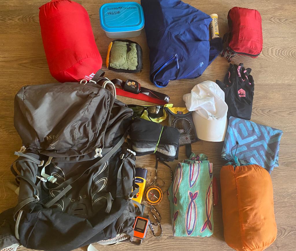
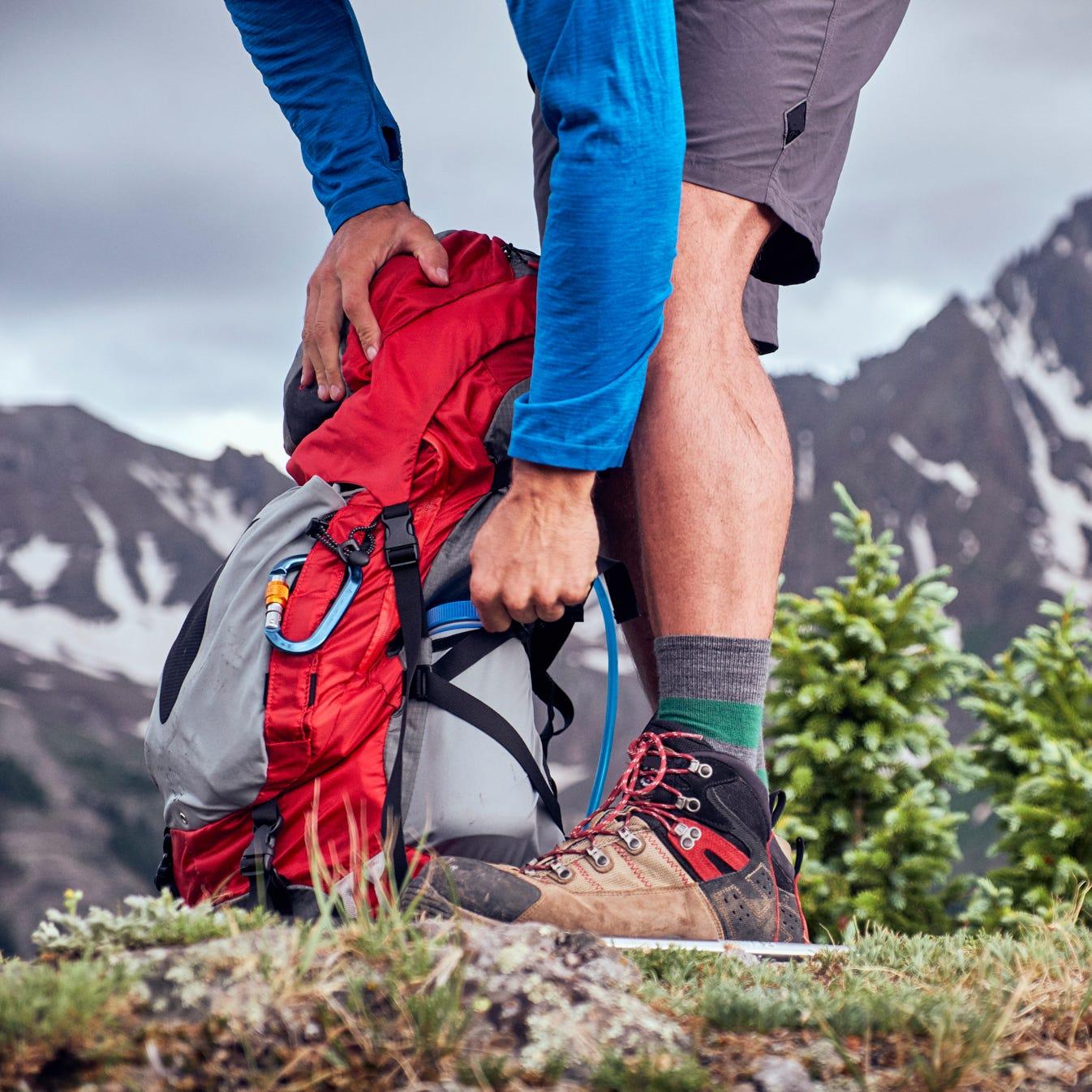
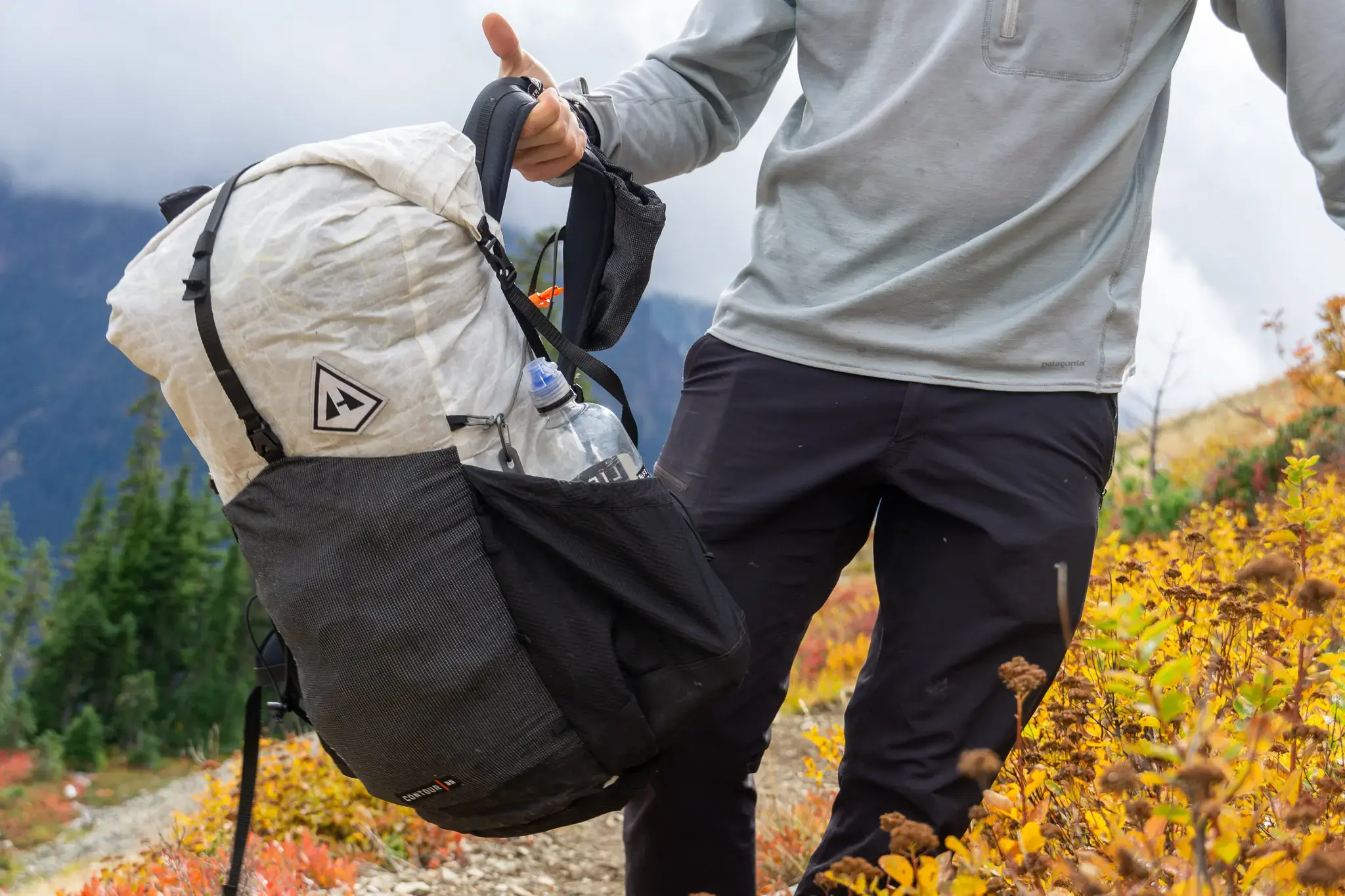
Selecting the correct equipment is essential for safely completing the GR20. Because the route involves rugged terrain and changing weather conditions, gear must balance durability, protection, and weight reduction.
Backpack
A trekking backpack between 40 and 50 liters is suitable for most hikers using refuge accommodation.
If carrying camping equipment, a 50 to 60 liter pack may be required.
Backpacks should include:
- adjustable hip belts
- ventilation systems
- waterproof rain covers
Footwear
Footwear is one of the most important equipment decisions.
Recommended options include:
- lightweight trekking boots with ankle support
- durable trail shoes with strong grip
The granite terrain of the GR20 can be slippery when wet, so good traction is essential.
Trekking Poles
Trekking poles help reduce strain on knees during long descents.
They also provide stability on rocky terrain.
Many experienced GR20 hikers consider poles essential.
Clothing Strategy
Weather conditions on the GR20 vary significantly between hot valley temperatures and cooler alpine ridges.
A layered clothing system is recommended.
Typical clothing includes:
- moisture-wicking base layers
- lightweight trekking shirts
- insulating mid-layer jacket
- waterproof shell jacket
- lightweight hiking pants
Even in summer, temperatures can drop significantly at higher elevations.
Sleeping Equipment
If staying in mountain refuges, hikers typically need:
- lightweight sleeping bag
- sleeping liner
If camping independently, additional equipment includes:
- tent
- sleeping pad
- stove and cooking system
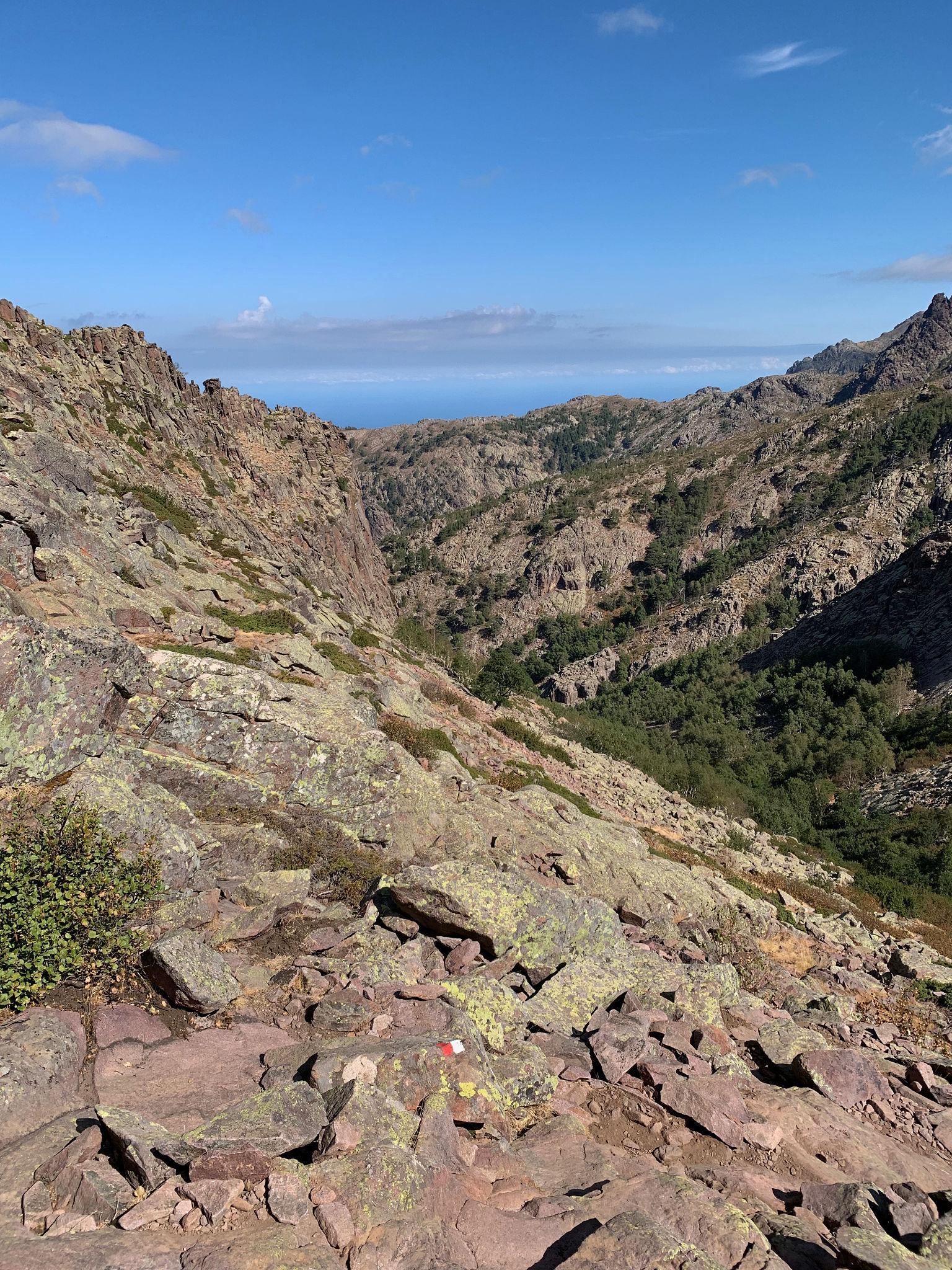
Although the GR20 is well marked with red and white trail markings, navigation tools remain important.
Recommended items include:
- printed trail map
- GPS navigation device or mobile app
- compass
In fog or poor visibility, these tools become especially useful.
Safety Equipment
Basic safety gear should include:
- first aid kit
- headlamp with spare batteries
- emergency blanket
- whistle
- water purification tablets or filter
Proper preparation reduces risks in remote mountain environments.
15. Best Time to Trek the GR20 and Seasonal Weather Conditions
The GR20 is a seasonal mountain route. Snow, storms, and difficult terrain mean the trail is generally accessible only during a limited period each year.
Understanding seasonal conditions is essential when planning the trek.
Main Trekking Season
The typical GR20 trekking season runs from:
Mid June to late September
During this period, most refuges along the trail are open and weather conditions are generally stable enough for multi-day trekking.
However, conditions vary significantly within this window.
Early Season – Mid June to Early July
Early season trekking offers cooler temperatures and fewer hikers.
However, several challenges exist:
- snow patches may remain on high passes
- certain steep sections can be slippery
- refuges may open gradually depending on conditions
Trekkers attempting the route early in the season should have experience with alpine conditions.
Peak Season – July and August
July and August represent the busiest period on the GR20.
During these months:
- weather is typically warm and stable
- most refuges are fully operational
- trail traffic is at its highest
Daytime temperatures at lower elevations can exceed 30°C, while higher ridges remain cooler.
Because of the popularity of the route during peak season, refuge reservations are essential.
Late Season – September
September is often considered one of the best months for the GR20.
Advantages include:
- cooler temperatures
- fewer crowds
- generally stable weather patterns
However, daylight hours begin to shorten and some refuges close toward the end of the month.
Trekkers should verify refuge availability when planning late-season trips.
Weather Characteristics
The Corsican mountains experience rapid weather changes.
Typical summer conditions include:
Warm daytime temperatures
Cool nights at higher elevations
Occasional thunderstorms in the afternoon
Because the trail follows exposed ridges, storms can develop quickly.
Lightning and heavy rain present risks in high mountain areas.
Temperature Range
Typical temperature ranges during the trekking season:
Lower valleys:
20°C to 30°C during the day
High mountain passes:
10°C to 20°C during the day
Night temperatures near refuges can drop to 5°C to 10°C, particularly at higher elevations.
16. Objective Risks and Mountain Safety
Although the GR20 is a marked hiking trail rather than a mountaineering route, it still presents several objective hazards.
Understanding these risks allows trekkers to prepare properly and minimize danger.
Steep and Technical Terrain
Many northern sections involve scrambling across steep granite slabs.
These areas can become slippery during rain.
Trekkers should move carefully and maintain three points of contact when climbing.
Exposure on Ridges
Several sections of the trail follow narrow ridgelines with steep drop-offs.
These areas require careful balance and attention, particularly during windy conditions.
Rockfall
In steep areas where the trail crosses rocky slopes, loose stones may fall.
Trekkers should maintain spacing between hikers to avoid dislodging rocks.
Heat and Dehydration
During summer months, lower elevations can become extremely hot.
Trekkers must carry sufficient water and avoid overexertion during the hottest part of the day.
Sudden Weather Changes
Mountain weather can change rapidly.
Thunderstorms may develop during the afternoon, particularly in July and August.
Exposed ridges become dangerous during lightning storms.
Although the GR20 is marked with red and white paint markers, fog or poor visibility can make navigation difficult.
Carrying a map or GPS device helps maintain correct route orientation.
Emergency Services
Corsica has mountain rescue services capable of responding to emergencies.
However, helicopter rescue may be delayed by weather conditions or remote terrain.
Trekkers should aim to manage risks responsibly rather than relying on emergency assistance.
17. Food and Water Strategy on the GR20
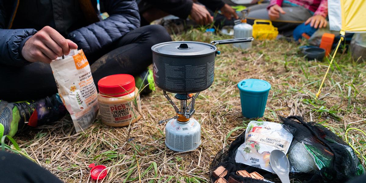
Food planning is an important logistical consideration for the GR20.
Trekkers have two primary options.
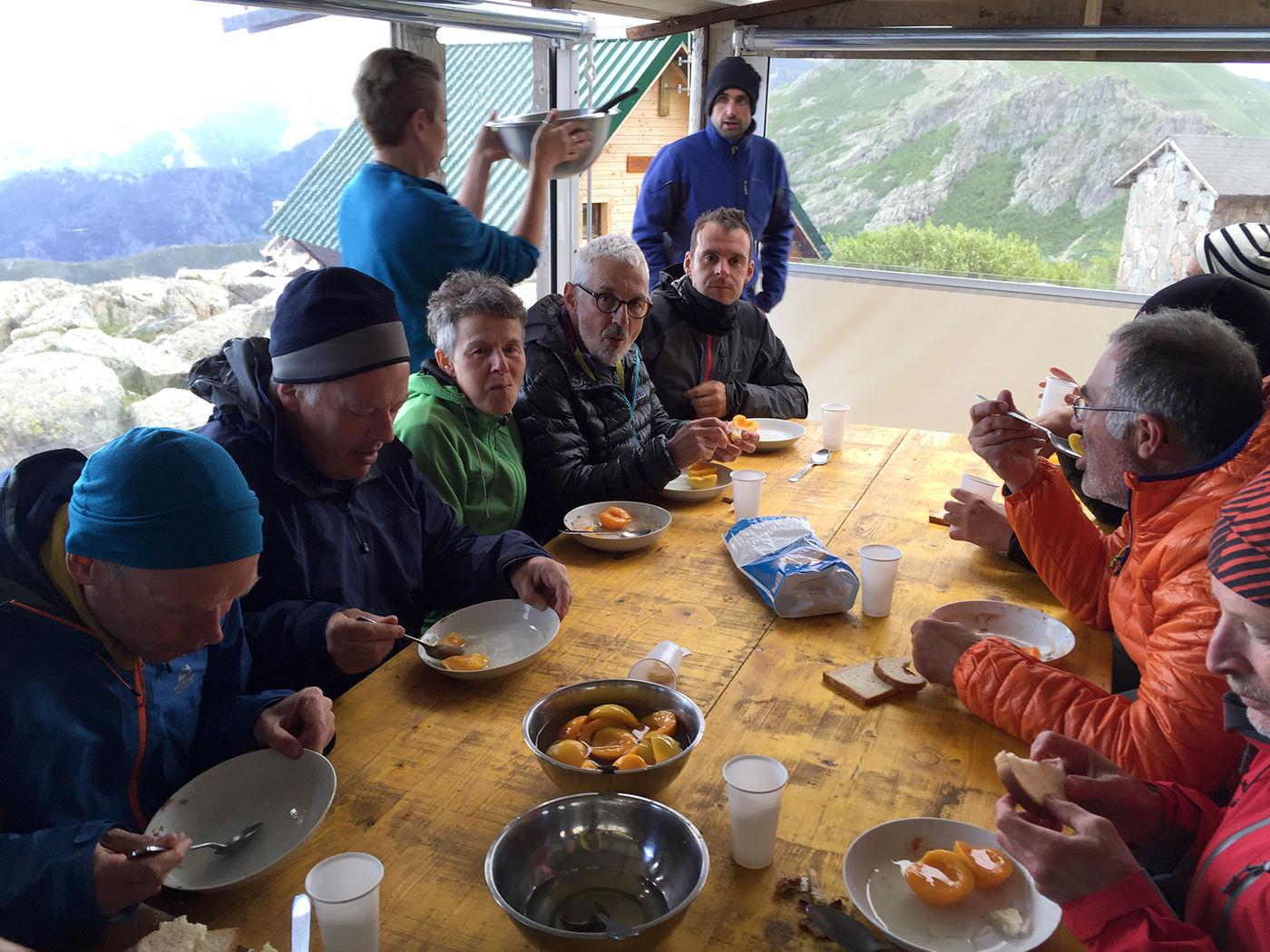
Refuge Meal System
Most hikers rely on meals provided at mountain refuges.
Typical refuge services include:
- dinner meals
- breakfast
- simple packed lunches
Meals usually consist of:
- pasta or rice dishes
- bread and cheese
- soups or stews
This system allows hikers to travel with lighter backpacks.
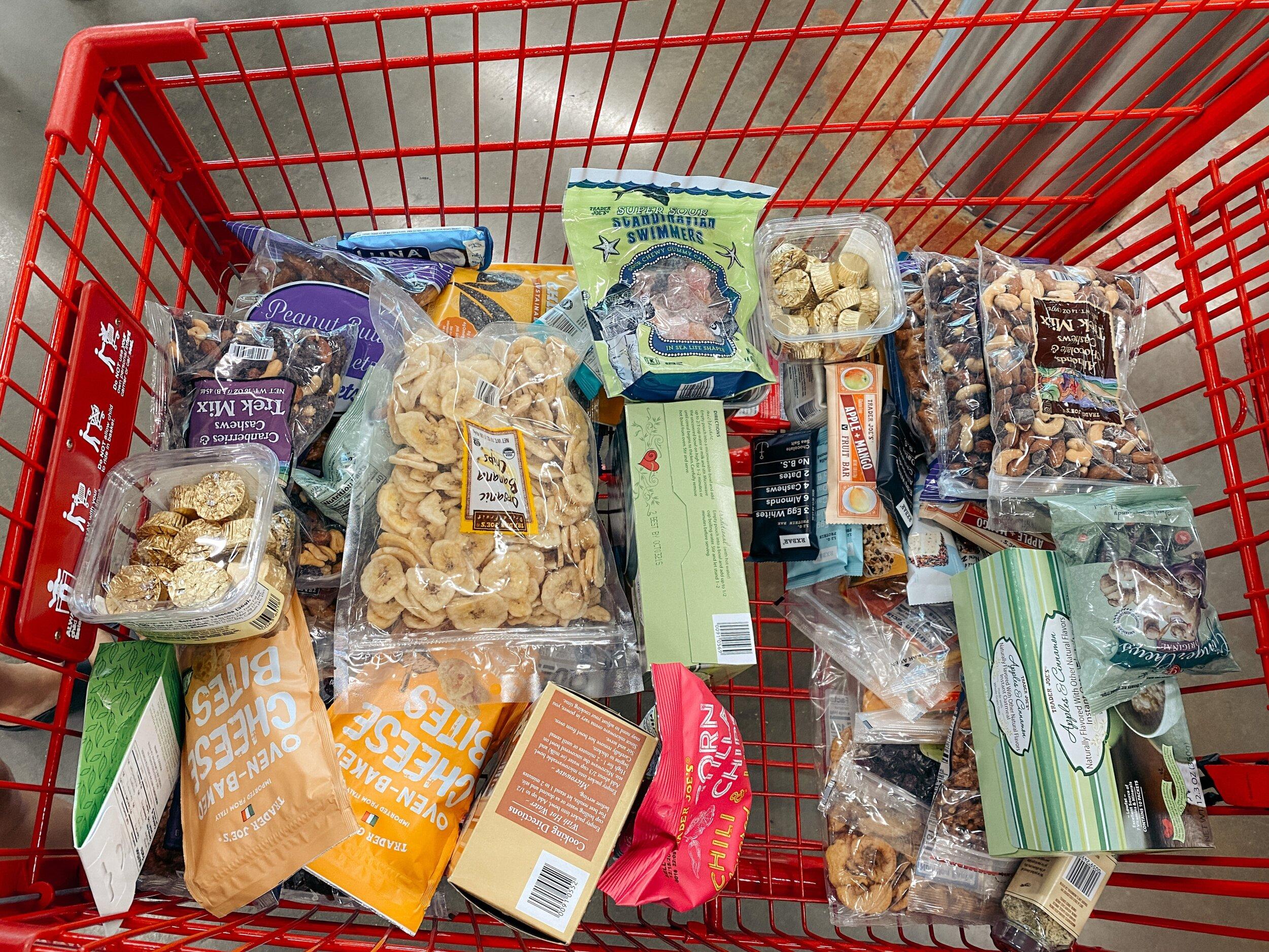
Self-Supported Food Strategy
Some trekkers prefer to carry their own food.
Common trekking food includes:
- dehydrated meals
- pasta or instant noodles
- nuts and energy bars
- dried fruit
Cooking requires carrying a stove and fuel.
Water Sources
Water is available at many refuges and mountain streams along the trail.
However, hikers should treat water before drinking.
Methods include:
- water purification tablets
- filtration systems
- boiling water
During hot summer days, hikers should carry at least 2 to 3 liters of water between refill points.
18. Permits and Refuge Reservation System
Unlike some major trekking routes worldwide, the GR20 does not require a trekking permit.
However, the refuge accommodation system effectively functions as a capacity control mechanism.
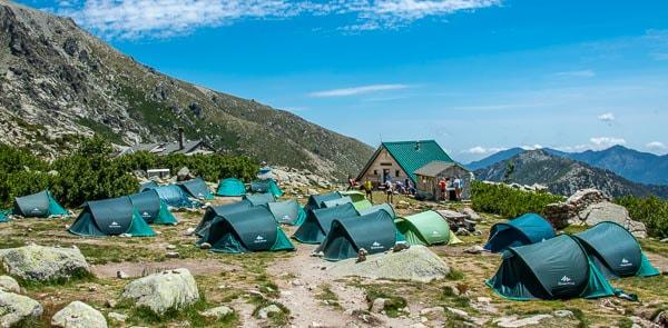
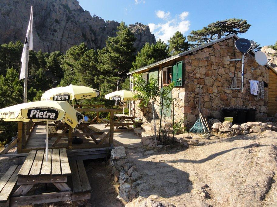
Mountain Refuges
The GR20 has a network of mountain refuges spaced along the route.
These refuges provide:
- dormitory sleeping spaces
- camping areas
- food services
- water sources
Refuges are managed by the Corsican Regional Natural Park.
Reservation System
During peak season, refuges often reach full capacity.
Reservations can be made online through the park’s booking system.
Booking accommodation in advance is strongly recommended, particularly for July and August.
Camping
Camping near refuges is allowed in designated areas.
Campers usually pay a small fee for access to water and facilities.
19. Cost Breakdown – Budget Planning
The total cost of trekking the GR20 varies depending on travel style.
Budget Independent Trek
Approximate daily costs:
Refuge camping: €10 to €15
Simple meals: €20 to €30
Food supplies: €10 to €15
Estimated daily cost:
€40 to €60
Estimated 14-day total:
€600 to €900 excluding flights.
Refuge Accommodation Trek
Dormitory beds: €20 to €25
Dinner and breakfast: €30 to €40
Estimated daily cost:
€60 to €80
Estimated total cost for full trek:
€900 to €1,200 excluding flights.
Guided Trekking Tours
Guided trekking packages typically include:
- guide services
- accommodation
- meals
- logistics support
Typical price range:
€1,800 to €3,000 for a 12–14 day guided trek.
The GR20 follows a well-marked path across Corsica’s mountainous spine.
Navigation is assisted by red and white painted trail markers, which indicate the official GR route.
However, trekkers should still carry navigation resources.
Recommended tools include:
- detailed GR20 trail maps
- GPS navigation apps
- compass
The highest sections of the trail reach elevations around 2,200 meters, although most stages remain between 1,200 and 2,000 meters.
Because the trail crosses numerous ridges and valleys, daily elevation changes are significant even when the altitude itself is moderate.
21. Final Professional Assessment
The GR20 is one of the most demanding and rewarding trekking routes in Europe.
Its reputation for difficulty comes not from extreme altitude but from rugged terrain, continuous elevation gain, and technical rocky sections.
For experienced trekkers seeking a challenging long-distance hike, the GR20 offers a unique combination of alpine landscapes and Mediterranean environments.
Key strengths of the route include:
dramatic mountain scenery
well-marked trail network
refuge infrastructure
cultural character of Corsican mountain regions
However, the trek should not be underestimated.
Proper preparation, realistic pacing, and careful logistical planning are essential for completing the route safely.
For international travelers interested in experiencing one of Europe’s most famous mountain trails, the GR20 provides a challenging but highly rewarding adventure across the heart of Corsica.
The information in this guide is intended for general planning purposes only. Trail conditions, permit requirements, costs, and access routes can change due to weather, seasonal closures, or local regulations. The itinerary provided is a suggested framework and may need to be adjusted based on your fitness level, acclimatization, and conditions on the ground. Always consult a local guide or trekking agency before departing and verify current conditions with authorities or affiliated company.
![K2 Base Camp Trek: Ultimate Guide k2 Trek 2026 [UPDATED]](https://karakoramdiaries.com/storage/ultimate-guide-to-k2-base-camp-trek-full-document-150x150.png)