Laugavegur Trail – Complete Guide
Table of contents [Show]
- 1. Understanding the Laugavegur Trail and the Icelandic Highlands
- 2. Geography and Volcanic Landscape of the Icelandic Highlands
- 3. Cultural and Historical Background of the Route
- 4. Where the Laugavegur Trail Fits Among Global Treks
- 5. Access and Logistics
- 6. Visa and Entry Requirements for International Travelers
- 7. Travel Insurance and Safety Preparation
- 8. Best Time to Trek the Laugavegur Trail and Seasonal Conditions
- 9. Complete Laugavegur Trail Itinerary – Day by Day
- 10. Difficulty Level and Physical Preparation
- 11. Gear and Equipment Strategy for the Laugavegur Trail
- 12. River Crossings and Trail Hazards
- 13. Food Strategy and Mountain Hut System
- 14. Permits and Environmental Regulations
- 15. Cost Breakdown for the Laugavegur Trail
- 16. Final Professional Assessment
- Trip Planning Summary
- Guided Trekking
- Independent Trekking
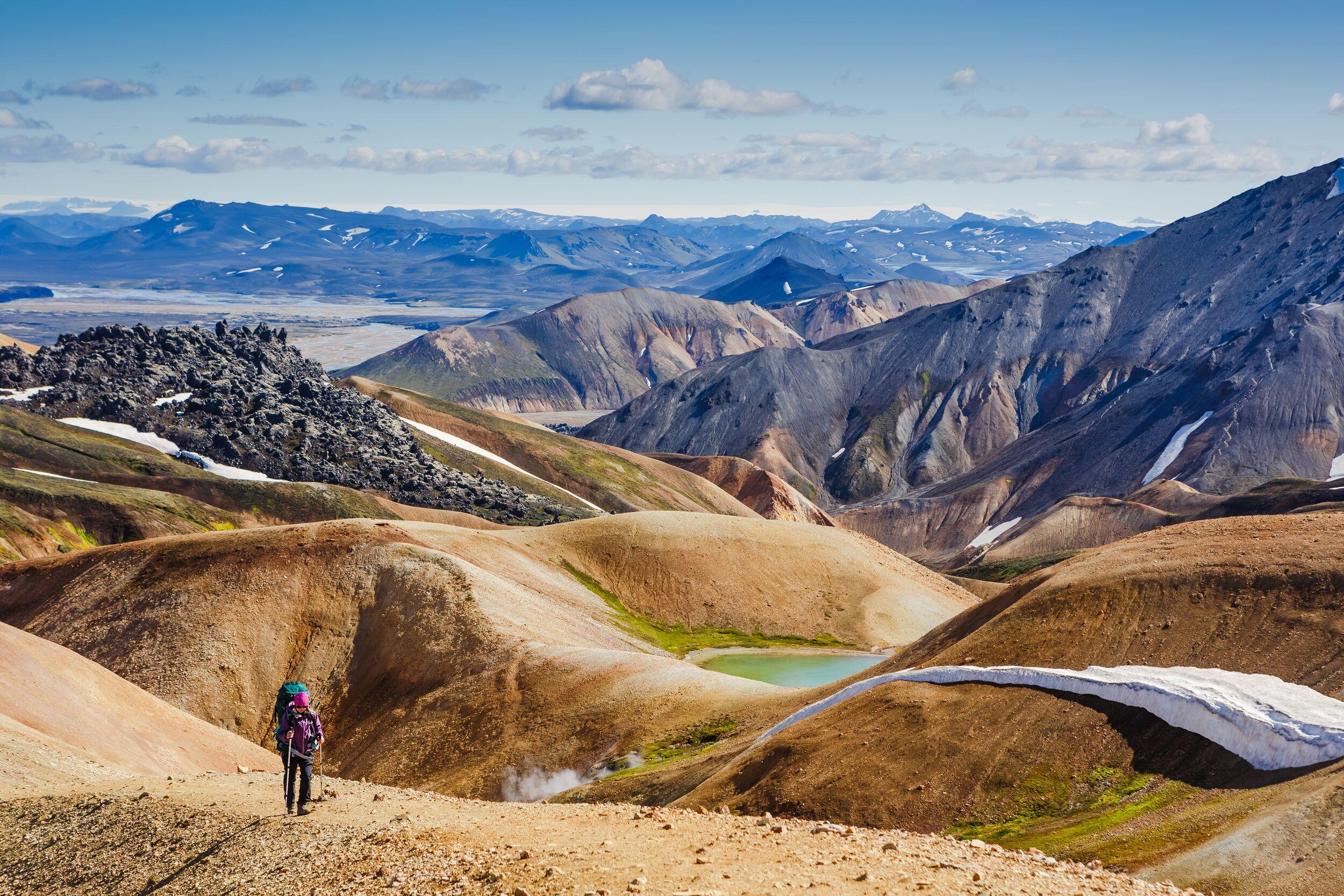
1. Understanding the Laugavegur Trail and the Icelandic Highlands
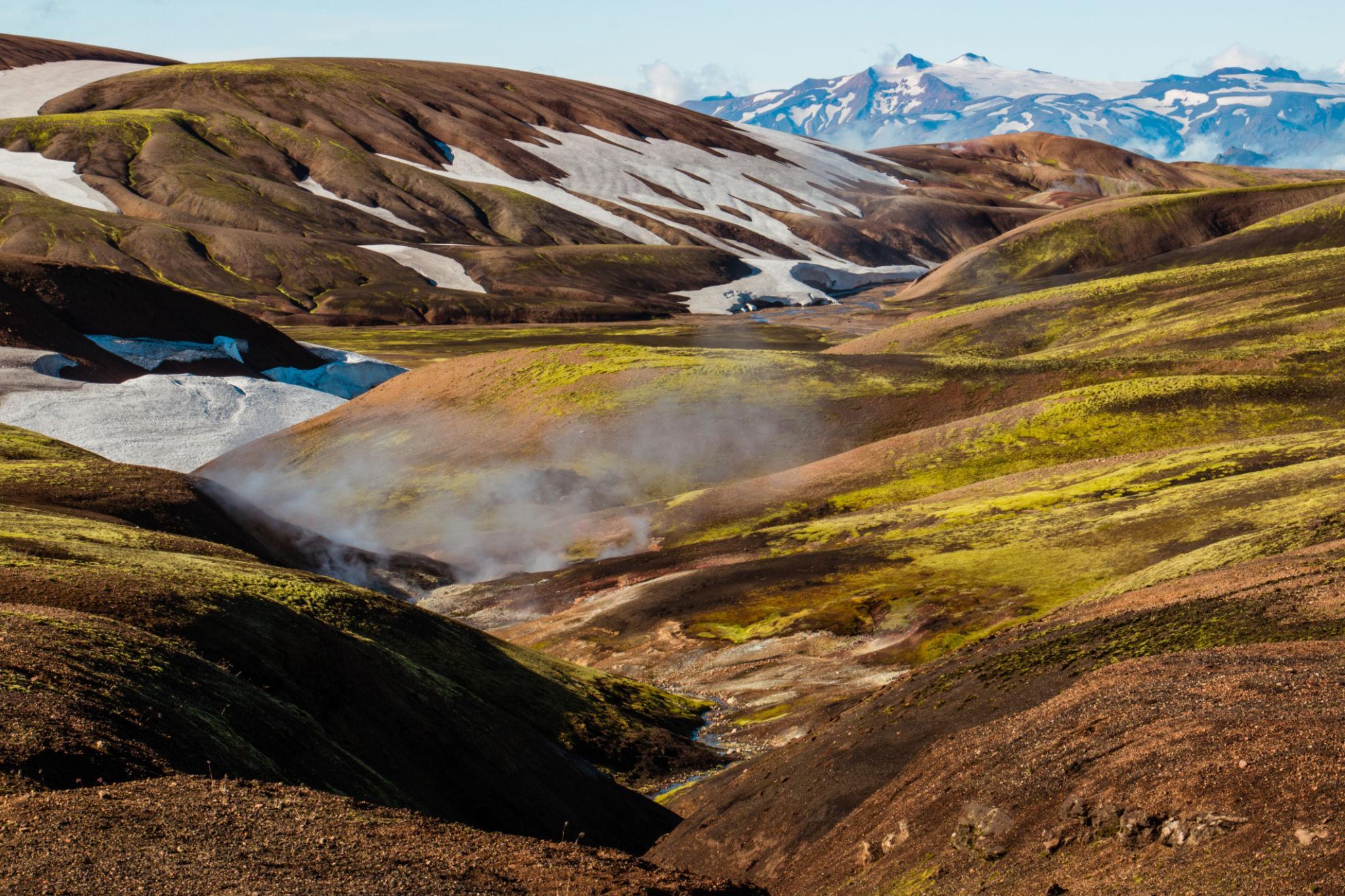
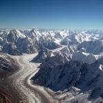
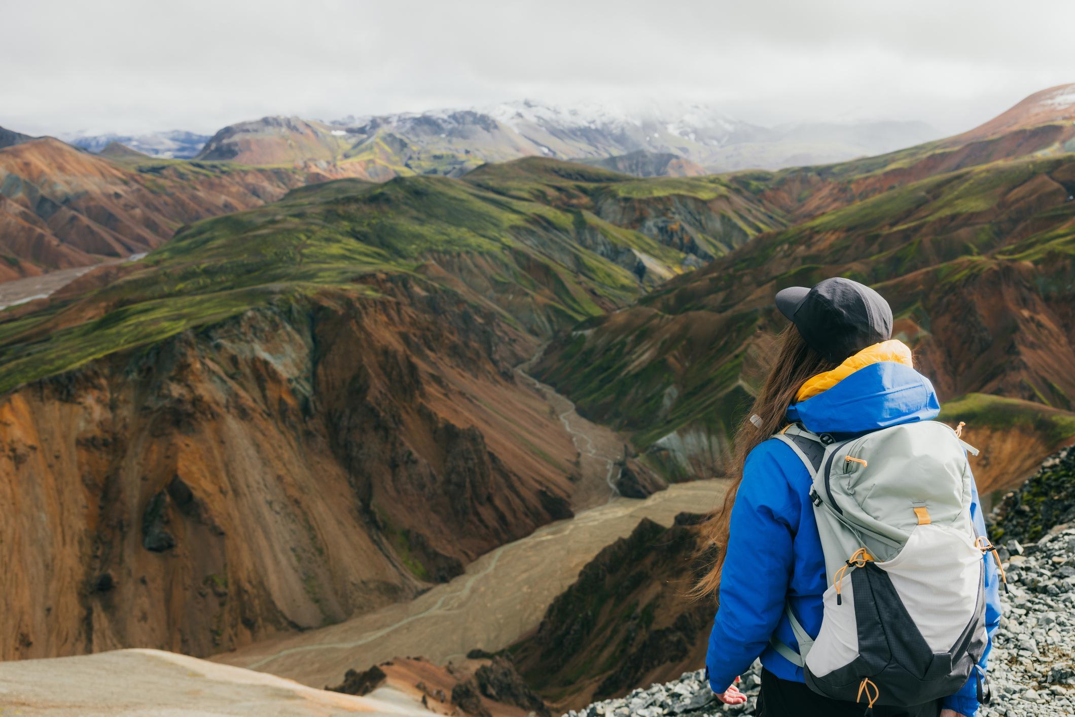
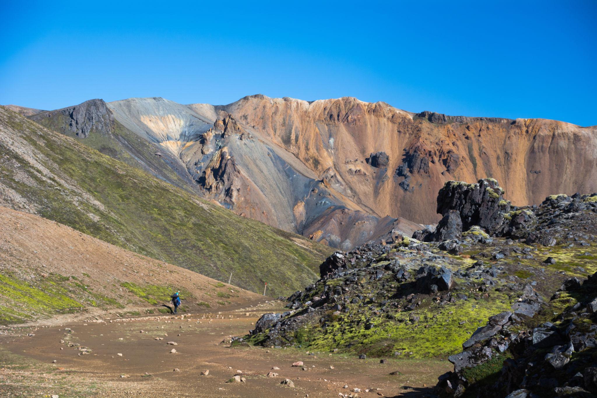
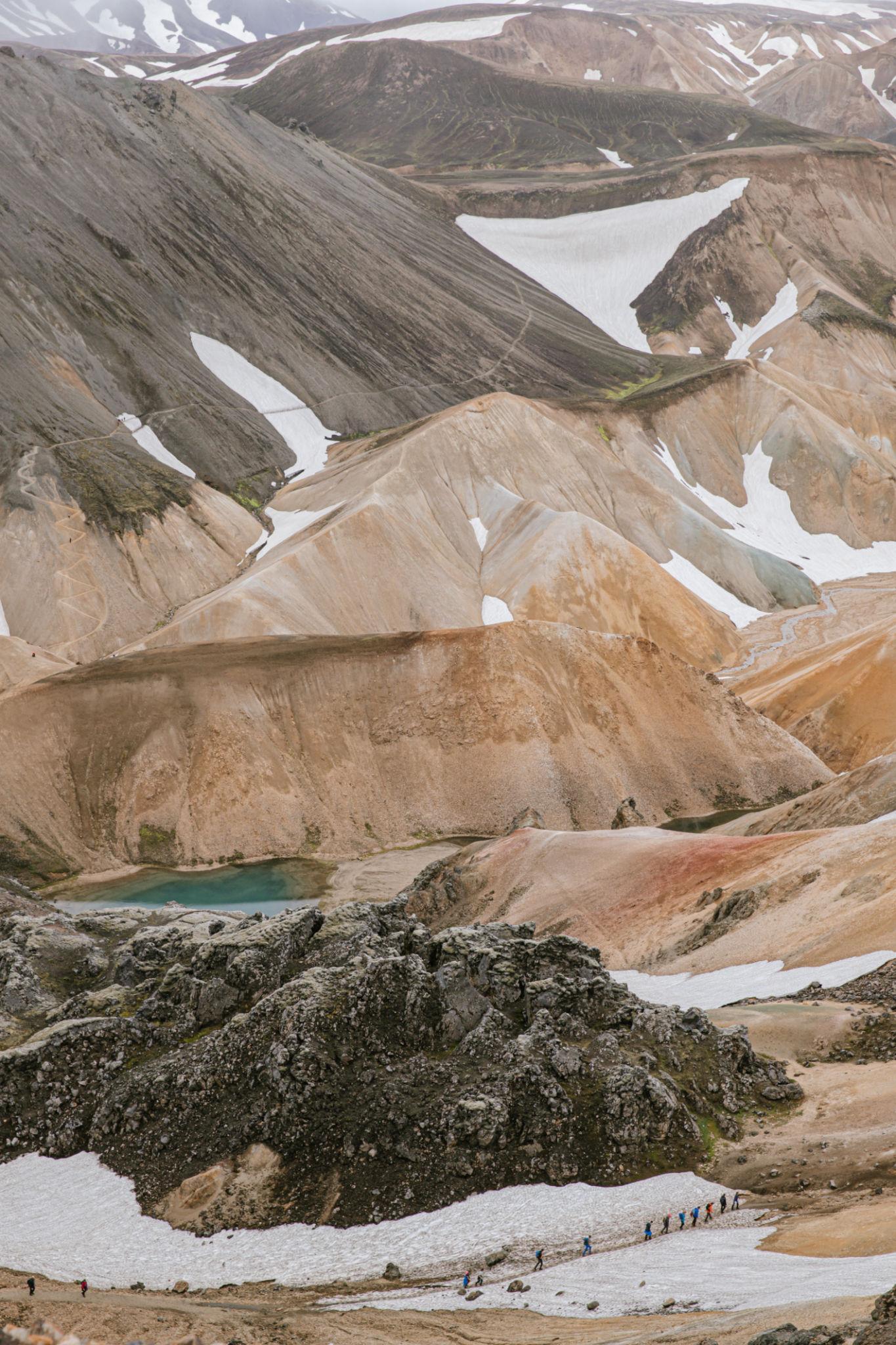
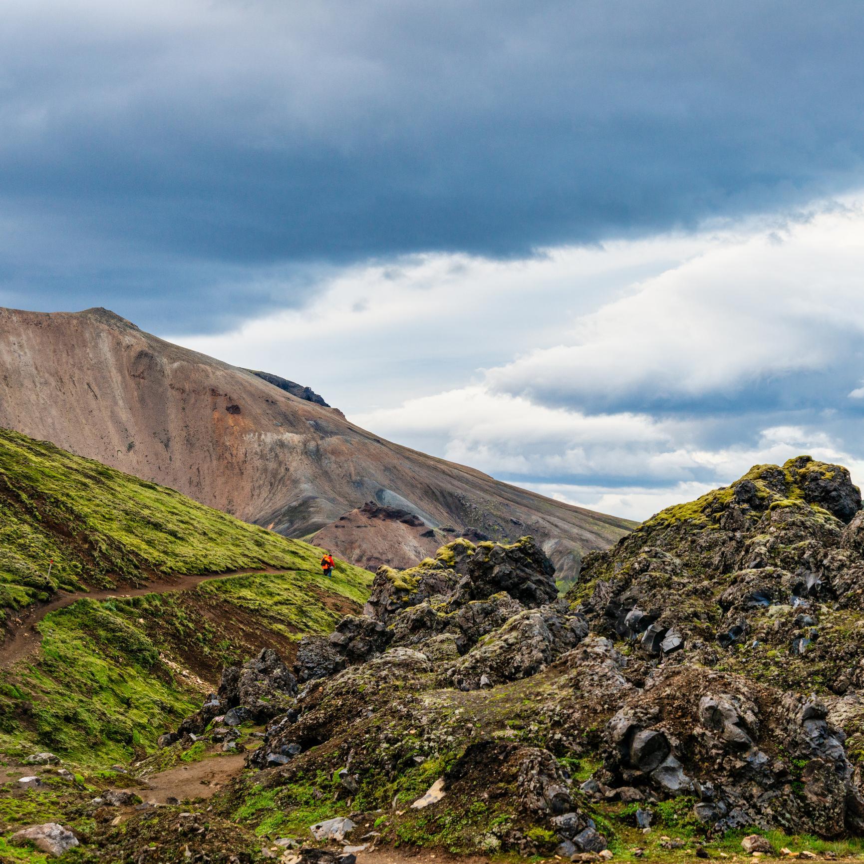
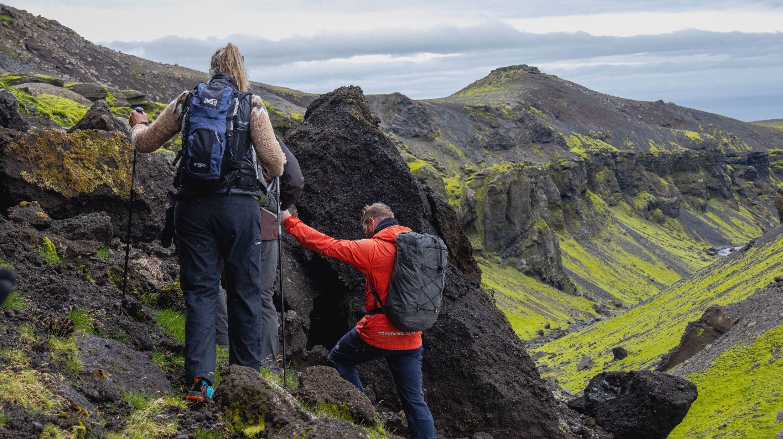
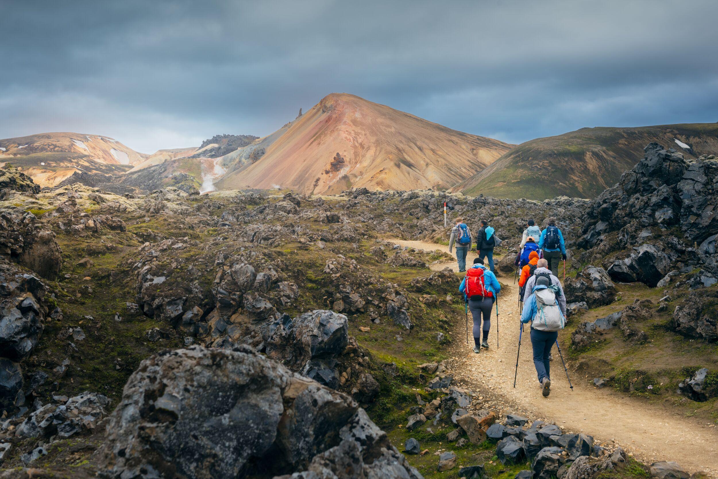
The colorful rhyolite mountains and geothermal valleys of Landmannalaugar mark the beginning of the Laugavegur Trail, one of Iceland’s most famous highland trekking routes.
The Laugavegur Trail is the most well-known multi-day trekking route in Iceland. The trail crosses the interior highlands of southern Iceland, linking the geothermal region of Landmannalaugar with the glacial valley of Þórsmörk.
The name Laugavegur translates roughly to “the hot spring route.” The name reflects the geothermal landscapes that characterize the beginning of the trek, where steam vents and hot springs emerge from volcanic ground.
The route covers approximately 55 kilometers and is usually completed in 3 to 4 days. Although the distance is moderate compared with longer mountain treks, the terrain and weather conditions of the Icelandic highlands make the experience unique.
Unlike many alpine trekking routes that cross forested mountains or glaciated peaks, the Laugavegur Trail passes through landscapes shaped by volcanic activity. The environment includes lava fields, rhyolite mountains, glacial rivers, geothermal valleys, and wide black sand plains.
These dramatic geological features make the Laugavegur Trail one of the most visually distinctive trekking routes in the world.
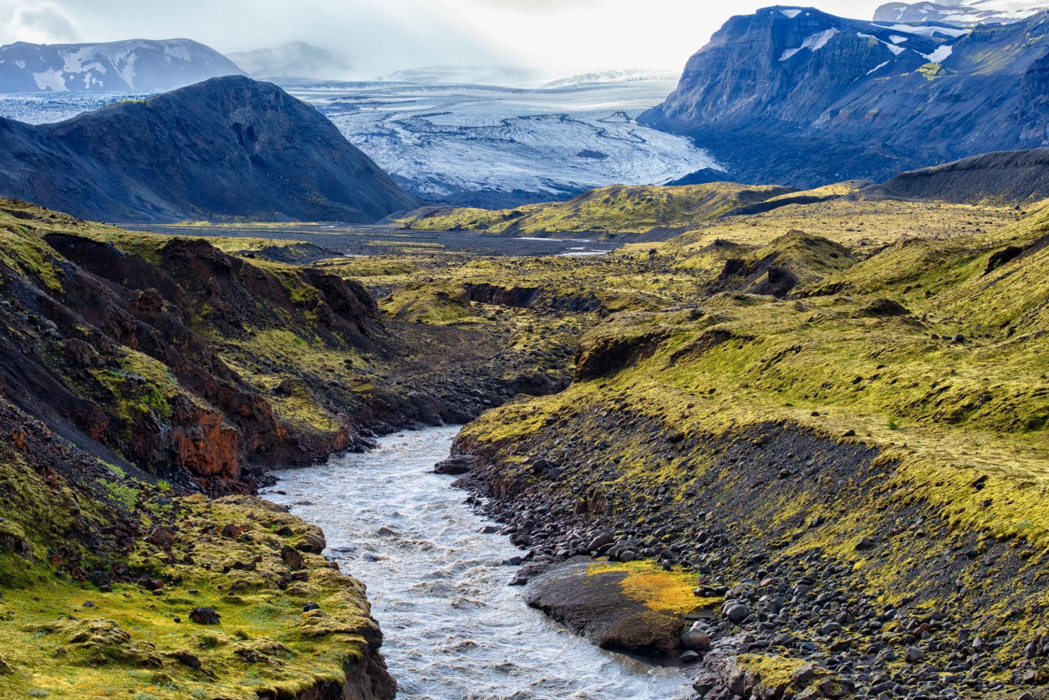
2. Geography and Volcanic Landscape of the Icelandic Highlands
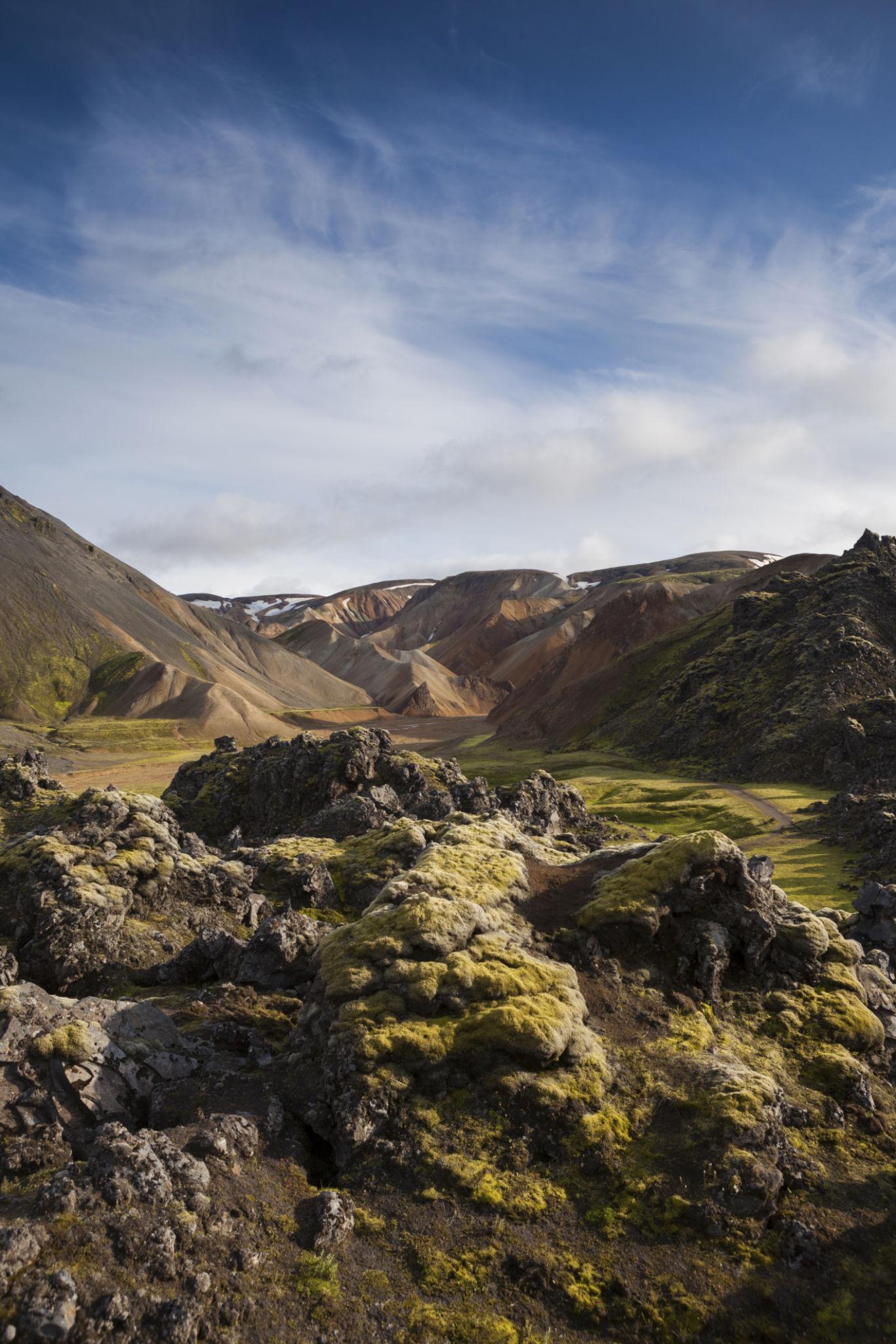
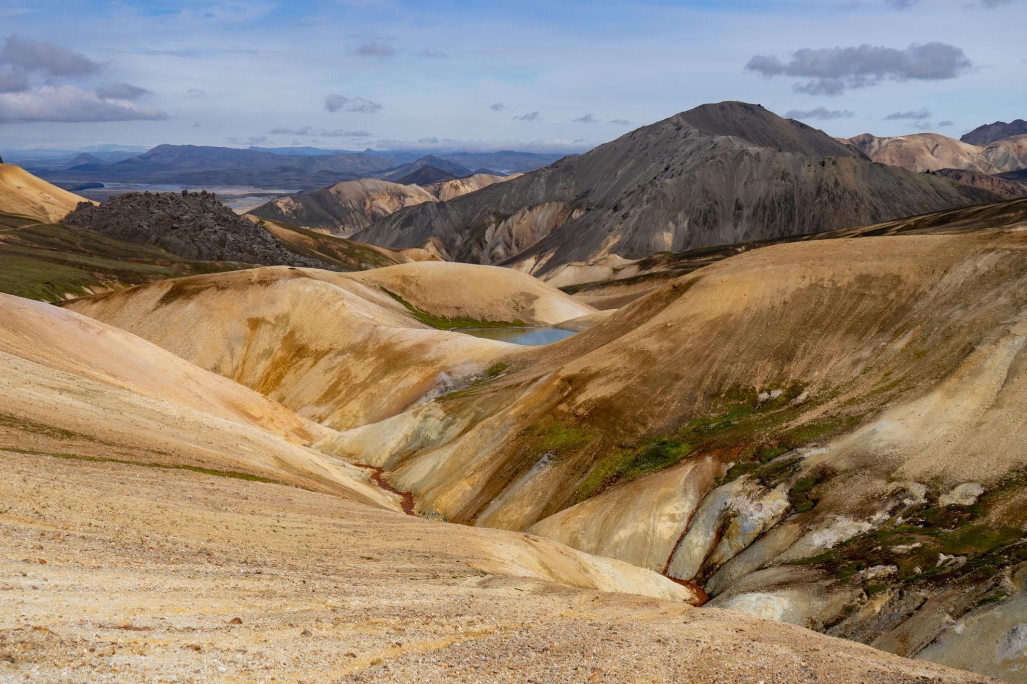
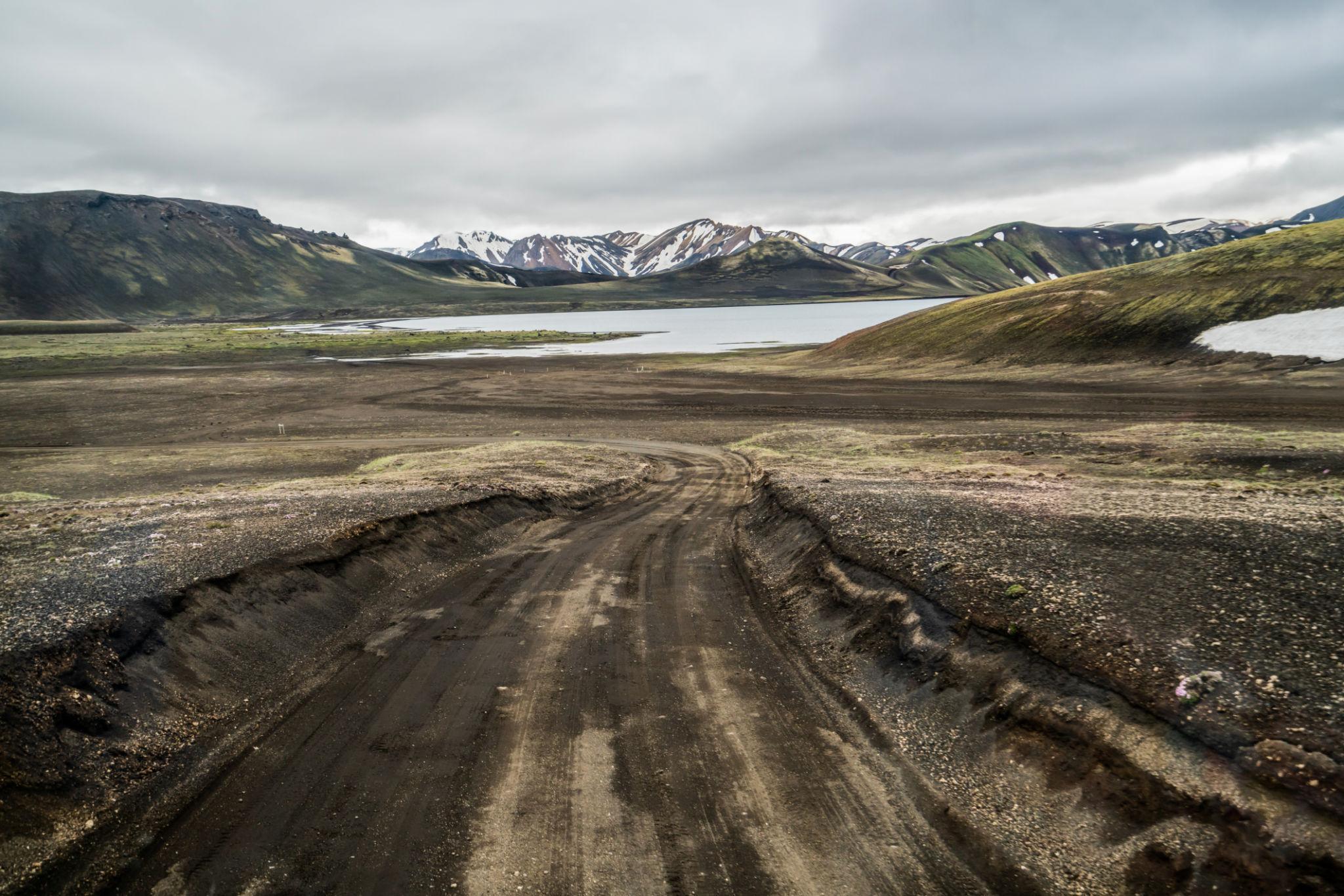
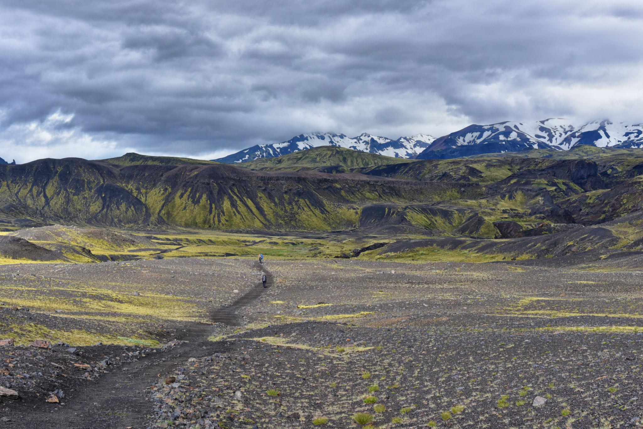
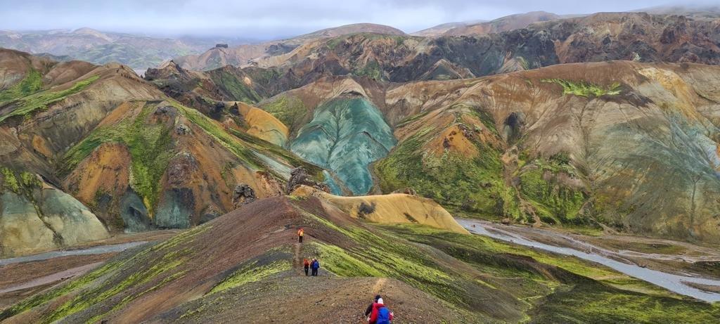
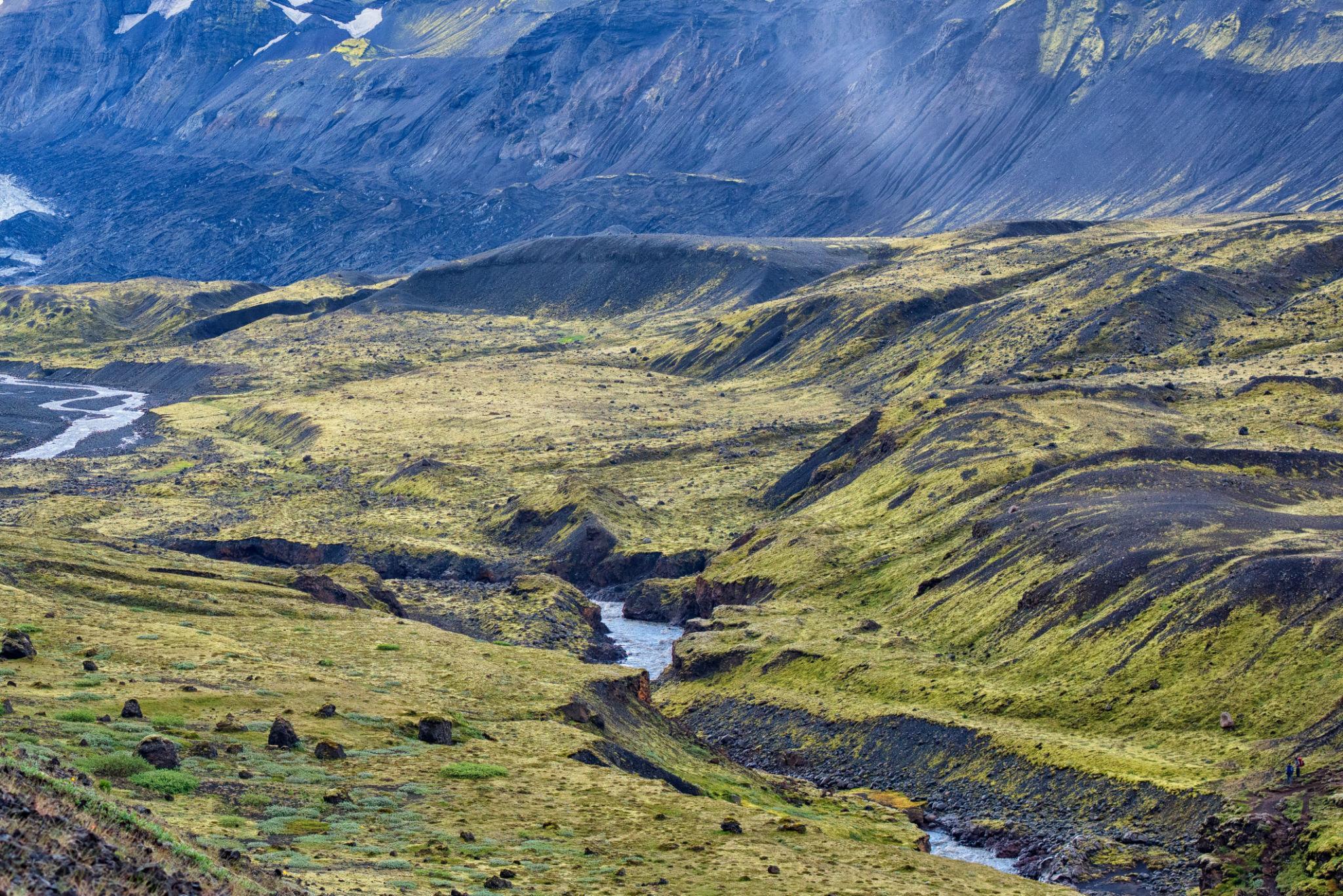
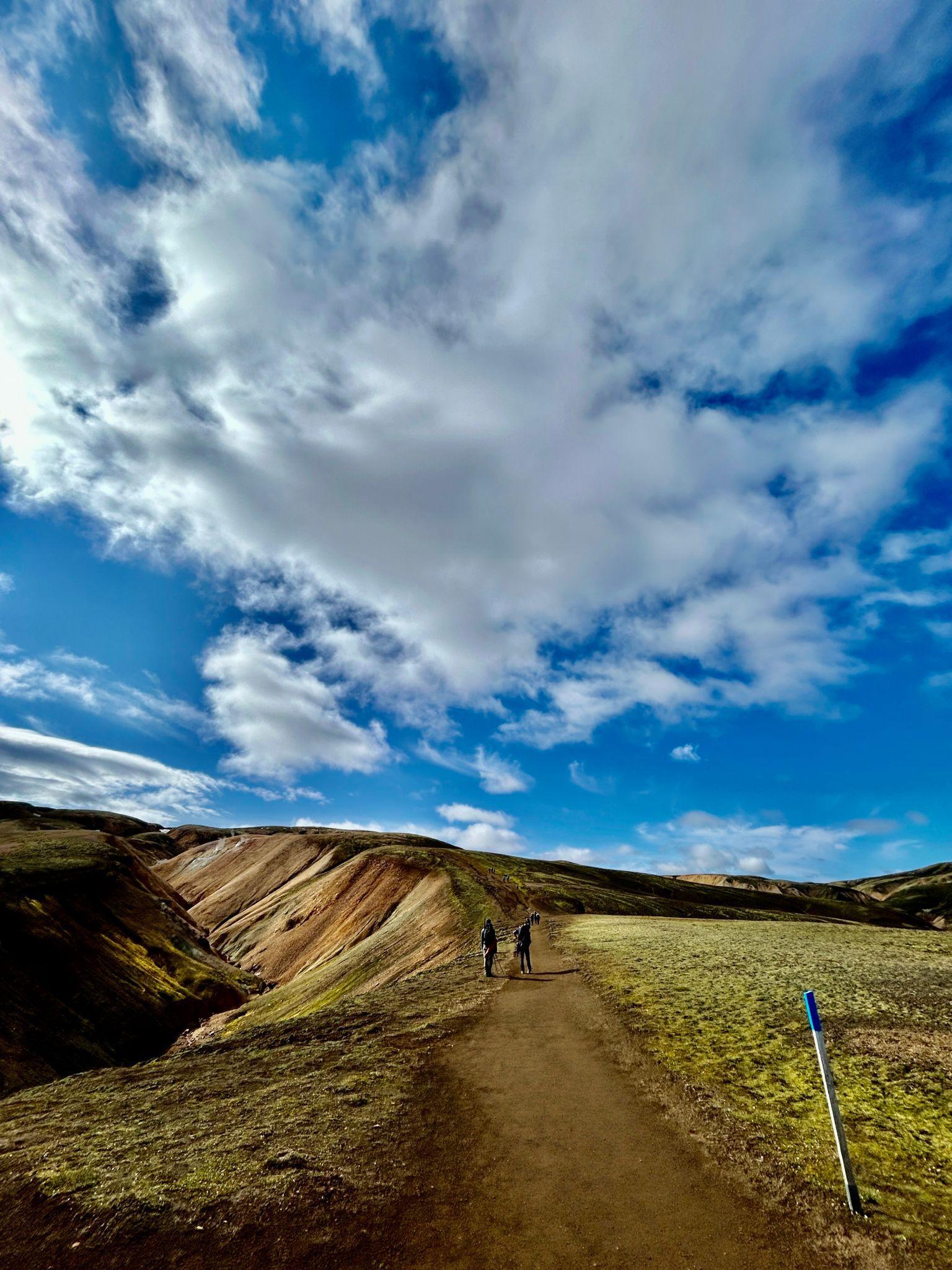
The Laugavegur Trail crosses a diverse volcanic landscape of lava fields, colorful rhyolite mountains, glacial valleys, and black sand deserts in Iceland’s central highlands.
The Icelandic highlands form a vast interior plateau that occupies much of the country’s central region. This area remains largely uninhabited because of its harsh climate, volcanic terrain, and difficult access.
The Laugavegur Trail crosses several distinct geological zones.
At the northern end of the route lies Landmannalaugar, an area famous for its colorful rhyolite mountains. These mountains display shades of red, yellow, green, and orange created by mineral deposits formed through geothermal activity.
Further along the route, hikers pass through extensive lava fields created by volcanic eruptions over thousands of years. These landscapes appear almost otherworldly, with hardened black lava forming irregular ridges and formations.
The trail also crosses large obsidian fields, composed of volcanic glass formed when molten lava cooled rapidly.
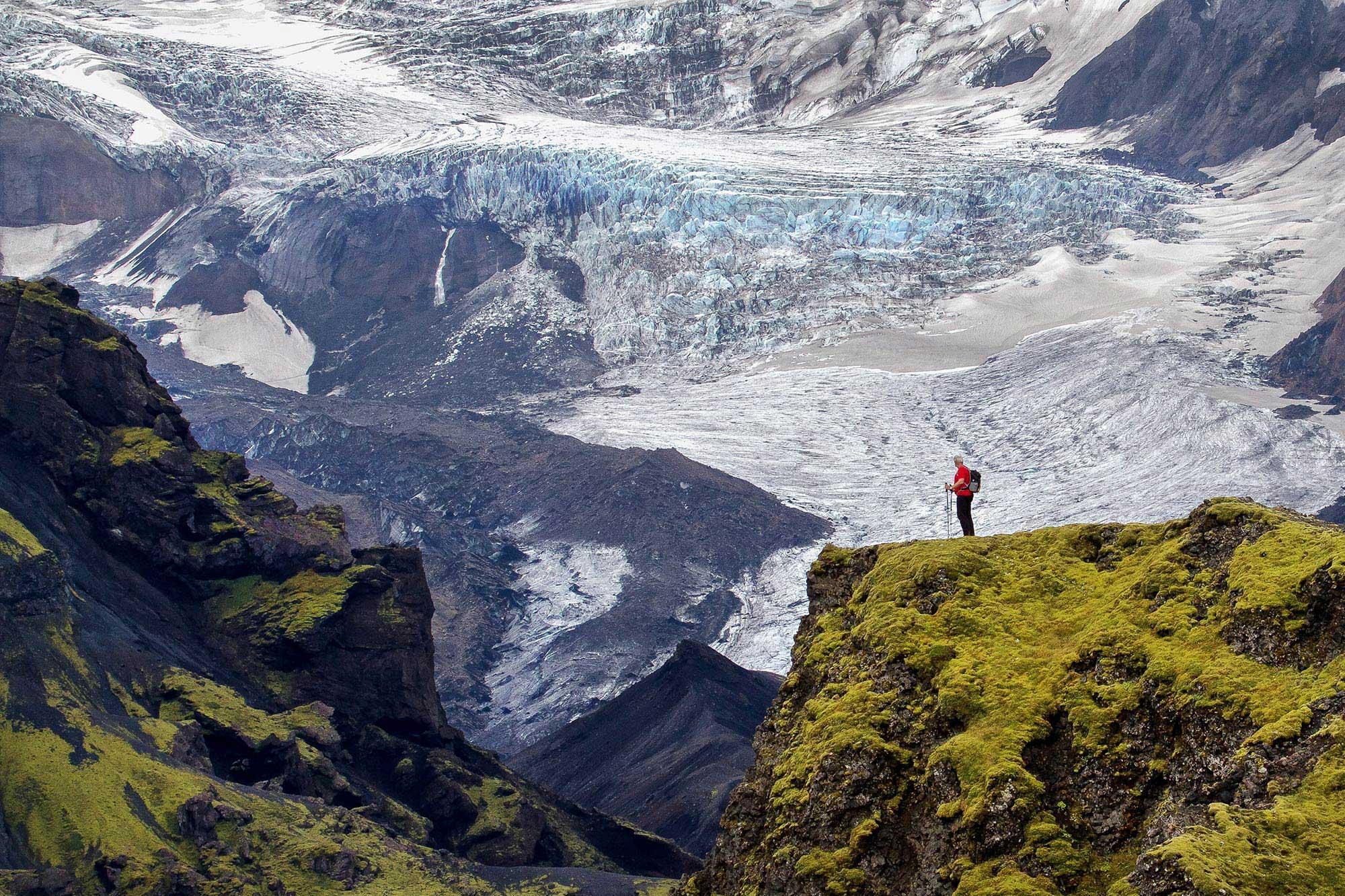
As the route progresses southward, the terrain gradually transitions into broad glacial valleys and volcanic deserts. The distant ice caps of glaciers such as Eyjafjallajökull and Mýrdalsjökull dominate the southern horizon.
This remarkable geological diversity is one of the main reasons the Laugavegur Trail attracts hikers from around the world.
3. Cultural and Historical Background of the Route
The Laugavegur Trail has long been used as a traditional travel route across Iceland’s highlands. Historically, Icelanders traveled between inland farms and coastal settlements using mountain tracks similar to the modern trekking route.
However, the present-day Laugavegur Trail was formally developed in the late twentieth century as a designated hiking route.
Iceland’s national parks and conservation authorities gradually established a network of mountain huts and marked trails to support trekking tourism in the highlands.
Today the trail is managed by the Icelandic Touring Association (Ferðafélag Íslands) and is recognized as one of the country’s most important hiking routes.
Although Iceland is a modern and technologically advanced country, its highland regions remain largely untouched by permanent development. The Laugavegur Trail therefore offers visitors an opportunity to experience the remote interior landscapes that have shaped Icelandic history and folklore.
4. Where the Laugavegur Trail Fits Among Global Treks
The Laugavegur Trail is often compared with other famous trekking routes around the world.
Examples include:
- Tour du Mont Blanc in Europe
- the Inca Trail in Peru
- the GR20 in Corsica
However, the Laugavegur Trail stands apart because of its geological setting.
Most famous trekking routes pass through mountain ranges formed by tectonic uplift. In contrast, the Icelandic highlands are shaped primarily by volcanic activity and glacial processes.
As a result, hikers encounter landscapes that feel closer to a volcanic desert than a traditional alpine environment.
The trail also offers dramatic contrasts in terrain within a relatively short distance. In just a few days, hikers move from geothermal valleys to lava fields, from colorful mineral mountains to vast glacial floodplains.
This diversity makes the Laugavegur Trail particularly appealing to travelers interested in geology and natural landscapes.
5. Access and Logistics
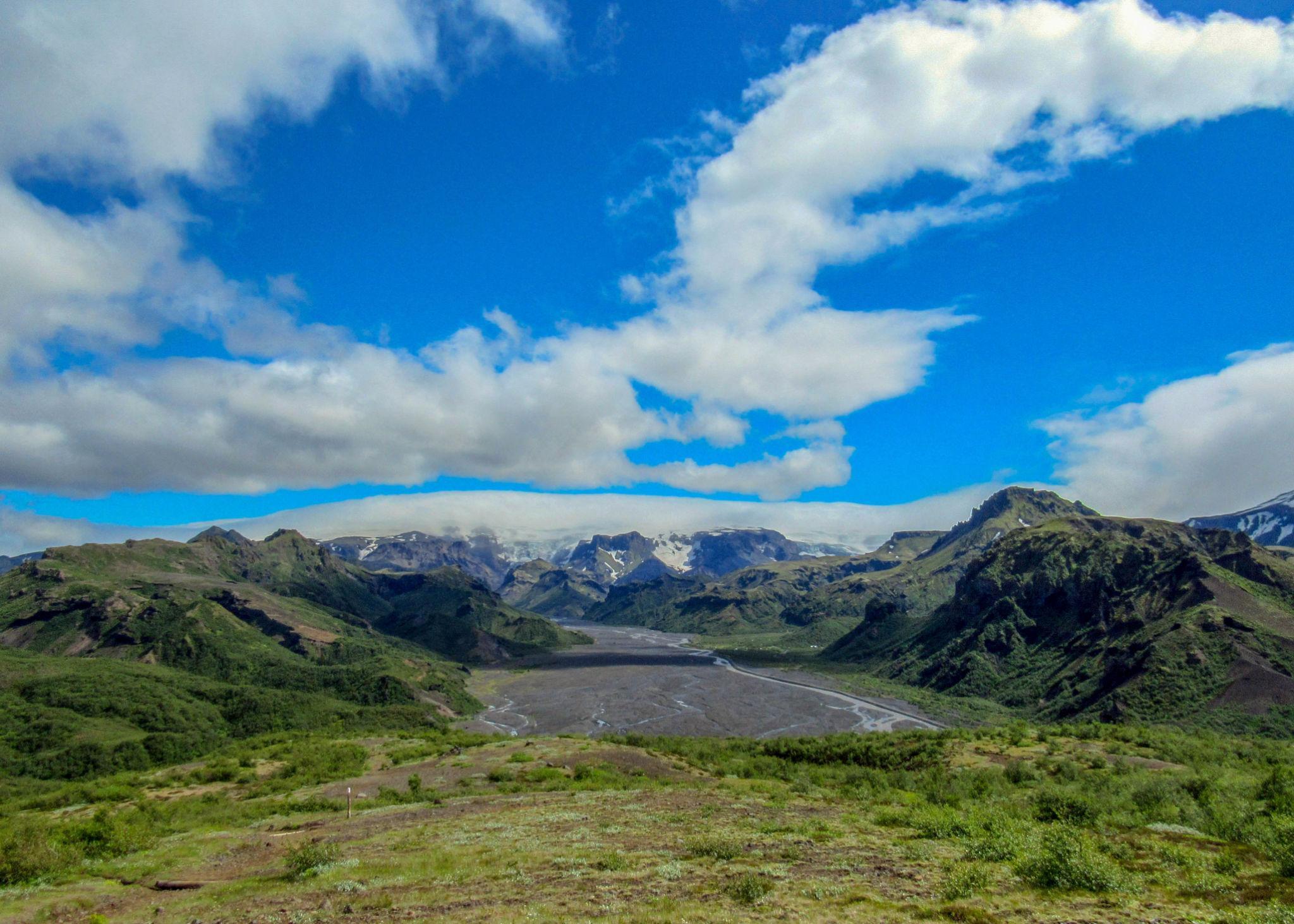
Landmannalaugar serves as the northern starting point of the Laugavegur Trail, while the lush glacial valley of Þórsmörk marks the southern end of the trek.
The Laugavegur Trail begins in the highland region of Landmannalaugar and ends in the valley of Þórsmörk (Thorsmork).
Both locations lie within Iceland’s interior highlands, which are not connected by standard paved roads.
Because of this, reaching the trailhead requires careful logistical planning.
International Access to Iceland
Most international travelers arrive in Iceland through Keflavík International Airport, located near the capital city of Reykjavík.
The airport receives flights from major cities in Europe and North America, making Iceland easily accessible for international visitors.
From Reykjavík, travelers must arrange transportation to the highland trailhead.
Transport to Landmannalaugar
Several transportation options exist for reaching Landmannalaugar.
Highland buses operate during the summer trekking season. These buses are specifically designed to travel on Iceland’s rough interior roads and often use large four-wheel-drive vehicles.
Travel time from Reykjavík to Landmannalaugar typically ranges from 3 to 4 hours.
Some travelers also rent 4×4 vehicles, as standard rental cars are not permitted on highland roads.
Return from Þórsmörk
After completing the trek, hikers usually travel back to Reykjavík from Þórsmörk using the same highland bus services.
These buses operate regularly during the trekking season and coordinate with typical hiking itineraries.
6. Visa and Entry Requirements for International Travelers
Since Iceland is part of the Schengen Area, entry rules follow standard Schengen visa regulations.
Travelers from Europe
Citizens of European Union countries can travel freely to Iceland without visa restrictions.
Travelers from the United States, Canada, Australia, and the United Kingdom
Visitors from these countries may enter Iceland visa-free for up to 90 days within the Schengen zone.
Travelers from South Asia, Africa, and other regions
Citizens of countries such as Pakistan, India, Bangladesh, and several African states must apply for a Schengen tourist visa before traveling to Iceland.
This visa allows travel within multiple European countries for a limited period.
Applicants must usually provide documentation including:
- travel itinerary
- accommodation reservations
- travel insurance coverage
- proof of financial means
Processing times vary depending on the country of application.
7. Travel Insurance and Safety Preparation
Although Iceland does not legally require travel insurance for all visitors, insurance coverage is strongly recommended for anyone attempting the Laugavegur Trail.
The route crosses remote highland terrain where weather conditions can change rapidly.
Travel insurance should ideally include:
- medical coverage
- emergency evacuation
- trip cancellation protection
Because the trail involves river crossings and unpredictable weather, adequate insurance provides an additional layer of safety for international trekkers.
8. Best Time to Trek the Laugavegur Trail and Seasonal Conditions
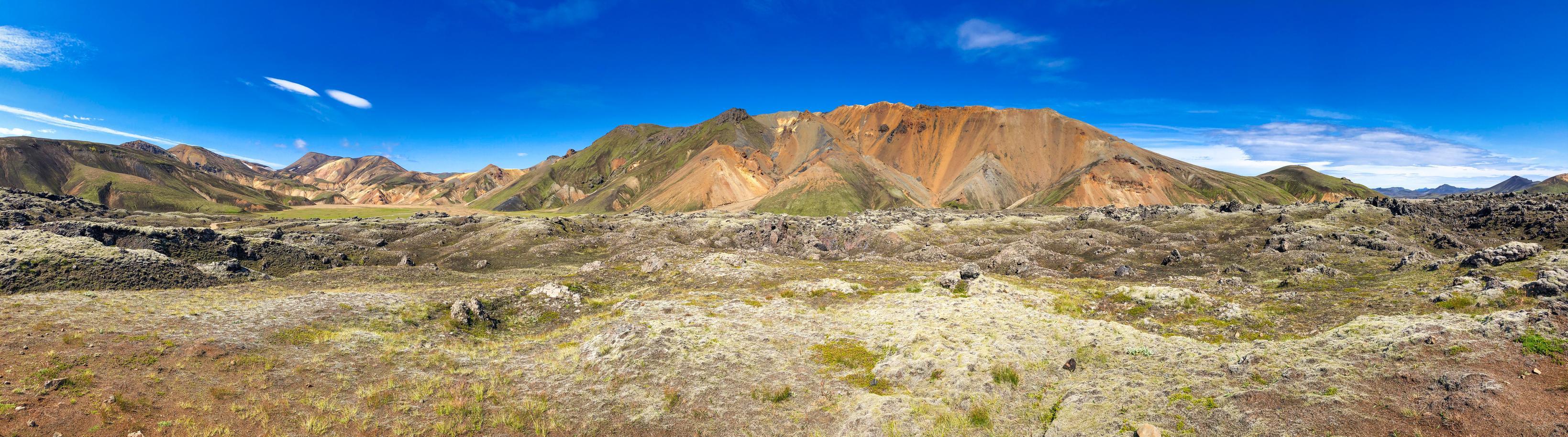
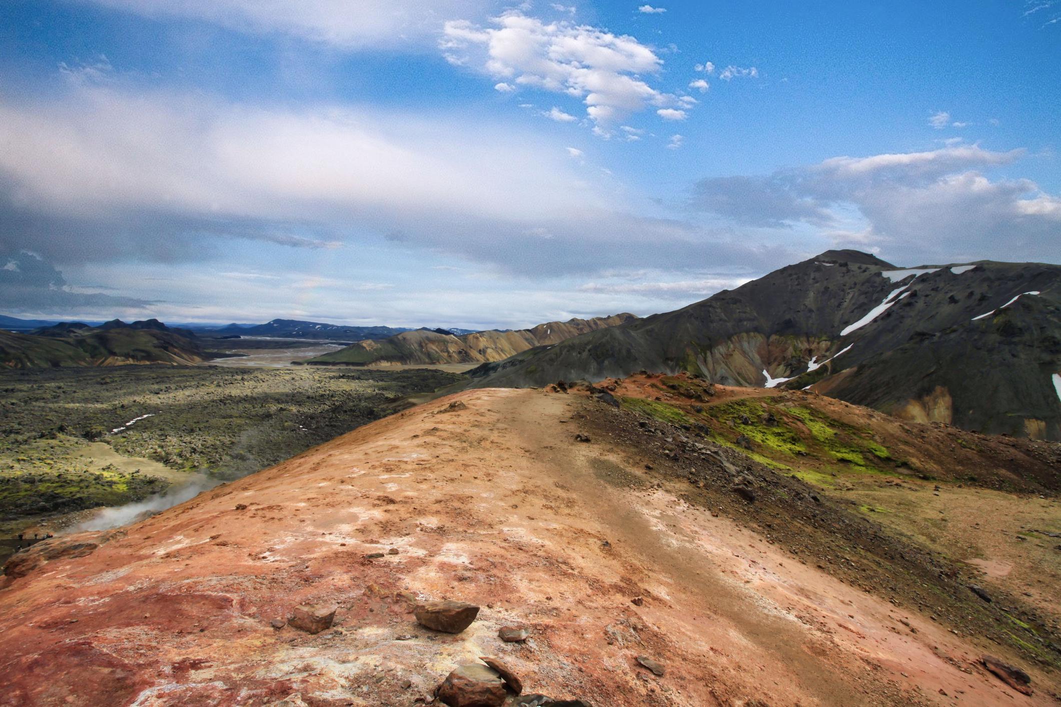
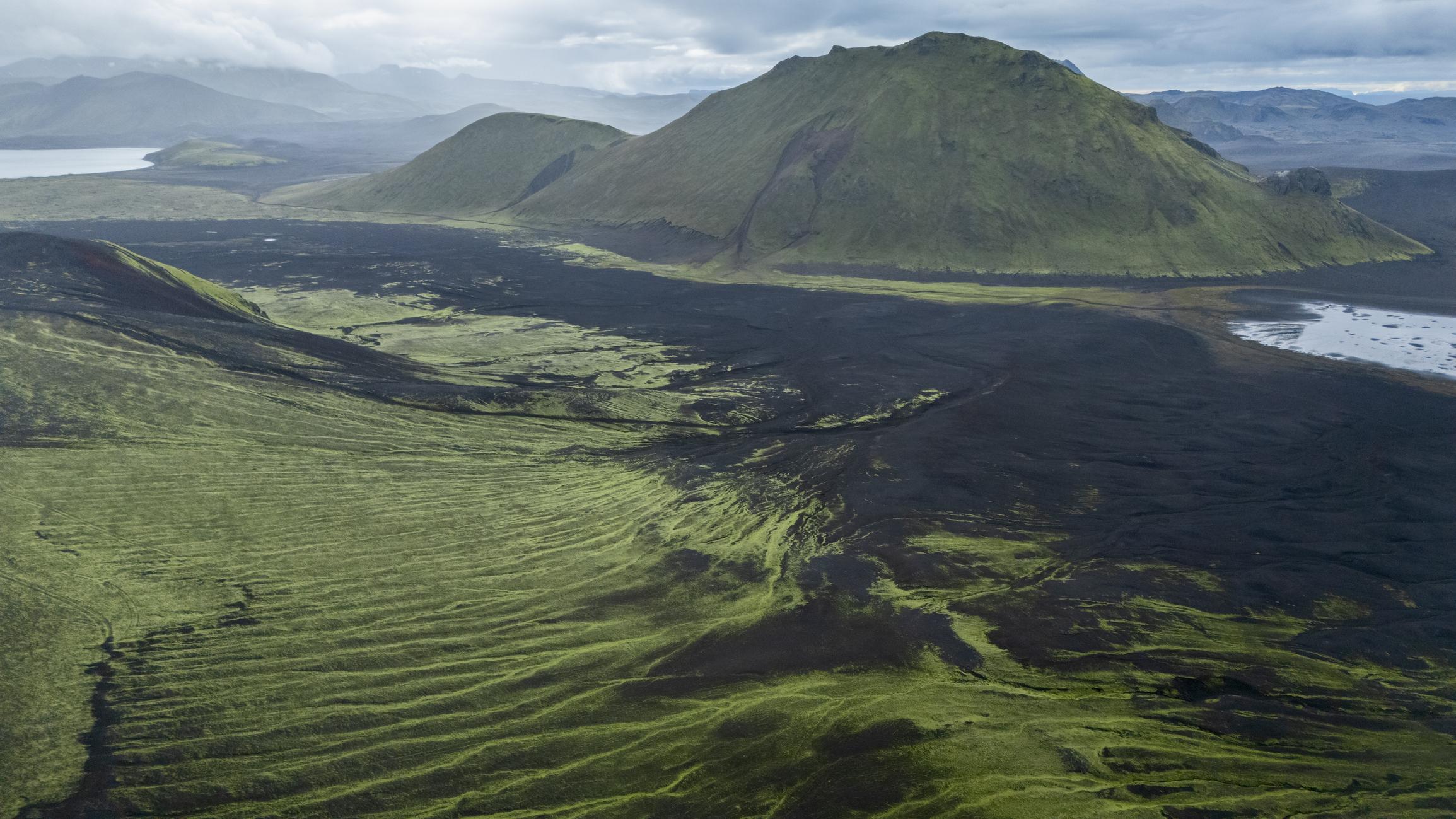
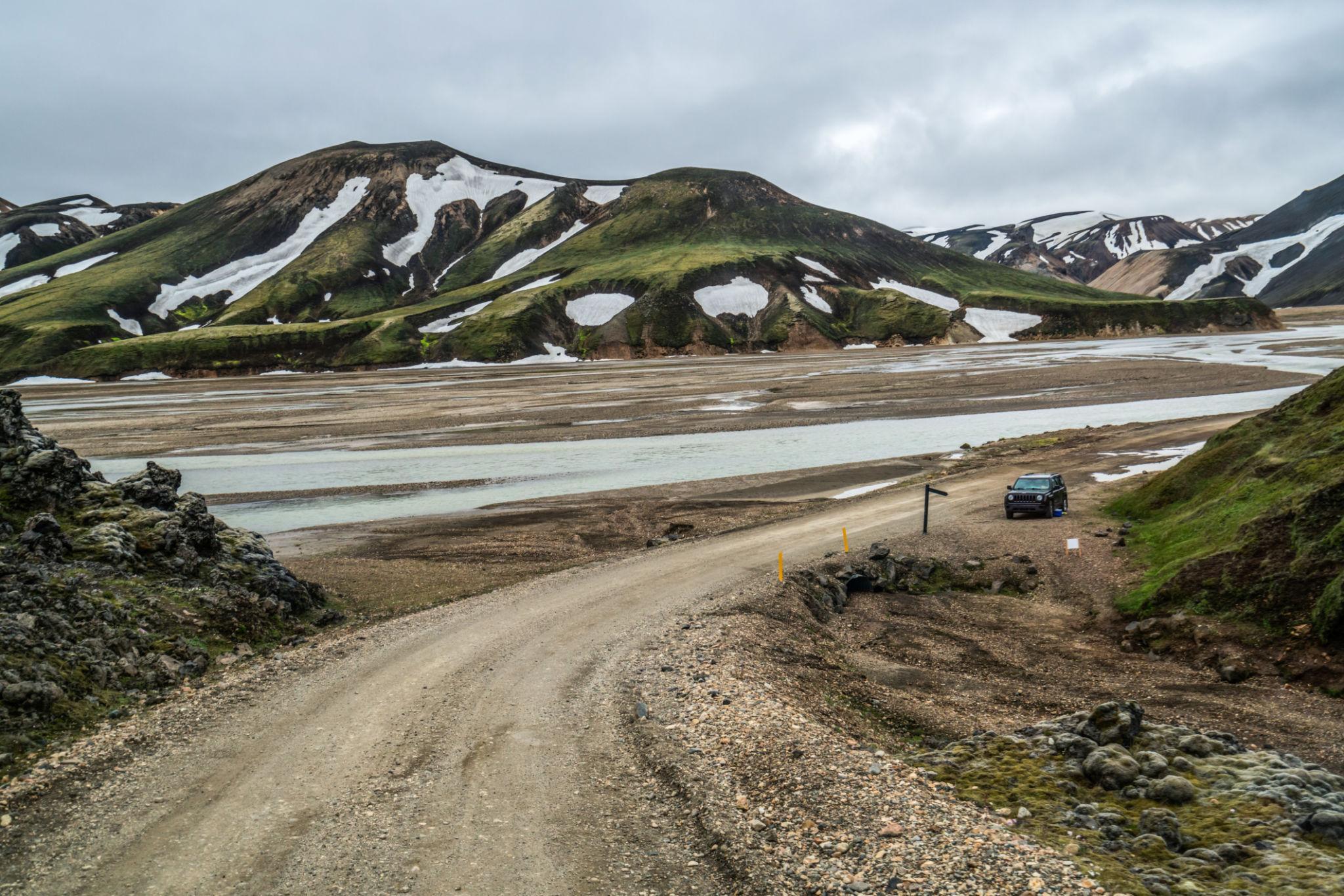
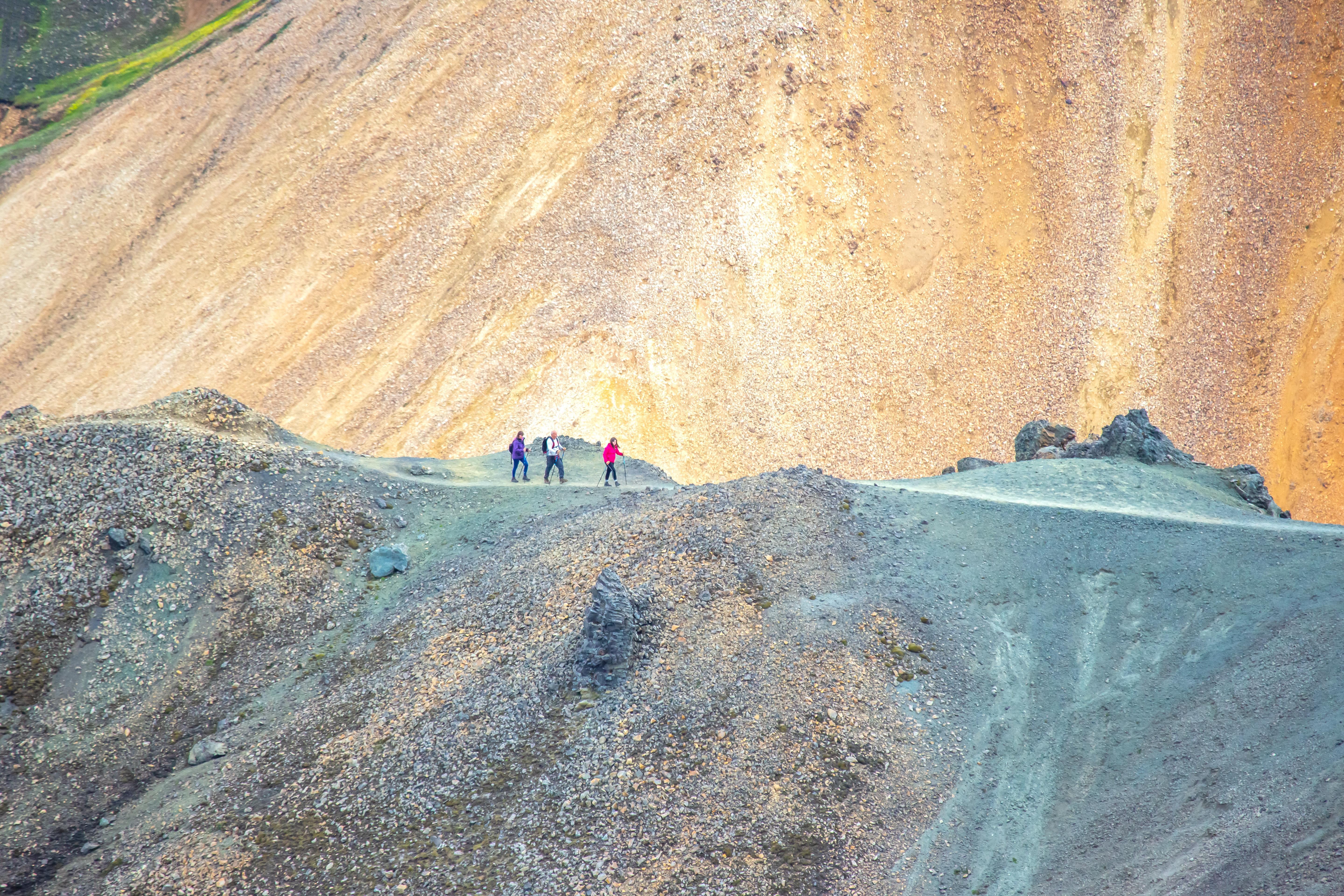
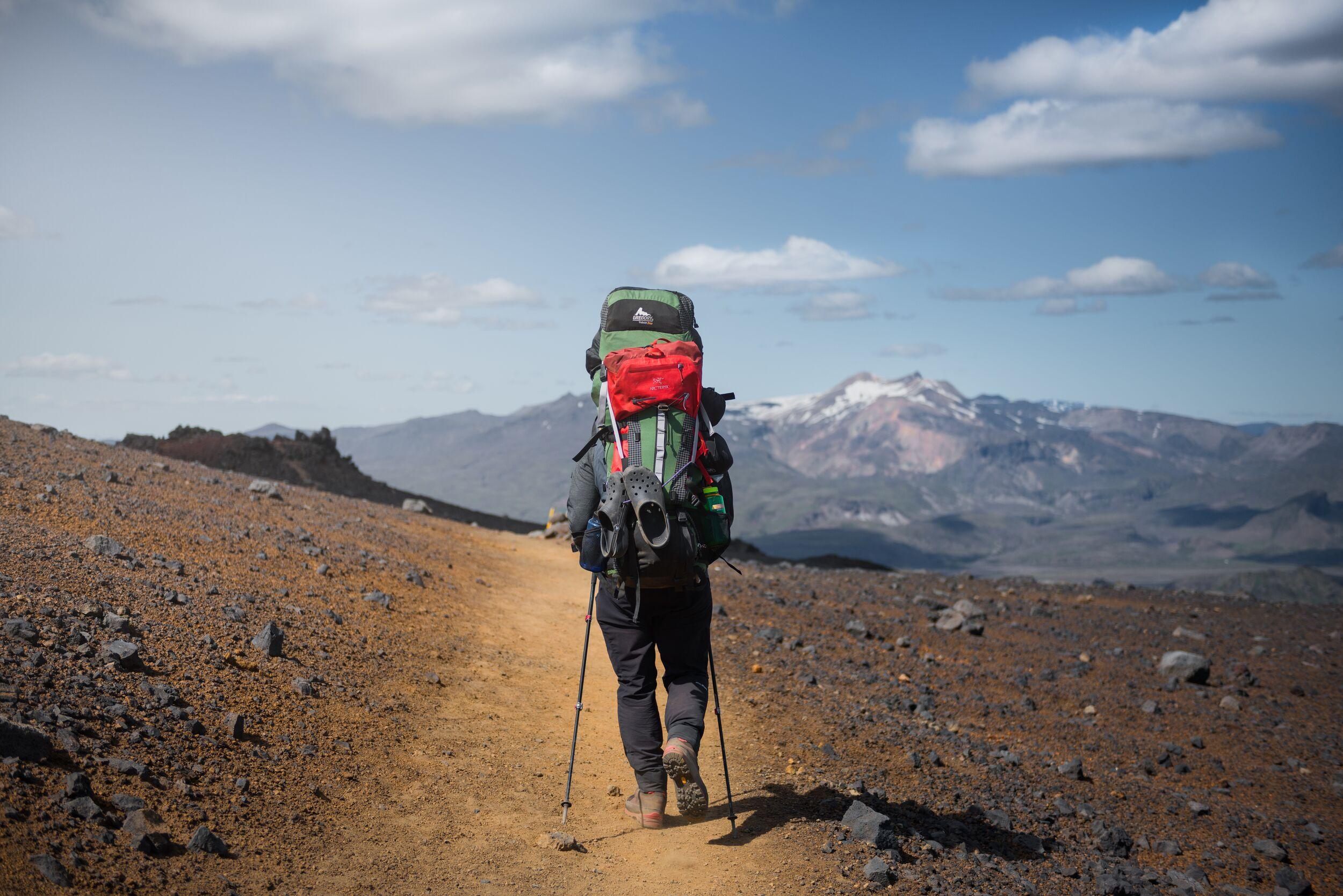
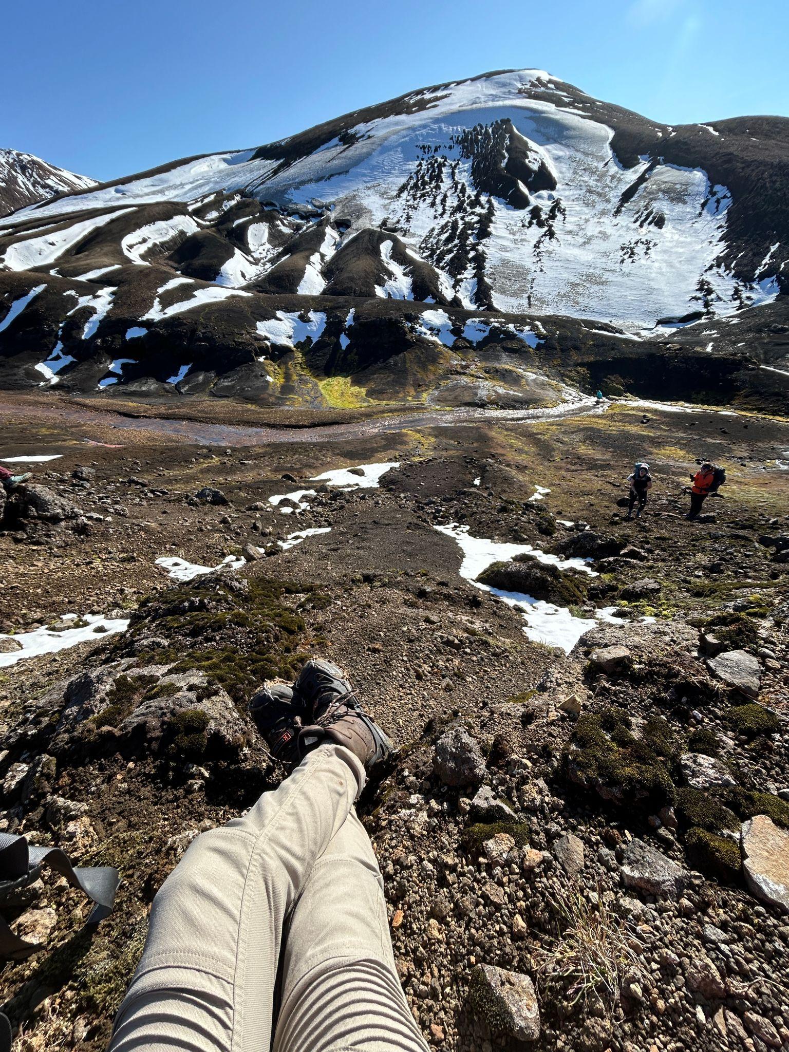
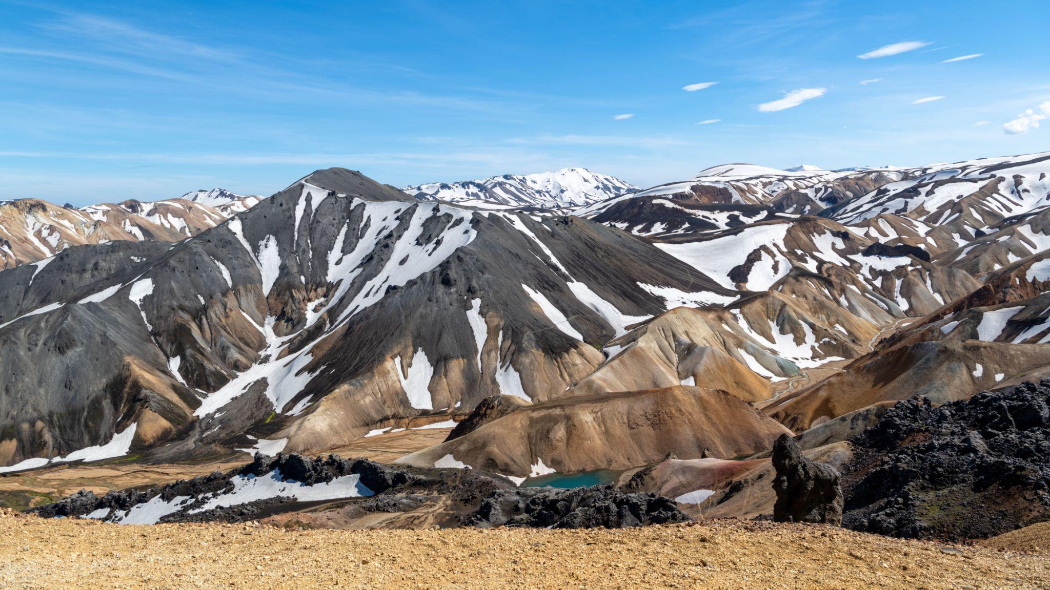
Stable summer weather and snow-free trails in the Icelandic highlands create the short seasonal window when the Laugavegur Trail is accessible.
The Laugavegur Trail lies deep in Iceland’s central highlands, a region that remains inaccessible for much of the year because of snow, flooding rivers, and extreme weather. As a result, the trekking season is short compared with many mountain trails elsewhere in the world.
The typical trekking season runs from late June through early September. During this period the highland roads open, mountain huts begin operating, and the trail becomes safely accessible for hikers.
Outside this window the route becomes extremely difficult because the interior highlands are often covered with snow and subject to strong winter storms.
Early Season – Late June to Early July
The first weeks of the trekking season usually begin in late June once snow begins melting in the highlands.
Early season trekking offers several advantages. Visitor numbers are relatively low, daylight hours are long, and the landscapes still contain patches of snow that create dramatic scenery around volcanic ridges.
However, trekkers should expect certain challenges. Snowfields may remain on higher sections of the route, and river levels can be high due to snowmelt. Weather conditions can also be unstable, particularly during sudden cold fronts.
Hikers attempting the route early in the season should be comfortable navigating snowy sections and prepared for colder temperatures.
Peak Season – July and August
The majority of hikers complete the Laugavegur Trail during July and August.
These months provide the most stable weather conditions in the Icelandic highlands. Daytime temperatures are generally mild, and most of the snow has melted from the trail.
All mountain huts operate during this period, and highland bus services run frequently between Reykjavík and Landmannalaugar.
Because of these advantages, the trail becomes busy during peak season. Hut reservations often fill quickly, and campsites may become crowded in popular areas.
Despite the increased visitor numbers, July and August remain the most reliable months for completing the trek.
Late Season – Late August to Early September
Late summer offers a quieter trekking experience as the number of visitors begins to decrease.
Temperatures gradually drop and the colors of the highland landscape begin to shift as mosses and grasses change shades before the onset of winter.
Weather conditions can still be stable, but storms become more frequent as autumn approaches. Some mountain huts close toward the end of the season, so trekkers should confirm availability before starting the route.
For hikers seeking fewer crowds and cooler temperatures, early September can still be an excellent time to experience the trail.
Temperature and Weather Characteristics
Weather conditions in the Icelandic highlands are unpredictable.
Typical daytime temperatures during the trekking season range between 8°C and 15°C. Night temperatures may drop close to 0°C, particularly at higher elevations.
Strong winds are common throughout the region, and rain can develop quickly even during summer months.
Because of these factors, hikers must be prepared for rapidly changing weather conditions at any time during the trek.
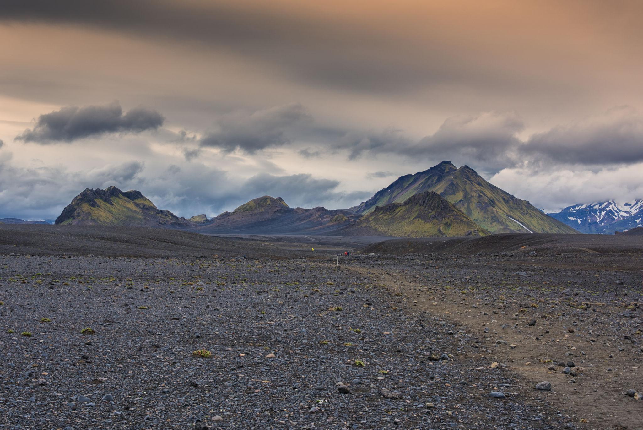
9. Complete Laugavegur Trail Itinerary – Day by Day
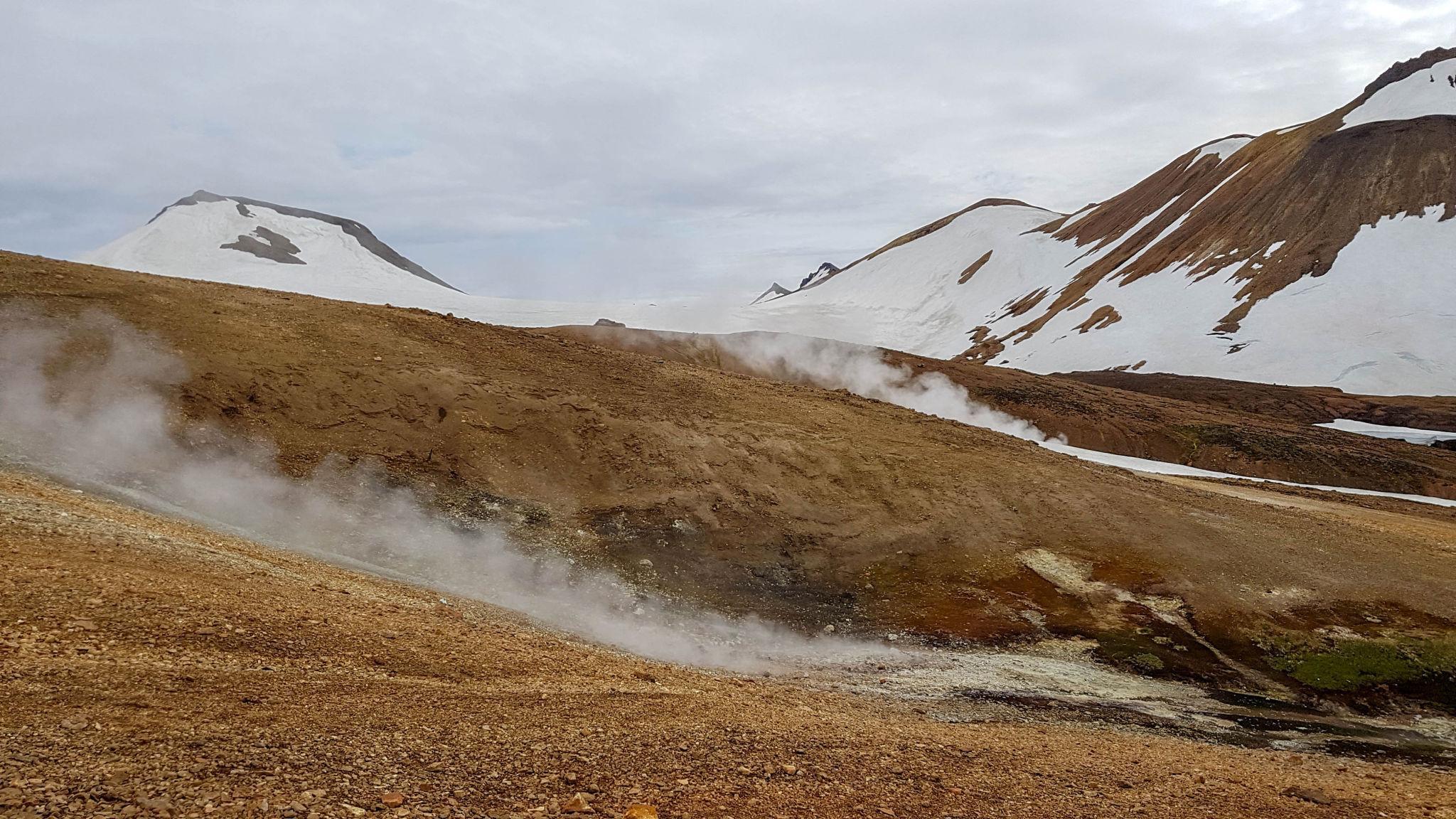
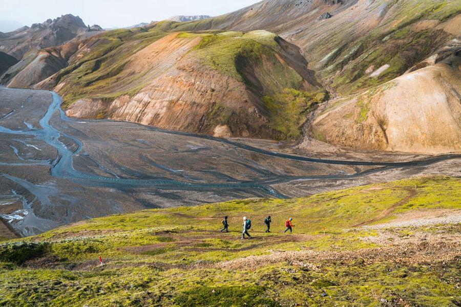
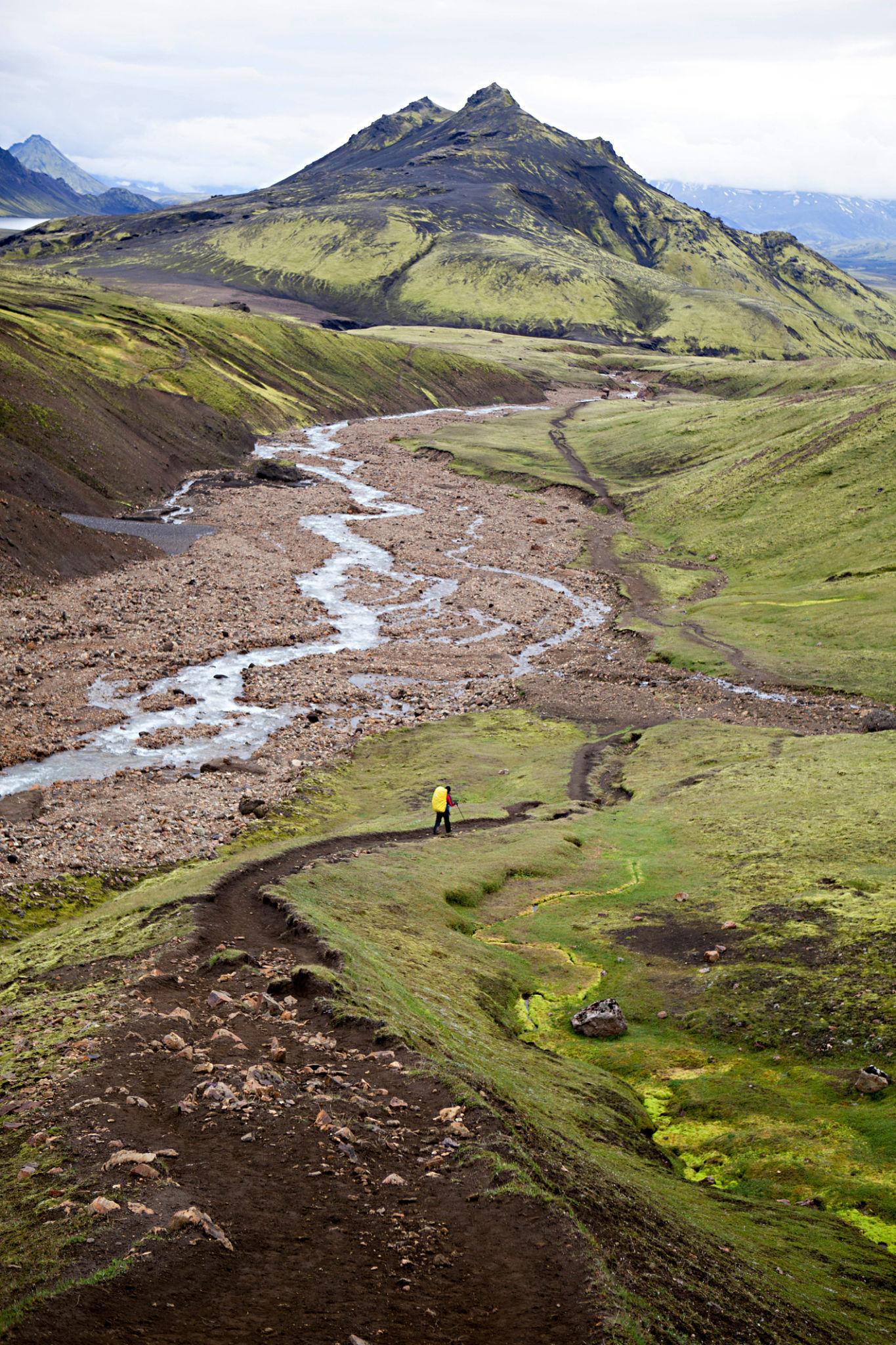
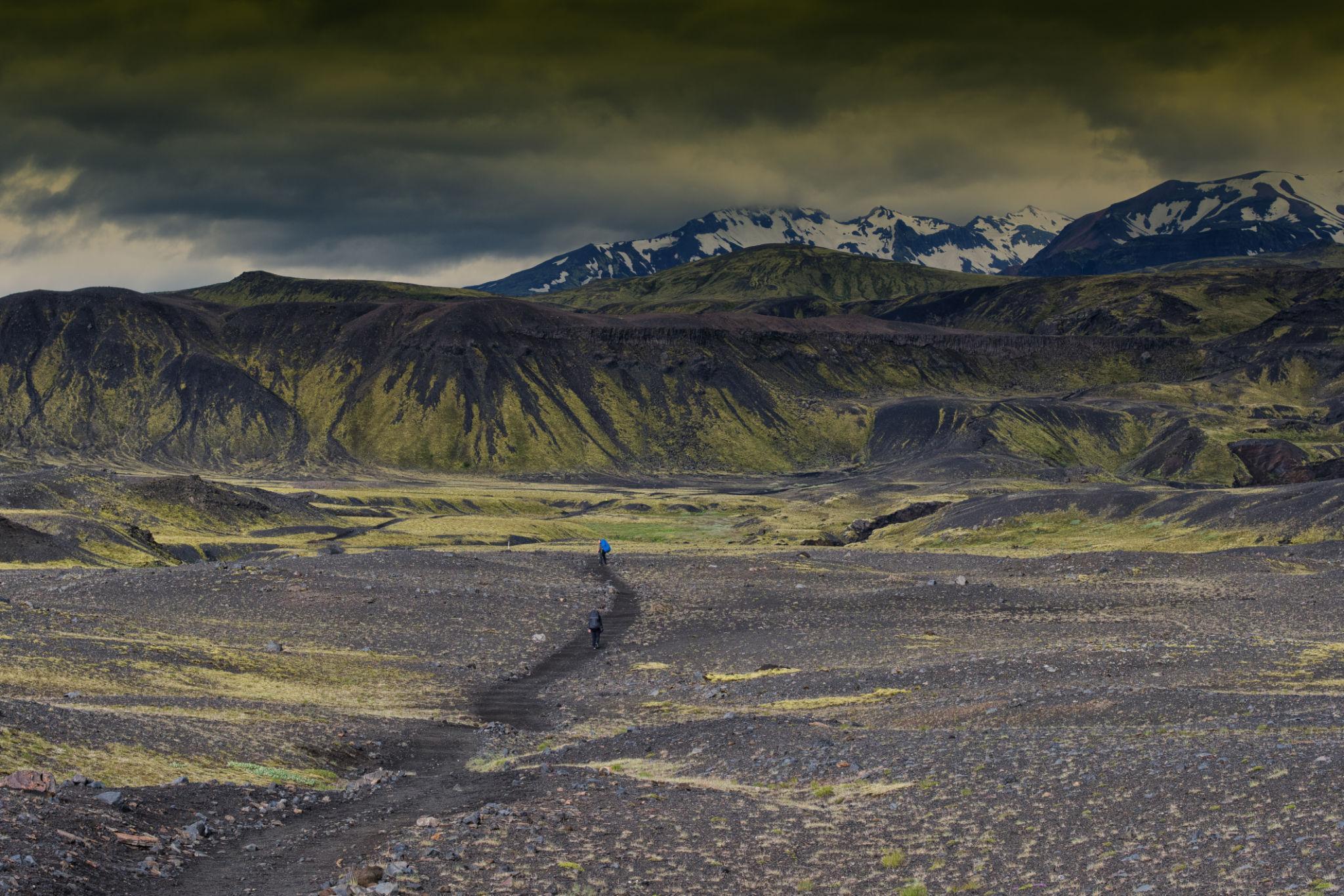
Hikers cross volcanic deserts, glacial rivers, and colorful mountains as the Laugavegur Trail travels from Landmannalaugar to the valley of Þórsmörk.
Although some experienced hikers complete the trail in three days, most trekkers follow a four-day itinerary that allows time to enjoy the landscapes and adjust to the terrain.
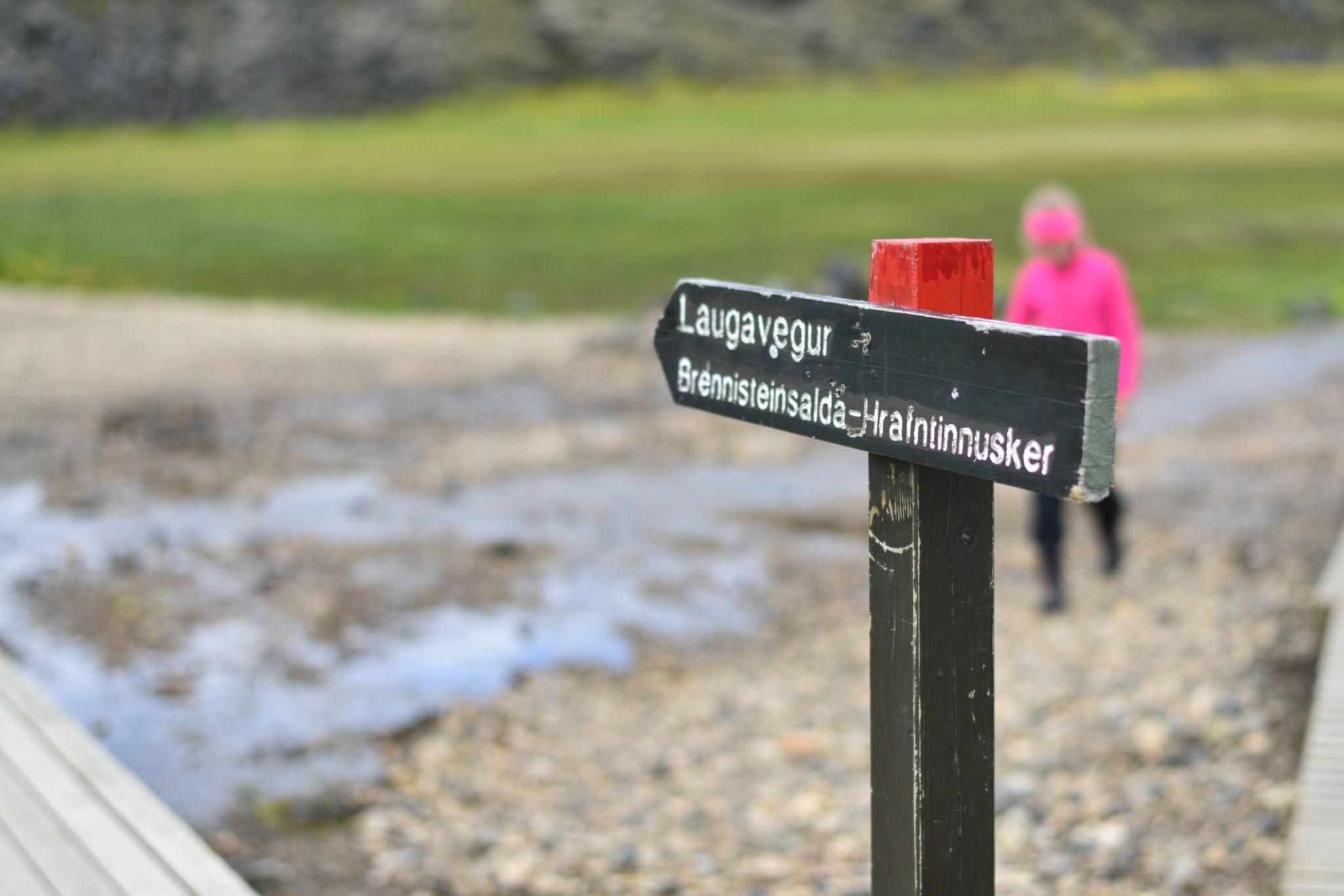
Day 1 – Landmannalaugar to Hrafntinnusker
Distance: approximately 12 km
Elevation gain: about 470 meters
The trek begins in Landmannalaugar, one of Iceland’s most famous geothermal regions.
The trail climbs gradually through rhyolite mountains whose mineral-rich rock produces vivid colors across the slopes. Steam vents and hot springs appear in several places along the route.
As hikers ascend toward the plateau, the landscape becomes more barren and volcanic. Snowfields may remain in this area even during midsummer.
The stage ends at Hrafntinnusker Hut, located in a remote highland environment surrounded by obsidian fields and volcanic formations.
Day 2 – Hrafntinnusker to Álftavatn
Distance: approximately 12 km
Elevation loss: around 490 meters
This stage begins with a descent from the high volcanic plateau into a series of geothermal valleys.
The trail passes through the Jökultungur region, where colorful geothermal hillsides contrast sharply with dark lava fields.
As the route continues southward, the landscape opens into wide valleys surrounded by distant glaciers.
Trekkers eventually reach Álftavatn Lake, a calm alpine lake where one of the trail’s most scenic huts is located.
The campsite near the lake provides excellent views across the surrounding highlands.
Day 3 – Álftavatn to Emstrur (Botnar)
Distance: approximately 15 km
The third stage crosses large black sand plains formed by glacial floods and volcanic eruptions.
This area appears almost desert-like, with dark volcanic soil stretching across broad valleys.
Several river crossings occur during this stage. These rivers are fed by glaciers and can be cold and fast-flowing.
As the trail continues, hikers approach the Markarfljót canyon, a dramatic gorge carved by glacial meltwater.
The stage ends at Emstrur Hut (Botnar), located near the edge of the canyon.
Day 4 – Emstrur to Þórsmörk
Distance: approximately 15 km
The final stage gradually transitions from volcanic desert to lush glacial valley.
The route enters the protected nature reserve of Þórsmörk, a region surrounded by glaciers and covered with green vegetation.
Several rivers must be crossed before reaching the valley floor.
Þórsmörk itself is a dramatic destination, enclosed by glaciers including Eyjafjallajökull, the volcano that erupted in 2010.
Most hikers celebrate the completion of the trek at one of the mountain huts or campsites in the valley.
10. Difficulty Level and Physical Preparation

Although technically easier than many alpine routes, the Laugavegur Trail requires endurance for long distances, river crossings, and unpredictable highland weather.
Compared with some famous mountain routes such as the GR20 in Corsica, the Laugavegur Trail is less technical. The path is generally well-marked and does not require scrambling over rock faces.
However, the trek still demands good physical condition.
Daily walking distances range from 12 to 15 kilometers, often across uneven volcanic terrain. Wind, rain, and cold temperatures can increase fatigue, particularly when carrying a backpack.
Trekkers should ideally have experience with multi-day hiking and be comfortable walking for several hours each day.
Preparation can include regular hiking, cardiovascular training, and carrying a loaded backpack during practice walks.
Because weather conditions may change rapidly in Iceland’s highlands, mental resilience and adaptability are also important.
11. Gear and Equipment Strategy for the Laugavegur Trail
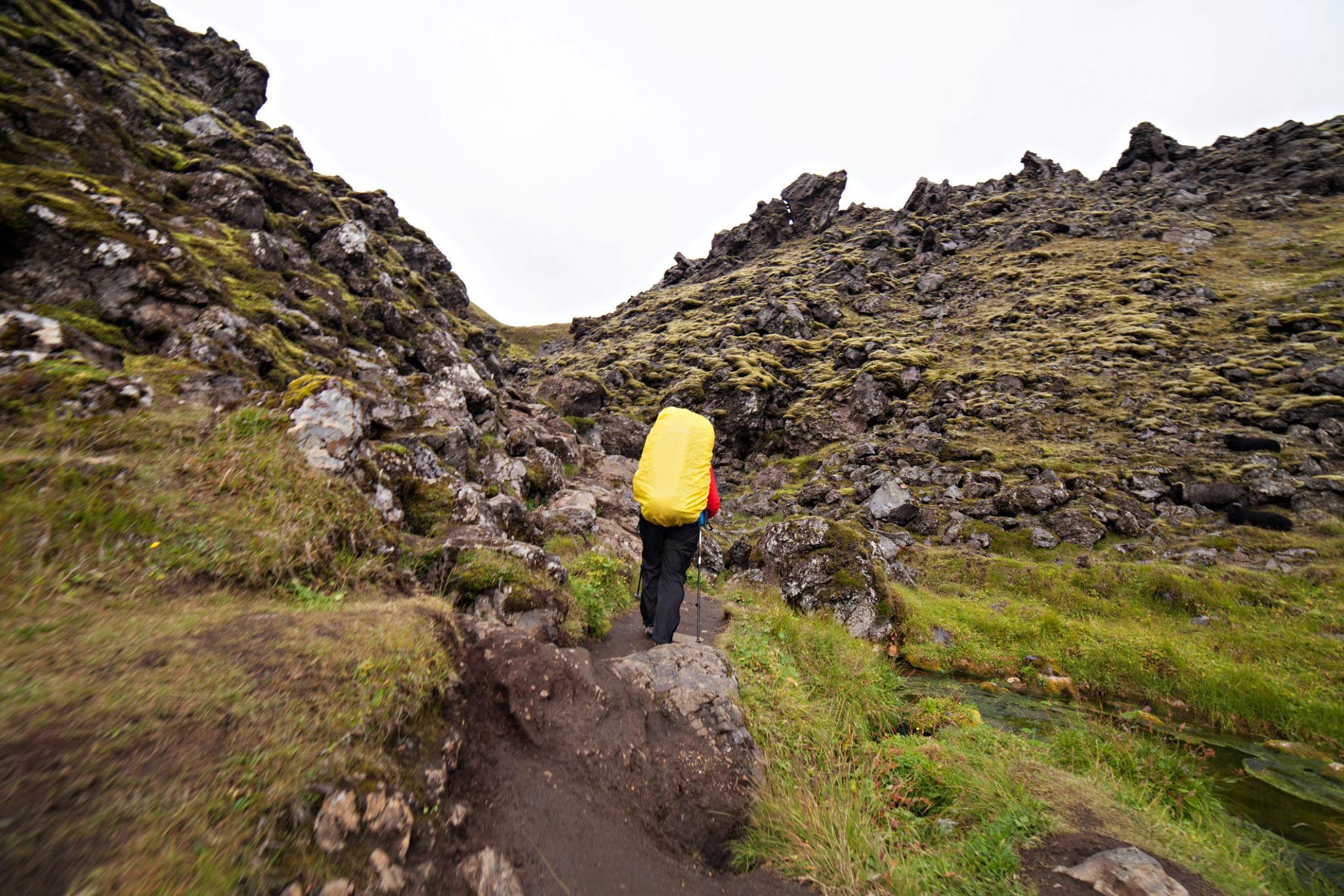
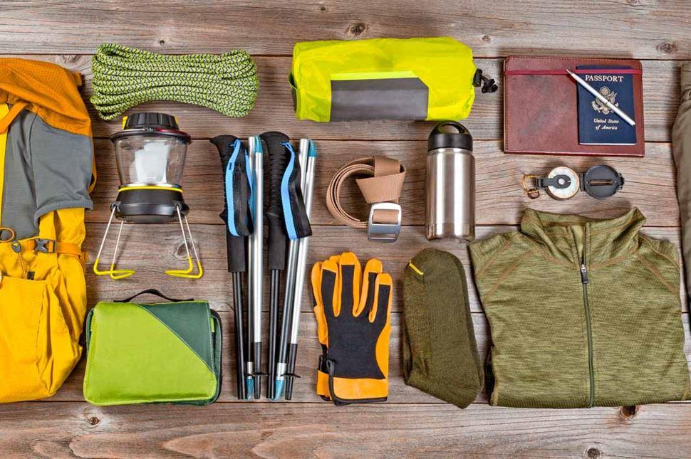
Proper equipment for the Laugavegur Trail focuses on waterproof protection, layered clothing, and lightweight gear capable of handling strong wind and rapidly changing weather.
The Icelandic highlands present a unique combination of environmental challenges. Trekkers must prepare for cold temperatures, strong winds, rain, and river crossings even during the summer season. As a result, gear selection should focus on weather protection while keeping backpack weight manageable.
Unlike technical alpine treks that require climbing equipment, the Laugavegur Trail primarily requires well-selected hiking gear suitable for long-distance trekking in unpredictable weather.
Backpack
A backpack between 40 and 50 liters is sufficient for most trekkers staying in mountain huts along the trail. Those carrying camping equipment may require a slightly larger pack of around 55 to 60 liters.
The backpack should include a rain cover because sudden rainstorms are common in the Icelandic highlands. Adjustable hip belts and supportive shoulder straps are also important for comfort during long walking days.
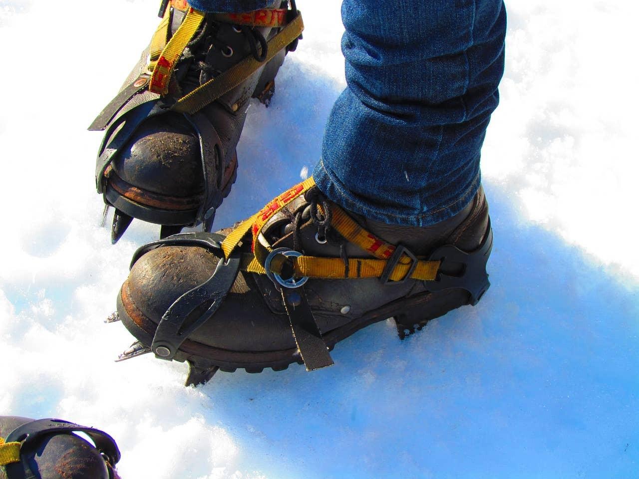
Footwear
Waterproof hiking boots are strongly recommended. The trail frequently crosses wet ground, snow patches, and shallow rivers.
Boots should provide:
- strong grip on loose volcanic soil
- ankle support on uneven terrain
- waterproof protection against wet conditions
Some experienced hikers use lightweight trail running shoes, but this approach requires careful consideration because of cold river crossings.
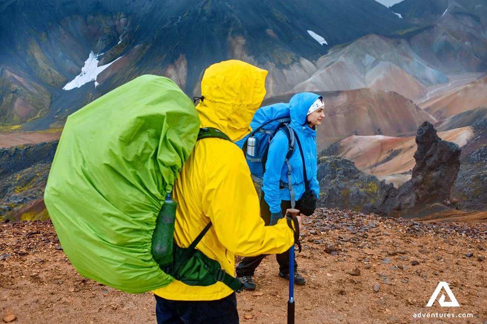
Clothing System
A layered clothing system is essential in Iceland’s highland climate.
The recommended clothing strategy includes:
Moisture-wicking base layers that keep sweat away from the skin.
An insulating mid-layer such as a fleece or lightweight down jacket.
A waterproof and windproof outer shell capable of handling heavy rain and strong wind.
Even during summer months, temperatures can drop close to freezing in exposed highland areas.
Trekking Poles
Trekking poles are useful for maintaining balance across uneven volcanic terrain. They also provide stability during river crossings and reduce strain on knees during descents.
Many hikers find poles particularly helpful when crossing loose gravel or sandy areas along the trail.
Sleeping Equipment
Trekkers staying in huts typically need only a sleeping bag or sleeping liner because mattresses are provided.
Campers will require a full camping system including:
- tent capable of handling strong winds
- sleeping pad
- warm sleeping bag suitable for near-freezing temperatures
The Laugavegur Trail is marked with wooden posts and sign markers along most of its length. Nevertheless, visibility can deteriorate rapidly in fog or storms.
Trekkers should carry a map of the route or a GPS navigation app on a smartphone. Offline maps are recommended because mobile coverage is limited in the highlands.
12. River Crossings and Trail Hazards
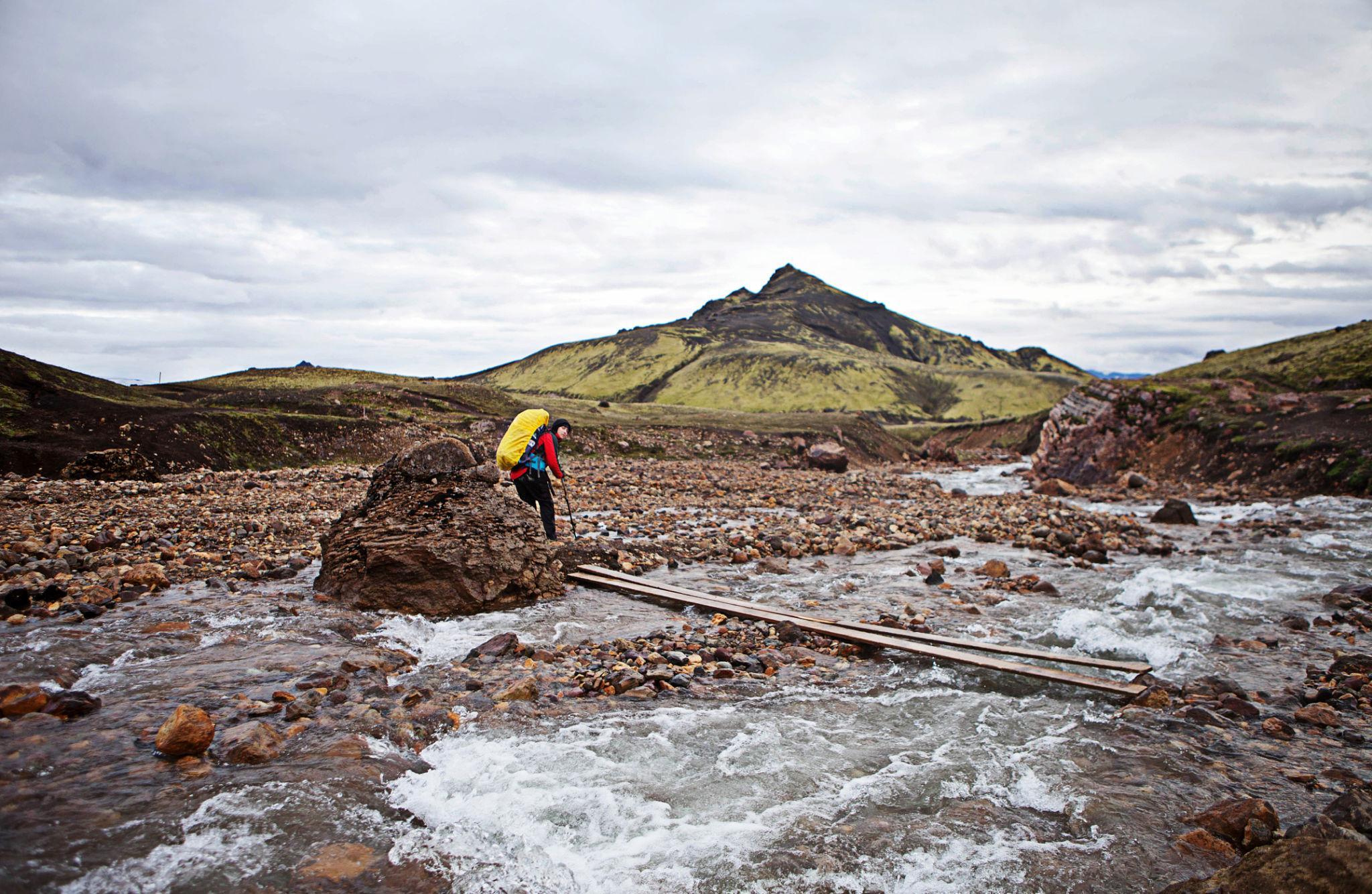
Glacial river crossings are one of the defining challenges of the Laugavegur Trail and require careful technique and attention to safety.
One of the most distinctive features of trekking in Iceland’s highlands is the presence of glacial rivers that must be crossed on foot.
These rivers originate from nearby glaciers and carry cold meltwater across the volcanic plains.
Characteristics of Highland Rivers
Glacial rivers have several characteristics that hikers should understand.
First, the water temperature is extremely cold. Direct contact with glacial meltwater can quickly numb feet and legs.
Second, river depth and flow speed vary throughout the day. Water levels are usually lower in the morning when temperatures are cooler and glacier melt is reduced.
Third, riverbeds often contain loose stones that can make footing unstable.
Safe River Crossing Techniques
Trekkers should always evaluate a river carefully before attempting a crossing.
If possible, choose sections where the river is wider and shallower rather than narrow channels where water flows faster.
Many hikers remove their boots and cross barefoot or wearing sandals. Trekking poles provide extra stability and allow hikers to test the riverbed ahead.
Crossing slowly while facing slightly upstream helps maintain balance against the current.
Other Trail Hazards
In addition to river crossings, several environmental factors can affect safety along the Laugavegur Trail.
Strong winds are common in the highlands and may make exposed ridges uncomfortable to traverse.
Dense fog occasionally reduces visibility and can make navigation more difficult.
Sudden rainstorms may occur even during stable weather periods, so hikers should always keep waterproof gear accessible.
Despite these challenges, the trail remains well managed and generally safe when hikers prepare properly and follow basic safety practices.
13. Food Strategy and Mountain Hut System
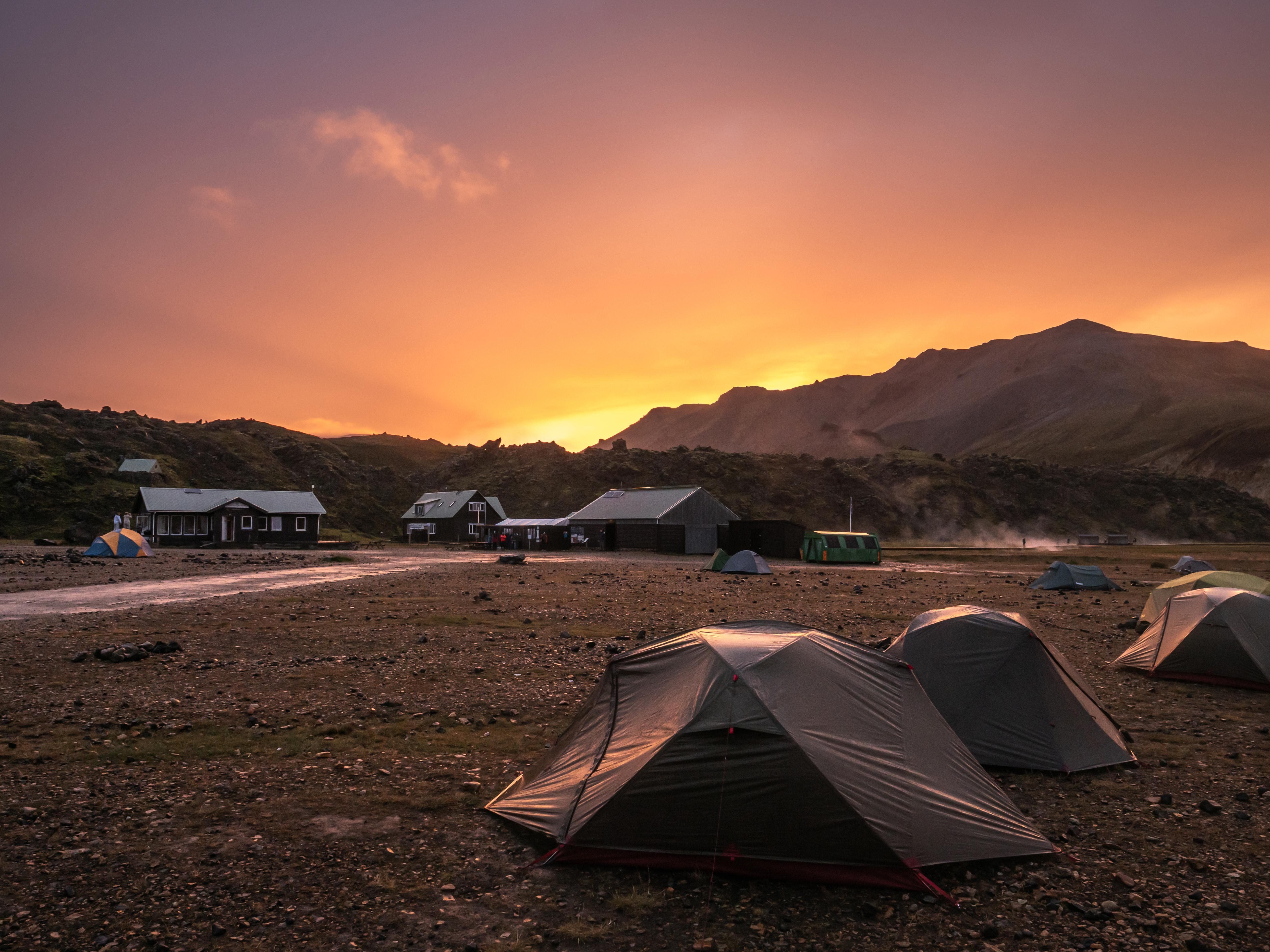
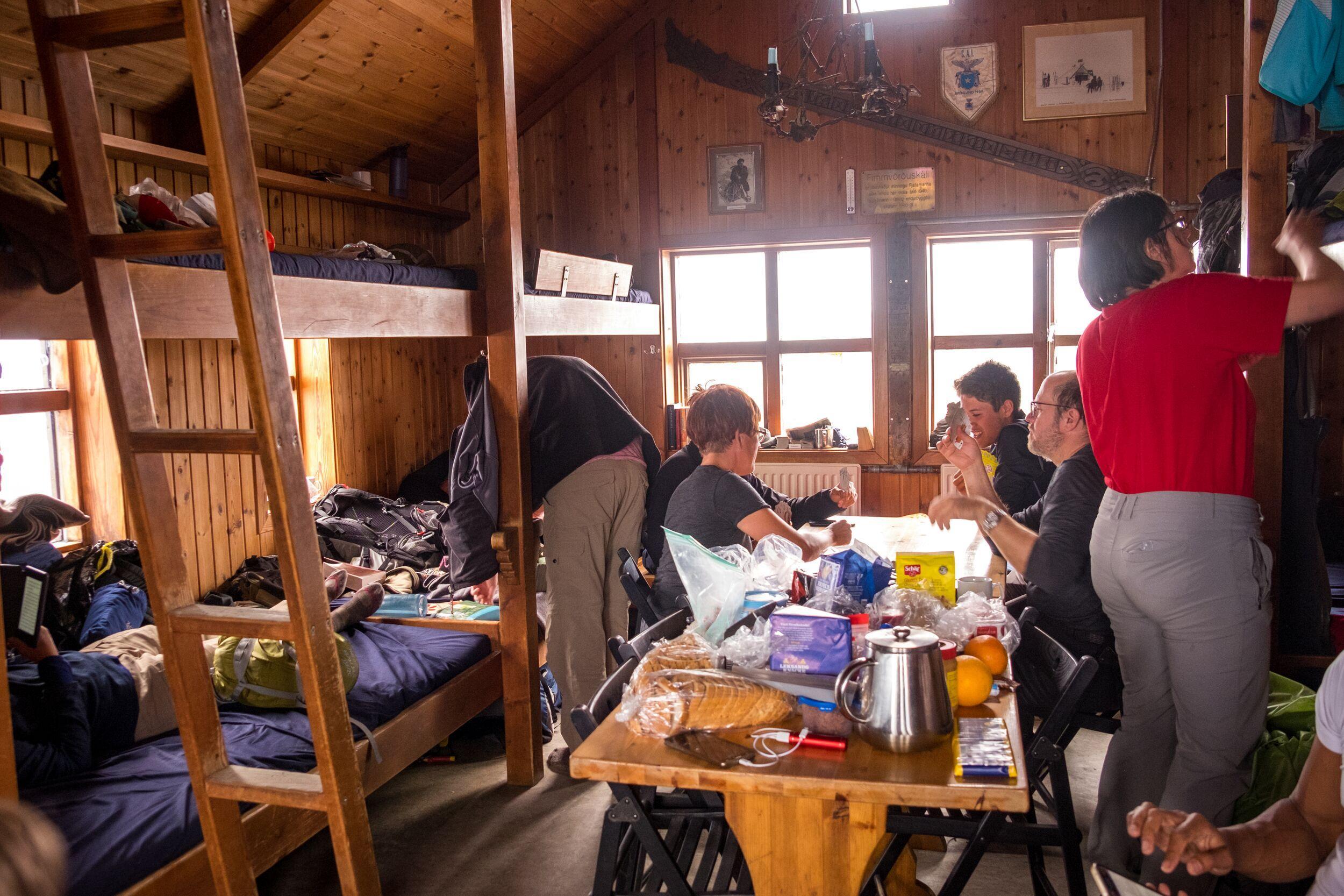
Mountain huts along the Laugavegur Trail provide shelter, camping areas, and basic facilities for trekkers crossing the Icelandic highlands.
A network of mountain huts operated by the Icelandic Touring Association supports trekking along the Laugavegur Trail.
These huts provide shelter and services in an otherwise remote highland environment.
Hut Locations
Huts are located at key points along the route including:
Landmannalaugar
Hrafntinnusker
Álftavatn
Emstrur
Þórsmörk
Each hut also has a nearby camping area for hikers who bring tents.
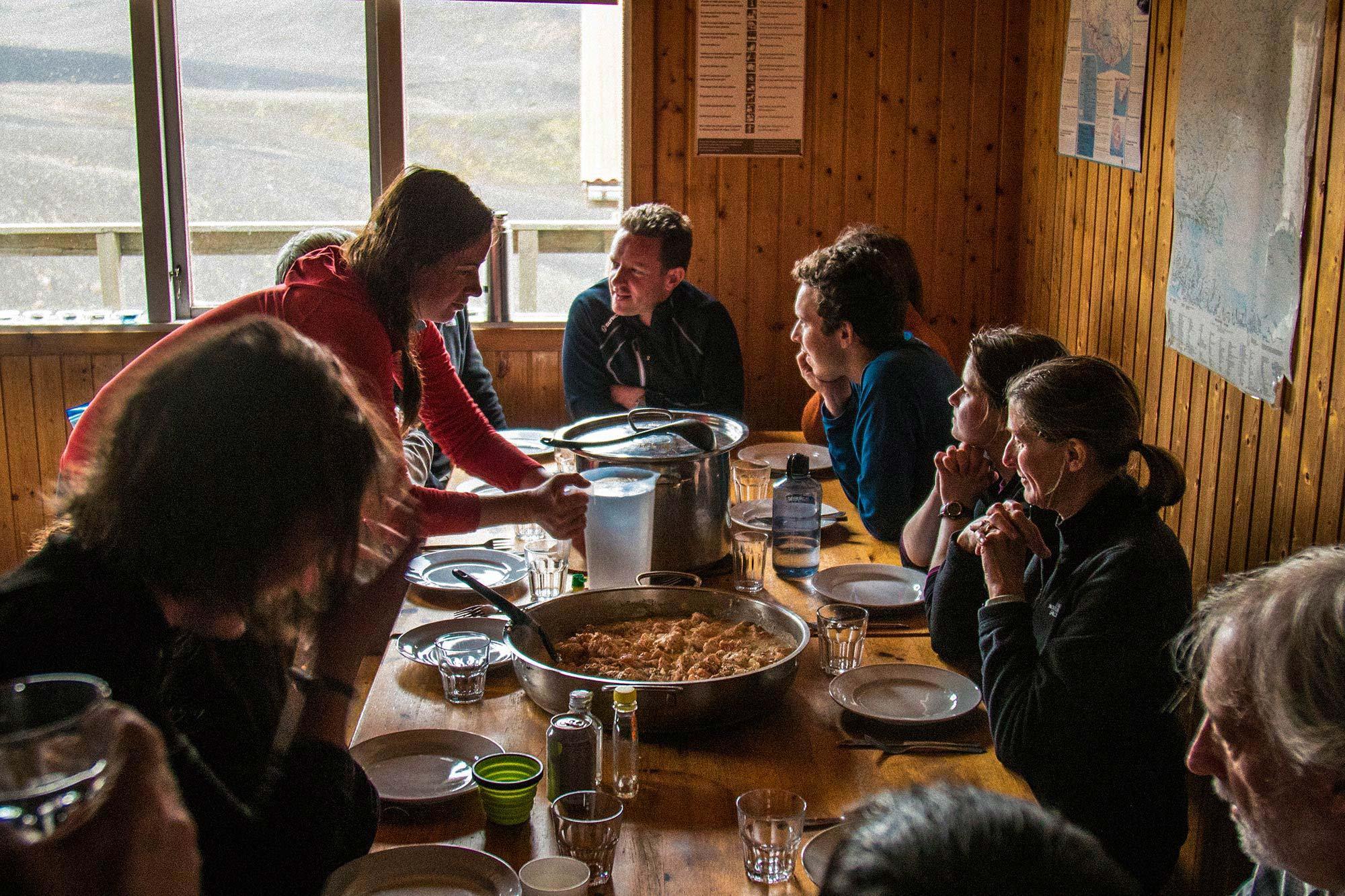
Food Planning
Unlike some trekking routes in Europe, huts along the Laugavegur Trail do not operate full restaurants.
Trekkers must carry their own food supplies for the entire journey.
Common trekking foods include:
dehydrated meals
instant noodles or pasta
energy bars
nuts and dried fruit
Portable gas stoves are commonly used for cooking simple meals at huts or campsites.
Water is generally available near huts or from mountain streams along the trail. However, hikers should treat or filter natural water sources when necessary.
14. Permits and Environmental Regulations
The Laugavegur Trail crosses protected highland landscapes where environmental regulations help preserve fragile volcanic ecosystems.
The Laugavegur Trail does not require a special trekking permit. However, several environmental regulations exist to protect the fragile landscapes of Iceland’s highlands.
Hut Reservations
Mountain huts must be reserved in advance through the Icelandic Touring Association booking system.
Because the huts have limited capacity, reservations are particularly important during the peak summer season.
Camping Rules
Camping is allowed only in designated camping areas near huts along the route.
This rule exists to prevent environmental damage to the delicate moss and vegetation that grows slowly in the volcanic environment.
Leave No Trace Principles
Trekkers are expected to follow strict environmental guidelines including:
carrying out all waste
avoiding damage to fragile vegetation
staying on marked trails
These measures help preserve the highlands for future visitors.
15. Cost Breakdown for the Laugavegur Trail
The cost of trekking the Laugavegur Trail depends largely on travel style and accommodation choices.
Budget Independent Trek
Typical daily costs include:
hut camping fee: approximately €20 to €25
food supplies: €10 to €20 per day
transportation to trailhead: €60 to €100 round trip
Estimated total cost for a 4-day trek:
€200 to €350 excluding international flights.
Hut Accommodation Trek
Sleeping in mountain huts increases the cost but reduces the need to carry camping gear.
Typical hut prices range from €70 to €90 per night.
Total estimated cost including huts, food, and transportation:
€400 to €600.
Guided Tours
Guided trekking tours typically include:
professional guide
transportation
hut accommodation
meals
Typical price range:
€1,200 to €2,000 for a guided 4–5 day trek.
16. Final Professional Assessment
The Laugavegur Trail is one of the most visually distinctive trekking routes in the world. The combination of volcanic mountains, geothermal valleys, glacial rivers, and black sand plains creates landscapes rarely seen elsewhere.
Unlike high-altitude mountain expeditions, the challenge of this route lies in Iceland’s unpredictable weather and remote terrain rather than extreme elevation.
For hikers with moderate trekking experience, the Laugavegur Trail offers an accessible yet memorable adventure through the interior of Iceland.
The relatively short distance allows trekkers to experience dramatic geological diversity within just a few days, making the route ideal for travelers seeking a compact but highly scenic trekking experience.
With proper preparation, appropriate gear, and careful planning, the Laugavegur Trail remains one of the most rewarding trekking journeys in the North Atlantic region.
Trip Planning Summary
Planning the Laugavegur Trail mainly involves organizing transportation to the highlands, accommodation along the route, and preparing equipment and food for several days of trekking.
The Laugavegur Trail is located in the remote Icelandic highlands where there are no towns, shops, or permanent settlements. Because of this, travelers must organize transportation, accommodation, and supplies before entering the highland region.
Trip planning usually begins with selecting trekking dates within the short summer season when the highland roads are open. After confirming travel dates, trekkers decide whether they will join a guided trekking program or organize the route independently.
This choice determines how much preparation is required before starting the trek.
Guided Trekking
Travelers joining a guided trekking program have most logistics arranged by the trekking company.
Typical planning steps include:
- check visa requirements for Iceland (Schengen visa if required)
- obtain tour confirmation or invitation letter if needed for visa
- book international flights to Iceland
- prepare personal trekking gear
- arrive in Reykjavík on the tour start date
Most guided programs usually arrange:
- transportation to Landmannalaugar
- hut or campsite reservations
- meals during the trek
- professional trekking guide
- return transport from Þórsmörk
Independent Trekking
Independent trekkers must organize all logistics themselves before entering the highlands.
Typical preparation includes:
- check visa requirements for Iceland
- book international flights to Keflavík Airport
- reserve mountain huts or campsites along the trail
- arrange highland bus transport to Landmannalaugar
- arrange return transport from Þórsmörk
- purchase food and trekking supplies in Reykjavík
- prepare trekking gear and navigation tools
- begin the trek from Landmannalaugar
This planning structure ensures that trekkers arrive fully prepared before entering Iceland’s remote highland environment where services and supplies are extremely limited.
![K2 Base Camp Trek: Ultimate Guide k2 Trek 2026 [UPDATED]](https://karakoramdiaries.com/storage/ultimate-guide-to-k2-base-camp-trek-full-document-150x150.png)