Mount Elbrus Climb Complete Guide
Table of contents [Show]
- 1. Understanding the Mountain and Regional Context
- 2. Access and Expedition Logistics
- 3. Route Options and Why Guides Choose the South Route
-
4. Complete Day-by-Day Itinerary (Standard South Route Program)
- Day 1 – Arrival in Mineralnye Vody and Transfer to Baksan Valley (2,100 m)
- Day 2 – Acclimatization Hike on Mount Cheget (3,000–3,500 m)
- Day 3 – Cable Car to Garabashi Huts (3,800 m)
- Day 4 – Acclimatization Climb to Pastukhov Rocks (4,700 m)
- Day 5 – Rest Day or Weather Buffer
- Day 6 – Summit Attempt (5,642 m)
- Day 7 – Descent to Valley
- 5. Acclimatization Rotation Strategy in Detail
- 6. Summit Day – Technical and Decision Breakdown
- 7. Weather Systems and Whiteout Navigation Reality
- 8. Frostbite and Cold Injury Management
- 9. Altitude Risk and Emergency Descent Protocol
- 10. Equipment Strategy in Operational Detail
- 11. Cost Modeling and Service Structure
- 12. Russian Visa and Registration Process
- 13. Rescue and Evacuation Reality
- 14. Seasonal Strategy Month by Month
- 15. Failure Patterns and Common Mistakes
- 16. Final Professional Assessment
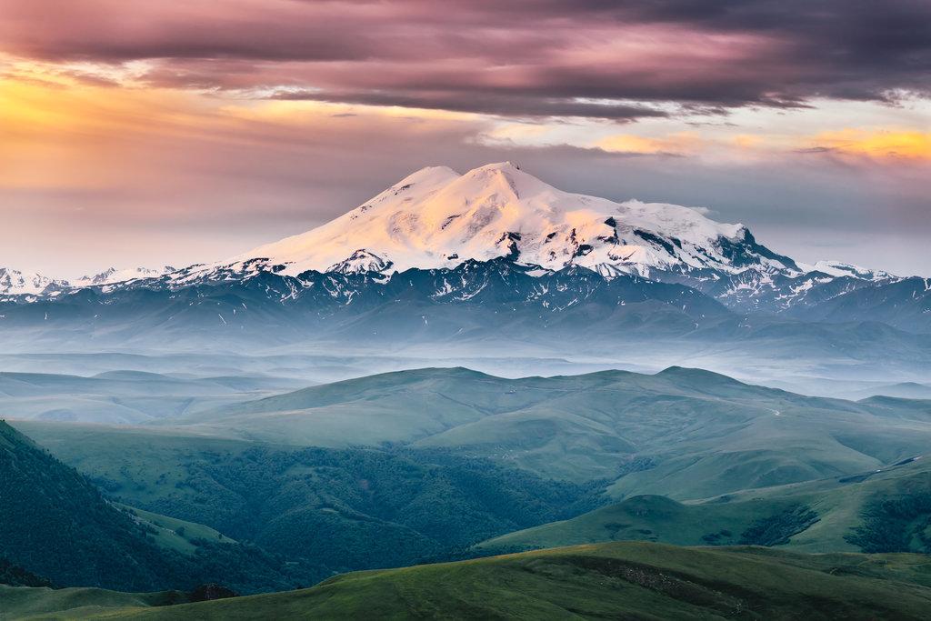
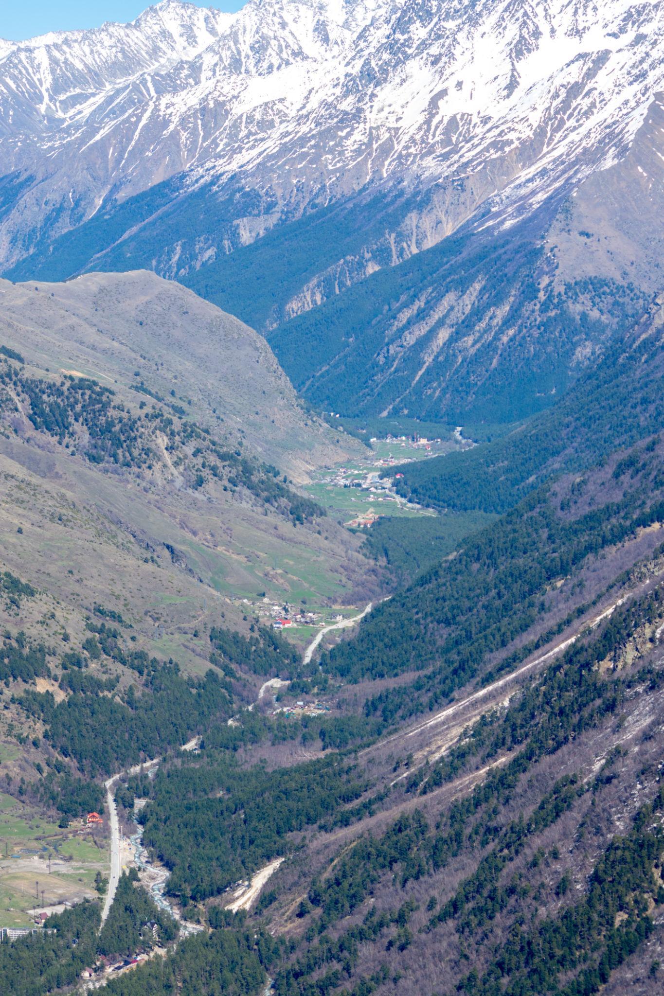
1. Understanding the Mountain and Regional Context
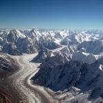
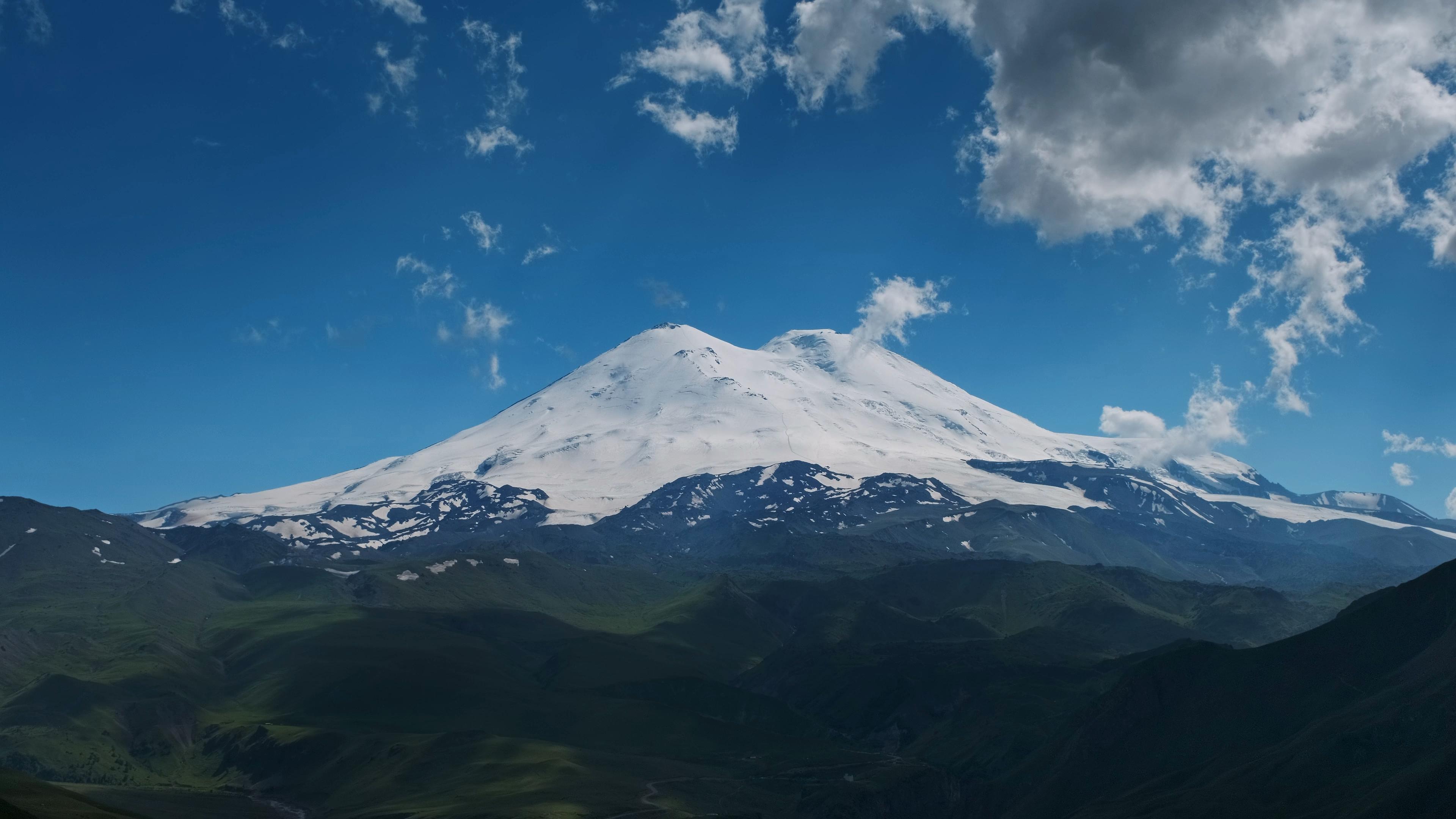
Mount Elbrus west summit and the standard south route glacier ascent in the Caucasus Mountains.
Mount Elbrus rises to 5,642 meters in the western Caucasus range. It is geographically considered the highest mountain in Europe and is part of the Seven Summits circuit.
Mount Elbrus is a dormant volcano with two summits. The west summit at 5,642 meters is the true high point. The east summit stands at 5,621 meters.
Elbrus is often categorized as a “non-technical” climb. That description is incomplete. While the standard south route does not require advanced rock climbing, it demands:
- Glacier travel competence
- Crampon efficiency
- Strong cold tolerance
- High-altitude endurance
- Strict weather discipline
- Night summit navigation capacity
Most accidents on Elbrus are not technical falls. They are caused by:
- Severe wind exposure
- Whiteout disorientation
- Inadequate acclimatization
- Frostbite
- Hypothermia
- Poor turnaround decisions
The mountain’s open slopes create wind tunnel conditions. When storms form, visibility can drop to zero within minutes.
Elbrus should be treated as a high-altitude expedition, not a lift-assisted hike.
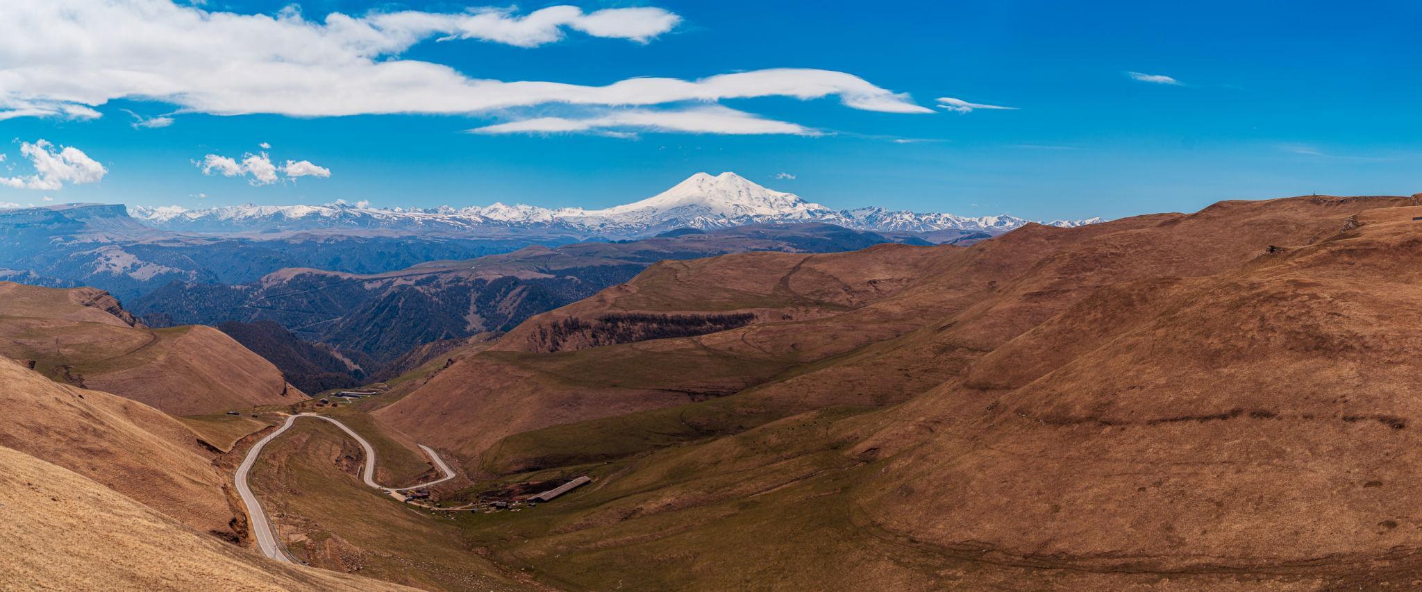
2. Access and Expedition Logistics
International climbers typically arrive via:
Mineralnye Vody
From there, ground transfer takes approximately 3 to 4 hours to the Baksan Valley region, including:
- Terskol
- Azau
- Cheget area
Base altitude in the valley:
Approximately 2,100 meters.
Most commercial climbs use the South Route due to:
- Cable car access to 3,800 meters
- Established huts
- Snowcat transport availability
- Rescue accessibility
However, lift access does not eliminate altitude risk. It increases it if misused.
Climbers typically stay in:
- Valley hotels for first nights
- High-altitude huts such as Garabashi or LeapRus
- Occasionally tent camps near 3,800 meters
Unlike Denali, Elbrus has infrastructure. Unlike Mont Blanc, there is no technical ridge. Unlike Matterhorn, there is no sustained rock scrambling. But unlike many trekking peaks, Elbrus has extreme wind exposure.
There are four primary routes:
South Route
North Route
East Route
West Route
The South Route is the standard commercial ascent due to infrastructure.
The North Route is more remote, lacks lift access, and requires camping from lower elevations. It is less crowded and more physically demanding.
Professional guides favor the South Route for most clients because:
- Rescue is faster.
- Weather monitoring is easier.
- Infrastructure reduces logistical risk.
- Acclimatization hikes are structured.
However, guiding discipline matters more than route choice.
Teams that rush summit using snowcat transport without proper rotation often fail.
4. Complete Day-by-Day Itinerary (Standard South Route Program)
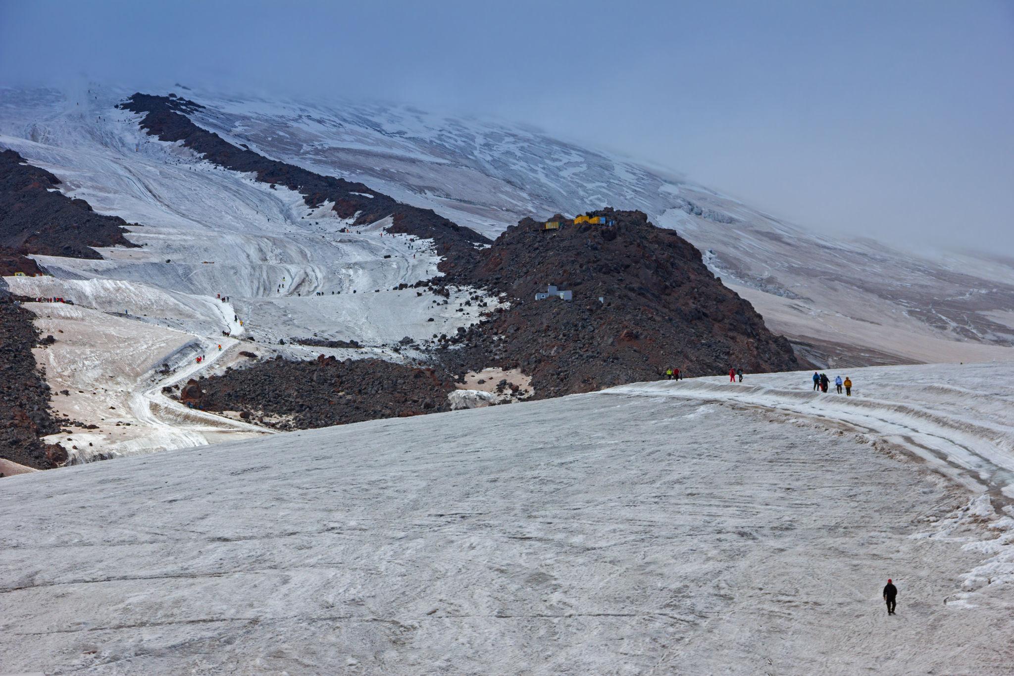
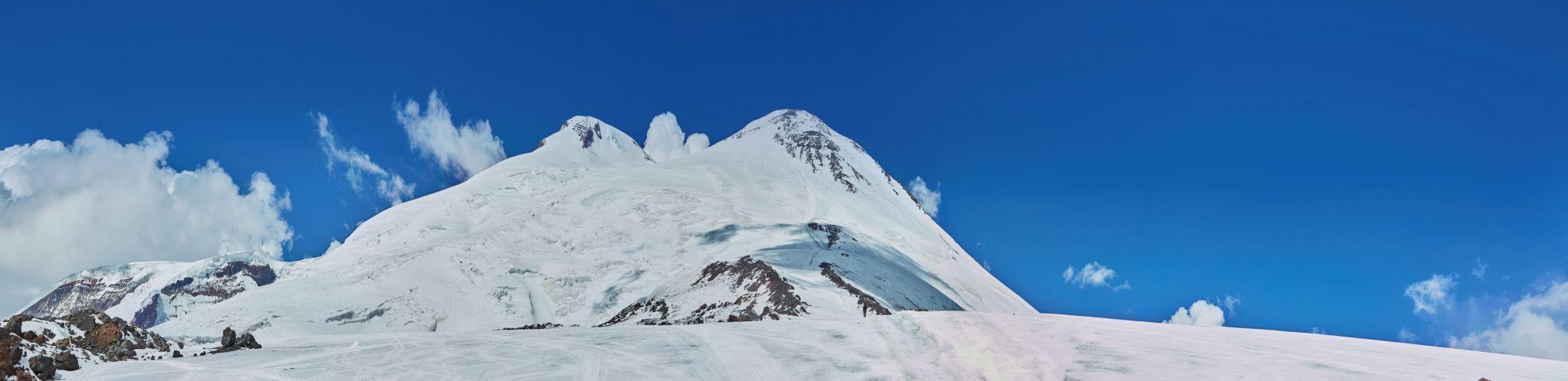
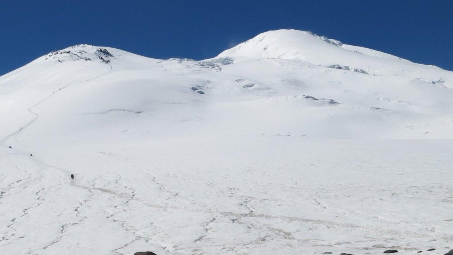
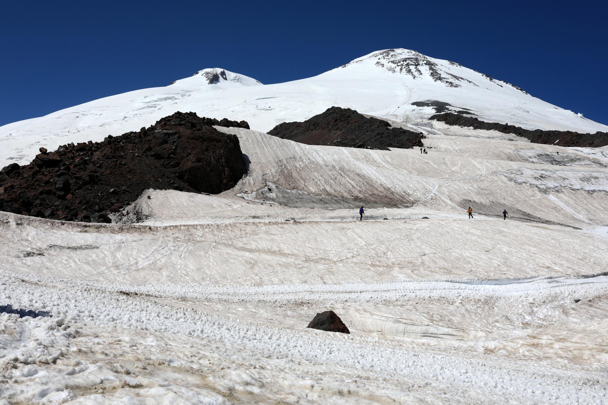
Baksan Valley base area, Garabashi huts, Pastukhov Rocks, and summit ridge conditions.
The standard Mount Elbrus program typically runs 7 to 9 days depending on acclimatization and weather buffers.
Below is the structured guided model used by disciplined operators.
Day 1 – Arrival in Mineralnye Vody and Transfer to Baksan Valley (2,100 m)
- Airport pickup.
- Transfer to Terskol or Azau.
- Hotel check-in.
- Equipment inspection.
- Gear rental adjustments if required.
- Initial briefing on acclimatization process.
Sleeping low on first night helps recovery from travel fatigue.
Day 2 – Acclimatization Hike on Mount Cheget (3,000–3,500 m)
Purpose:
Active acclimatization before lift access.
Activity:
Cable car partway up Mount Cheget followed by hiking to approximately 3,200 to 3,500 meters.
Focus:
Slow pace.
Hydration discipline.
Breathing control.
Return to valley for overnight.
This day is critical for reducing altitude shock when moving higher next day.
Day 3 – Cable Car to Garabashi Huts (3,800 m)
Lift access via Azau cable car system to approximately 3,500 meters.
Short hike to Garabashi hut area at around 3,800 meters.
Activities:
Short acclimatization walk above huts to approximately 4,000 meters.
Return to hut.
Sleeping altitude:
3,800 meters.
Common symptoms:
Mild headache.
Poor sleep.
Reduced appetite.
Hydration must be strictly maintained.
Day 4 – Acclimatization Climb to Pastukhov Rocks (4,700 m)
This is the most important acclimatization day.
Walking time:
5 to 7 hours round trip.
Elevation gain:
Approximately 900 meters.
Terrain:
Steady glacier slope.
Snowfield ascent.
Gradual incline increasing toward Pastukhov Rocks.
Purpose:
Expose body to near 4,700 meters without sleeping there.
Return to 3,800 meters to sleep.
This rotation significantly improves summit success probability.
Day 5 – Rest Day or Weather Buffer
Weather assessment.
Short acclimatization walk.
Equipment preparation for summit push.
Rest day allows body to consolidate acclimatization.
Teams skipping this rest often show fatigue during summit attempt.
Day 6 – Summit Attempt (5,642 m)
Departure:
Between 1:00 AM and 3:00 AM.
Some operators use snowcat to approximately 4,700 meters. Strong guiding ethics recommend limiting snowcat reliance unless necessary.
Route Breakdown:
Garabashi to Pastukhov Rocks:
Steady snow slope.
Cold conditions.
Slow controlled pacing.
Pastukhov Rocks to Saddle (5,300 m):
Wind exposure increases.
Oxygen deficit noticeable.
Saddle to West Summit:
Steeper slope.
Short but demanding final ascent.
Exposure to crosswinds.
Summit conditions:
Often windy.
Limited shelter.
Short summit stay recommended.
Descent:
Physically demanding.
Increased fall risk due to fatigue.
Whiteout risk increases later in day.
Total summit day:
8 to 12 hours.
Return to 3,800 meters for overnight.
Day 7 – Descent to Valley
Cable car descent.
Transfer to hotel.
Celebration dinner.
Monitoring for delayed altitude symptoms.
5. Acclimatization Rotation Strategy in Detail
Elbrus is frequently underestimated because lift access allows rapid altitude gain.
Poor acclimatization is the primary cause of summit failure.
Effective acclimatization model follows:
- Climb high, sleep low.
- Avoid sleeping above 4,000 meters before summit day.
- Increase daily sleeping altitude gradually.
- Build at least one exposure day above 4,500 meters before summit.
Snowcat shortcut strategies reduce fatigue but do not replace acclimatization.
Strong guides monitor:
- Resting heart rate.
- Oxygen saturation.
- Walking rhythm.
- Mental clarity.
Clients pushing too fast are slowed intentionally.
Summit day pace must be conversational pace.
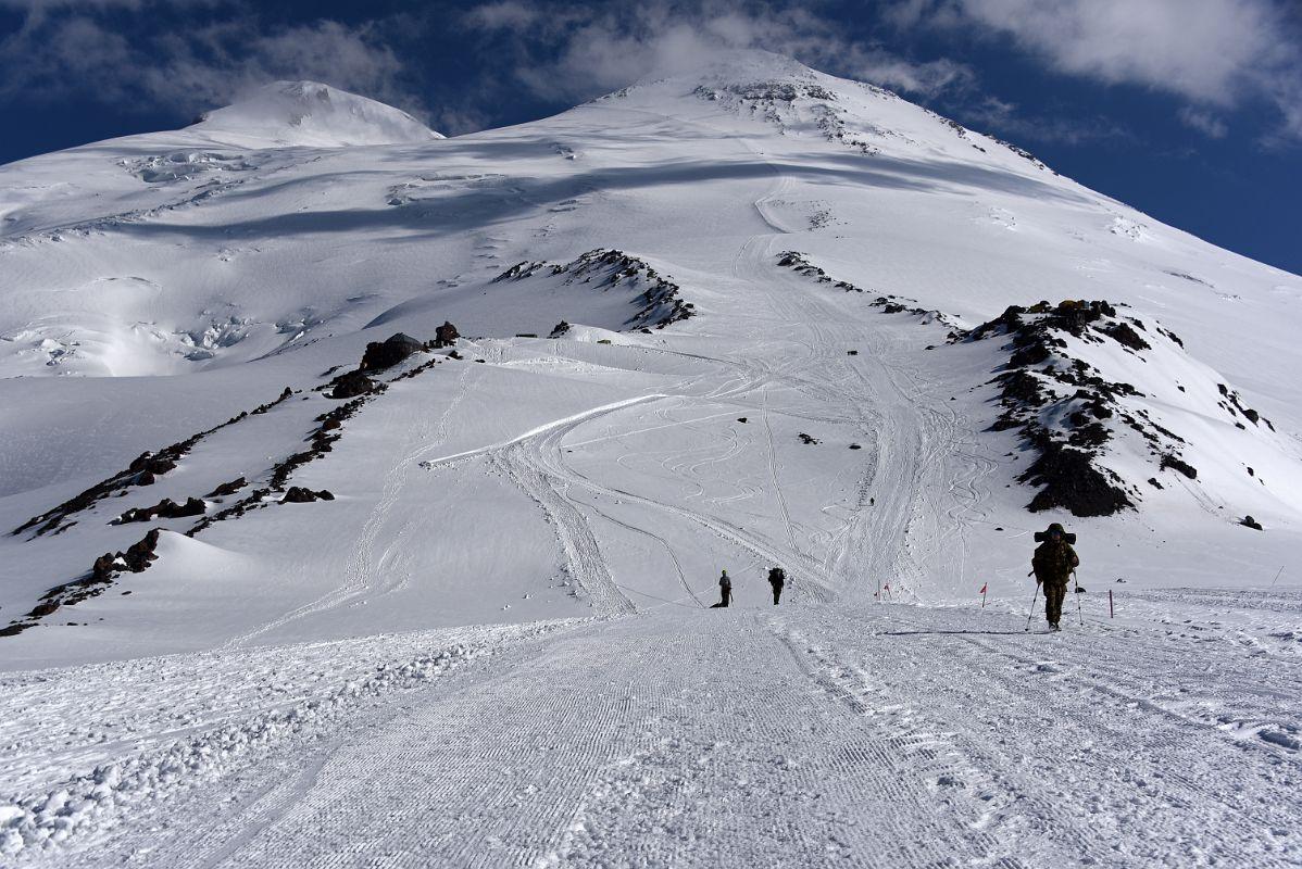
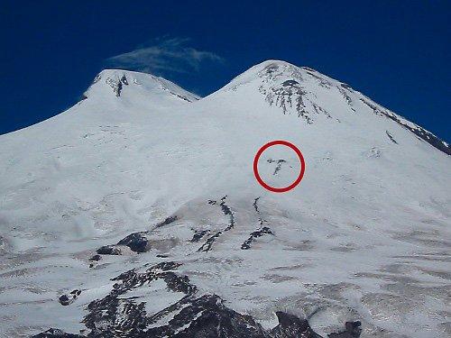
6. Summit Day – Technical and Decision Breakdown
Although not technically steep, summit day presents several critical risk zones.
6.1 Pastukhov Rocks (4,700 m)
Common turnaround point.
Cold fatigue often begins here.
Many climbers misjudge energy reserves.
6.2 Saddle (5,300 m)
Wind tunnel zone.
Wind chill extreme.
Crampon efficiency critical.
Exposure to sudden weather change.
Guides assess here:
- Facial frostbite signs.
- Speech clarity.
- Walking stability.
If climber shows instability, descent is mandatory.
6.3 Final Summit Slope
Angle increases.
Energy reserves low.
Wind often strongest here.
Turnaround time strictly enforced.
Most professional guides use 10:00 AM as hard cutoff.
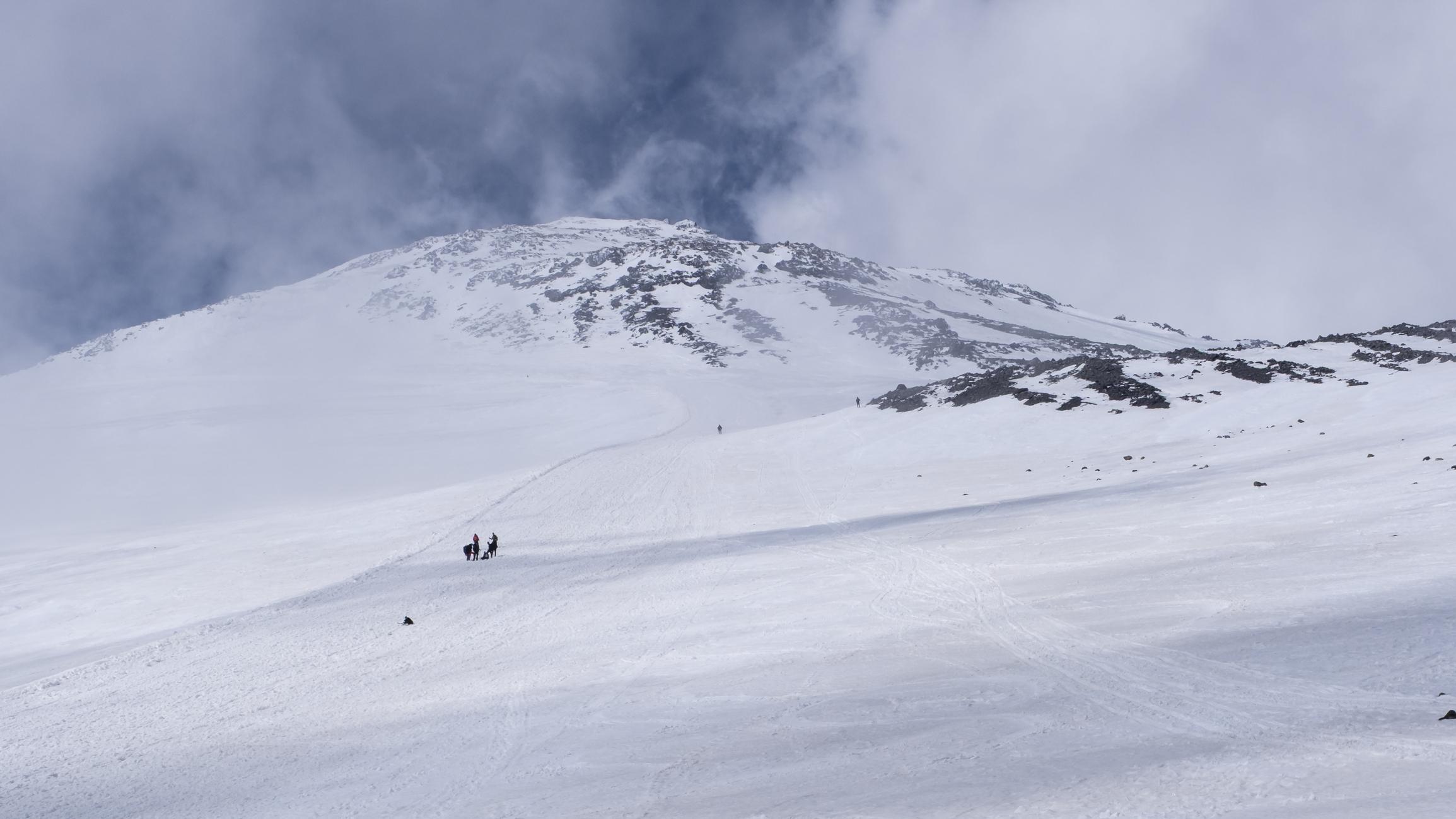
Storm formation over Elbrus and typical whiteout and wind exposure conditions on the upper mountain.
Mount Elbrus generates violent and unpredictable weather patterns. Its broad, open slopes create conditions where wind accelerates without natural protection. There are no rock ridges or terrain shields like those found on technical alpine peaks.
Wind speeds above 70 km/h are common during unstable systems. Gusts above 100 km/h are not rare. When wind combines with blowing snow, visibility can drop to near zero within minutes.
Whiteout is the most dangerous condition on Elbrus.
In whiteout:
- Horizon disappears.
- Ground definition vanishes.
- Climbers lose depth perception.
- Foot placement becomes uncertain.
- Navigation becomes extremely difficult.
Unlike Denali where fixed camps are widely spaced, Elbrus has many overlapping ascent tracks during peak season. In poor visibility, tracks can drift, disappear, or lead in wrong directions.
Professional guiding practice includes:
- Carrying GPS navigation devices.
- Pre-loading route tracks.
- Maintaining rope teams in unstable weather.
- Setting strict turnaround rules before wind thresholds are reached.
- Descending immediately if visibility drops below safe margin.
Many fatal incidents on Elbrus are caused by climbers descending off-route during storms and becoming lost above 5,000 meters.
Weather forecast discipline is essential. Summit attempts must be based on stable high-pressure systems, not optimistic assumptions.
8. Frostbite and Cold Injury Management
Cold is not secondary risk on Elbrus. It is primary.
Even in mid-summer, summit temperatures can fall below -20°C. Combined with wind, exposed skin can freeze within minutes.
Most common frostbite zones:
- Fingers.
- Toes.
- Nose.
- Cheeks.
Early frostbite signs:
- Numbness.
- White or pale skin patches.
- Loss of sensation.
- Stiffness in fingers.
Guides regularly inspect clients’ faces during summit ascent.
Proper prevention includes:
- Double-layer gloves with overmitt system.
- Hand warmers as backup.
- Insulated double boots.
- Dry socks.
- Face mask or balaclava.
- Goggles to prevent snow blindness.
Climbers who remove gloves to take photos frequently expose themselves to frostbite.
Cold mismanagement is a major summit failure cause.
9. Altitude Risk and Emergency Descent Protocol
Altitude sickness on Elbrus is common because lift access allows climbers to sleep at 3,800 meters very quickly.
Typical symptoms at 3,800 meters:
- Mild headache.
- Reduced sleep quality.
- Fatigue.
Symptoms above 4,700 meters may intensify.
Emergency descent protocol is simple:
- Immediate descent to 3,800 meters.
- Hydration and rest.
- Medical evaluation if symptoms persist.
If severe symptoms occur near saddle or above:
- Descent takes priority over summit.
- Guides may rope client short.
- Snowcat assistance may be requested from lower slopes if available.
Descent remains the only definitive solution to serious altitude illness.
10. Equipment Strategy in Operational Detail
Mount Elbrus does not require technical rock protection but demands serious cold and glacier equipment.
Essential equipment includes:
- Insulated double or high-altitude single mountaineering boots.
- Step-in crampons compatible with boots.
- Ice axe suitable for glacier travel.
- Harness for rope travel.
- Helmet.
- Down jacket rated for -20°C or lower.
- Hardshell outer layer.
- Insulated overmitt gloves.
- Goggles for wind and snow protection.
- Headlamp with spare batteries.
- Thermos bottle to prevent water freezing.
Clothing layering strategy must allow:
- Rapid temperature regulation.
- Windproof outer protection.
- Moisture management.
Overheating during ascent leads to sweat saturation, which increases freezing risk during rest stops.
Professional guides monitor client clothing and hydration frequently.
11. Cost Modeling and Service Structure
Mount Elbrus is one of the most financially accessible high-altitude summits.
Guided South Route Program
Cost range:
USD 1,500 to USD 3,500 per person depending on service level.
Included typically:
- Airport transfers.
- Accommodation in valley.
- Hut accommodation.
- Meals during climb.
- Guide services.
- Permit and registration handling.
- Cable car access.
Snowcat service:
Often optional, approximately USD 100 to USD 200.
Higher-end programs include:
- Smaller group sizes.
- Higher quality huts.
- Private room upgrades.
- Backup weather days.
Independent Climbing
Possible but requires:
- Russian visa.
- Regional registration.
- Mountain rescue awareness.
- Independent navigation capacity.
Independent climbers often underestimate whiteout risk.
Summit success rate improves significantly with experienced guide oversight.
12. Russian Visa and Registration Process
Foreign climbers require:
- Russian tourist visa.
- Official invitation letter from licensed operator.
- Passport validity beyond travel dates.
- Registration with local authorities upon arrival.
Visa processing times vary by nationality and should begin several weeks in advance.
Political conditions can influence visa issuance. Climbers must verify current requirements before booking.
13. Rescue and Evacuation Reality
Rescue on Elbrus is more accessible than on Denali due to infrastructure and regional proximity.
However:
- Helicopters cannot operate in severe wind.
- Whiteout prevents aerial rescue.
- Descent on foot may be required before evacuation.
Insurance must include:
- High-altitude mountaineering coverage.
- Rescue and medical evacuation.
- Repatriation.
Evacuation cost can exceed USD 10,000 without coverage.
14. Seasonal Strategy Month by Month
Primary climbing window:
Late May through early September.
Late May to Early June
- Colder temperatures.
- Firmer snowpack.
- Fewer climbers.
- Higher storm probability.
Late June to July
- Most stable weather.
- Highest summit traffic.
- Best snow consistency.
- Moderate temperatures.
August
- Warmer lower slopes.
- Increased slush later in day.
- Afternoon storms more frequent.
Early September
- Fewer crowds.
- Cooler nights.
- Increasing storm frequency.
Peak commercial success typically occurs in July.
15. Failure Patterns and Common Mistakes
Most common failure causes:
- Inadequate acclimatization.
- Underestimating wind conditions.
- Summit fever overriding turnaround time.
- Improper clothing.
- Dehydration.
- Starting summit push too late.
- Overreliance on snowcat without preparation.
Elbrus punishes poor judgment more than technical inexperience.
16. Final Professional Assessment
Mount Elbrus is often categorized as an introductory high-altitude summit. This classification creates dangerous overconfidence.
In reality, Elbrus is:
- Weather-sensitive.
- Wind-exposed.
- Altitude-demanding.
- Frostbite-prone.
- Navigation-risk mountain.
It is suitable for:
- Strong trekkers transitioning to 5,000-meter peaks.
- Climbers preparing for higher objectives.
- 7 Summits aspirants with structured training.
It is not suitable for:
- Rapid lift-assisted summit attempts without acclimatization.
- Individuals unfamiliar with glacier travel.
- Weather-ignorant ascent attempts.
Professional guiding dramatically improves safety and success due to disciplined pacing and conservative weather decisions.
![K2 Base Camp Trek: Ultimate Guide k2 Trek 2026 [UPDATED]](https://karakoramdiaries.com/storage/ultimate-guide-to-k2-base-camp-trek-full-document-150x150.png)