Fairy Meadows and Nanga Parbat Base Camp: A Complete Trekking Guide
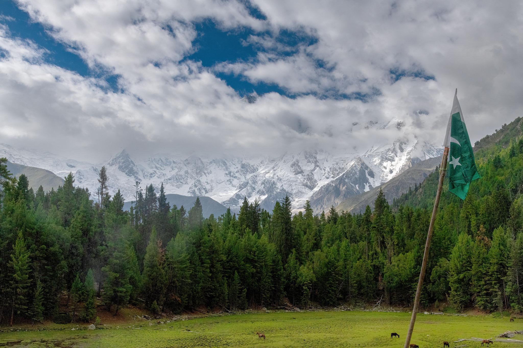
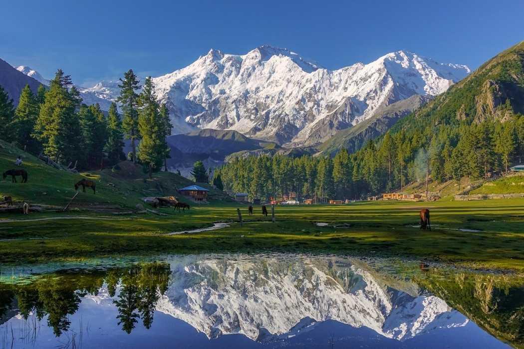
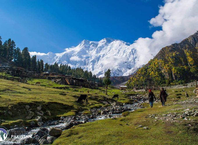
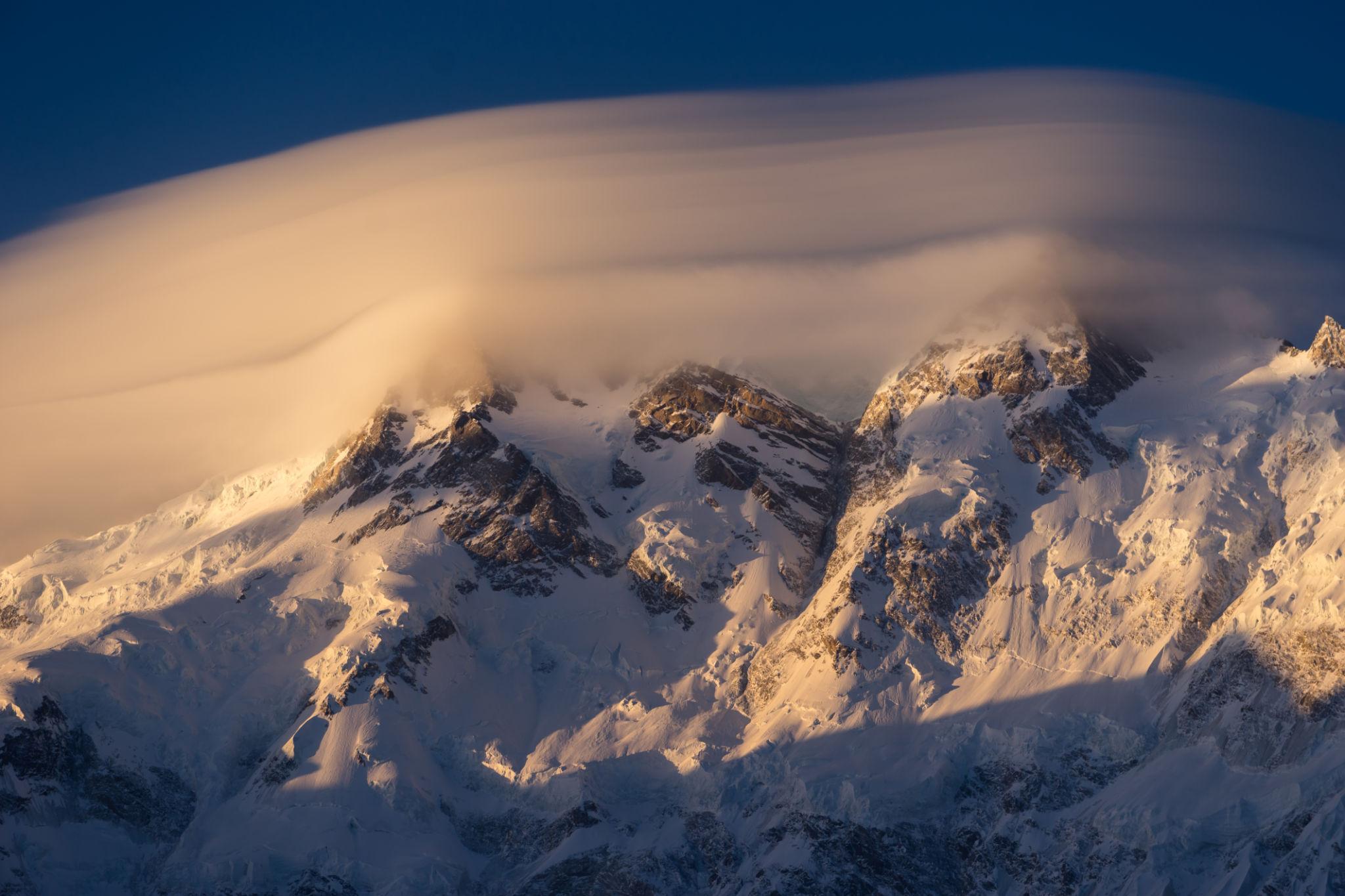
Fairy Meadows is one of the most famous trekking destinations in Pakistan and offers one of the most accessible high altitude mountain experiences in Gilgit-Baltistan. Located at approximately 3,300 metres above sea level in the Diamer District, the meadow sits directly beneath the towering north face of Nanga Parbat, the ninth highest mountain in the world at 8,126 metres.
For trekkers, photographers, backpackers, and adventure travelers, Fairy Meadows combines alpine scenery, dense pine forests, glacier landscapes, and panoramic views of Nanga Parbat’s Raikot Face. The route is accessible enough for casual trekkers while also offering the option to continue toward Beyal Camp and Nanga Parbat Base Camp for a more demanding alpine experience.
This complete trekking guide covers transportation, trekking routes, camping, accommodation, seasonal travel conditions, altitude considerations, and practical travel tips for visiting Fairy Meadows and Nanga Parbat Base Camp.
Table of contents [Show]
- About Fairy Meadows
- Where is Fairy Meadows?
- Why Visit Fairy Meadows?
- How to Reach Fairy Meadows
- Jeep Track from Raikot Bridge to Tato Village
- Trek from Tato Village to Fairy Meadows
- Fairy Meadows Campsite
- Nanga Parbat Base Camp Trek
- Best Time to Visit Fairy Meadows
- Fairy Meadows in Summer
- Fairy Meadows in Autumn
- Camping & Accommodation
- Packing List & Essential Gear
- Physical Difficulty & Altitude
- Practical Travel Tips
- Frequently Asked Questions
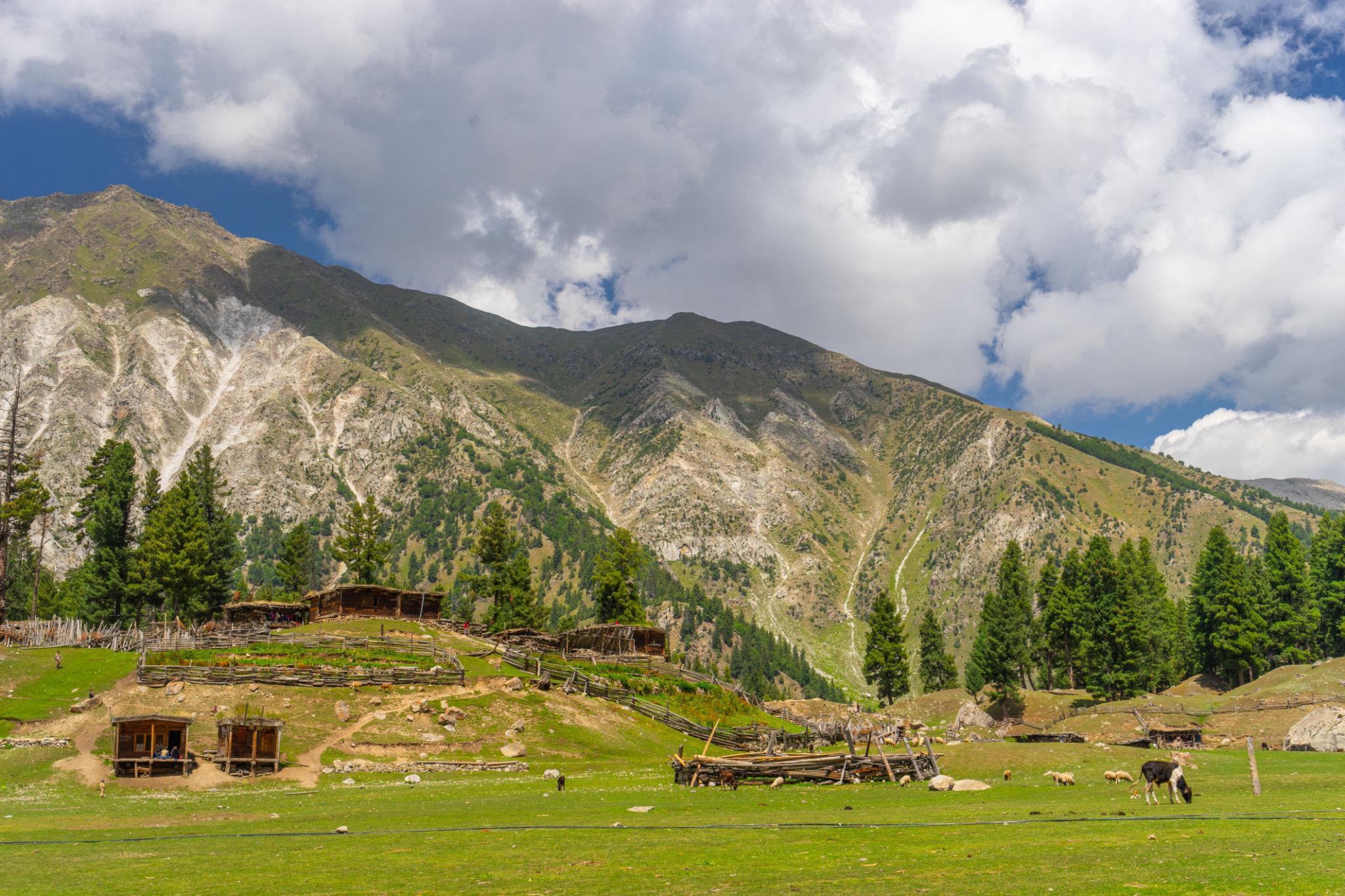
About Fairy Meadows
Fairy Meadows, locally known as Joot, was named by German climbers during early expeditions to Nanga Parbat. Today it remains one of Pakistan’s most iconic trekking destinations and attracts:
- Trekkers
- Climbers
- Backpackers
- Photographers
- International travelers
- Adventure tourists
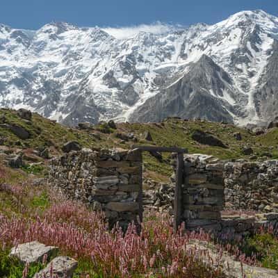
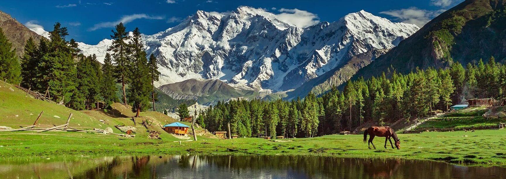
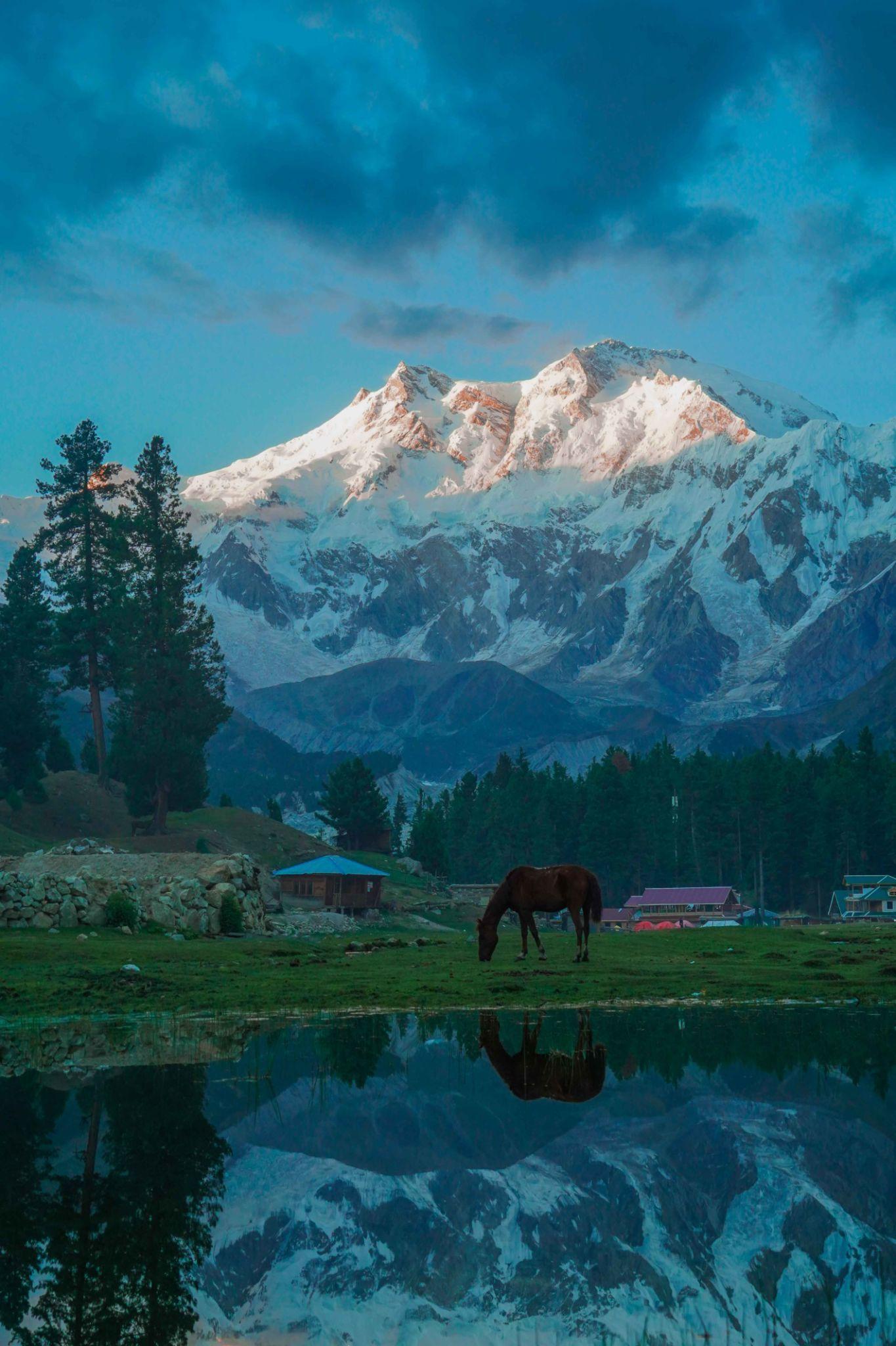
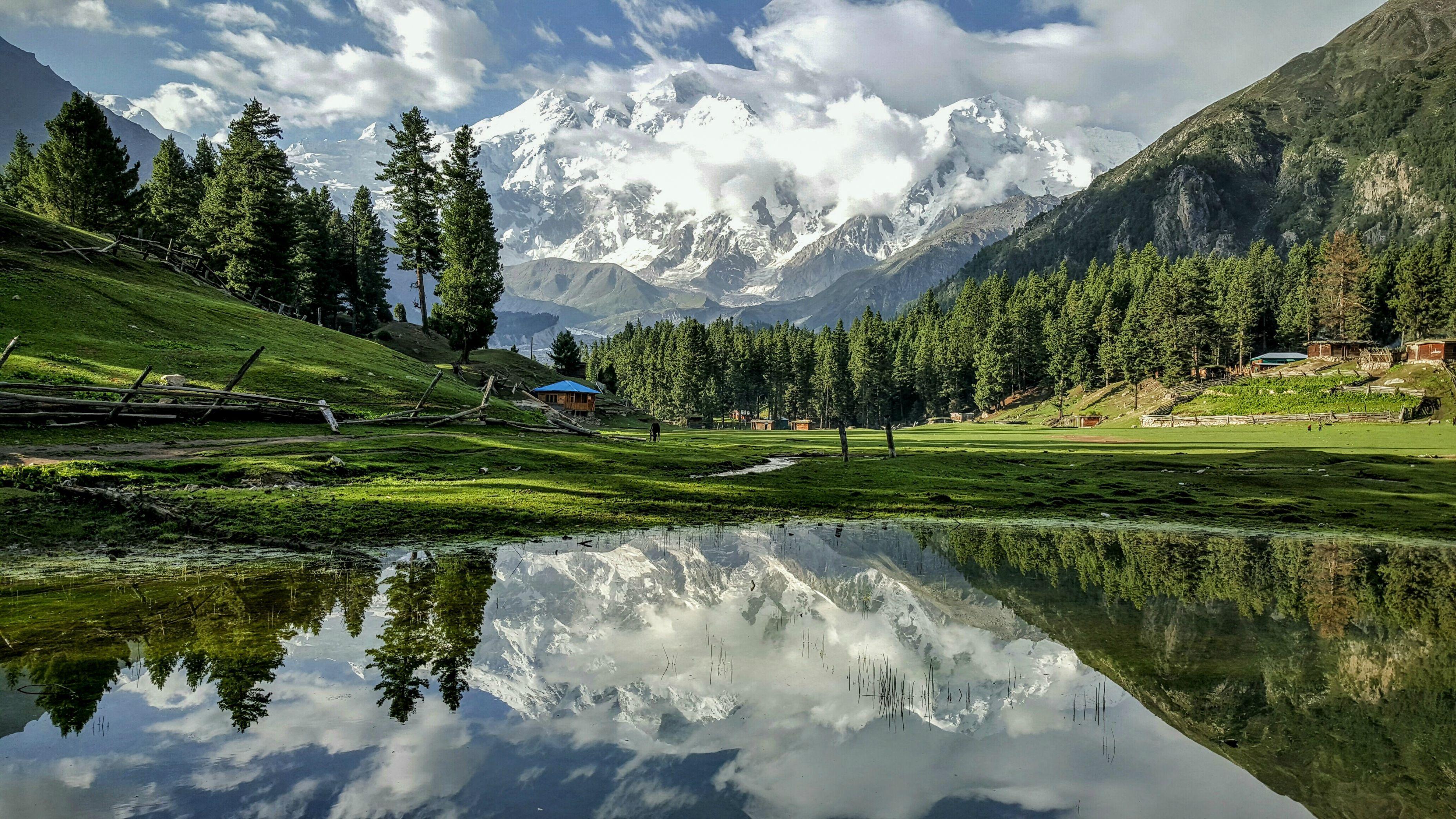
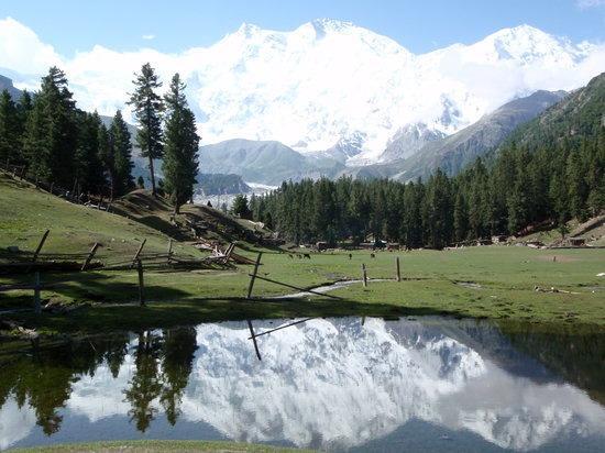
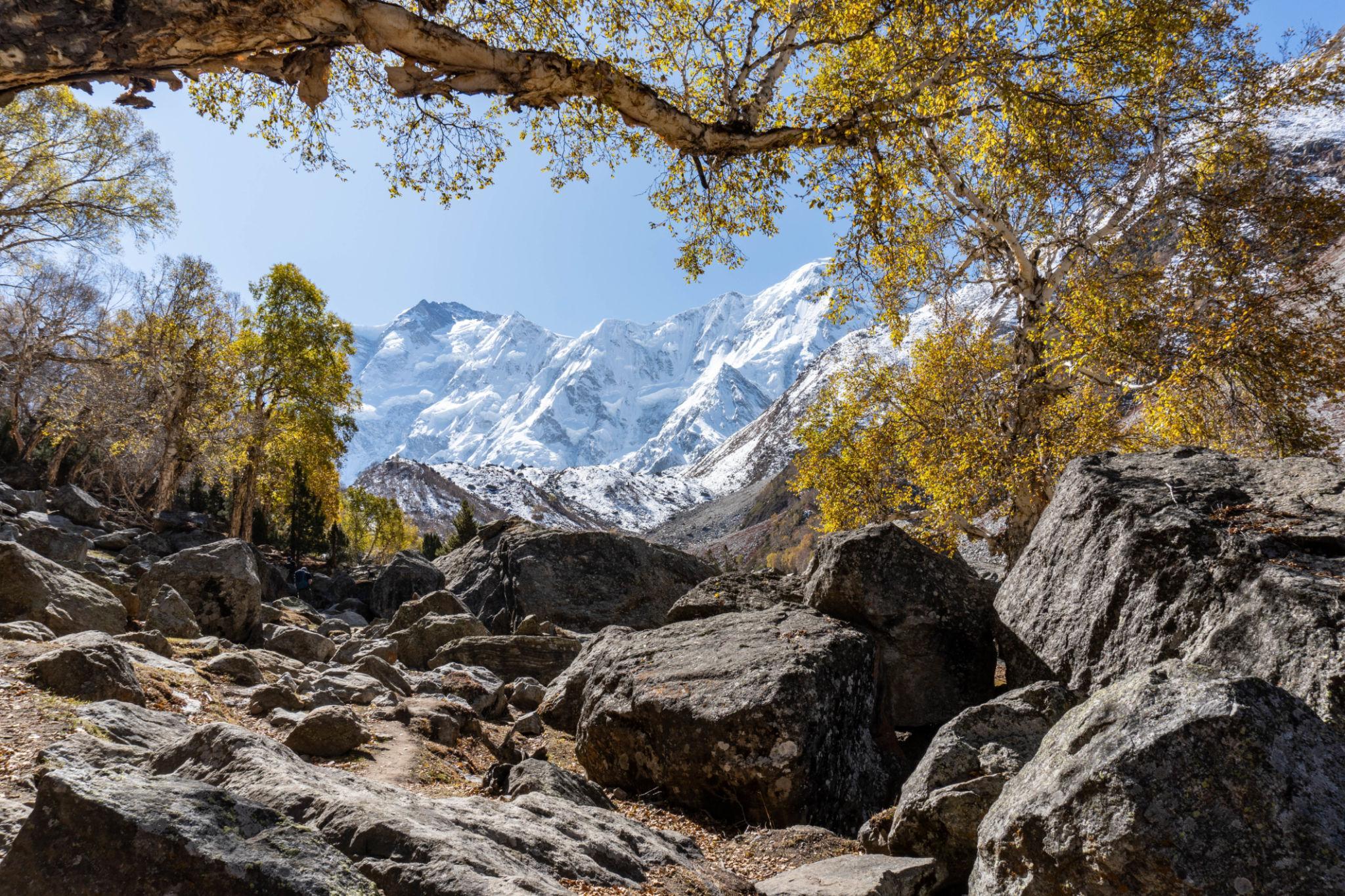
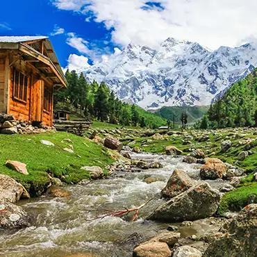
The meadow lies beneath the Raikot Glacier and offers direct views of Nanga Parbat’s massive north face.
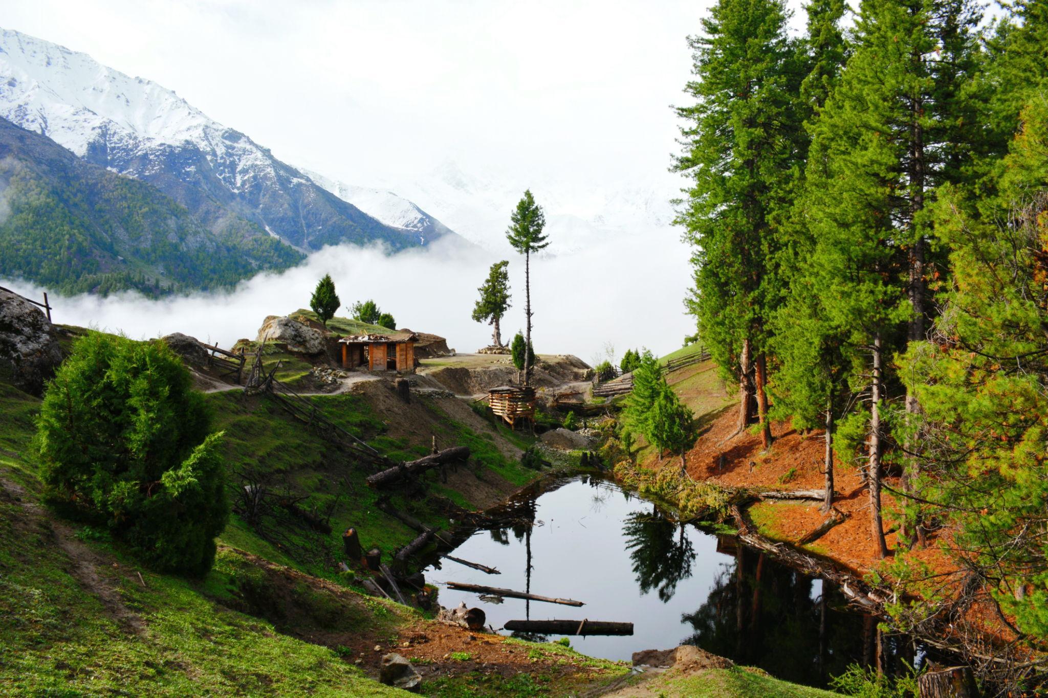
The area is surrounded by:
- Alpine grasslands
- Pine forests
- Glacier valleys
- High mountain landscapes
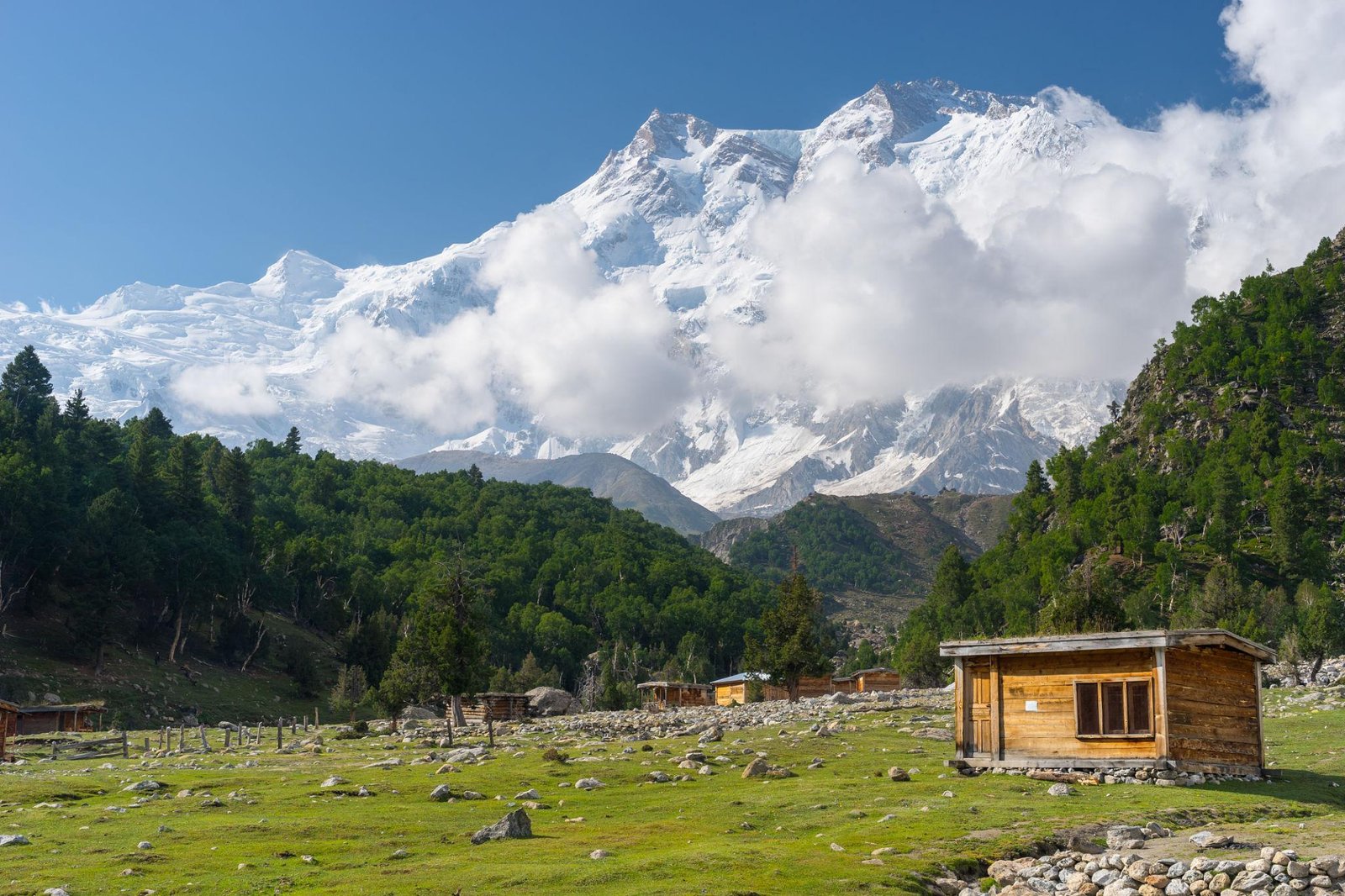
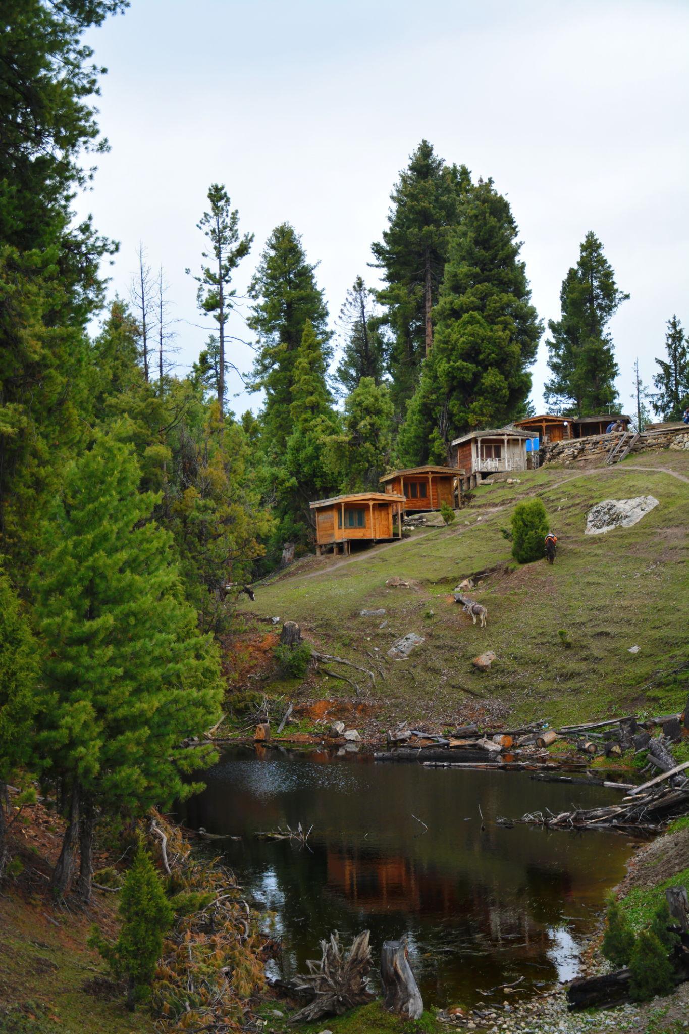
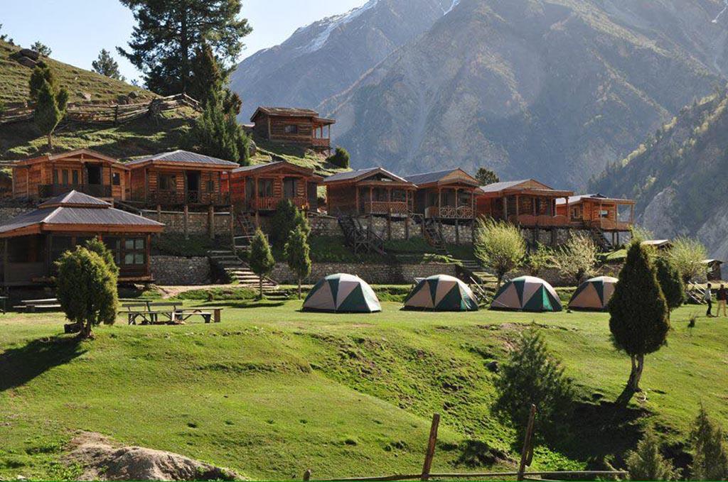
Several local guesthouses and wooden huts operate seasonally in the meadow, while open sections of the grassland are used for camping.
Where is Fairy Meadows?
Fairy Meadows is located in the Diamer District of Gilgit-Baltistan near the historic Karakoram Highway.
The main access point is:
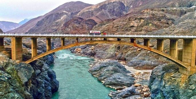
- Raikot Bridge
Approximate travel times:
- Islamabad to Raikot Bridge: 12 to 14 hours by road
- Gilgit to Raikot Bridge: 2 to 3 hours by road
The route involves:
- Road journey to Raikot Bridge
- Jeep ride to Tato Village
- Trek to Fairy Meadows
Why Visit Fairy Meadows?
Fairy Meadows is considered one of the best trekking destinations in Pakistan because it offers:
- Close views of Nanga Parbat
- Accessible high altitude trekking
- Camping opportunities
- Glacier scenery
- Forest landscapes
- Multi day trekking routes
- Excellent photography locations
Unlike remote expedition treks such as K2 Base Camp, Fairy Meadows is accessible for travelers with moderate trekking experience.
The combination of grasslands, forests, and one of the world’s highest mountains makes the landscape unique within northern Pakistan.
How to Reach Fairy Meadows
Reaching Fairy Meadows involves three stages:
- Travel to Raikot Bridge
- Jeep ride to Tato Village
- Trek to Fairy Meadows
From Islamabad
Most travelers travel north through the Karakoram Highway toward Chilas.
Popular transport options include:
- Private cars
- Buses toward Gilgit
- Shared transport services
Many travelers spend the night in Chilas before continuing toward Fairy Meadows.
From Gilgit
From Gilgit, the drive toward Raikot Bridge takes approximately:
- 2 to 3 hours
Private transport and shared vehicles are available daily.
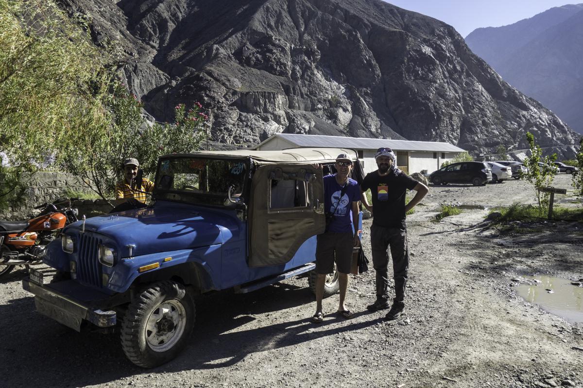
Jeep Track from Raikot Bridge to Tato Village
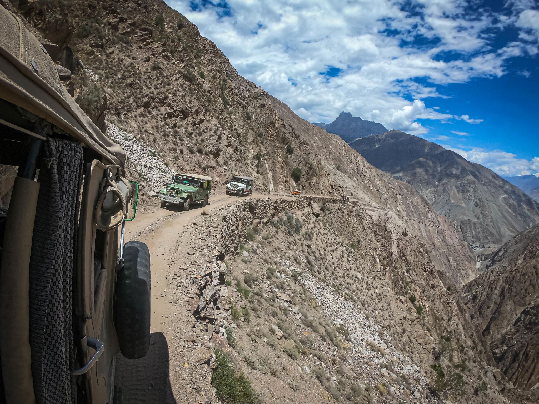
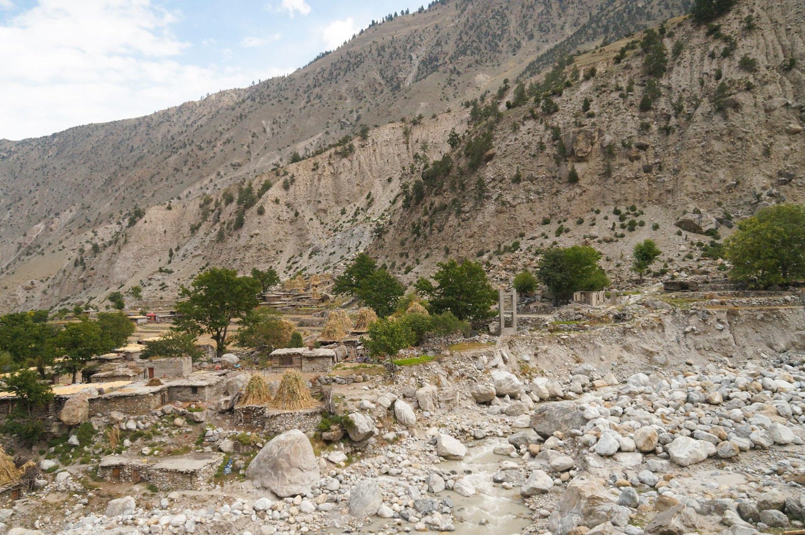
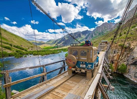
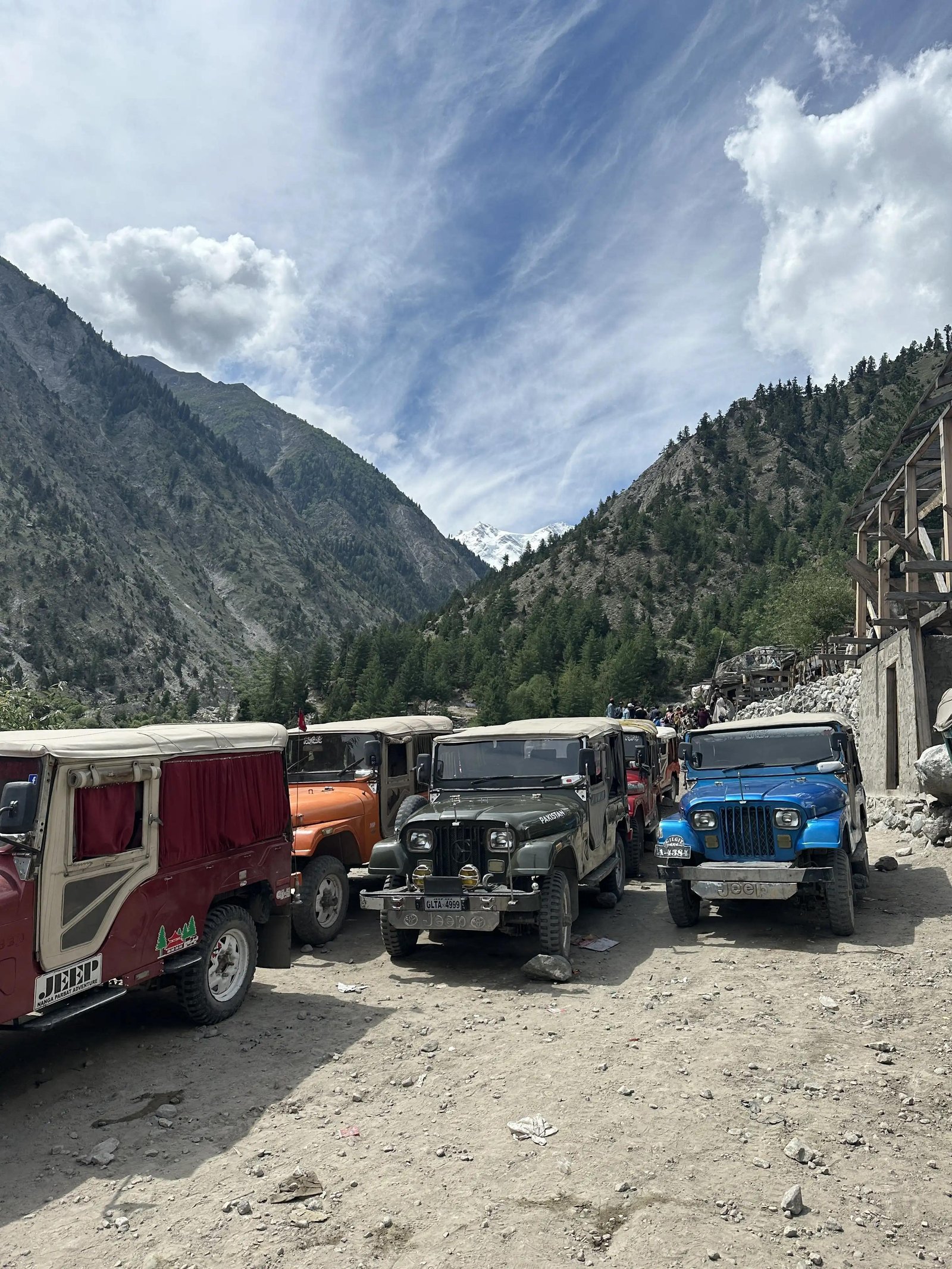
The jeep track between Raikot Bridge and Tato Village is one of the most dramatic mountain roads in Pakistan.
Key Details
- Distance: approximately 16 km
- Travel time: 1 to 2 hours
- Accessible only by 4WD jeep
The road is:
- Narrow
- Rocky
- Steep
- Exposed in several sections
Landslides occasionally affect the route after heavy rainfall.
Local jeeps are available at Raikot Bridge, and many travelers share costs with other trekkers.
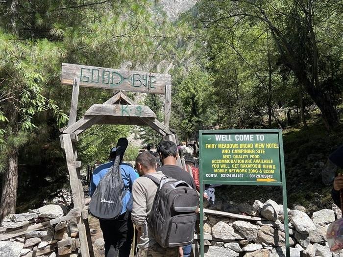
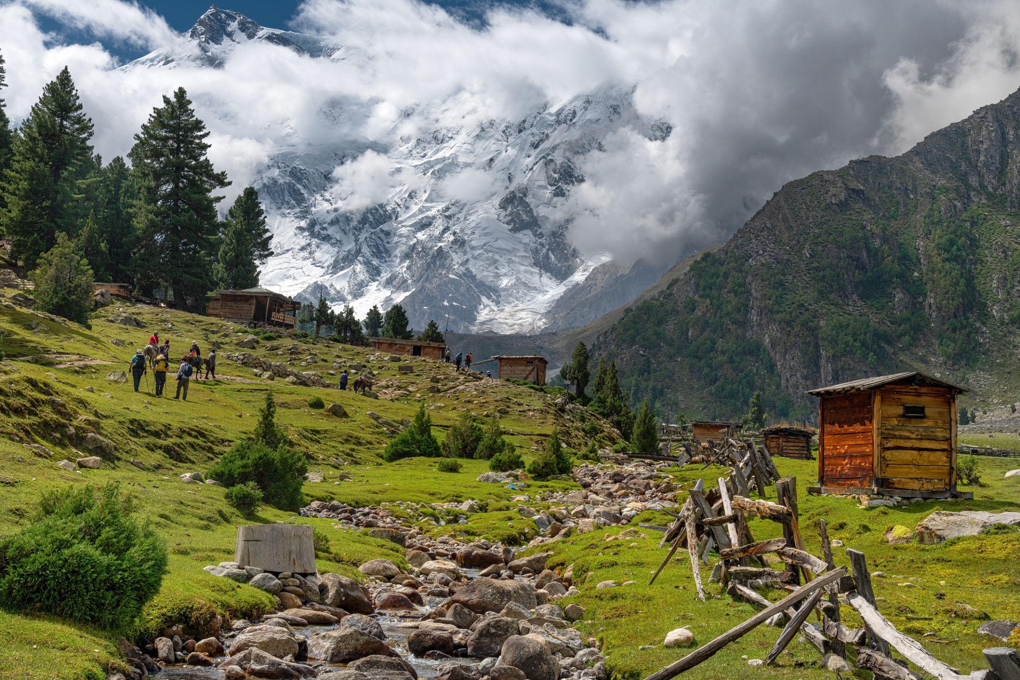
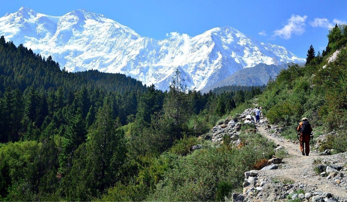
Trek from Tato Village to Fairy Meadows
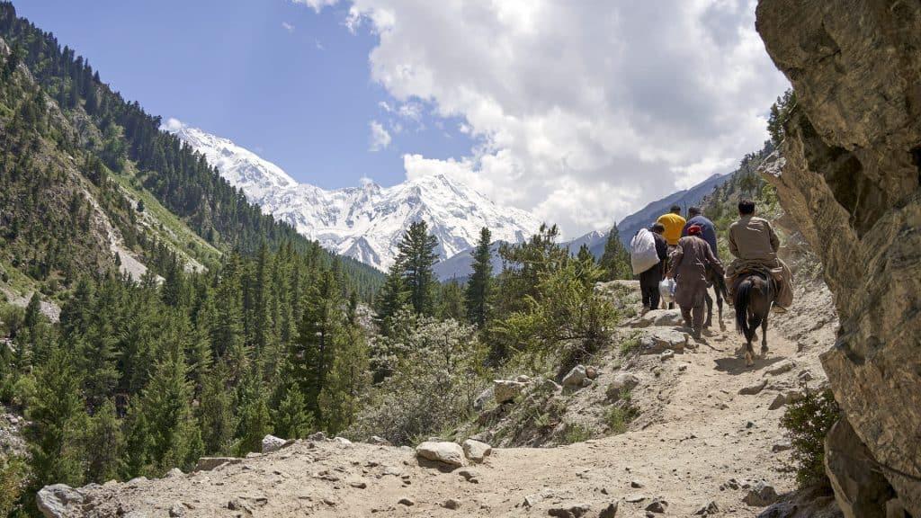
From Tato Village, the journey continues on foot through forest toward Fairy Meadows.
Trek Details
- Distance: approximately 3 km
- Elevation gain: around 500 metres
- Trek duration: 1 to 1.5 hours
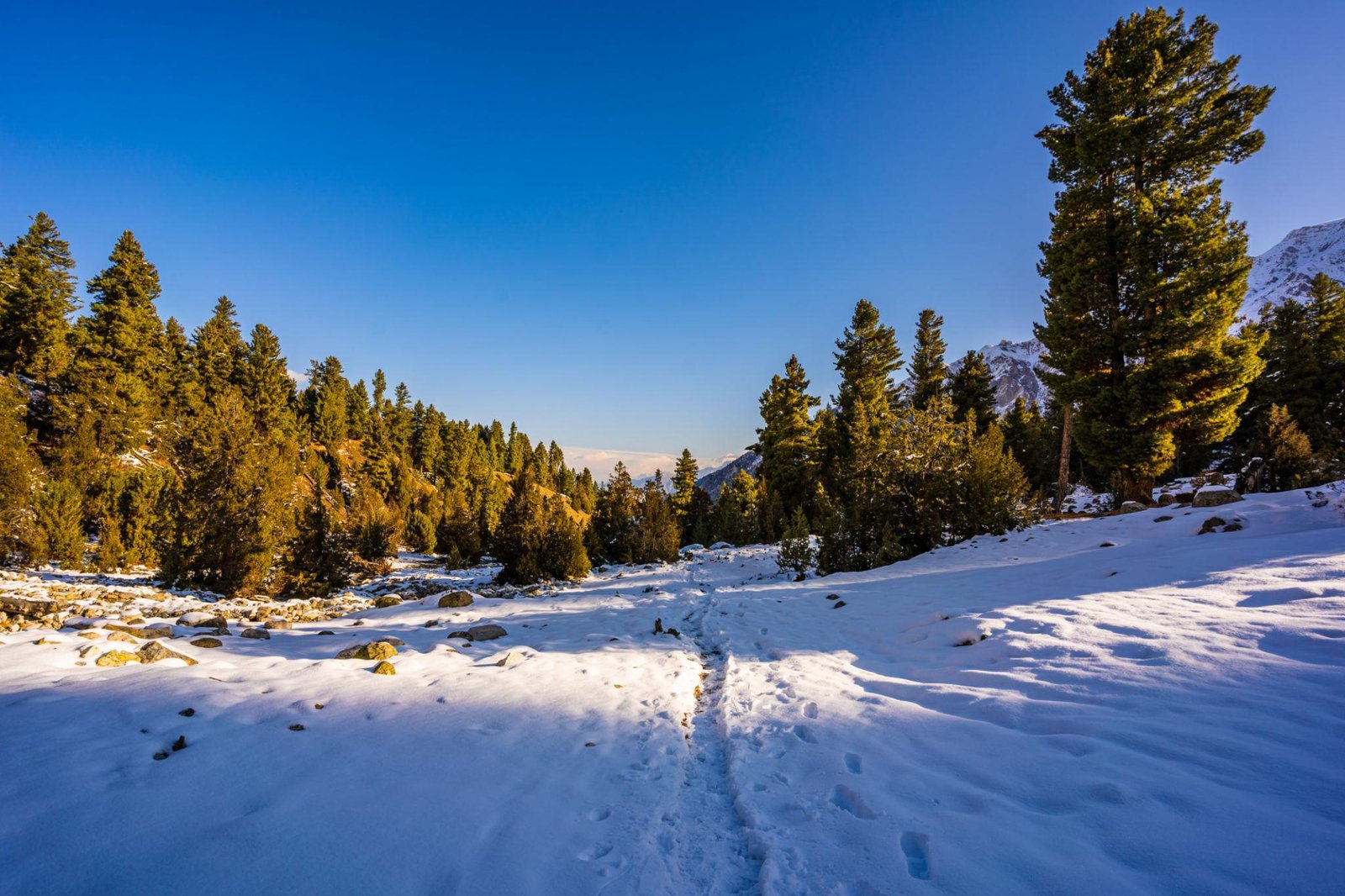
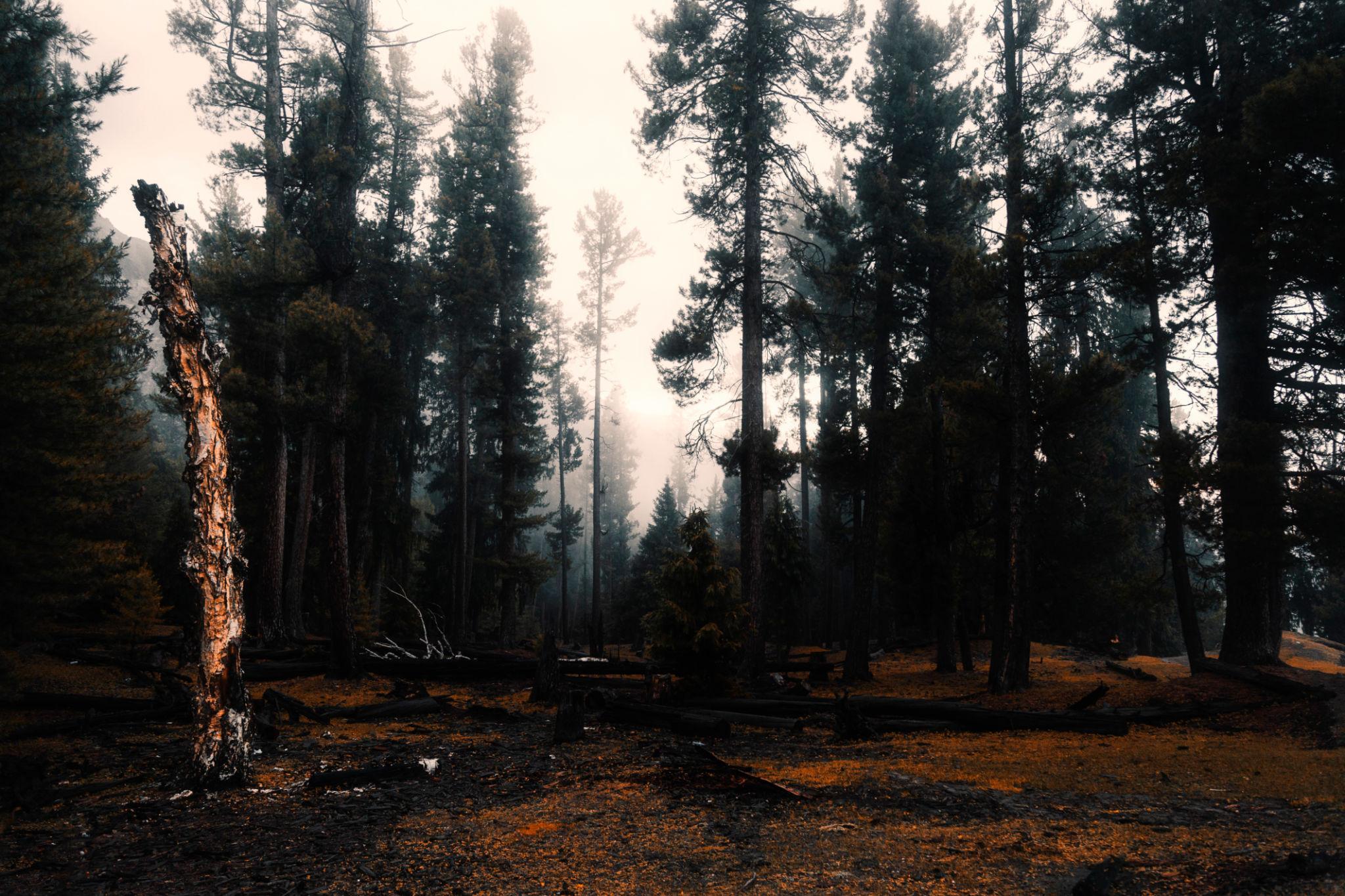
The trail passes through:
- Pine forests
- Rocky sections
- Mountain viewpoints
- Forest clearings
The route is well defined and manageable for most travelers with moderate fitness levels.
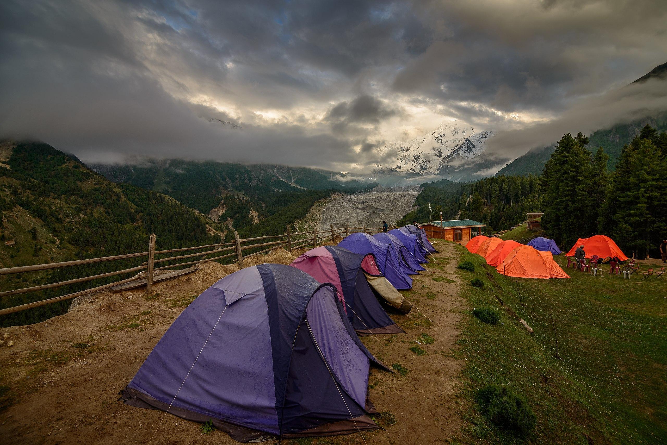
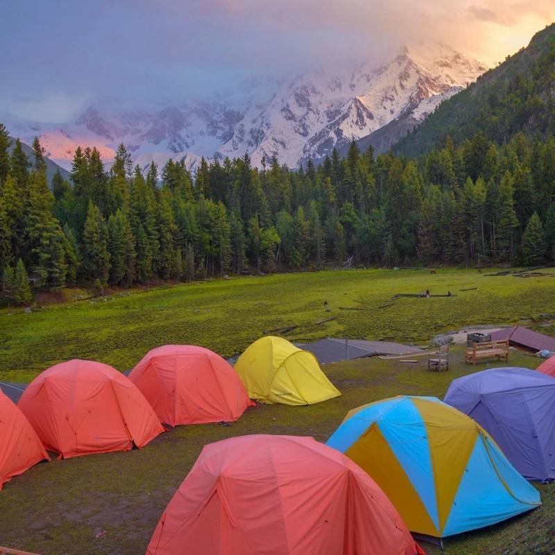
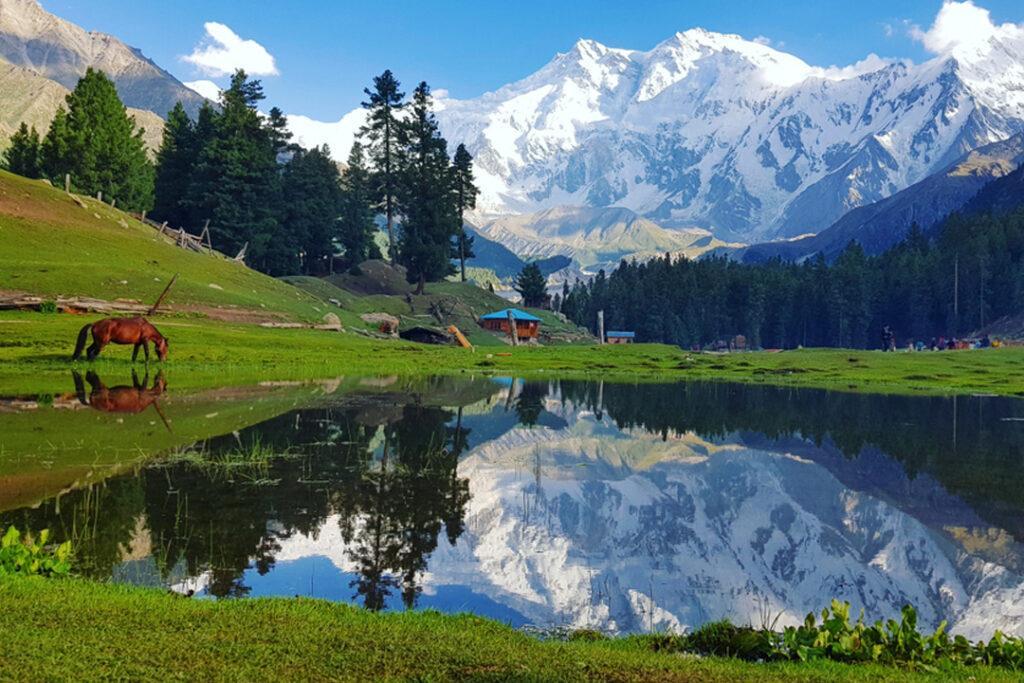
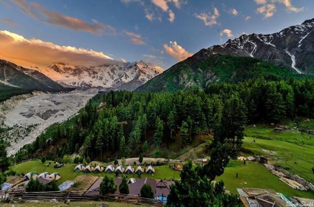
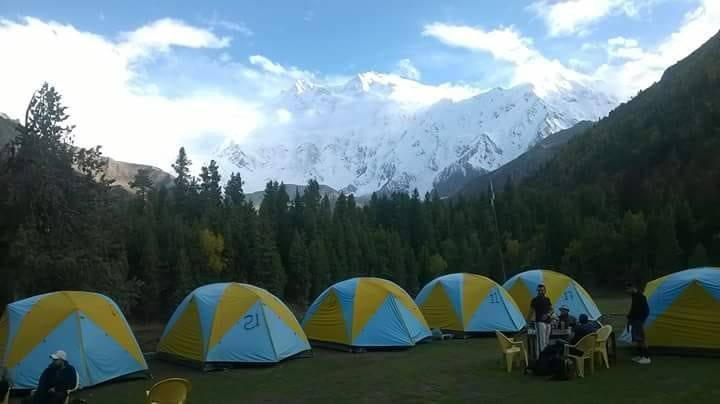
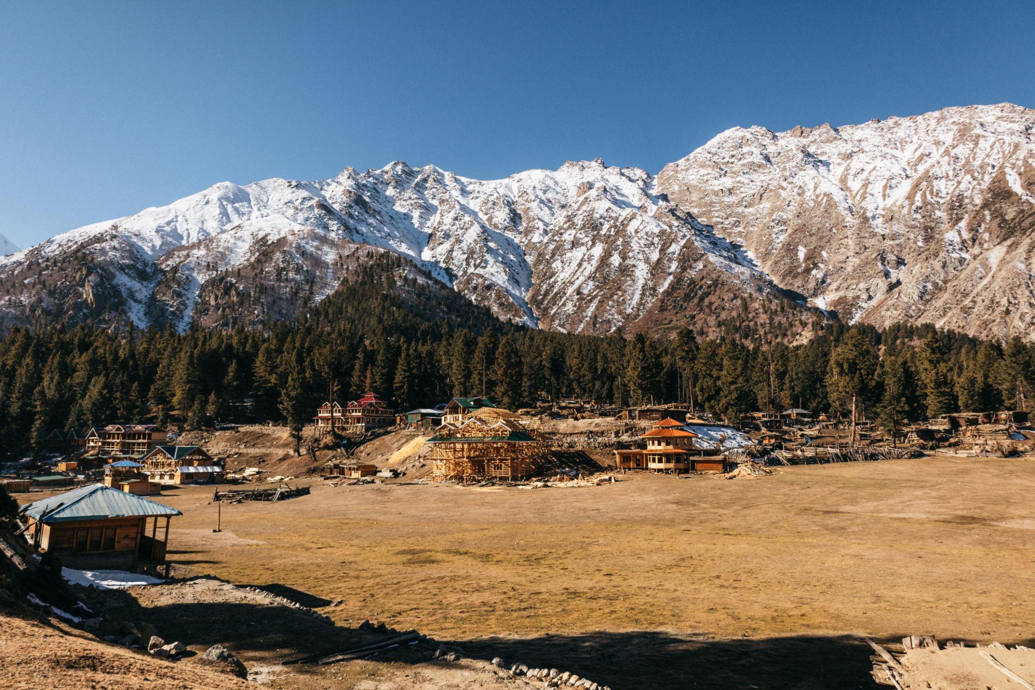
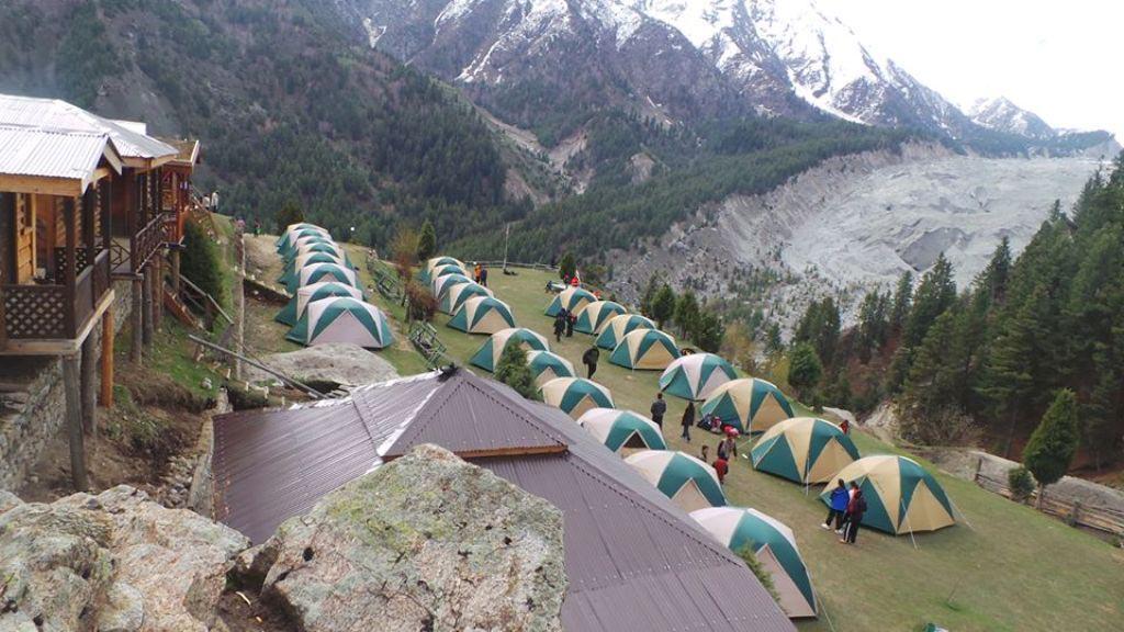
Fairy Meadows Campsite
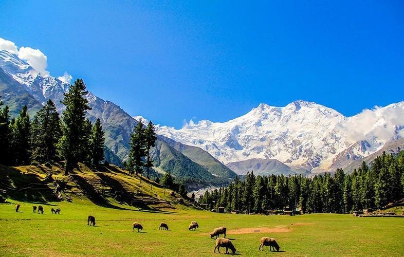
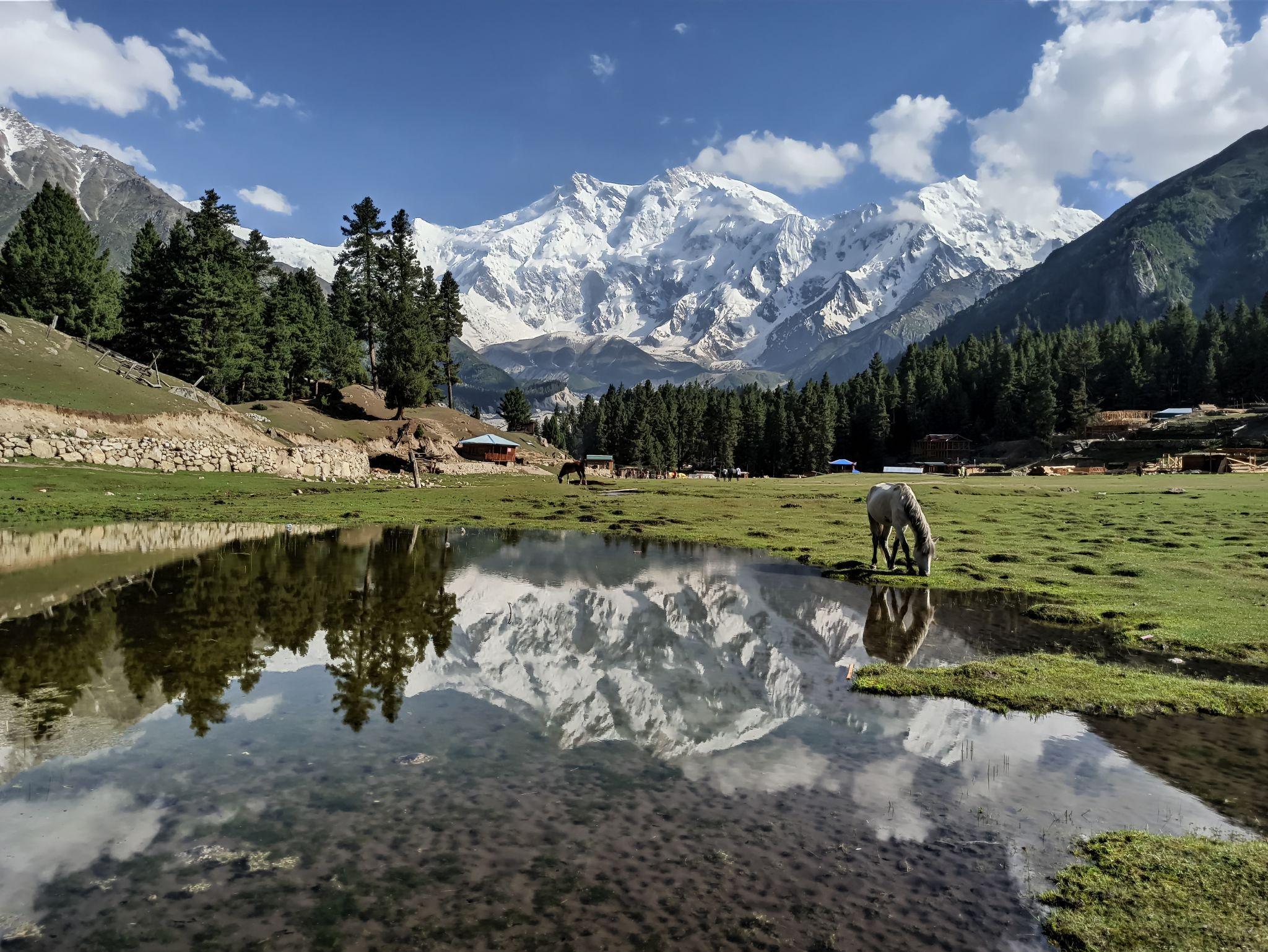
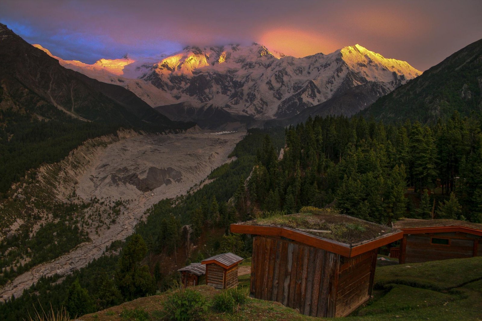
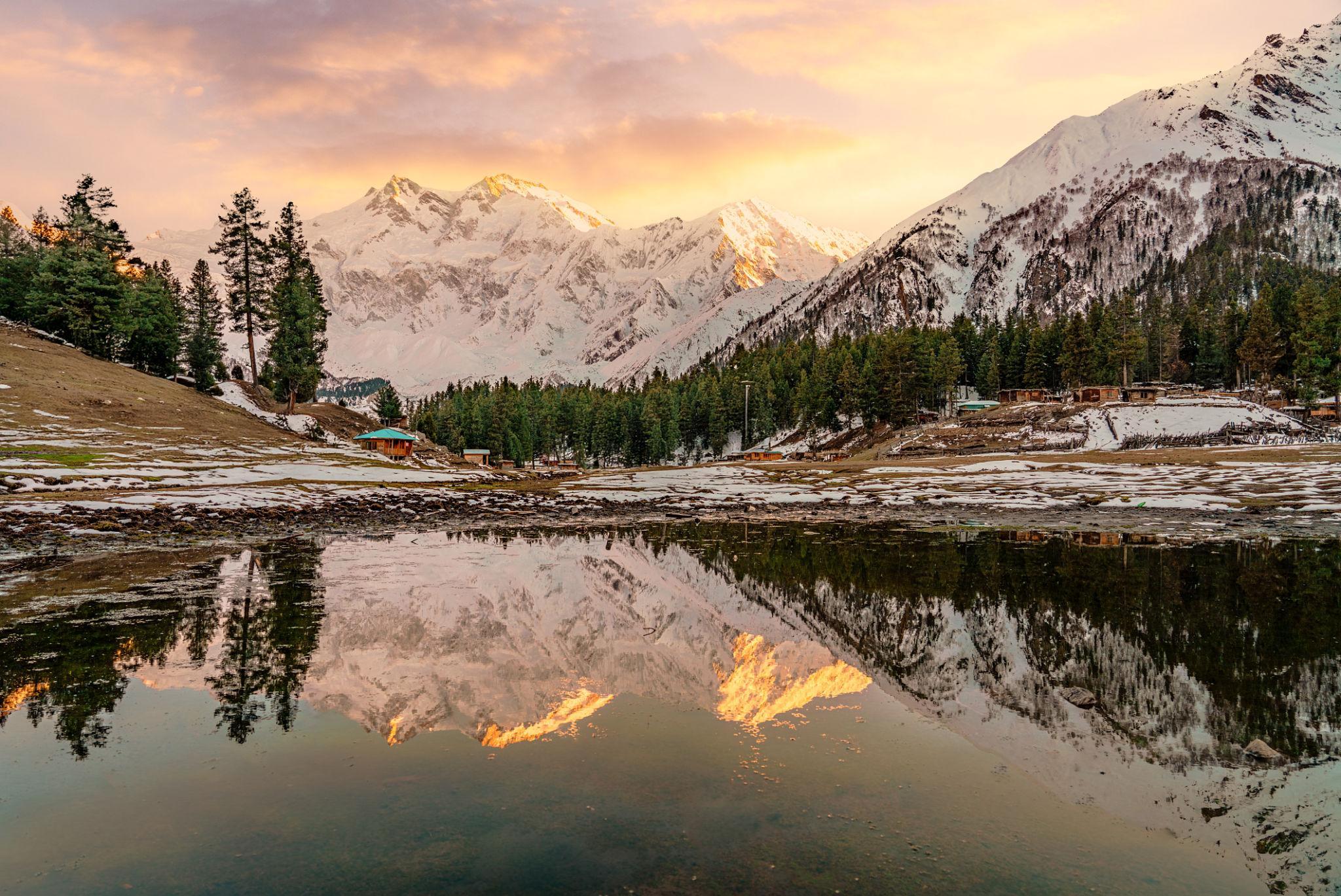
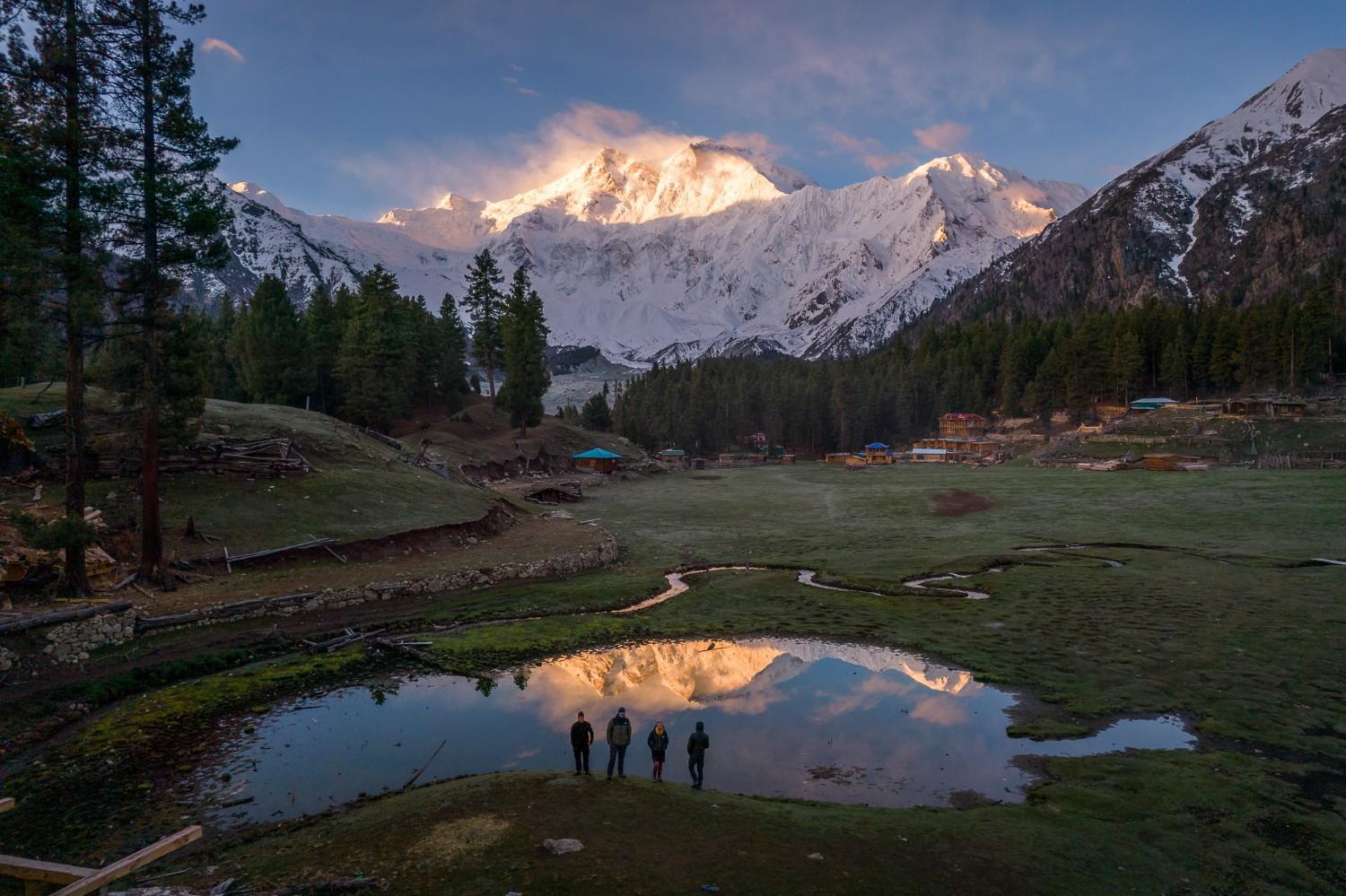
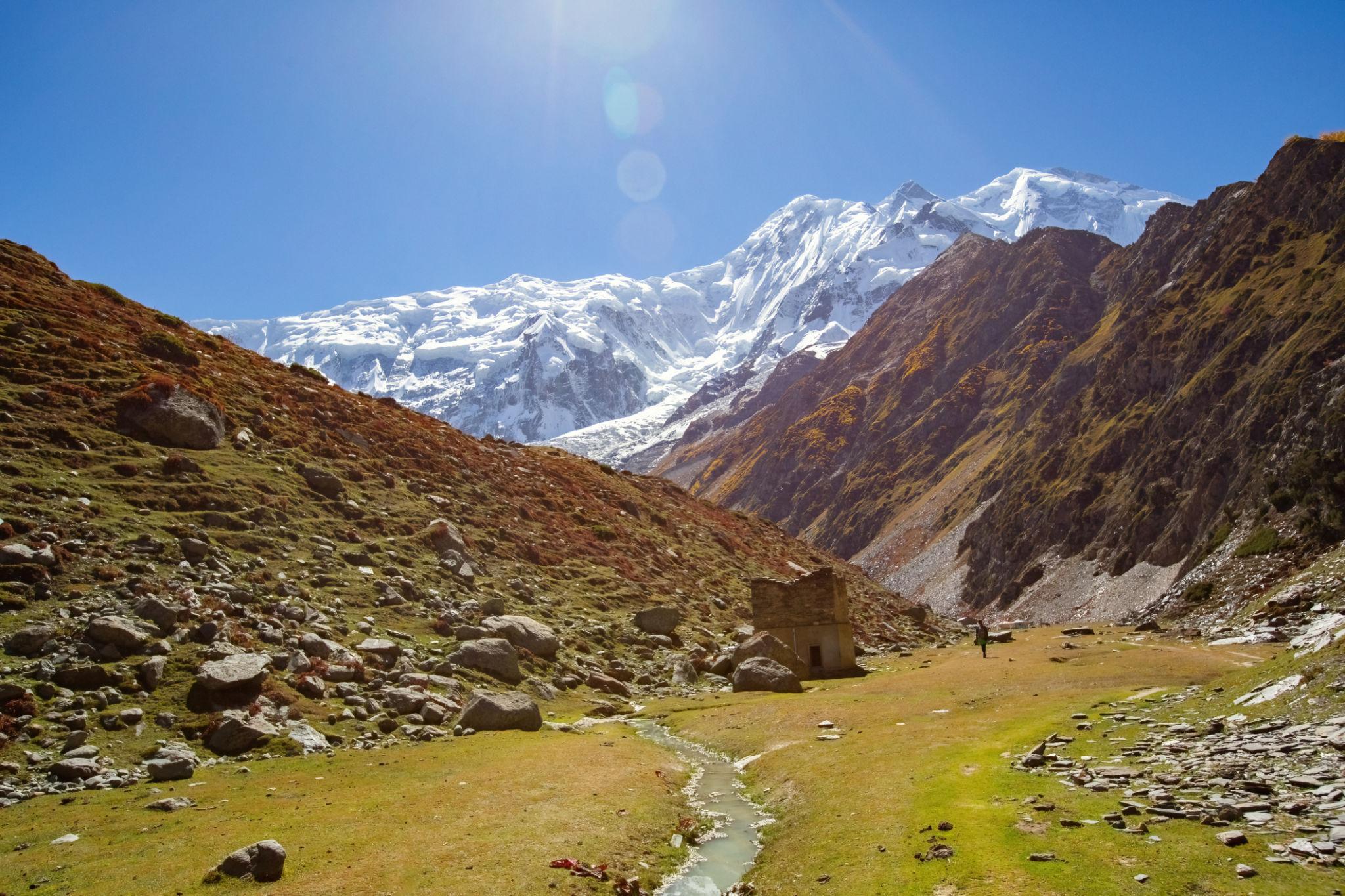
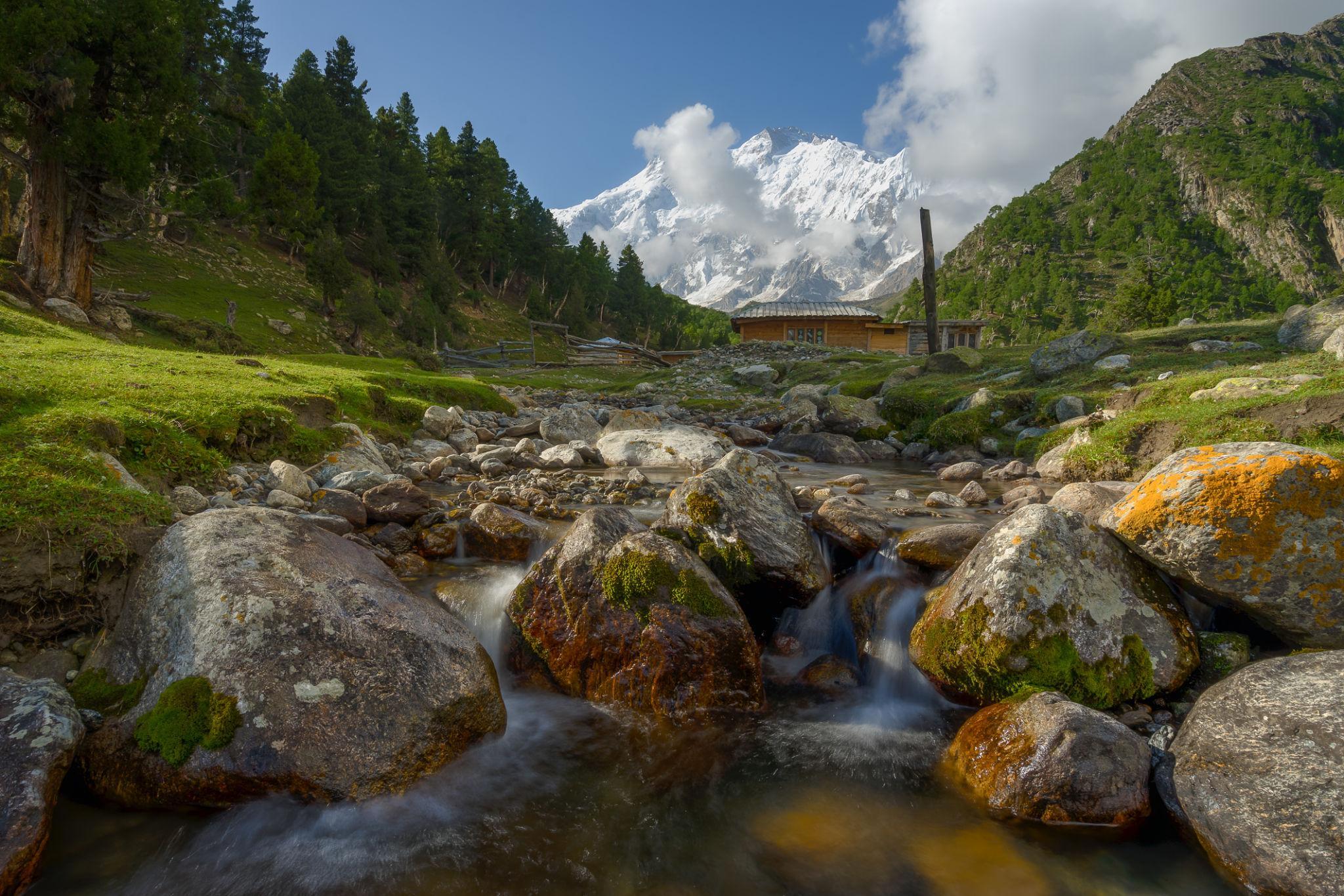
The meadow itself is a wide alpine grassland with direct views toward Nanga Parbat’s Raikot Face.
At sunrise and sunset, changing light conditions create some of the best mountain photography opportunities in Pakistan.
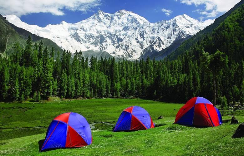
The campsite area includes:
- Open camping grounds
- Wooden huts
- Basic guesthouses
- Water sources
- Simple toilet facilities
Typical summer temperatures:
- Daytime: 15°C to 20°C
- Night: 2°C to 5°C
Even during peak summer, nights can become extremely cold.
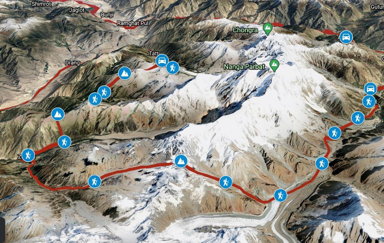
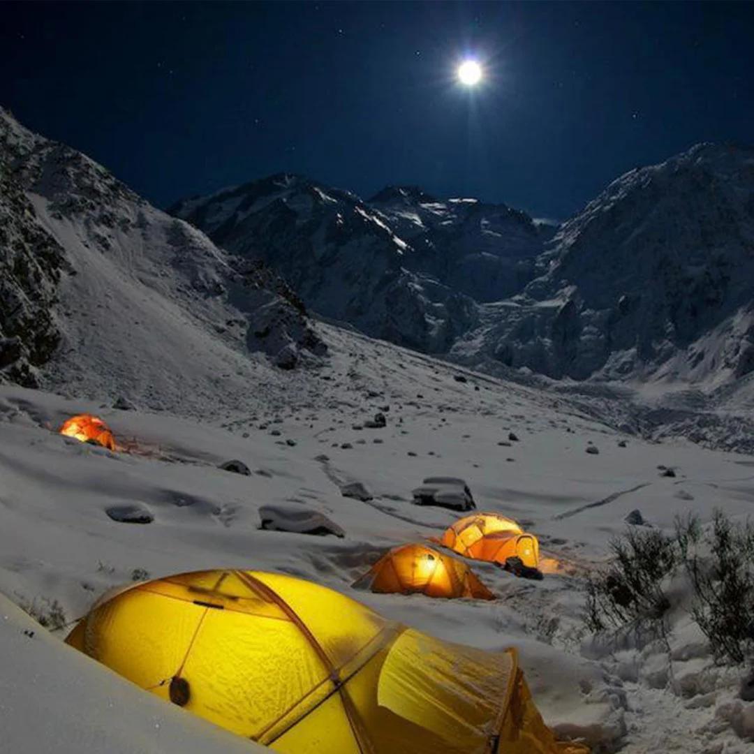
Nanga Parbat Base Camp Trek
The trek from Fairy Meadows to Beyal Camp and Nanga Parbat Base Camp is one of the highlights of the region.
Trek Details
- Elevation: approximately 3,950 metres
- Trek duration: 2 to 3 hours one way
- Elevation gain: around 650 metres
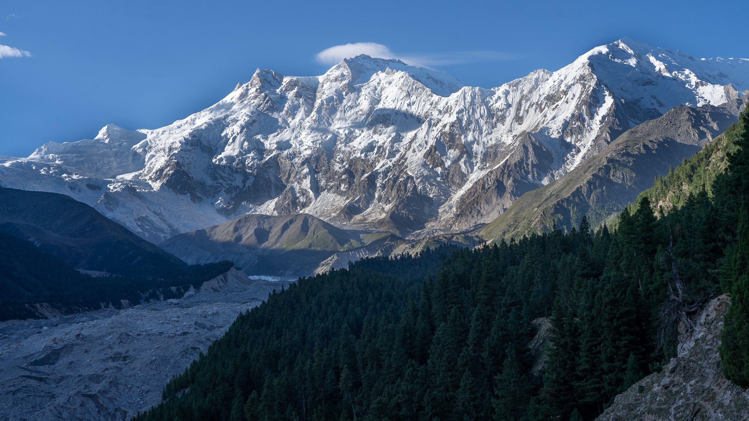
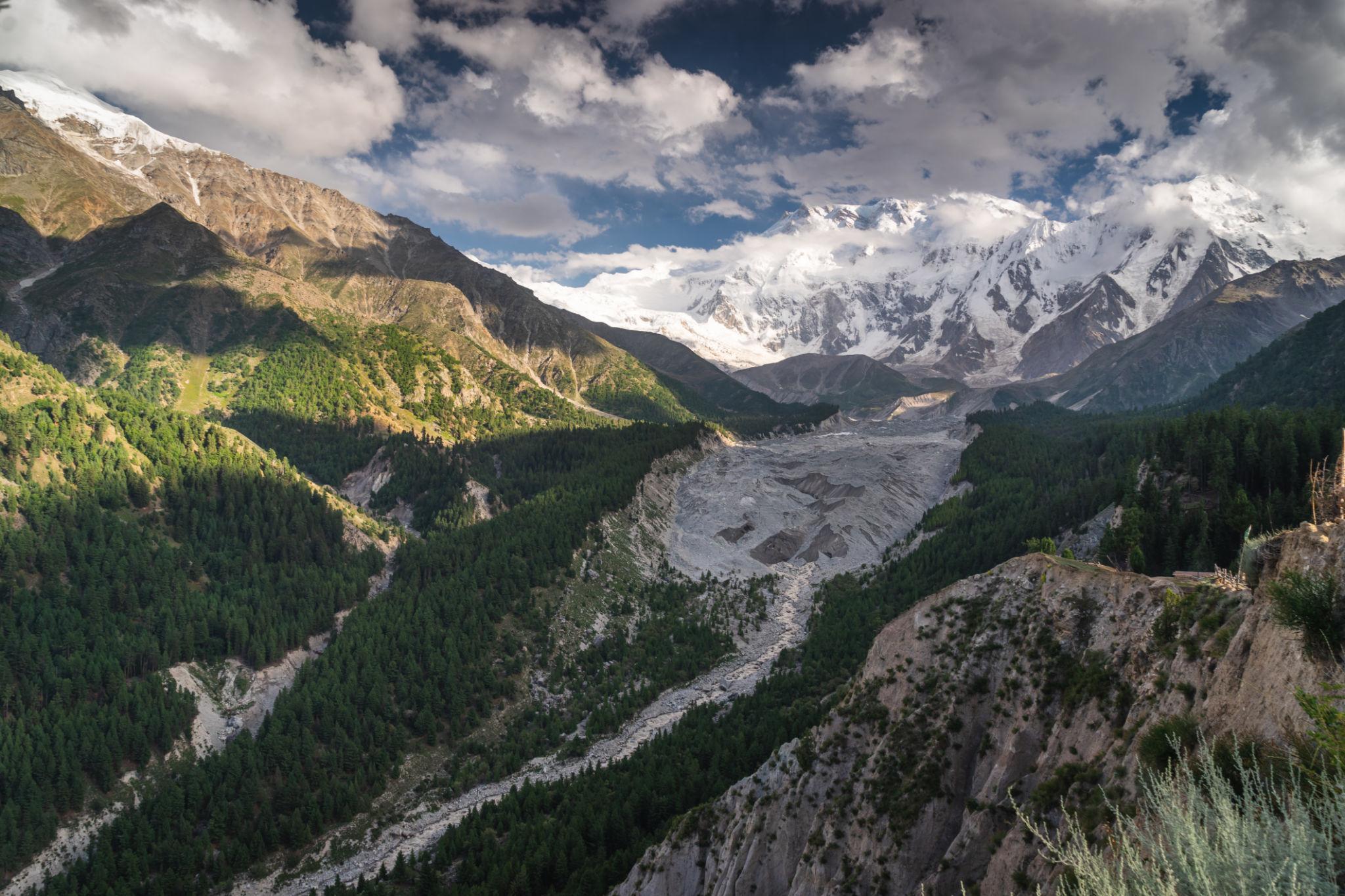
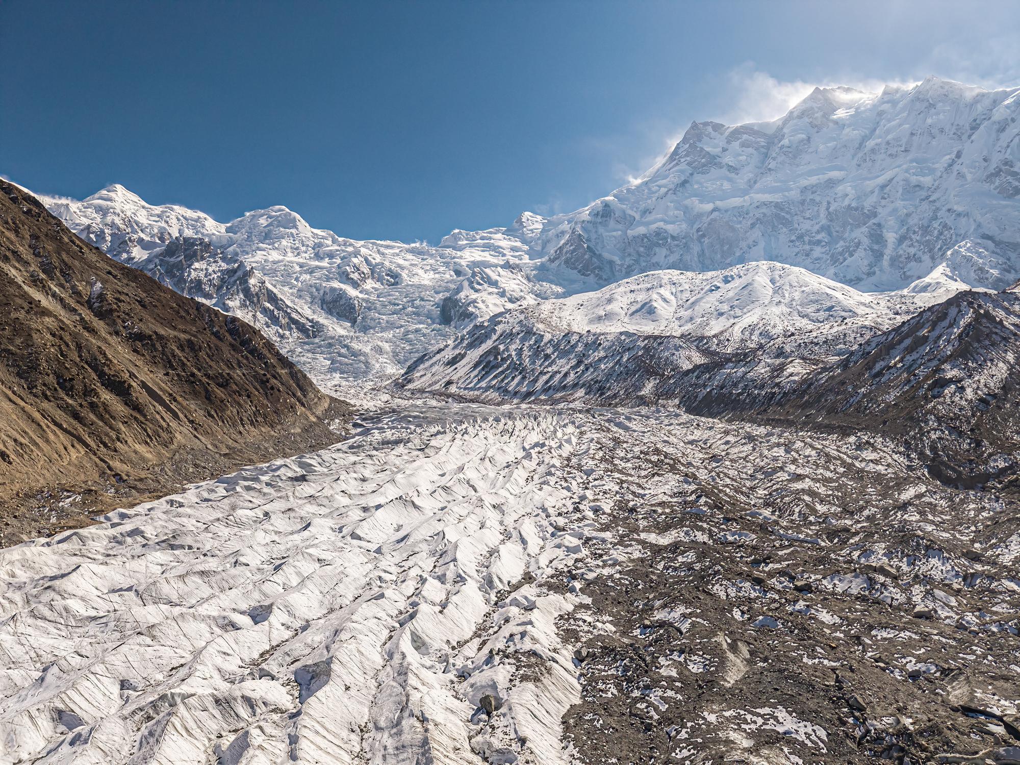
The trail climbs above the tree line onto moraine and rocky terrain near the glacier.
What to Expect at Beyal Camp
Beyal Camp offers:
- Glacier views
- Massive north face scenery
- Expedition camp atmosphere
- High altitude alpine terrain
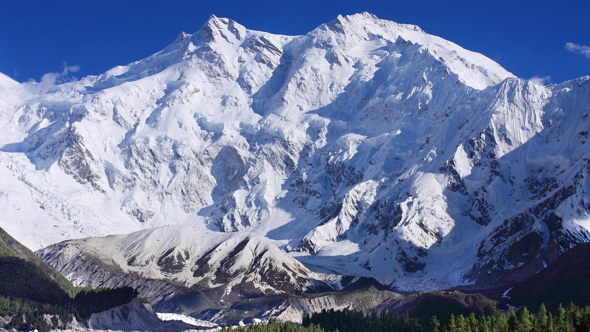
The north face of Nanga Parbat rises dramatically above the glacier and dominates the landscape.
Trekkers usually complete the route as:
- A day hike
- Overnight camping trip
Water is available from glacial streams but should always be filtered before drinking.
Best Time to Visit Fairy Meadows
The trekking season usually runs from:
- Late May to September
Outside these months, snow and landslides often block access routes.
Late May to June
Best for:
- Green meadows
- Snow covered mountains
- Photography
- Smaller crowds
July to August
Best for:
- Stable trekking conditions
- Fully operational campsites
- Warm weather
This is also the busiest tourism period.
September
Best for:
- Autumn colors
- Clear air
- Landscape photography
- Fewer tourists
Temperatures become colder and snowfall may begin late in the month.
Fairy Meadows in Summer
Summer is the busiest trekking season at Fairy Meadows.
Why Visit in Summer?
- Clear mountain views
- Fully accessible trekking trails
- Pleasant daytime weather
- Active guesthouses and campsites
July and August attract the highest number of domestic and international visitors.
Afternoon clouds and occasional rainfall are common because of monsoon influence.
Fairy Meadows in Autumn
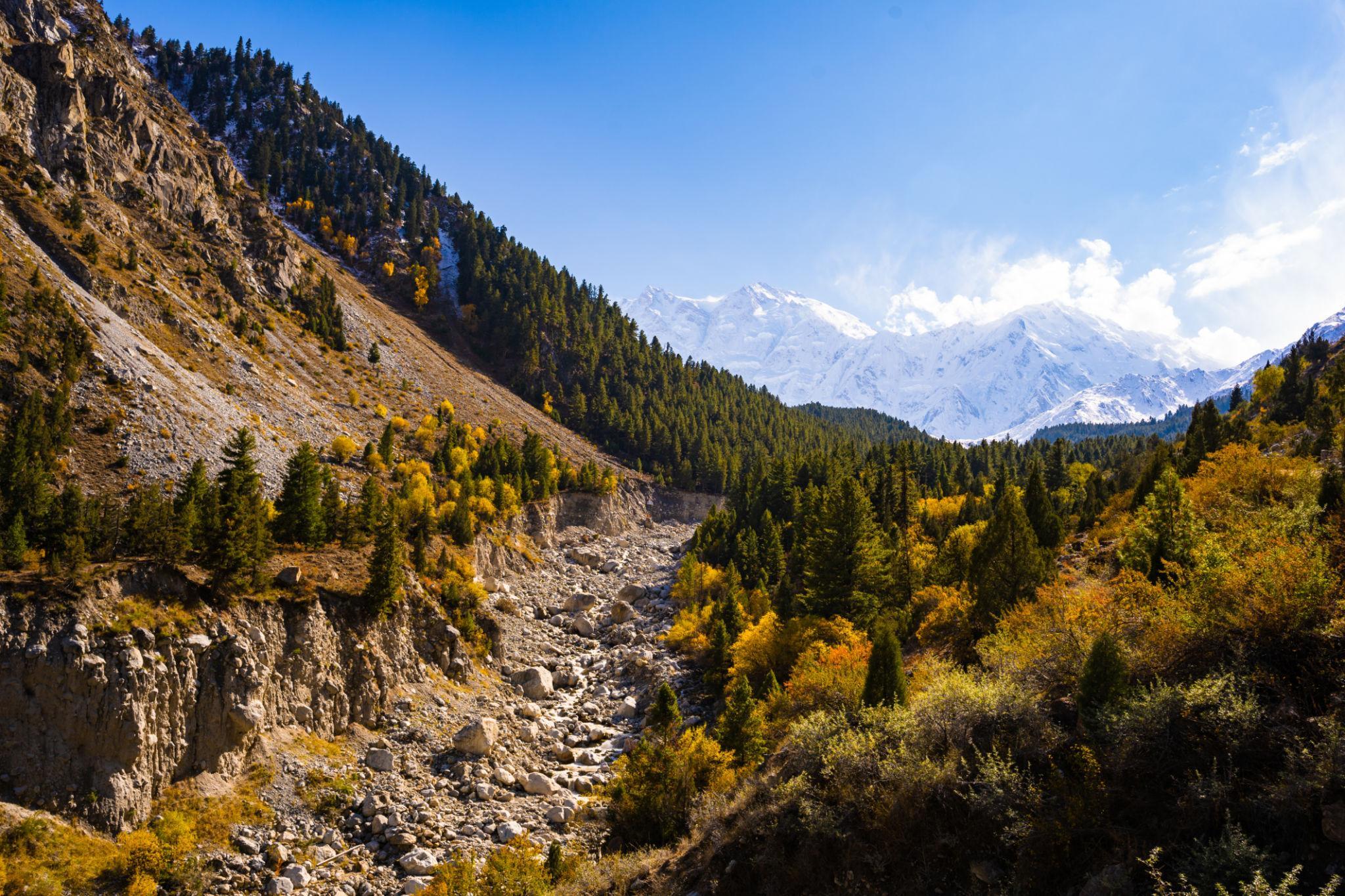
Autumn at Fairy Meadows offers:
- Cooler temperatures
- Fewer crowds
- Clearer skies
- Forest color changes
- Excellent photography conditions
September is considered one of the best months for landscape photography in the region.
Night temperatures drop rapidly and early snowfall can occasionally affect road access.
Camping & Accommodation
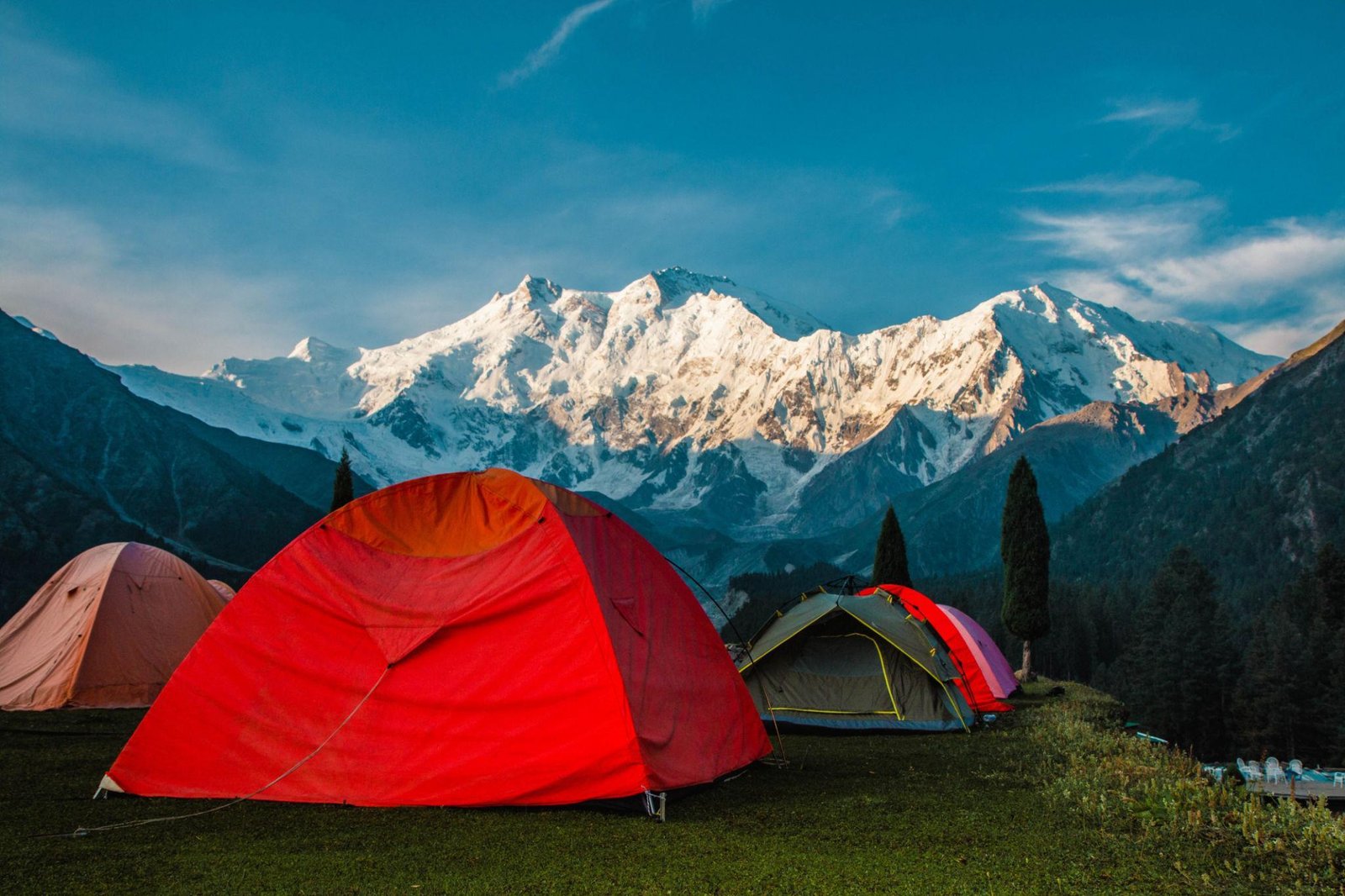
Camping at Fairy Meadows
Camping is the most popular accommodation option.
The meadow offers:
- Open camping areas
- Scenic mountain views
- Water access
- Flexible camping spots
A four season sleeping bag is recommended because temperatures often fall below freezing at night.
Guesthouses & Wooden Huts
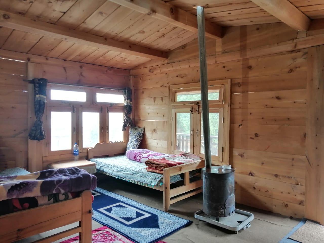
Several local families operate:
- Wooden cabins
- Basic guesthouses
- Camping services
Facilities generally include:
- Shared toilets
- Mattresses and blankets
- Basic meals
- Tea and local food
Advance booking is difficult because network coverage in the area is limited.
Packing List & Essential Gear
Recommended Gear
- Trekking boots with ankle support
- Warm clothing layers
- Waterproof jacket
- Sleeping bag
- Trekking poles
- Sunscreen and sunglasses
- Headlamp
- Water purification tablets
- Power bank
Mountain weather changes quickly, making layered clothing essential.
Physical Difficulty & Altitude
Fairy Meadows itself is moderately accessible, but altitude still affects some travelers.
Elevations
- Fairy Meadows: approximately 3,300 metres
- Beyal Camp: approximately 3,950 metres
Possible symptoms include:
- Headaches
- Fatigue
- Difficulty sleeping
The trek requires:
- Moderate fitness
- Ability to walk uphill for several hours
- Comfort on uneven terrain
No technical mountaineering experience is required.
Practical Travel Tips
- Start the jeep journey early in the morning
- Carry cash because there are no ATMs nearby
- Bring warm clothing even during summer
- Keep extra travel days for weather delays
- Carry a power bank because electricity is limited
- Stay hydrated during trekking
- Avoid carrying unnecessary weight
Frequently Asked Questions
How difficult is the Fairy Meadows trek?
The trek is moderate and suitable for most travelers with reasonable fitness.
How many days are needed for Fairy Meadows?
A 3 to 4 day trip is ideal, including the Nanga Parbat Base Camp trek.
Is Fairy Meadows safe for tourists?
Yes. Fairy Meadows is generally considered safe for both domestic and international travelers.
What is the best month to visit Fairy Meadows?
June to September offers the best trekking and weather conditions.
Can beginners trek to Nanga Parbat Base Camp?
Yes. The Beyal Camp trek is suitable for beginners with moderate fitness, although altitude and rocky terrain can still be challenging.
![K2 Base Camp Trek: Ultimate Guide k2 Trek 2026 [UPDATED]](https://karakoramdiaries.com/storage/ultimate-guide-to-k2-base-camp-trek-full-document-150x150.png)