Karakoram Highway Road Trip Guide: Islamabad to Khunjerab Pass
The Karakoram Highway is one of the world’s most dramatic mountain roads and connects Pakistan with China through the high-altitude landscapes of Gilgit-Baltistan. Stretching approximately 1,300 kilometres from Hasan Abdal near Islamabad to the Khunjerab Pass on the Pakistan-China border, the highway crosses the Himalayas, Karakoram, and Hindu Kush mountain systems while following parts of the ancient Silk Road.
Built jointly by Pakistan and China and officially opened in 1986, the route passes through deep gorges, glacial valleys, historic mountain settlements, and some of the most spectacular scenery in Asia.
Today, the Karakoram Highway serves as:
- A strategic trade corridor
- A lifeline for remote mountain communities
- Pakistan’s most iconic road trip
- One of the world’s great overland journeys
This complete guide covers the full journey from Islamabad to Khunjerab Pass, including major stops, driving stages, accommodation, attractions, practical logistics, seasonal travel advice, and road trip planning tips.
Table of contents [Show]
- Table of Contents
- Route Overview and Key Distances
- Best Time to Travel the Karakoram Highway
- Stage 1: Islamabad to Chilas
- Stage 2: Chilas to Gilgit
- Stage 3: Gilgit to Karimabad, Hunza
- Stage 4: Karimabad to Attabad Lake and Passu
- Stage 5: Sost to Khunjerab Pass
- Vehicle Requirements & Road Conditions
- Accommodation Along the Route
- Essential Travel Tips
- Frequently Asked Questions
Table of Contents
- Route Overview and Key Distances
- Best Time to Travel the Karakoram Highway
- Stage 1: Islamabad to Chilas
- Stage 2: Chilas to Gilgit
- Stage 3: Gilgit to Karimabad, Hunza
- Stage 4: Karimabad to Attabad Lake and Passu
- Stage 5: Sost to Khunjerab Pass
- Vehicle Requirements & Road Conditions
- Accommodation Along the Route
- Essential Travel Tips
- Frequently Asked Questions
Route Overview and Key Distances
The drive from Islamabad to Khunjerab Pass covers approximately 1,300 kilometres and usually takes between 5 and 7 days depending on stops and weather conditions.
The route passes through:
- Khyber Pakhtunkhwa
- Diamer District
- Gilgit
- Hunza Valley
- Upper Hunza
- Khunjerab National Park
Key Distances
- Islamabad to Chilas: 420 km
- Chilas to Gilgit: 90 km
- Gilgit to Karimabad: 110 km
- Karimabad to Passu: 60 km
- Passu to Khunjerab Pass: 90 km
Recommended 6 Day Itinerary
Day 1
Islamabad to Chilas
Day 2
Chilas to Gilgit
Day 3
Gilgit to Karimabad
Day 4
Hunza Valley exploration
Day 5
Karimabad to Passu
Day 6
Khunjerab Pass excursion and return
Best Time to Travel the Karakoram Highway
Spring (March to May)
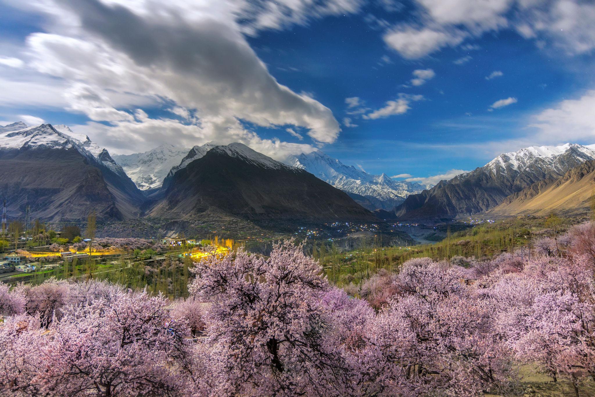
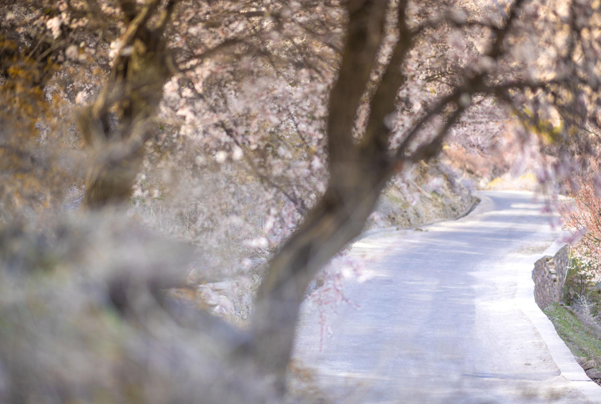
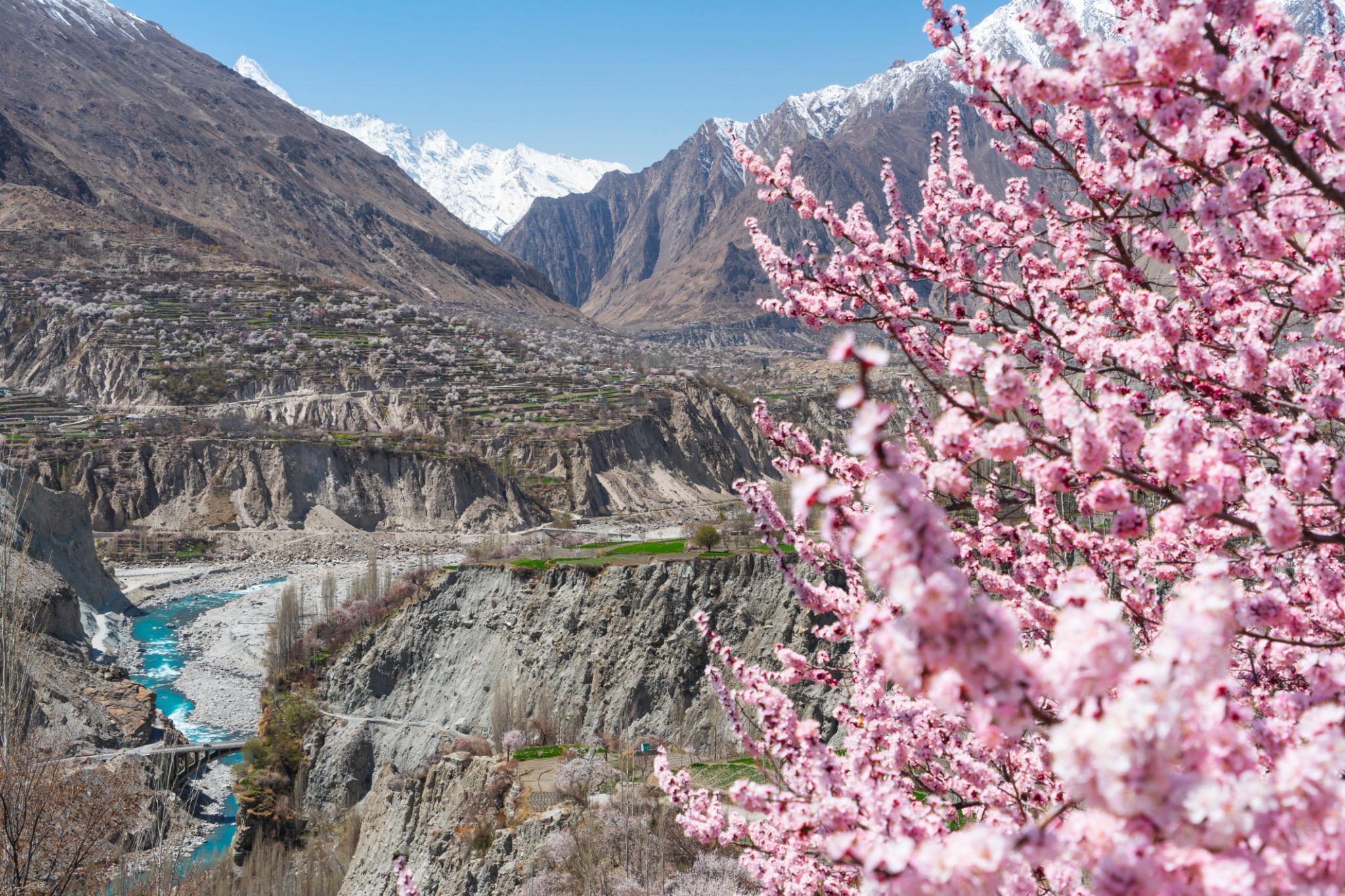
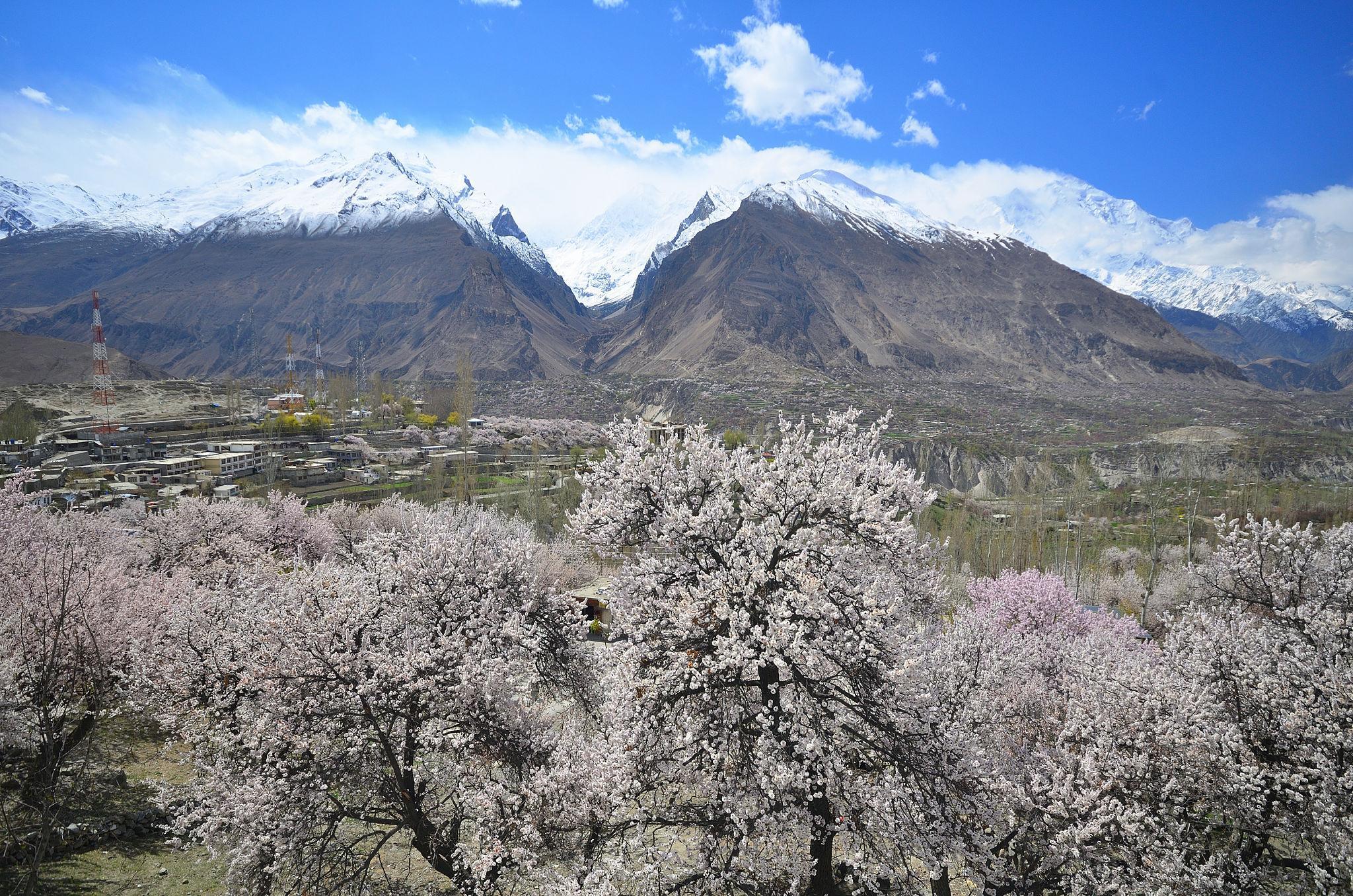
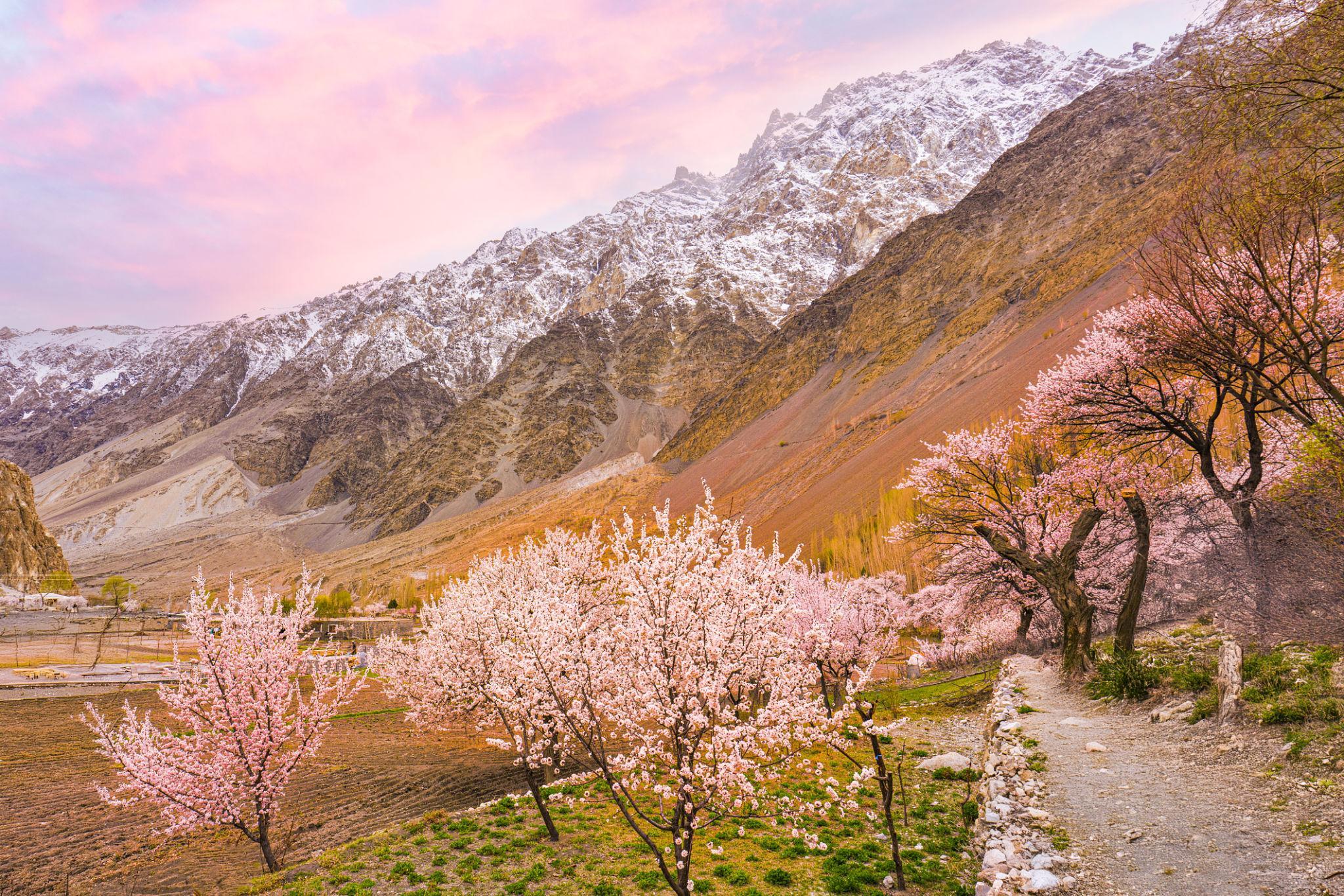
Spring is one of the best seasons for the Karakoram Highway because of:
- Cherry blossom season in Hunza
- Snow-covered peaks
- Pleasant daytime temperatures
- Green valleys
Summer (June to August)
Summer offers:
- Fully accessible roads
- Best trekking conditions
- Long daylight hours
- Warm weather in upper valleys
However, July and August can bring:
- Landslides
- Monsoon rainfall in lower regions
- Heavy domestic tourism traffic
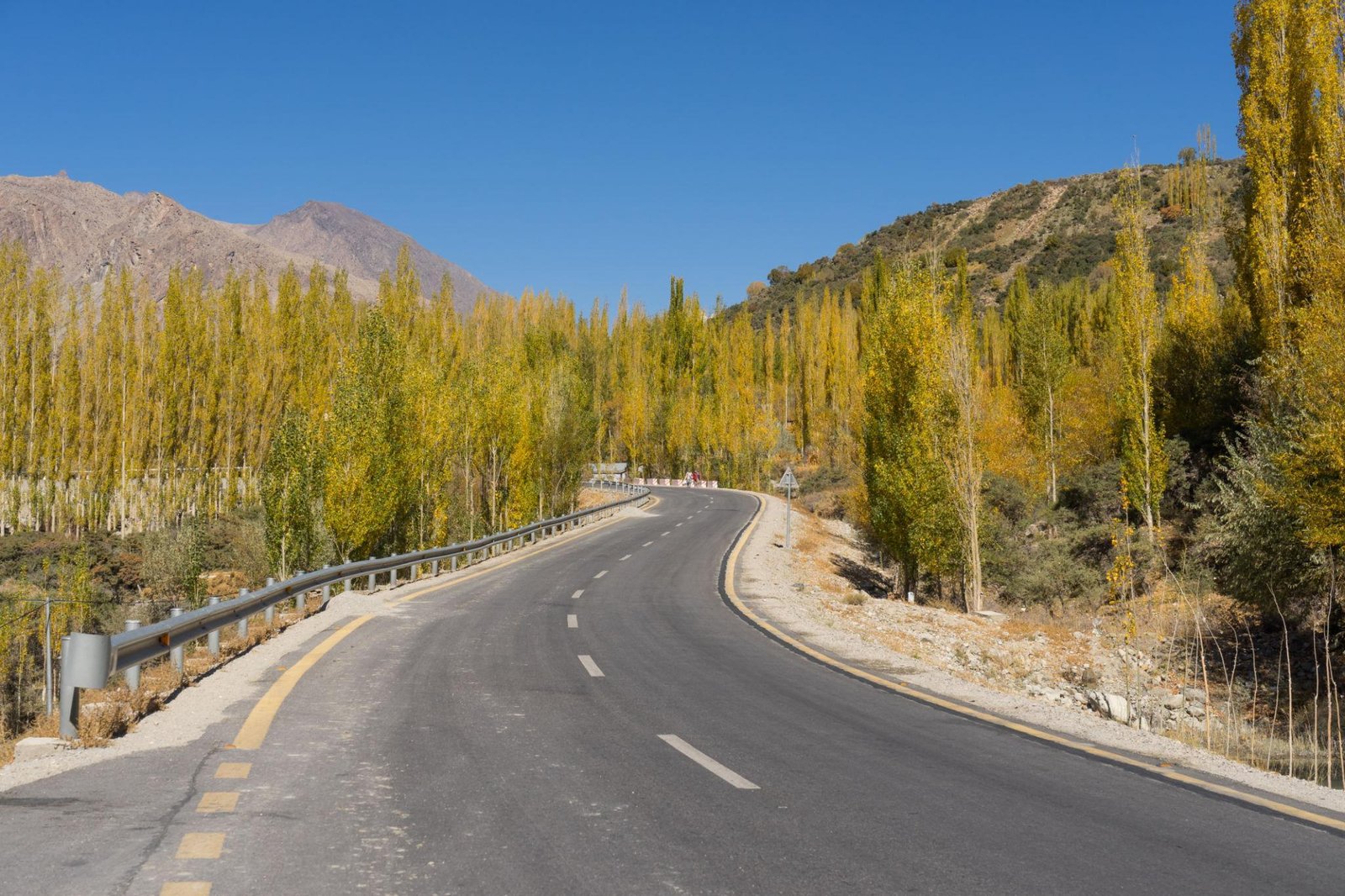
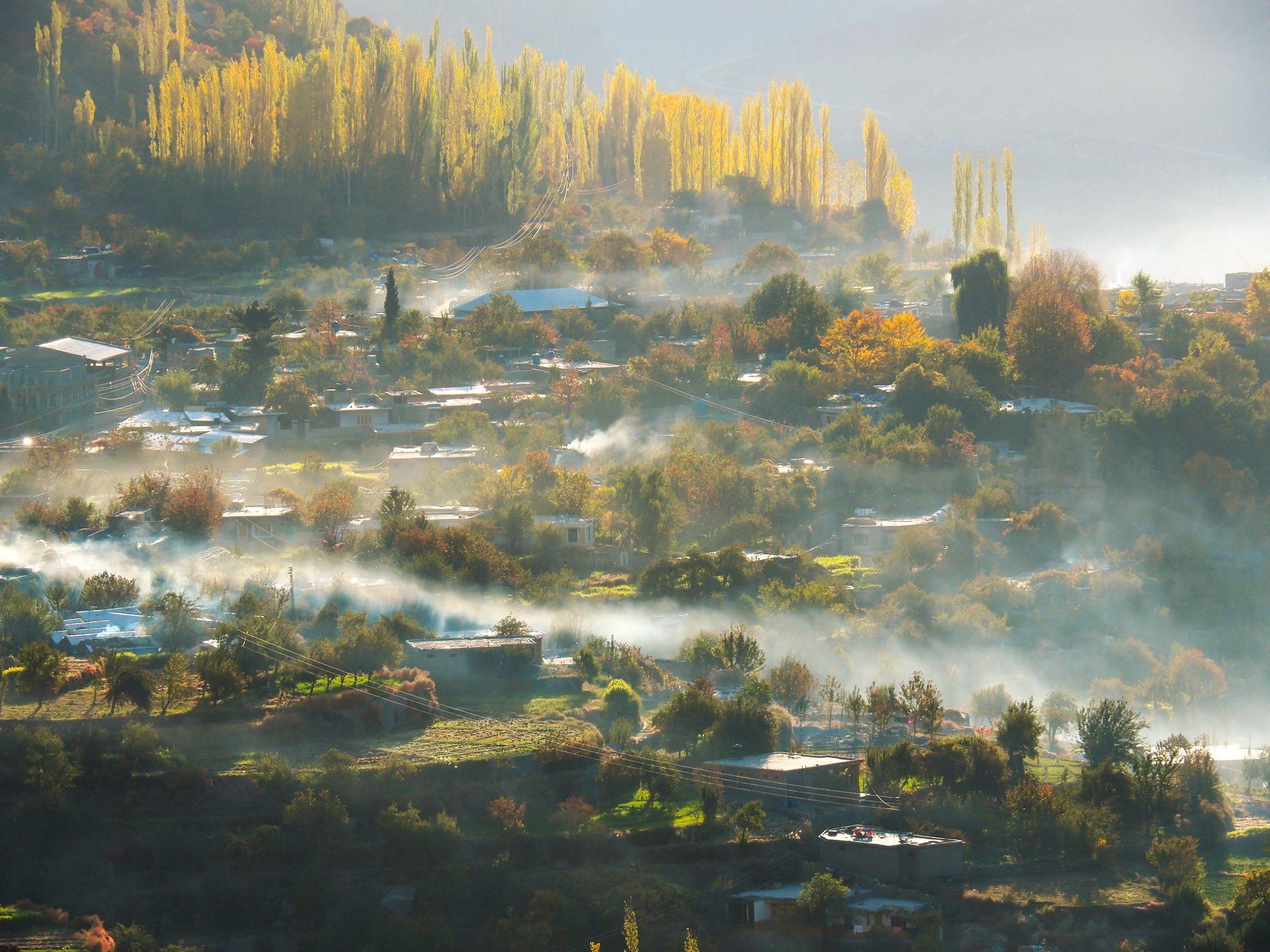
Autumn (September to October)
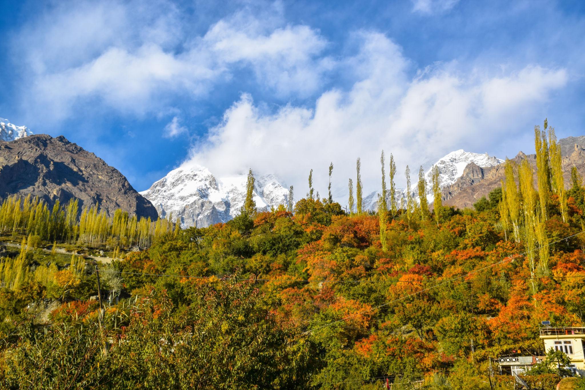
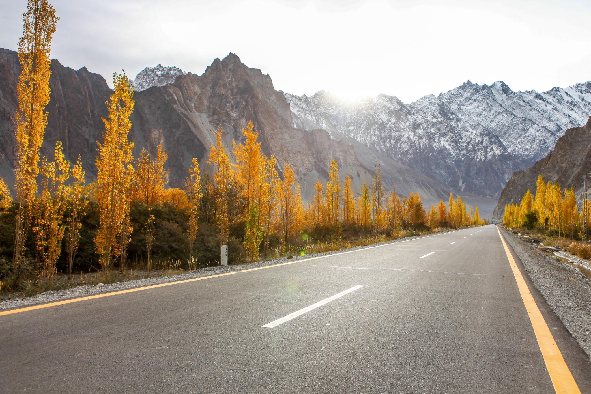

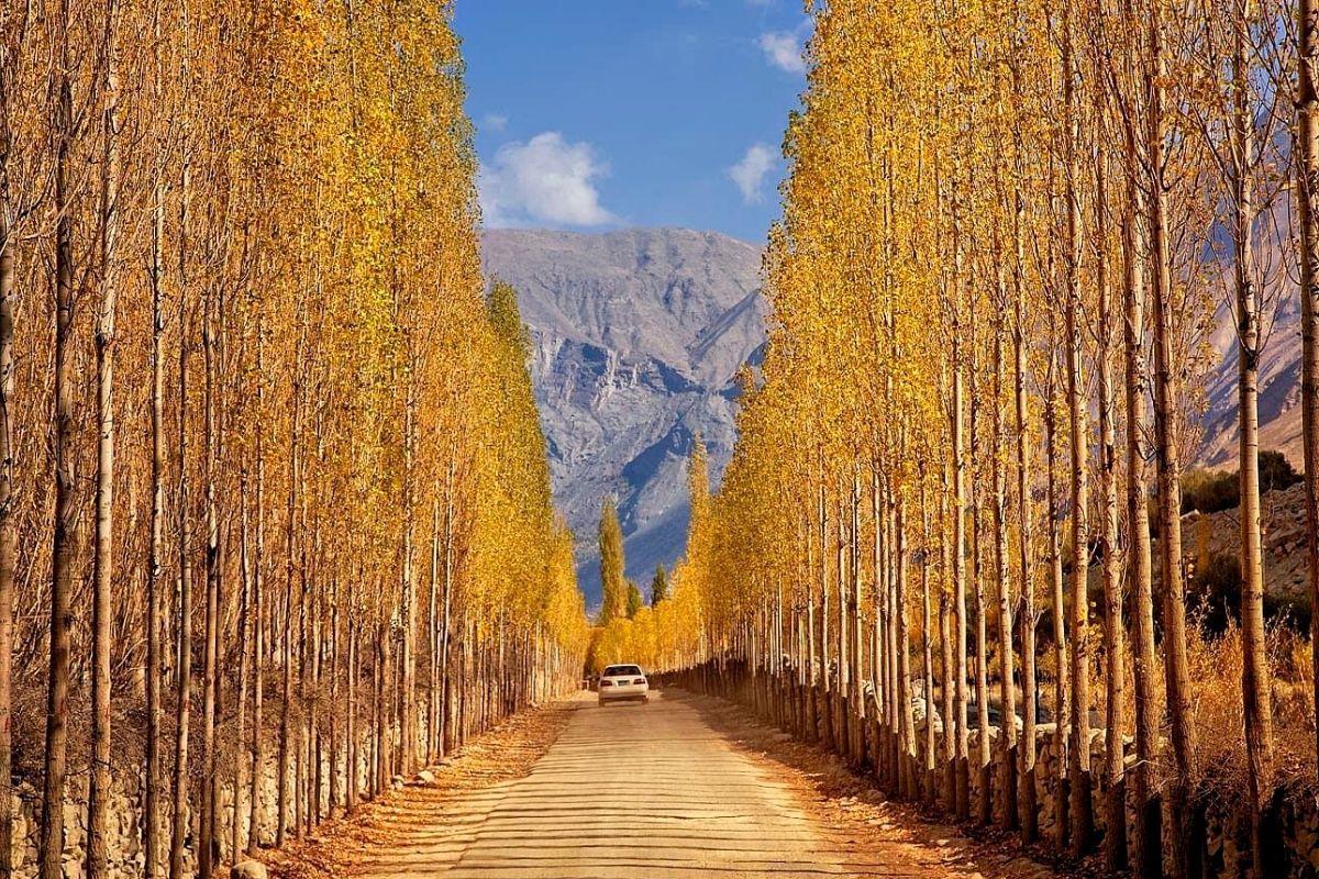
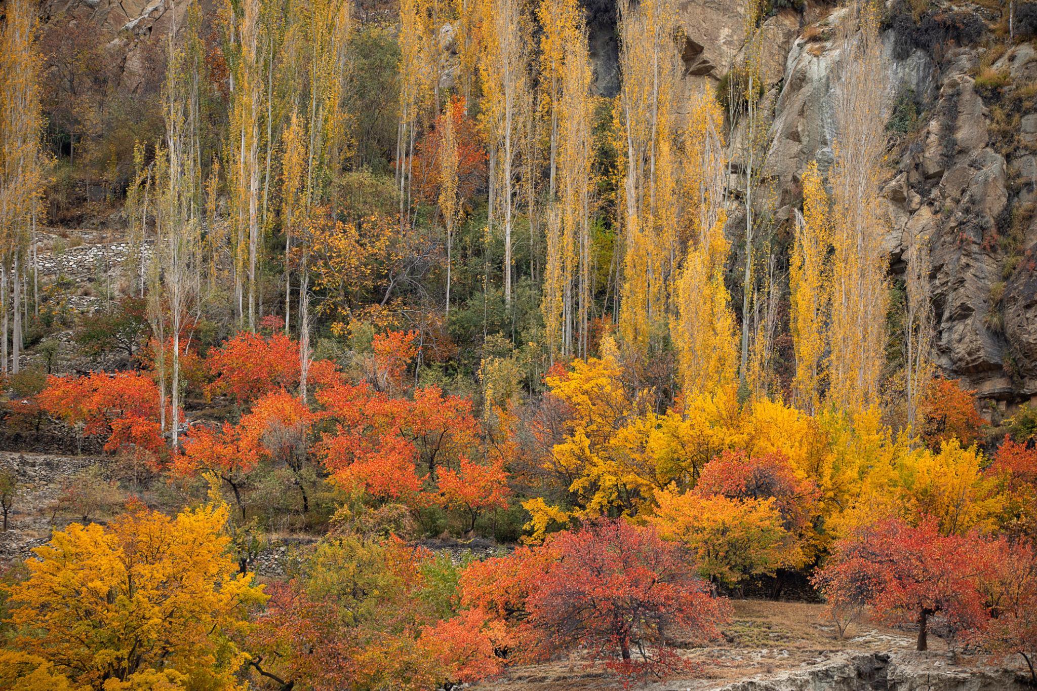
Autumn is considered one of the best seasons for road trips and photography.
Highlights include:
- Golden poplar trees
- Clear mountain visibility
- Stable weather conditions
- Fewer tourists compared to summer
Winter (November to February)
Winter travel becomes difficult because:
- Khunjerab Pass closes seasonally
- Heavy snowfall affects upper sections
- Temperatures drop significantly
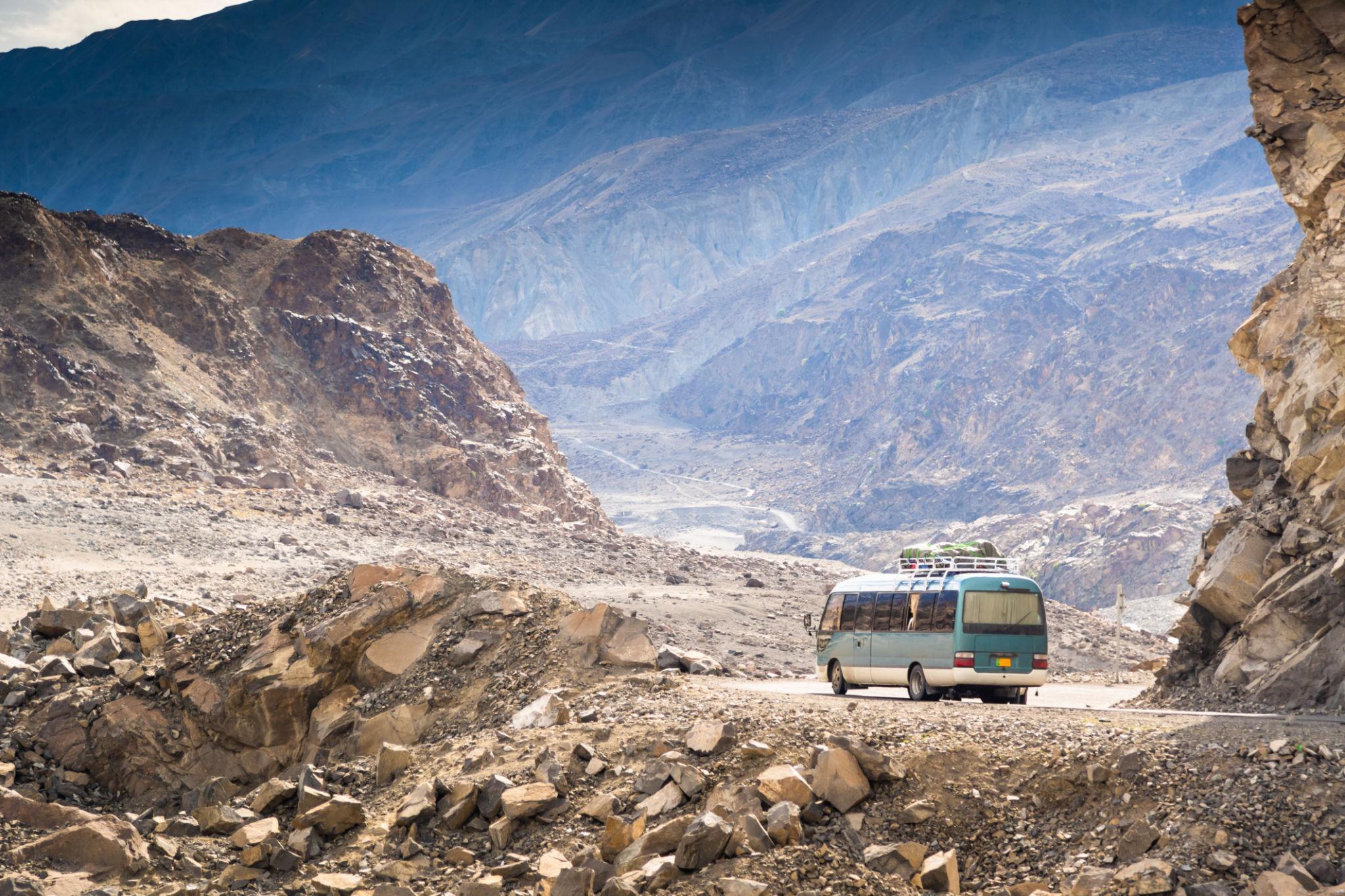
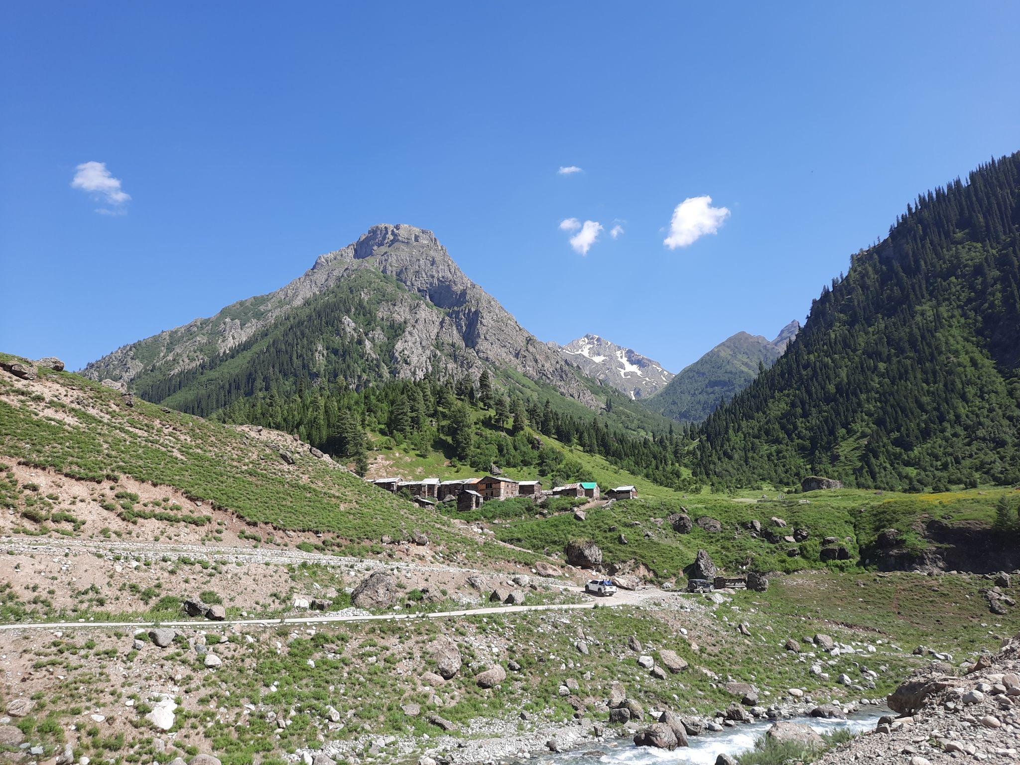
Stage 1: Islamabad to Chilas
The first stage is the longest driving section of the journey and takes travelers from Islamabad into the mountain regions of northern Pakistan.
The route follows:
- Abbottabad
- Mansehra
- Besham
- Indus Kohistan
- Chilas
Road conditions vary significantly throughout this section.
Abbottabad & Mansehra
Abbottabad and Mansehra are the final major urban centers before entering the mountain gorge sections.
Travelers should:
- Refuel vehicles
- Withdraw cash
- Check vehicle condition
- Carry supplies
Besham & the Indus Kohistan Gorges
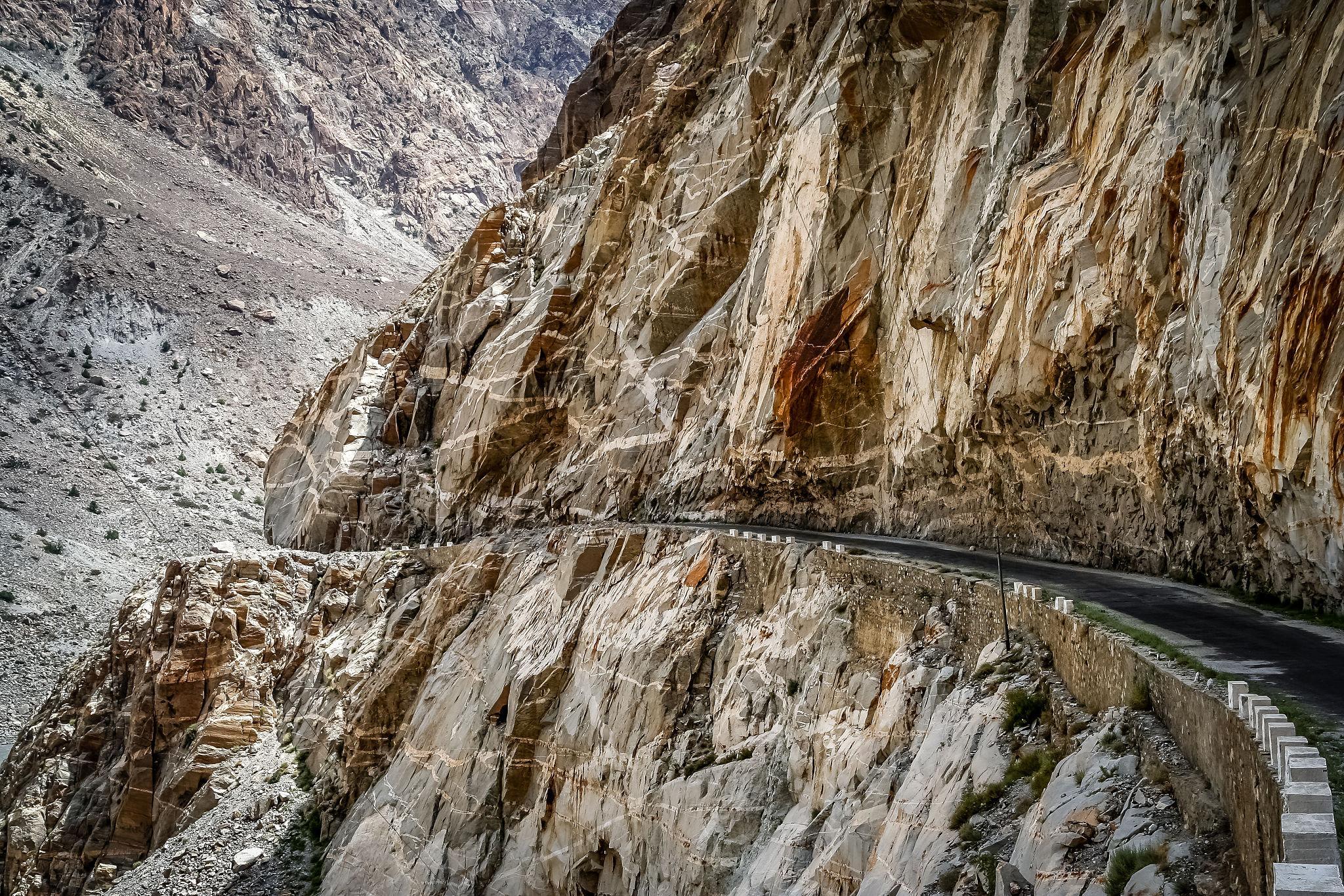
North of Besham, the road enters the Indus Kohistan region where the Karakoram Highway becomes narrow and exposed.
This section is known for:
- Cliffside driving
- Rockfall zones
- Sharp turns
- Limited guardrails
- Heavy truck traffic
Avoid driving this section after dark.
Chilas
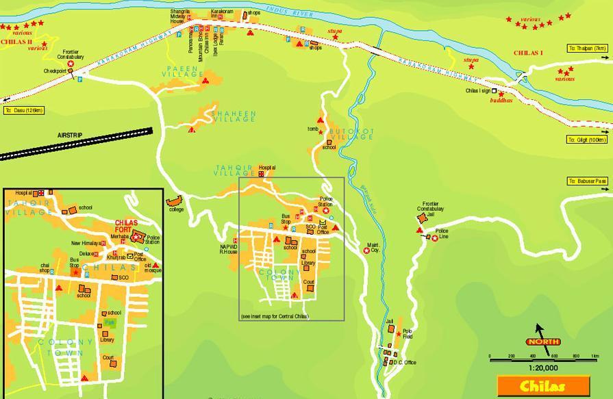
Chilas serves as the primary overnight stop between Islamabad and Gilgit.
The town offers:
- Hotels and guesthouses
- Fuel stations
- Basic supplies
- Restaurants
Chilas Petroglyphs
The region contains thousands of ancient rock carvings dating back thousands of years.
The carvings include:
- Buddhist symbols
- Animal depictions
- Caravan inscriptions
- Ancient travelers’ markings
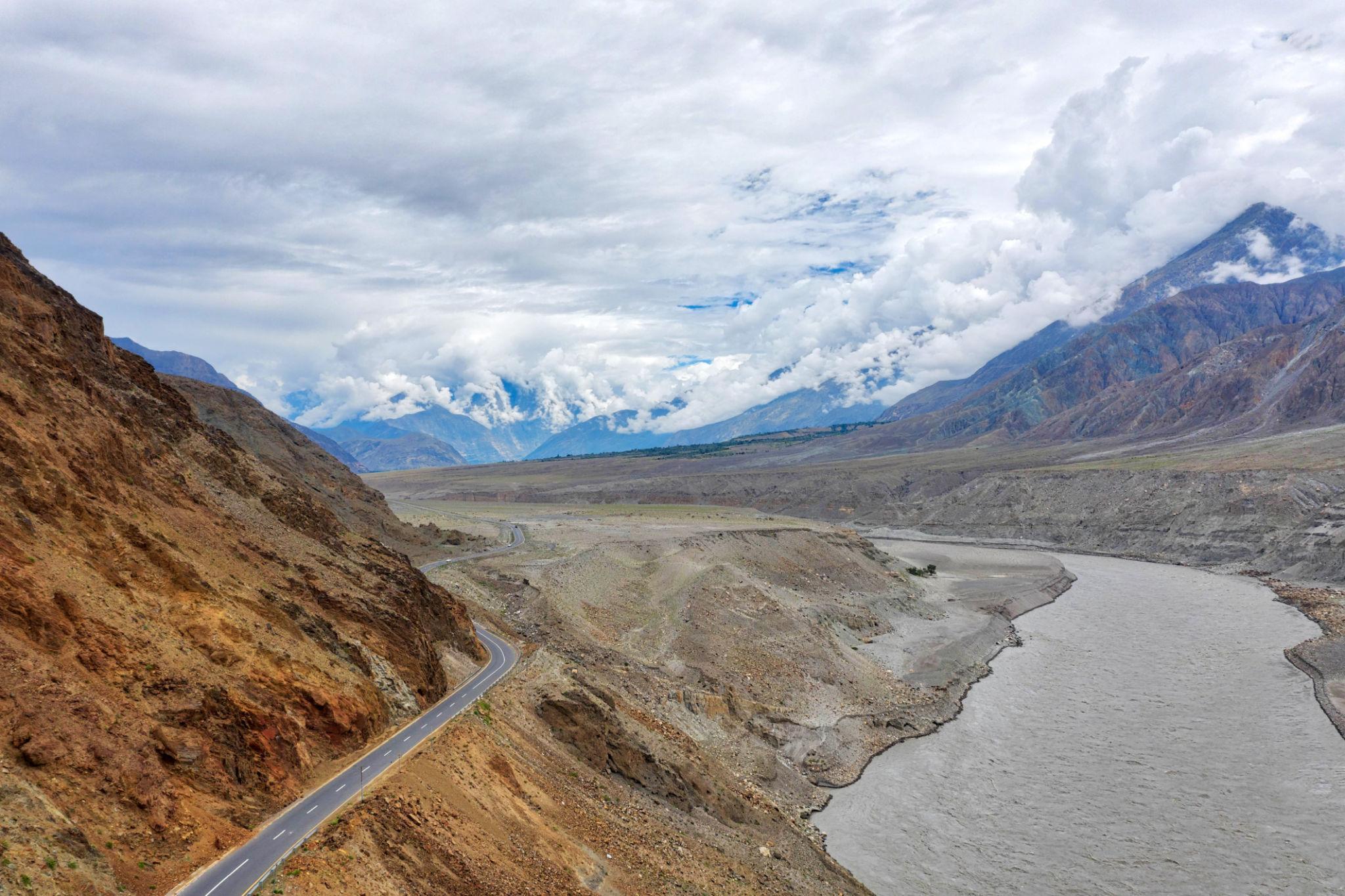
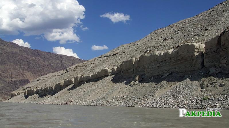
Stage 2: Chilas to Gilgit
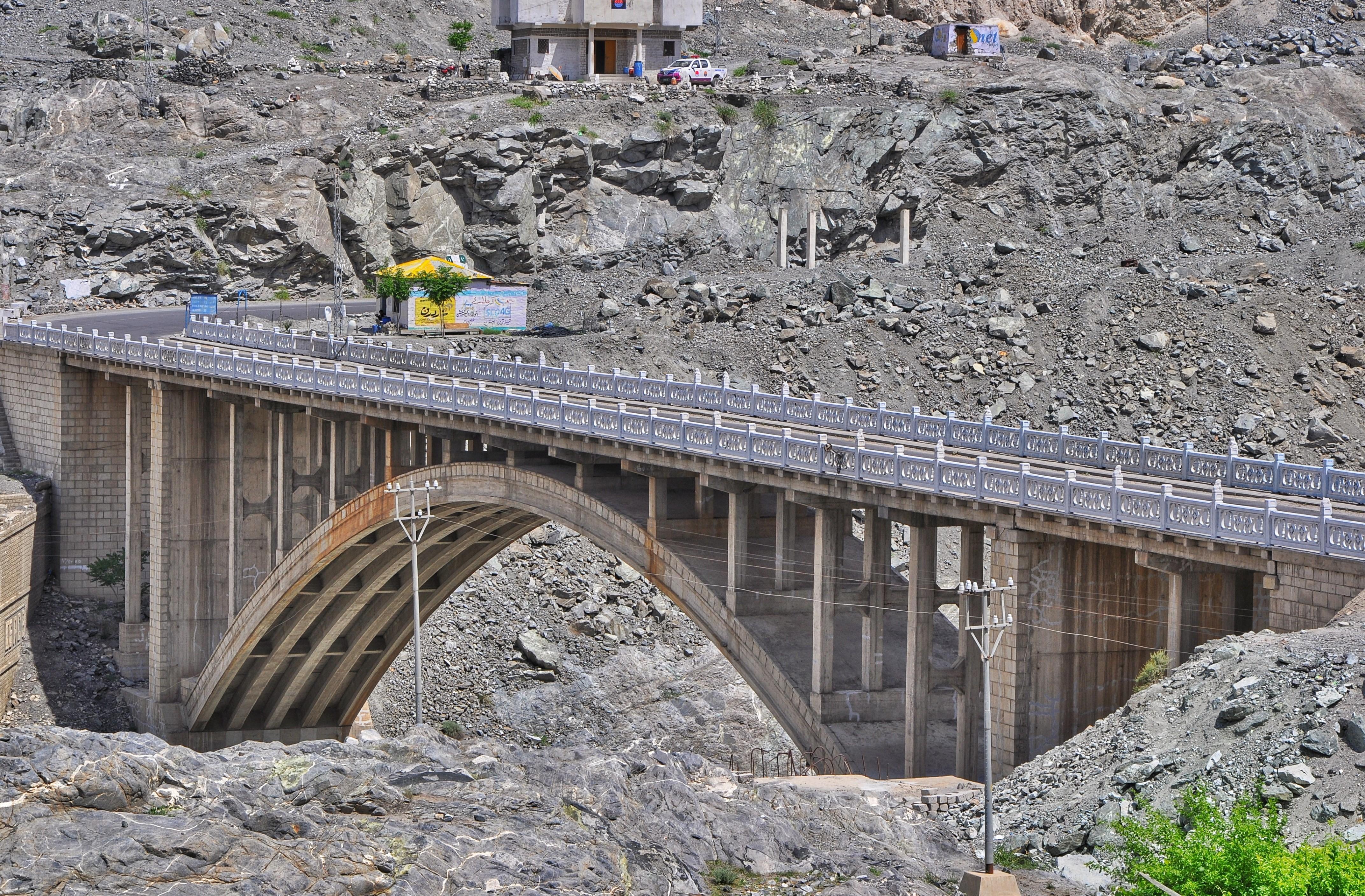
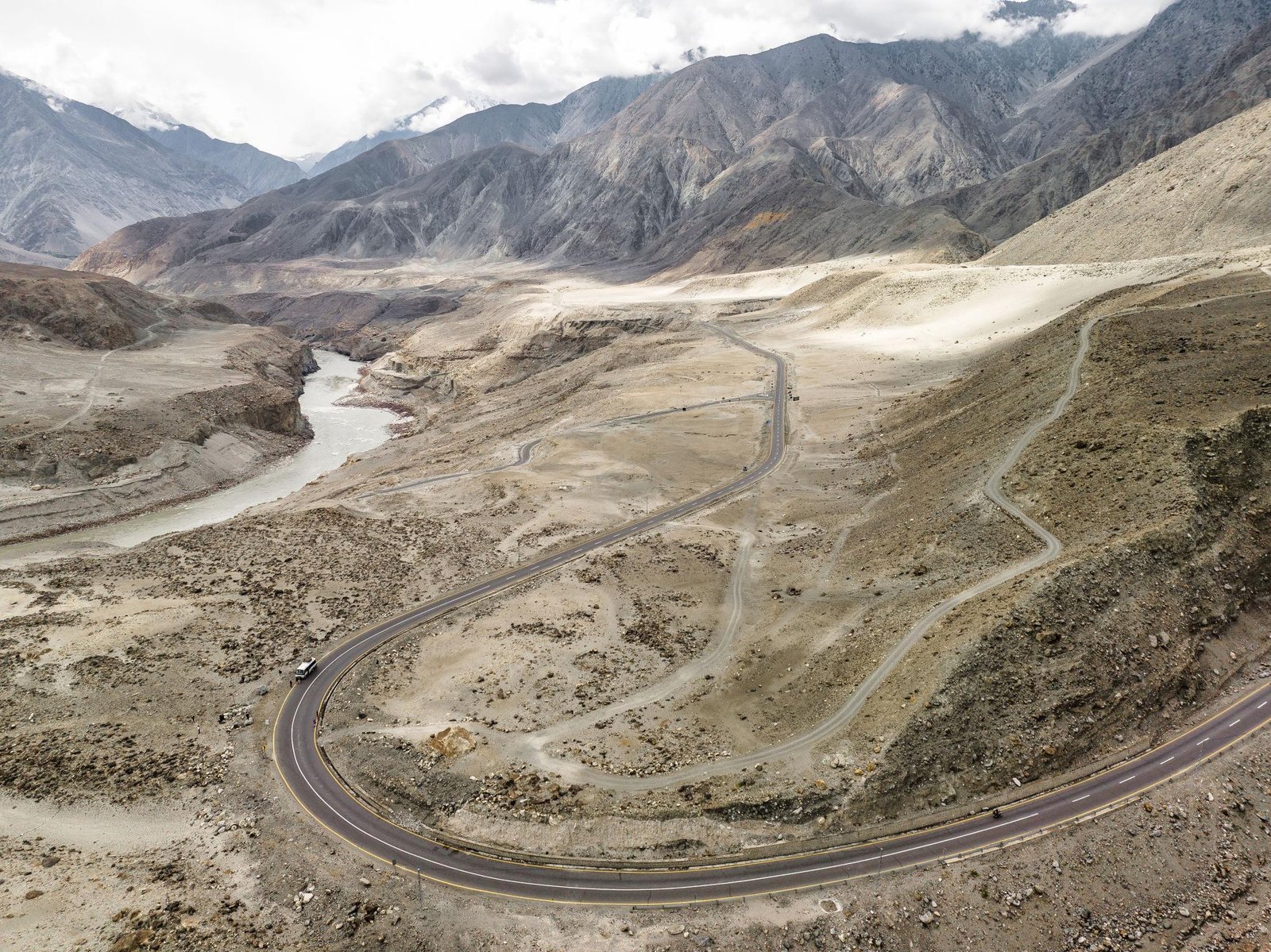
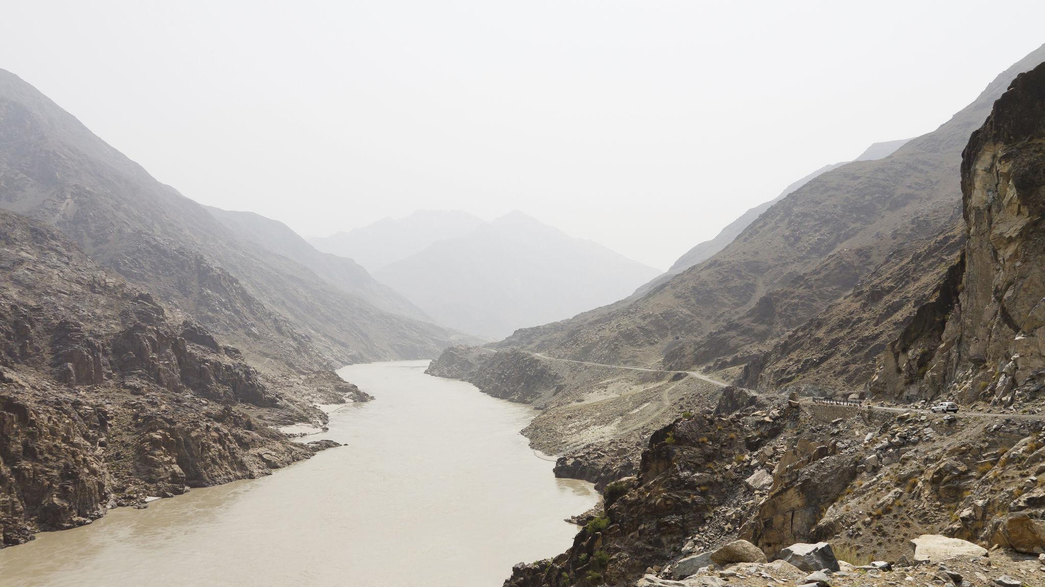
This section of the Karakoram Highway follows the Indus River northward toward Gilgit.
Road conditions improve noticeably compared to the Kohistan gorge section.
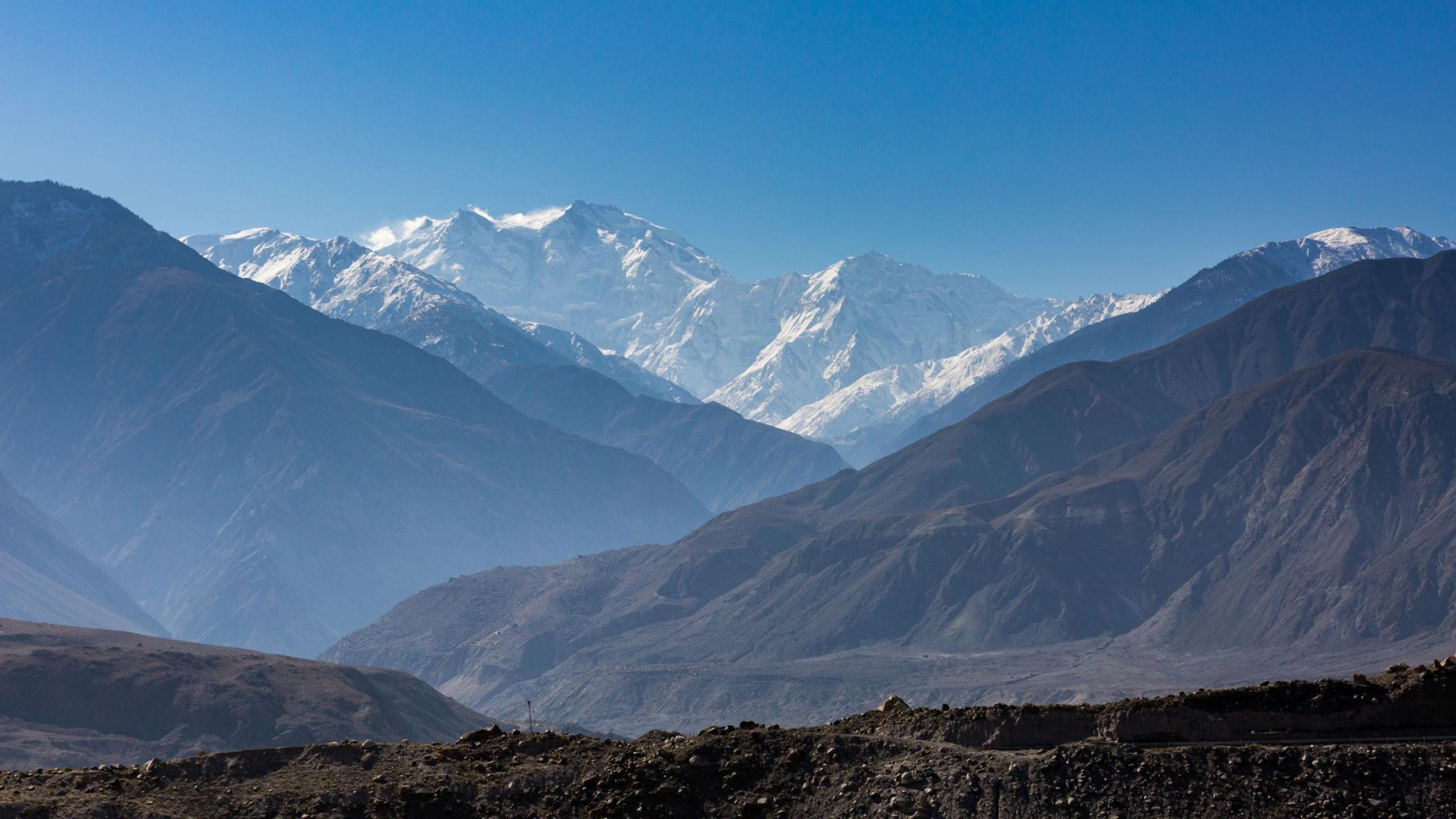
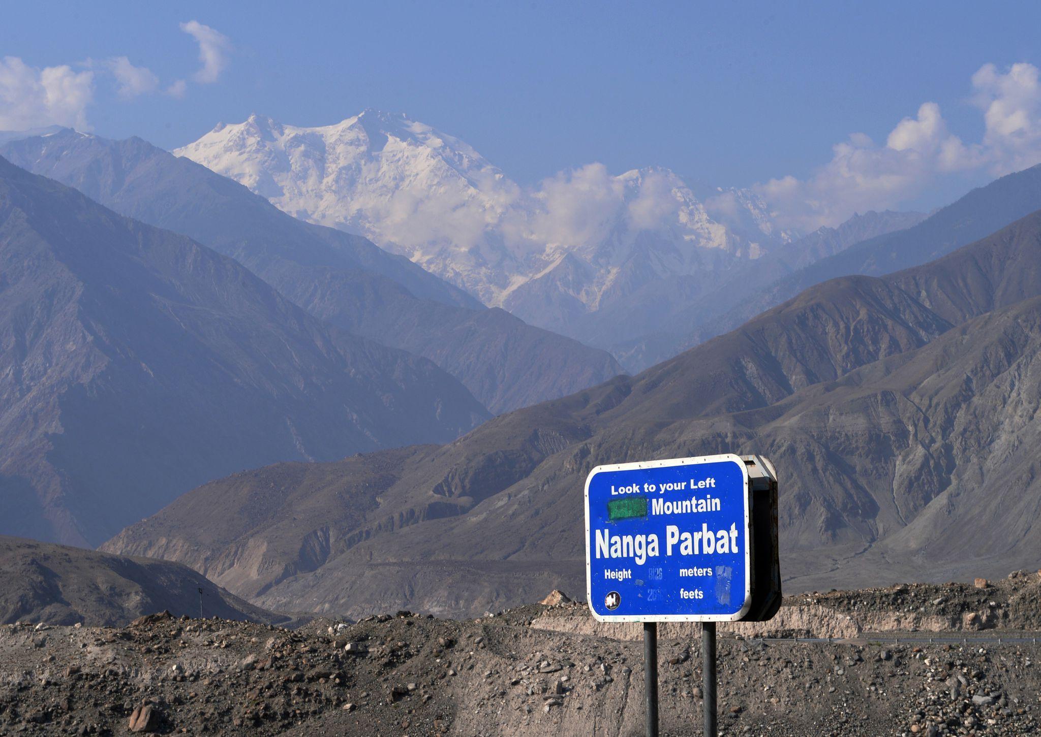
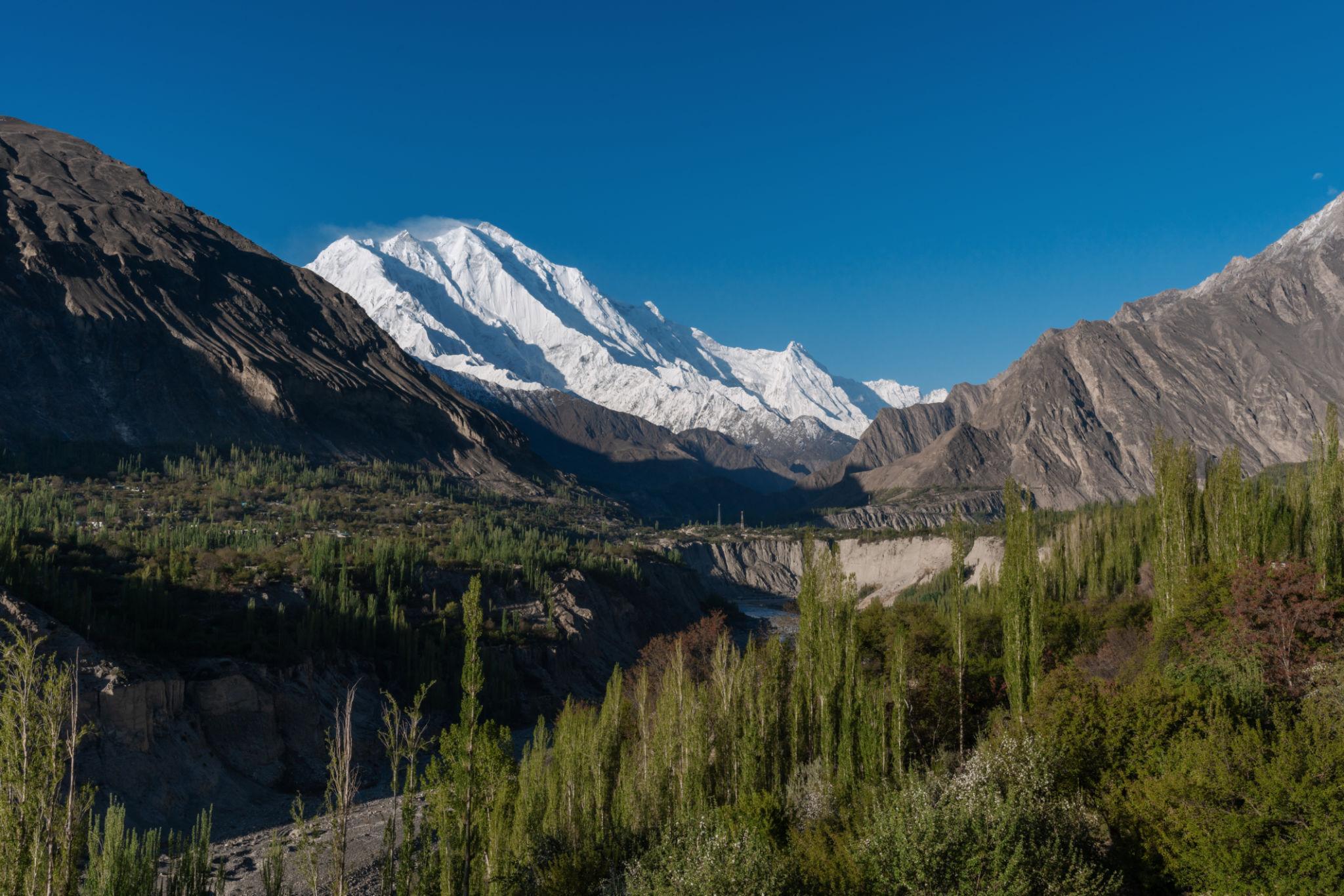
Nanga Parbat Viewpoints
The route passes near the western face of Nanga Parbat, the ninth-highest mountain in the world.
Popular viewpoints are located near:
- Raikot Bridge
- Several roadside pullouts
Clear morning weather usually offers the best visibility.
Gilgit City
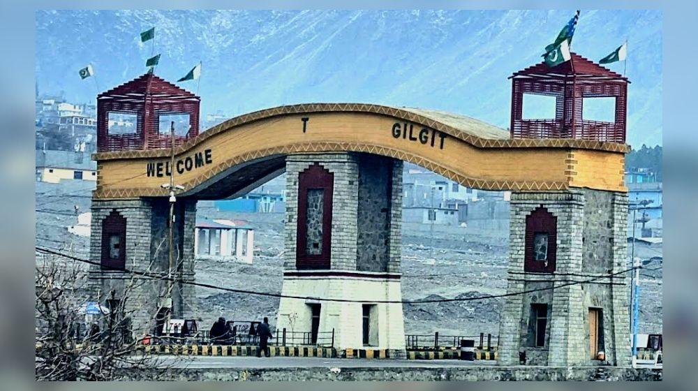

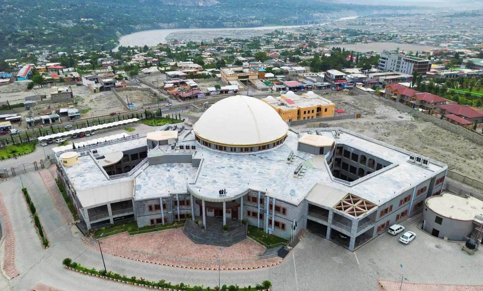
Gilgit is the administrative center of Gilgit-Baltistan and serves as the main transport and supply hub for the region.
The city offers:
- Hotels
- Restaurants
- Banks and ATMs
- Vehicle services
- Travel agencies
- Local markets
Things to Do in Gilgit
Kargah Buddha
A 7th-century rock carving located outside the city.
Gilgit Bazaar
Known for handicrafts, dried fruits, gemstones, and local products.
Gilgit Museum
Covers Silk Road history and regional cultures.
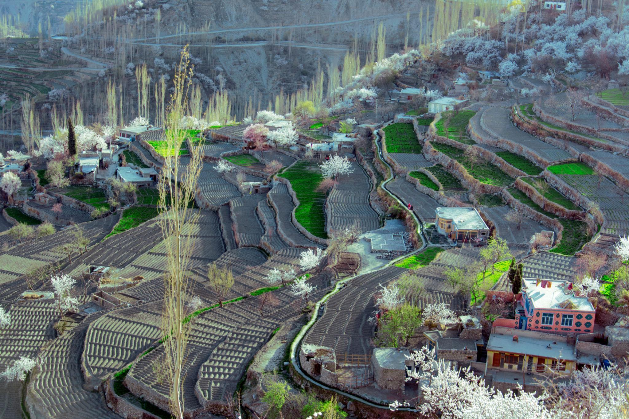
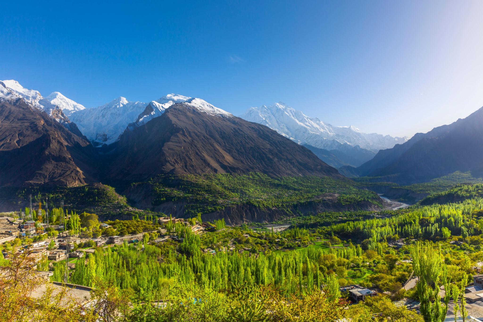
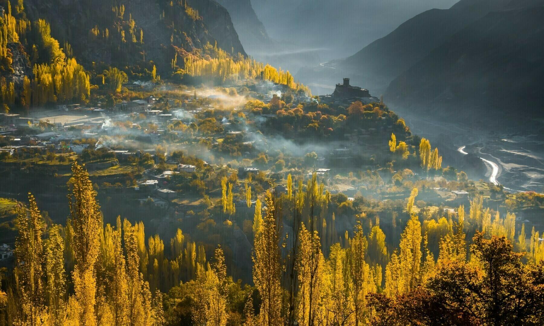
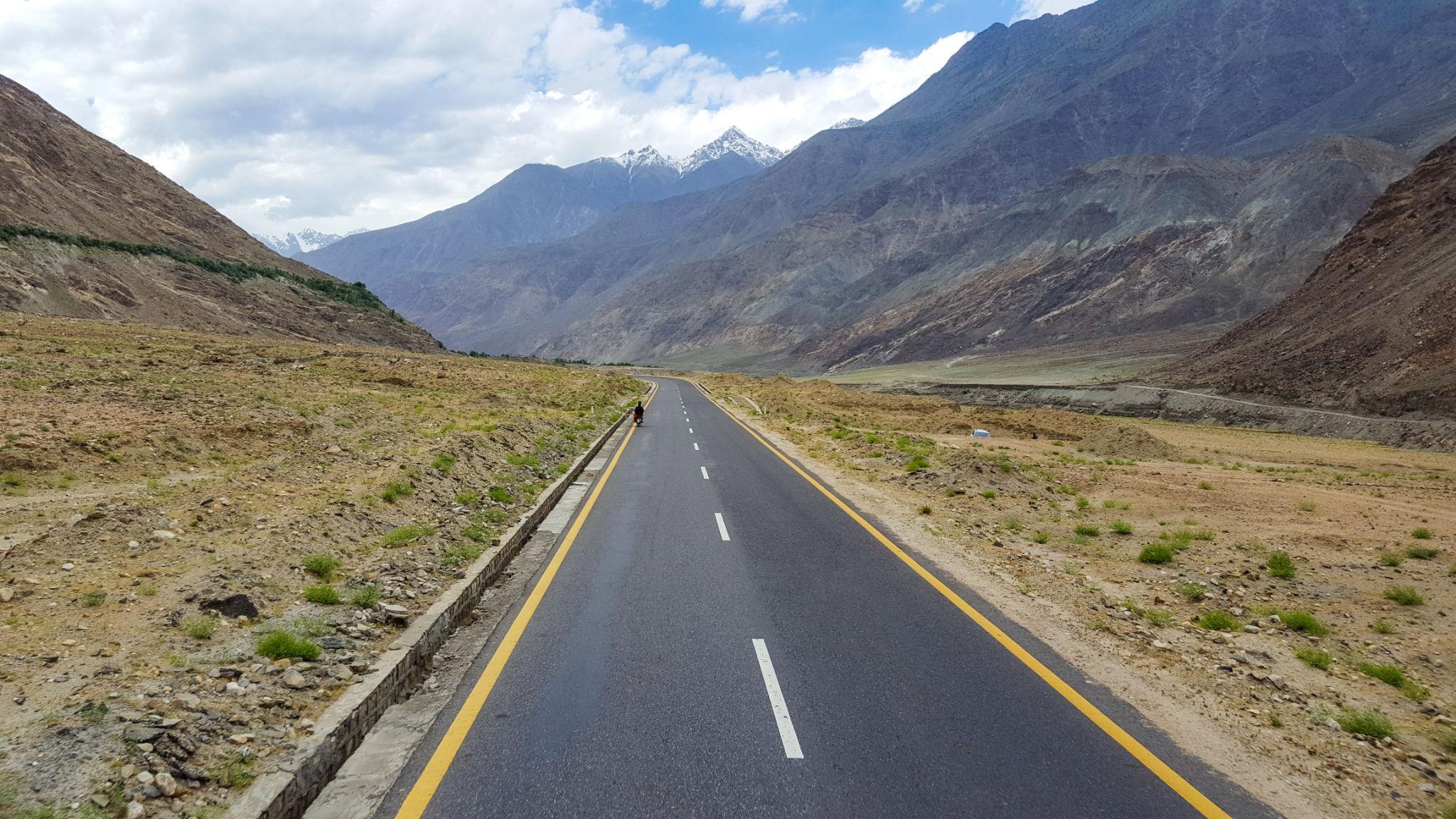
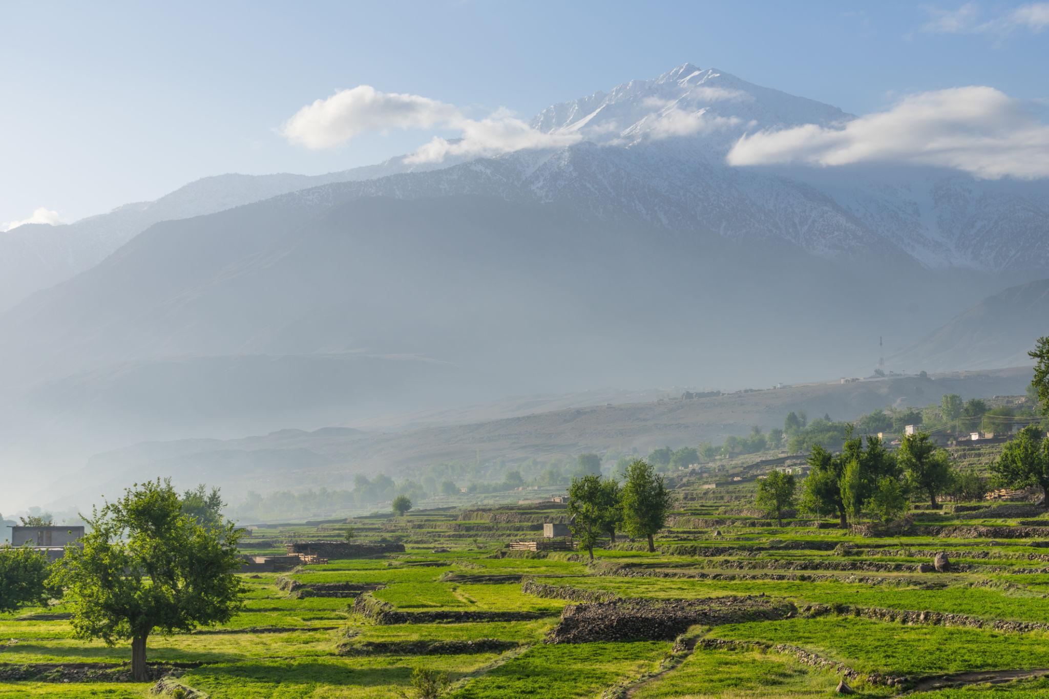
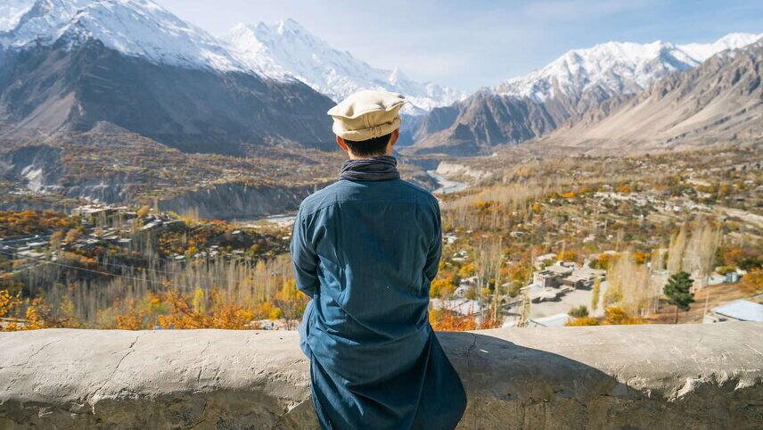
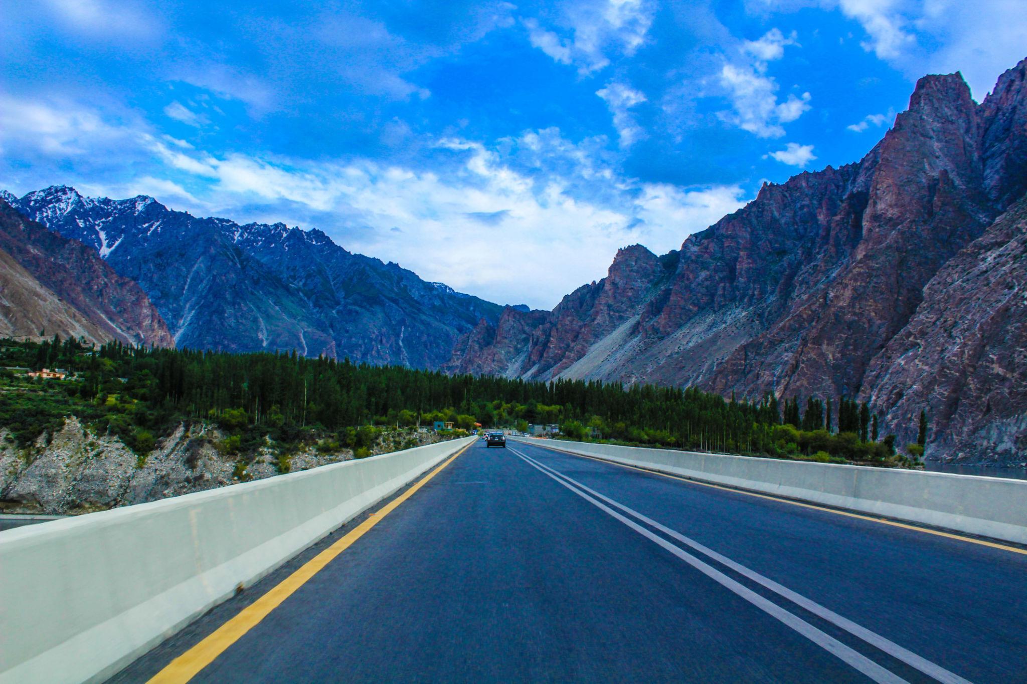
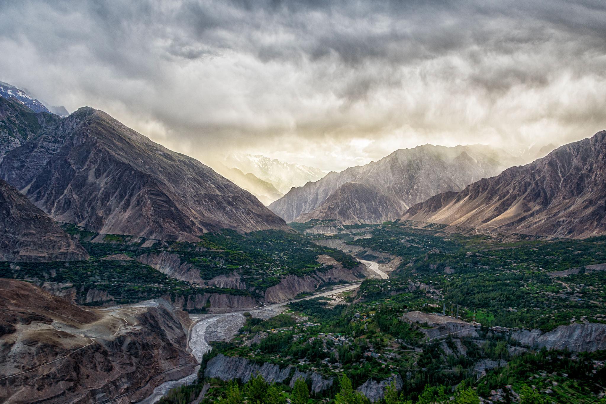
Stage 3: Gilgit to Karimabad, Hunza
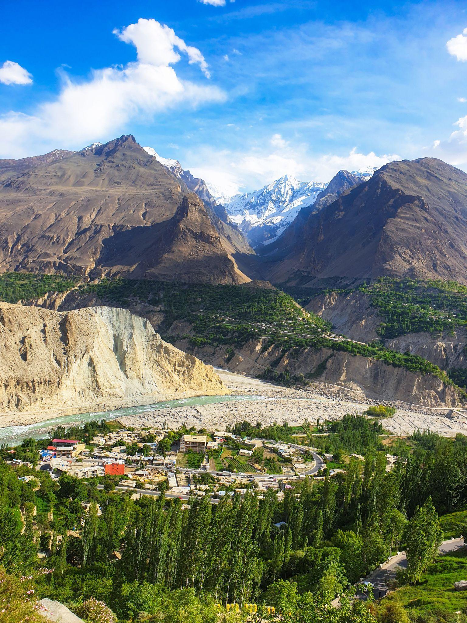
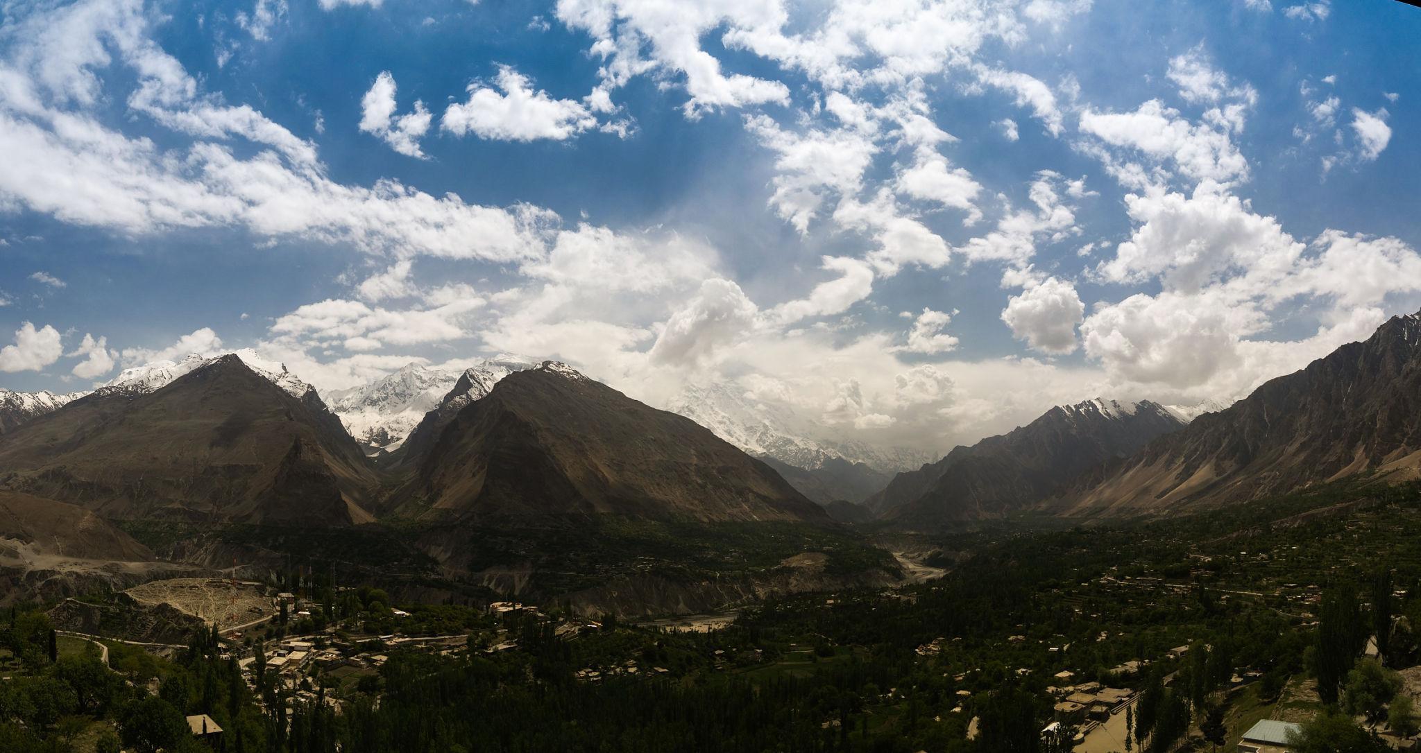
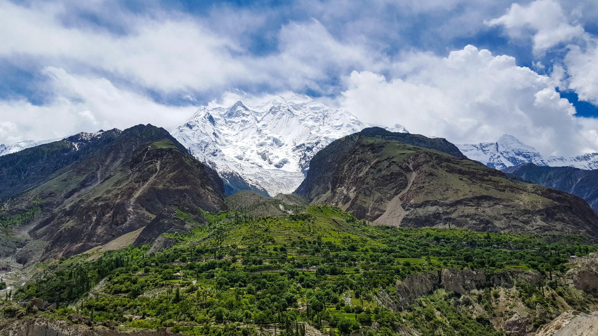
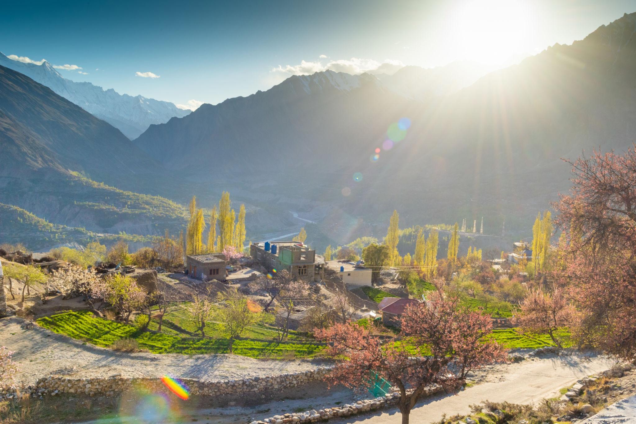
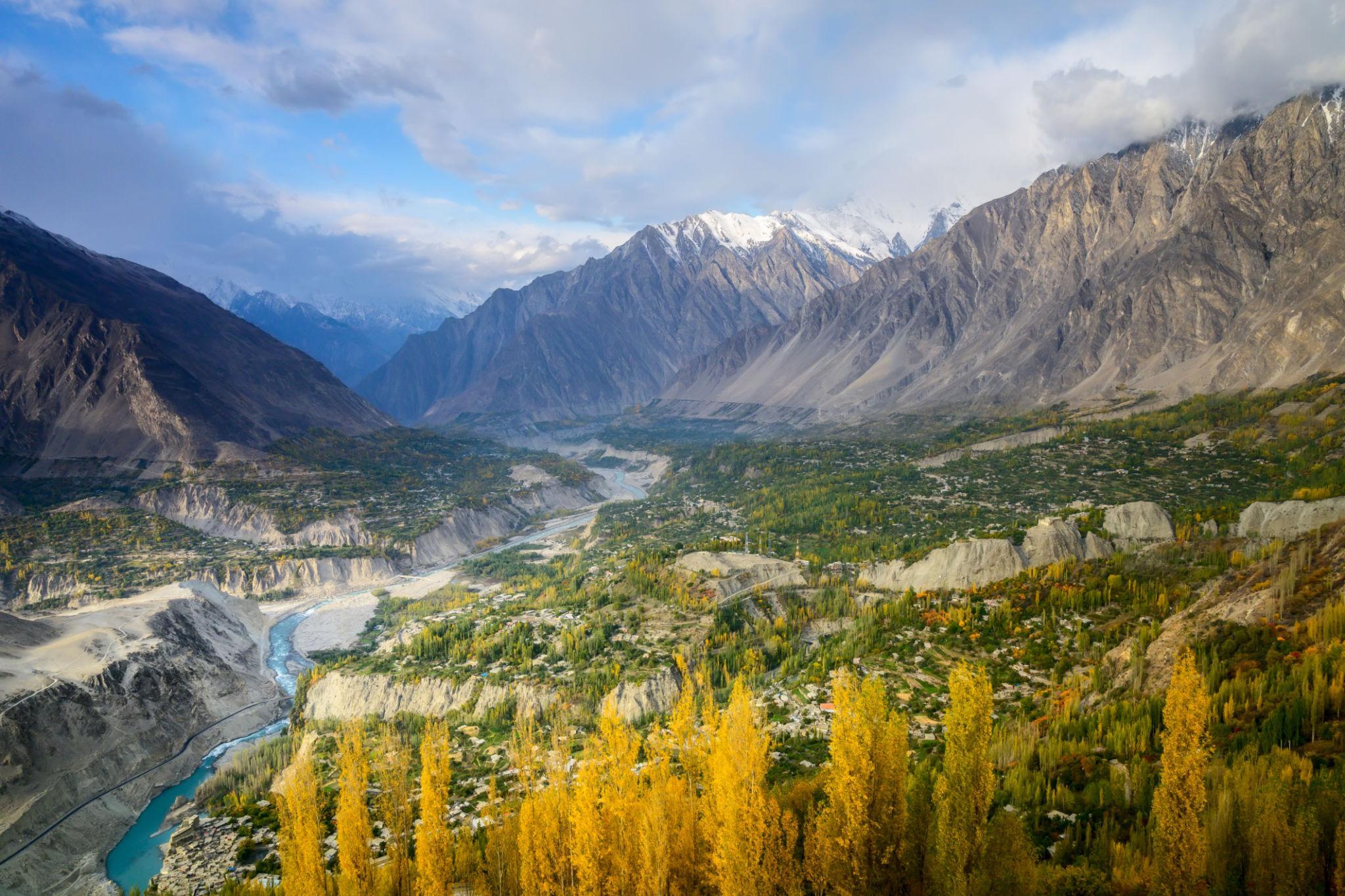
The drive from Gilgit to Hunza is one of the most scenic sections of the Karakoram Highway.
The landscape changes from rocky valleys to:
- Fruit orchards
- Terraced villages
- Snow-covered peaks
- Wide mountain valleys
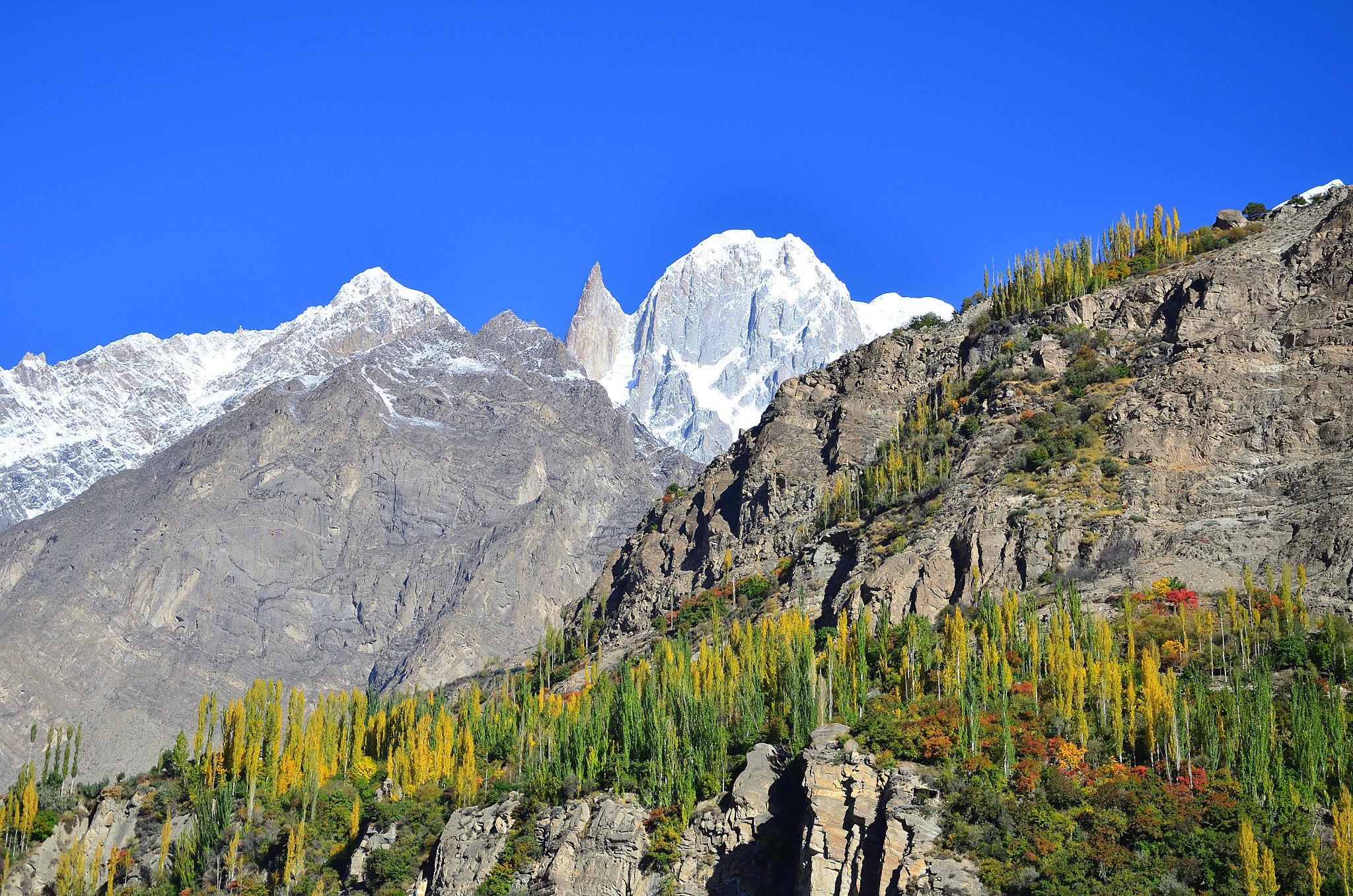
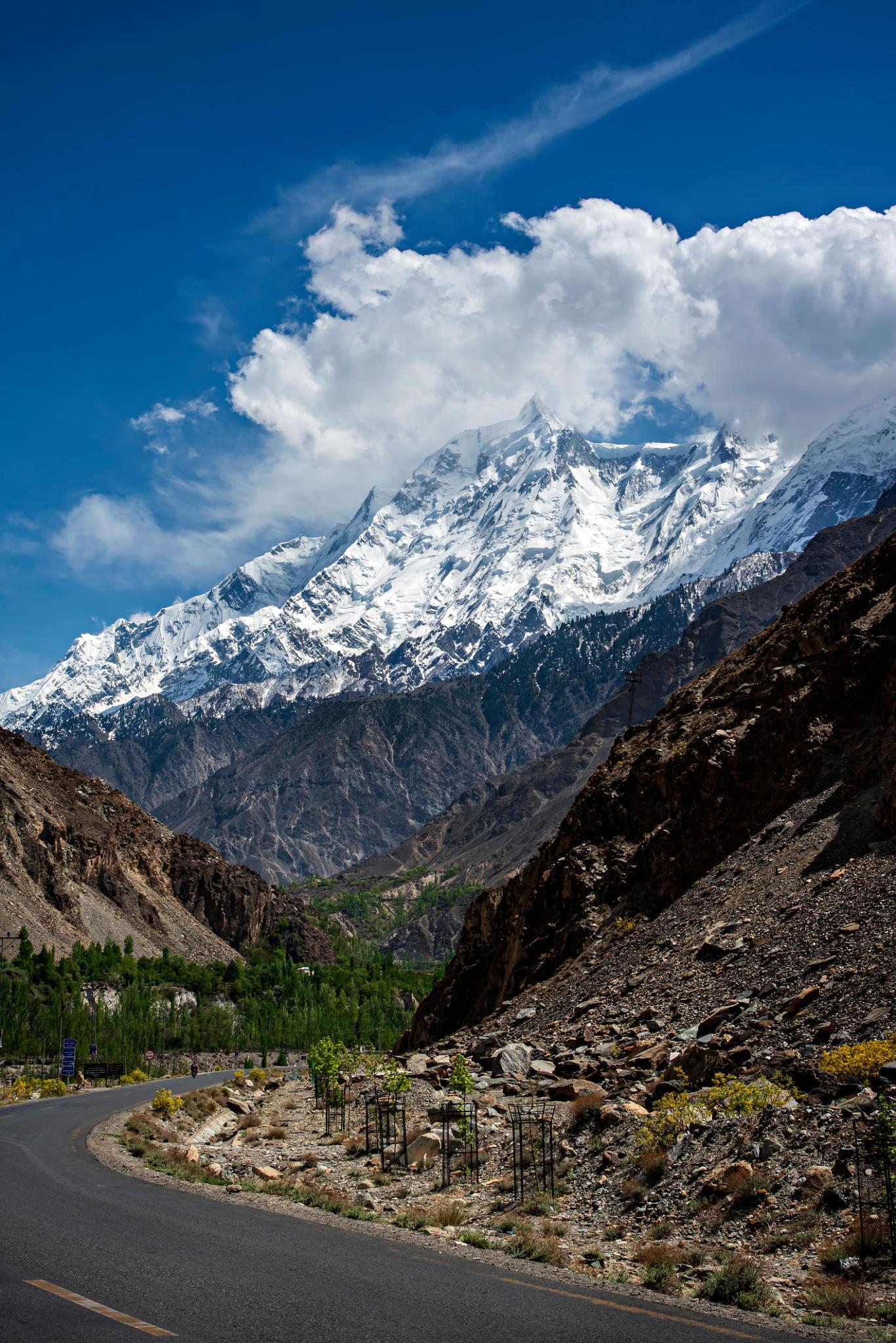
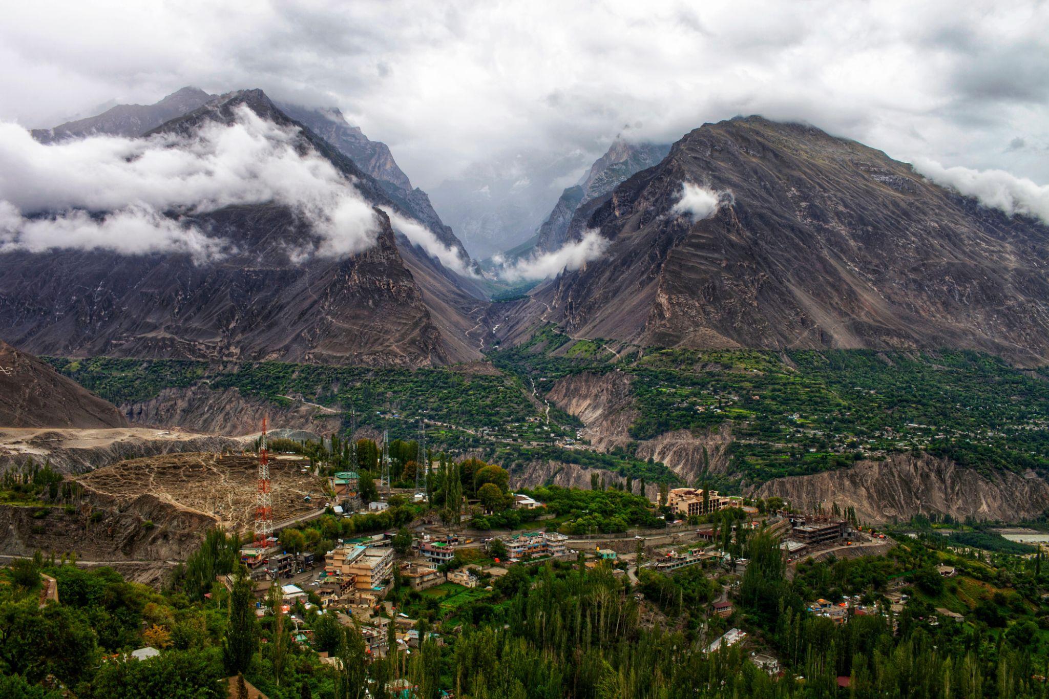
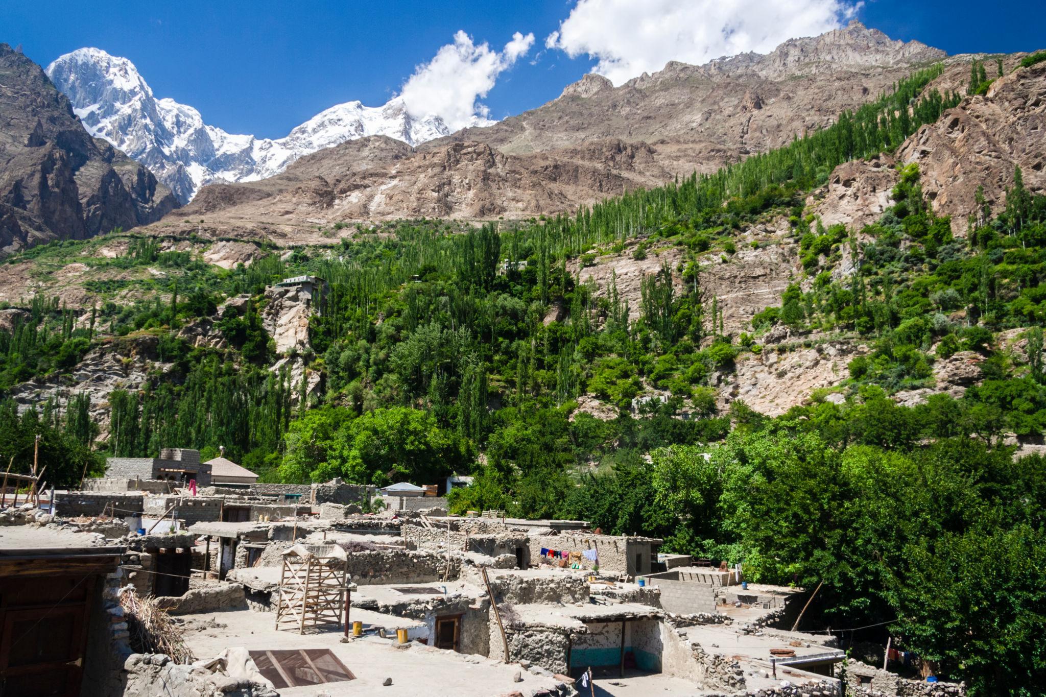
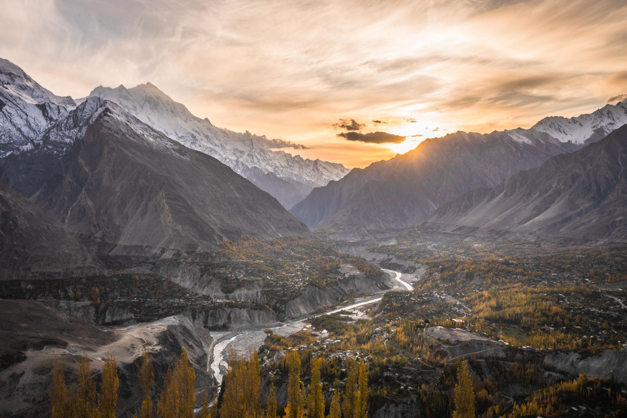
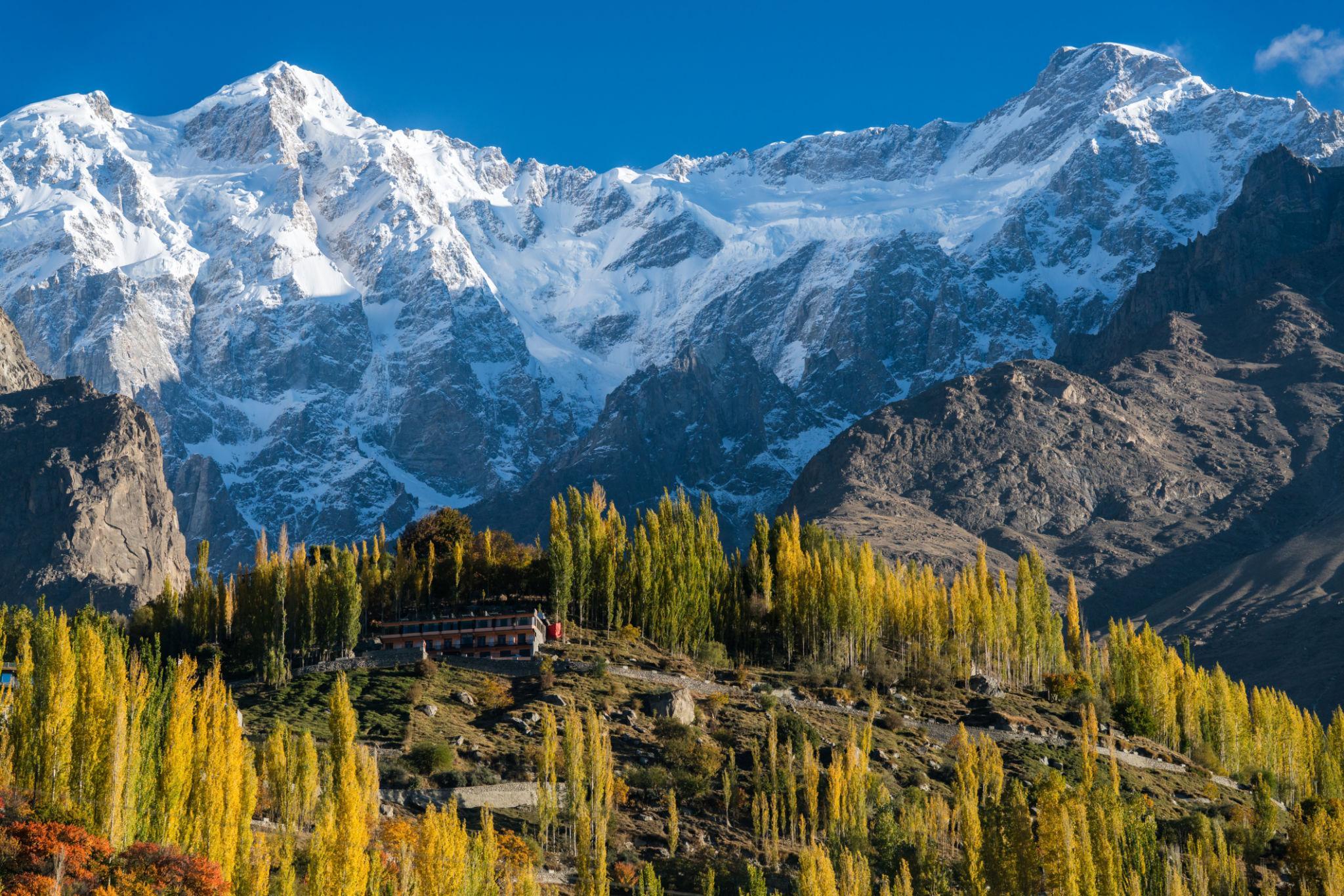
Karimabad
Karimabad is the tourism center of Hunza Valley and offers:
- Hotels and guesthouses
- Cafes and restaurants
- Traditional markets
- Mountain viewpoints
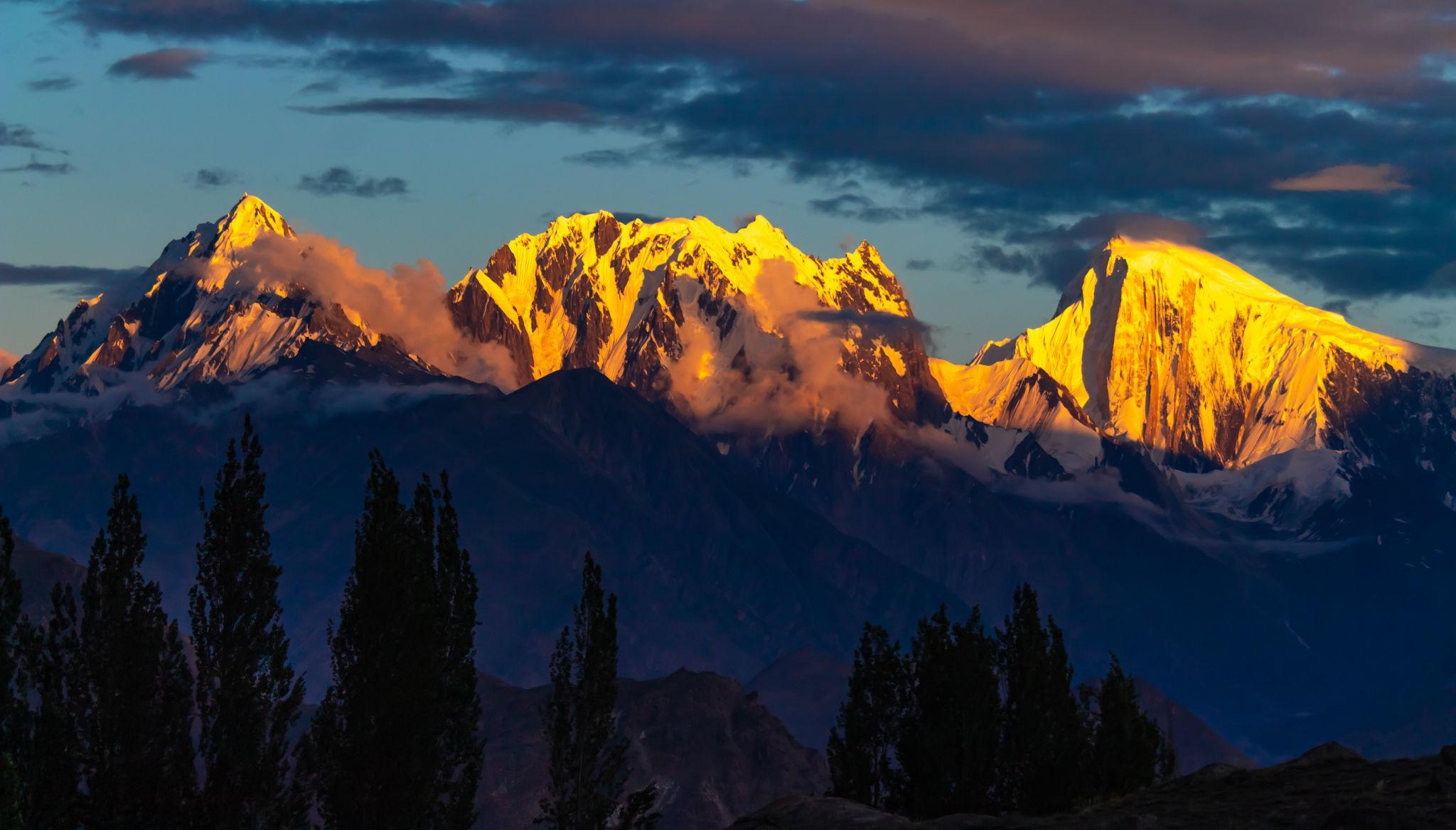
The town overlooks:
- Rakaposhi
- Ultar Sar
- Ladyfinger Peak
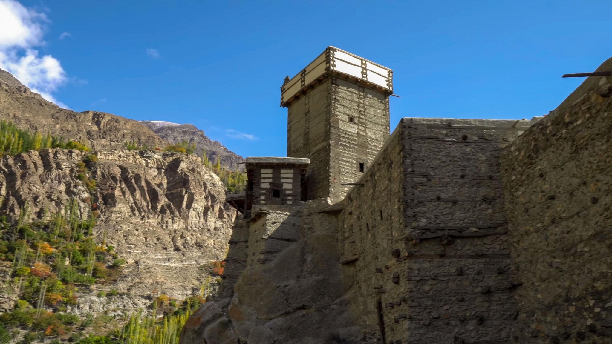
Baltit Fort
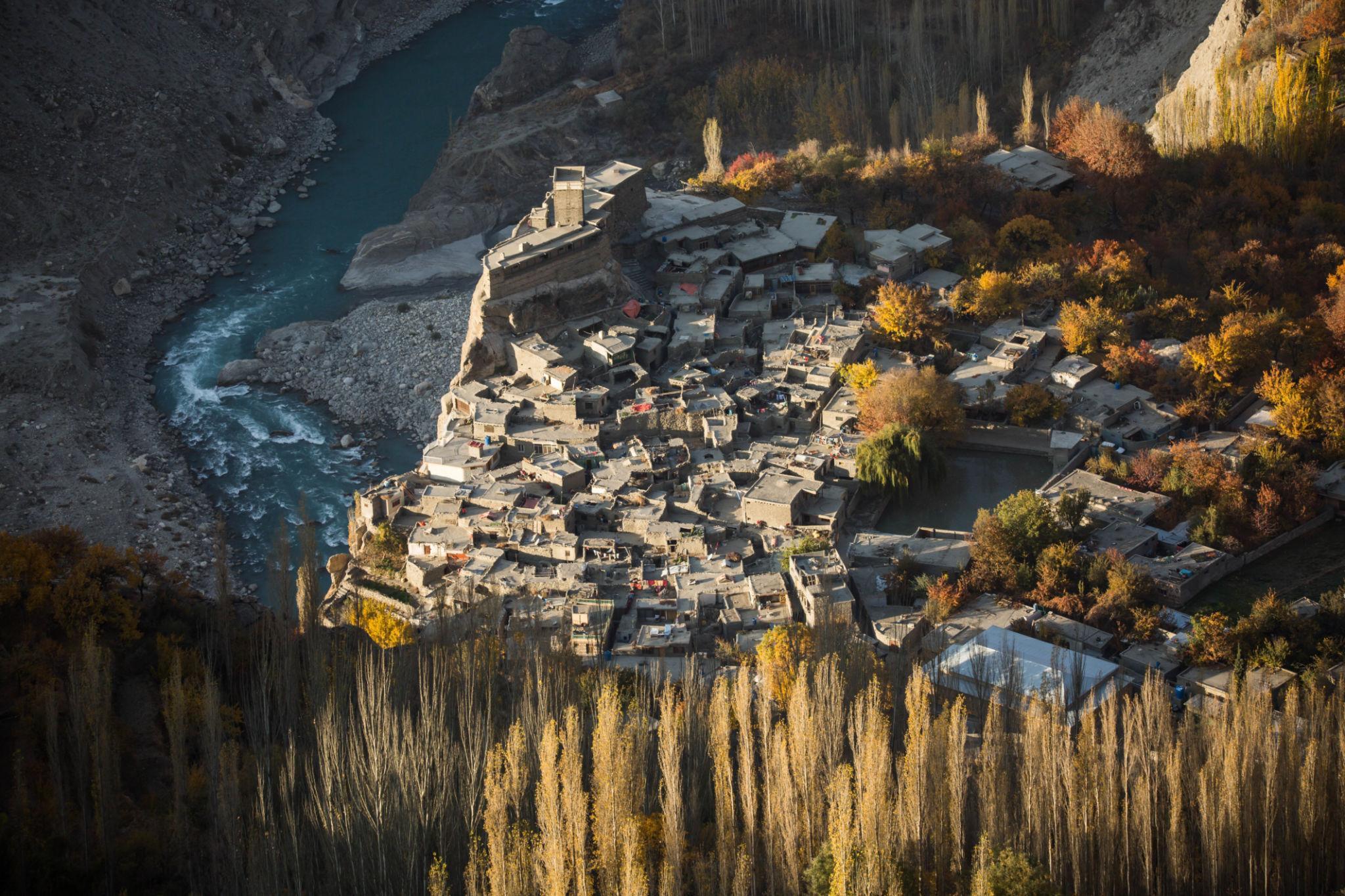
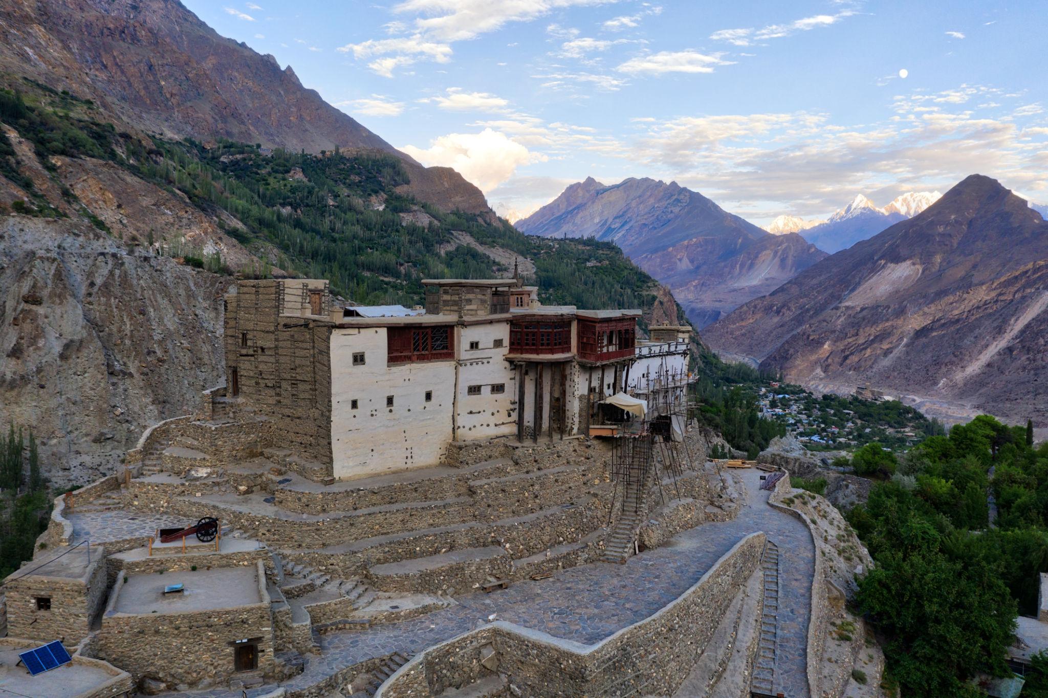
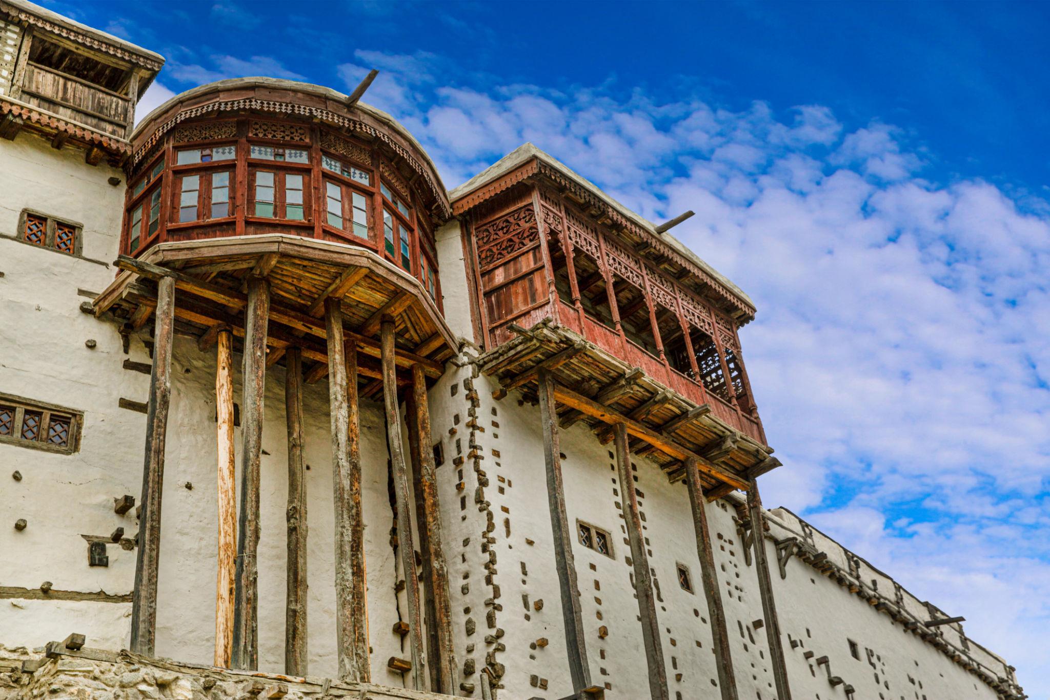
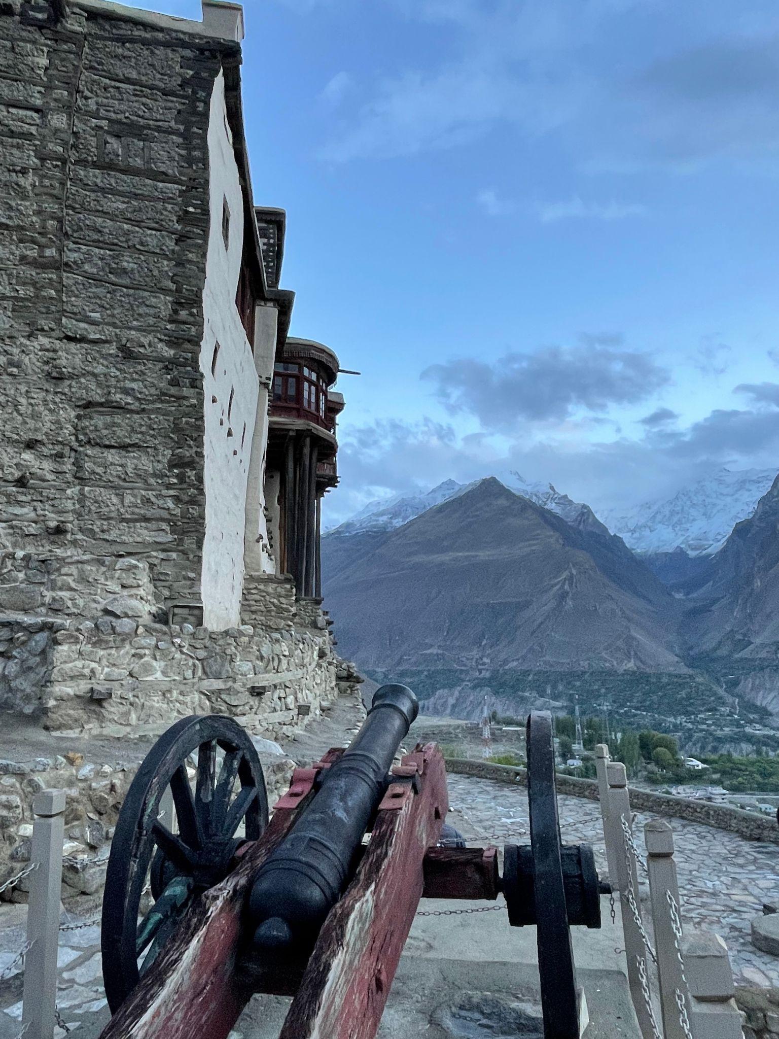
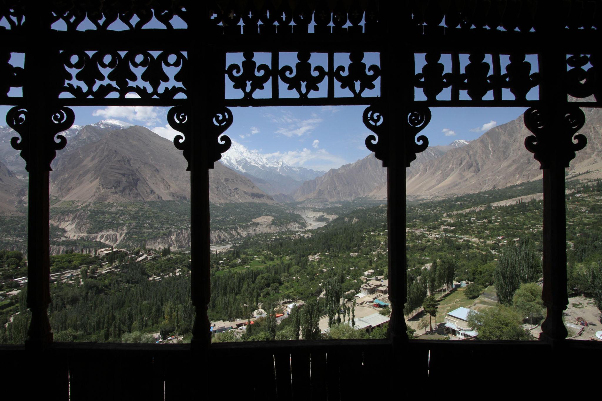
Baltit Fort is one of the most important historical landmarks in Hunza.
Highlights include:
- Traditional architecture
- Historic royal residence
- Panoramic valley views
- Museum exhibitions
Altit Fort
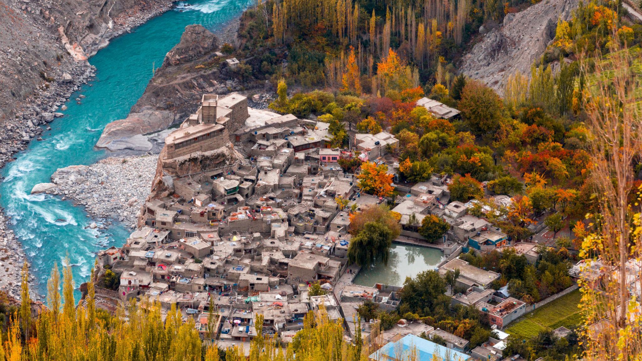
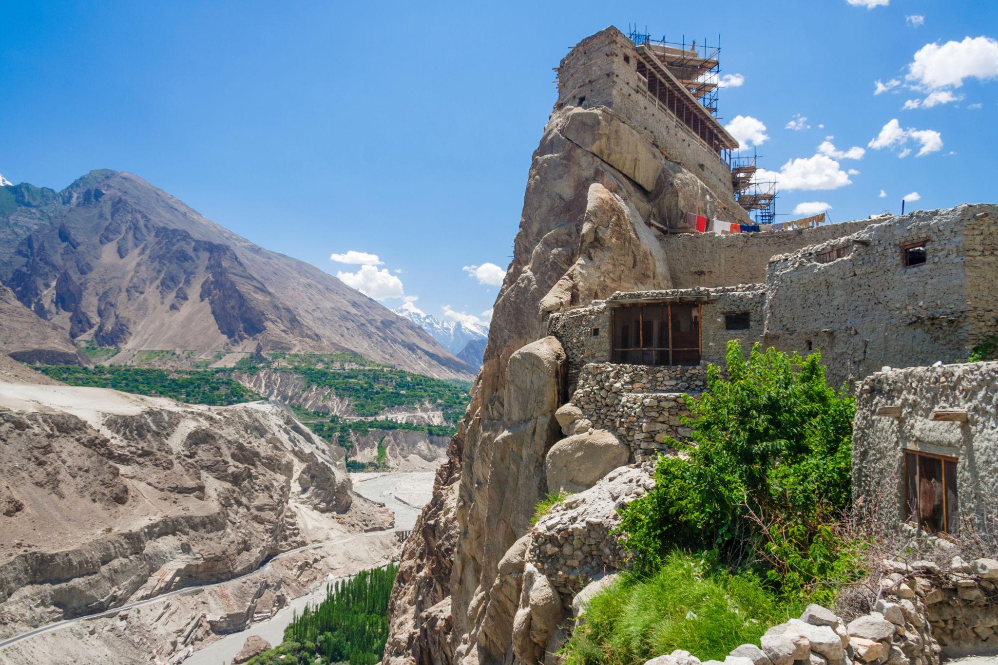
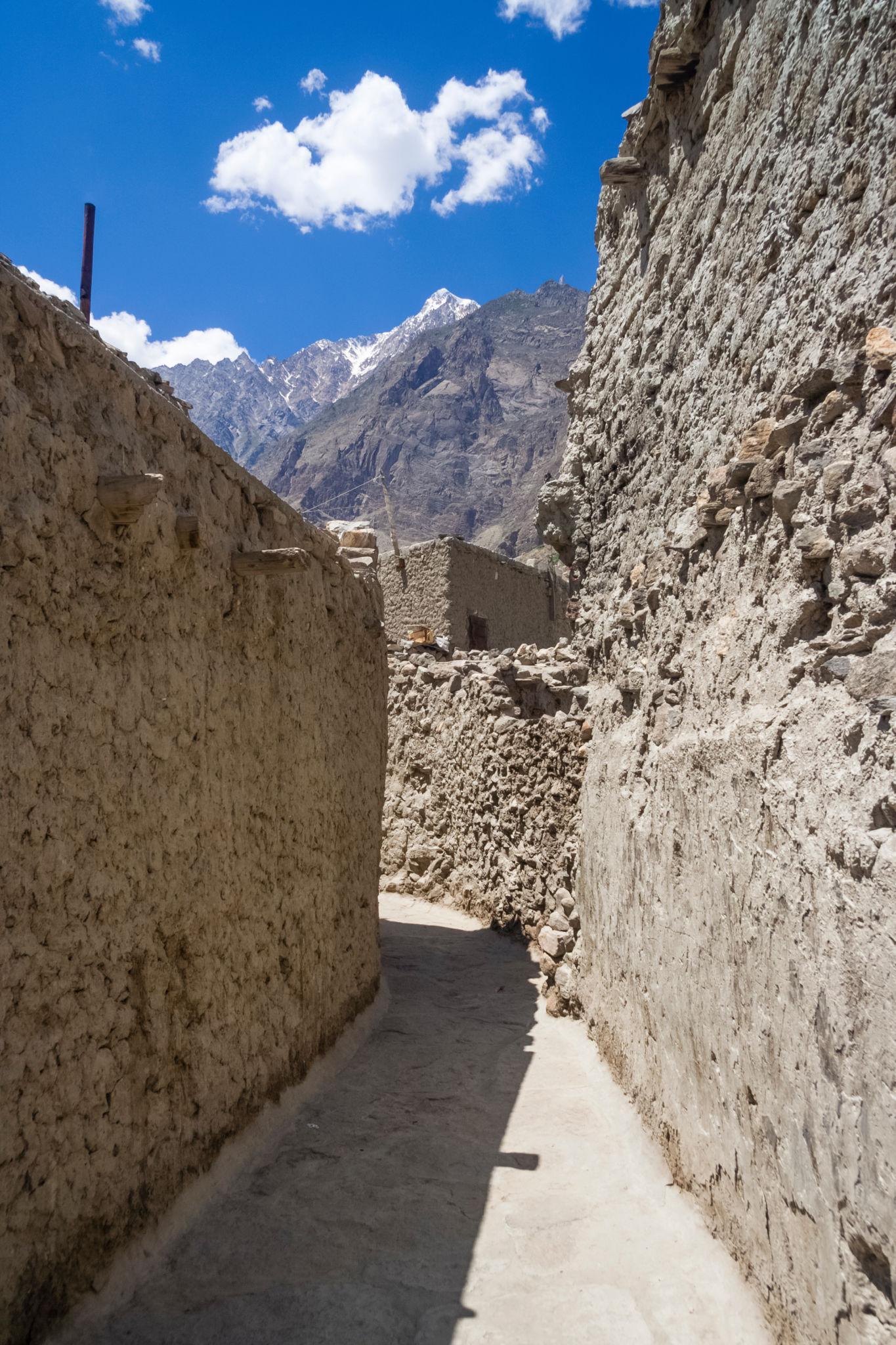
Altit Fort is older than Baltit Fort and sits above Altit village.
The surrounding village preserves traditional Hunza architecture and narrow pedestrian lanes.
Eagle’s Nest Viewpoint
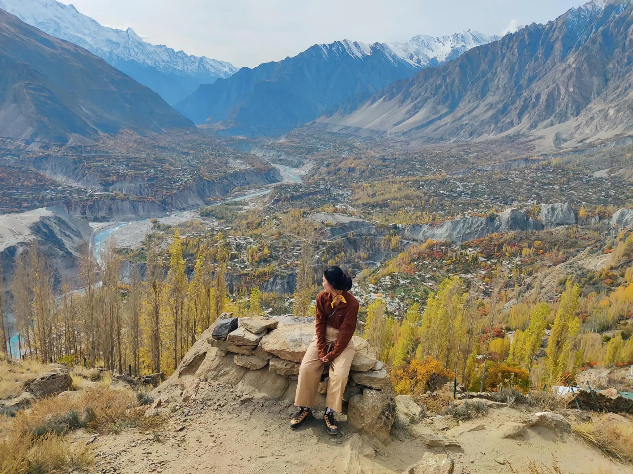
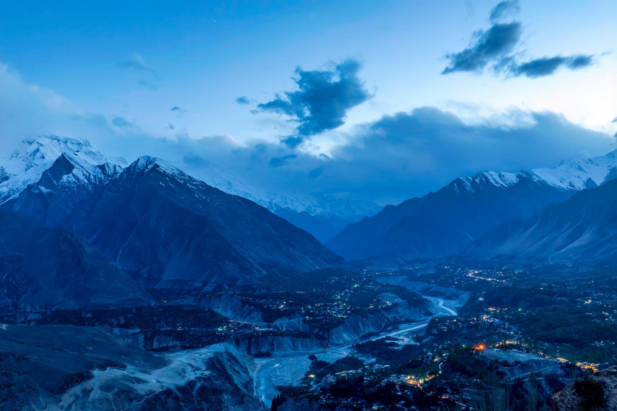
Located above Karimabad, Eagle’s Nest offers some of the best panoramic views in Hunza Valley.
The viewpoint is especially popular at:
- Sunrise
- Sunset
- Autumn season
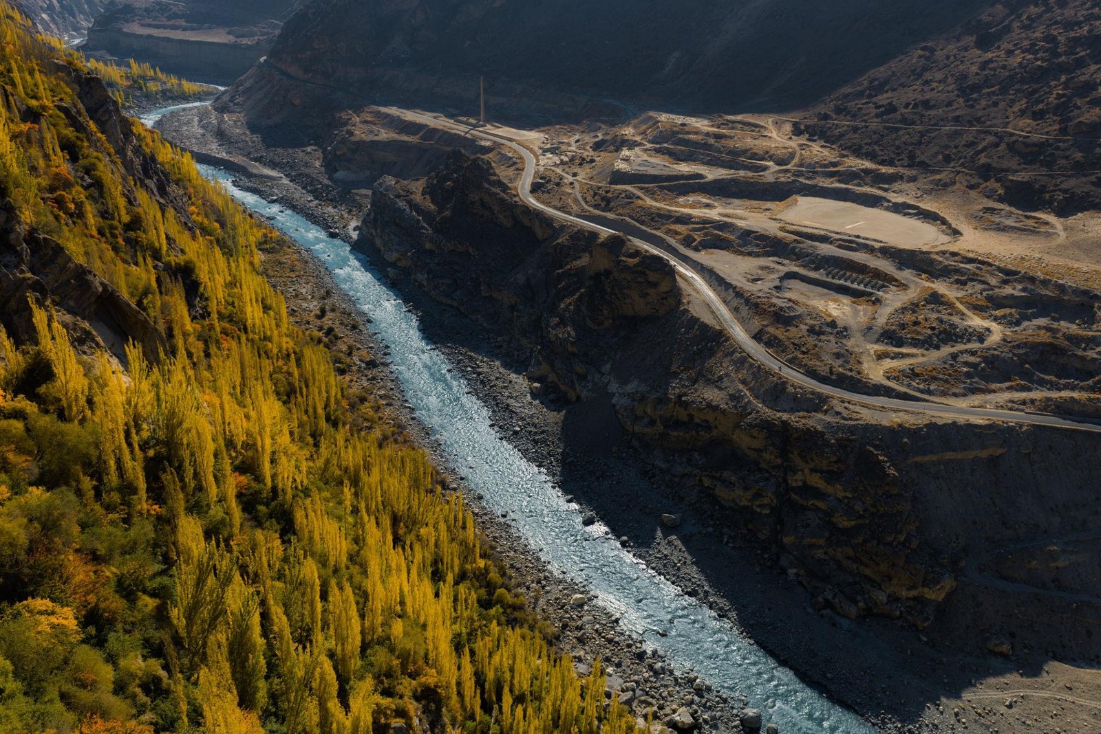
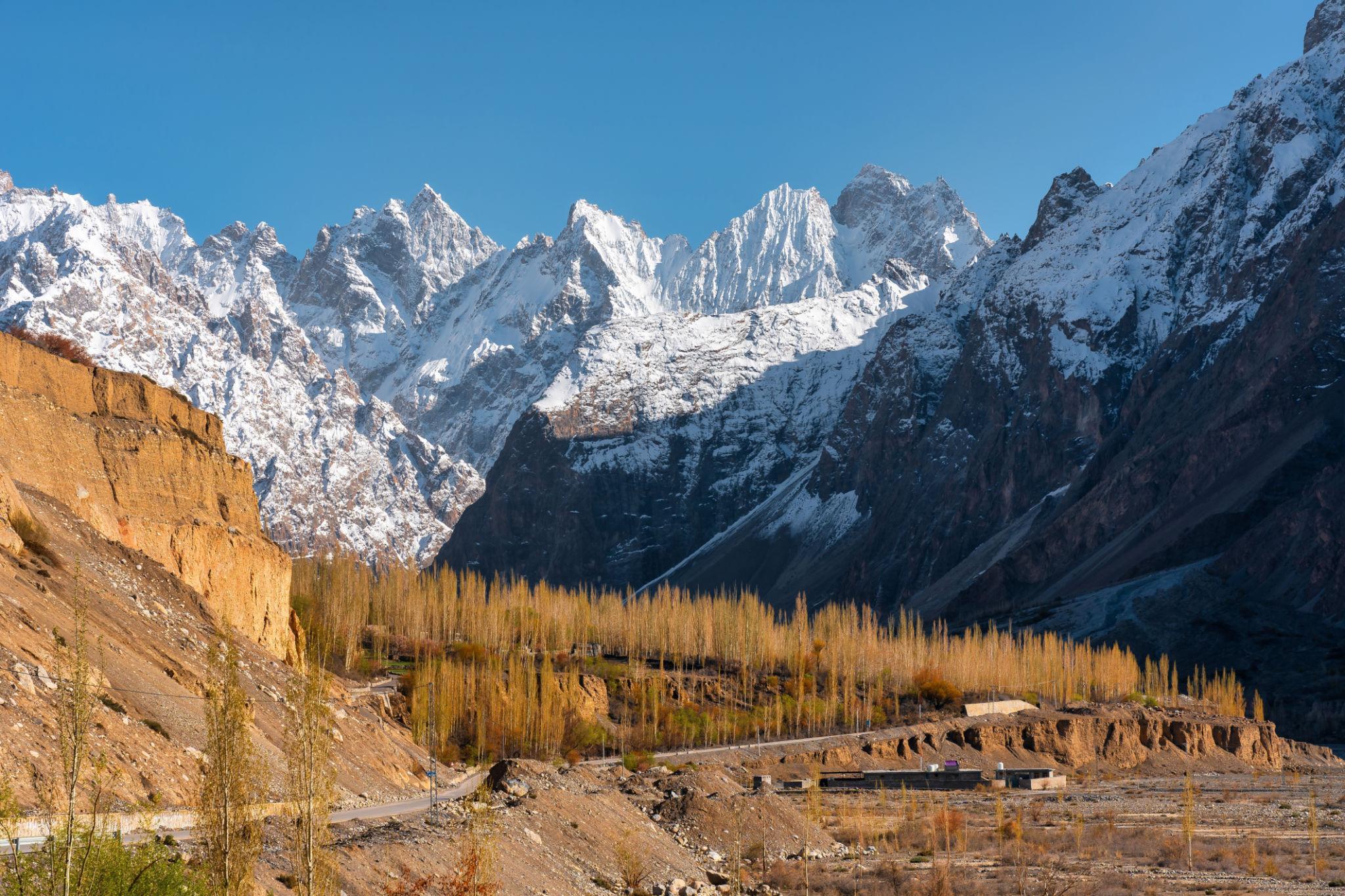
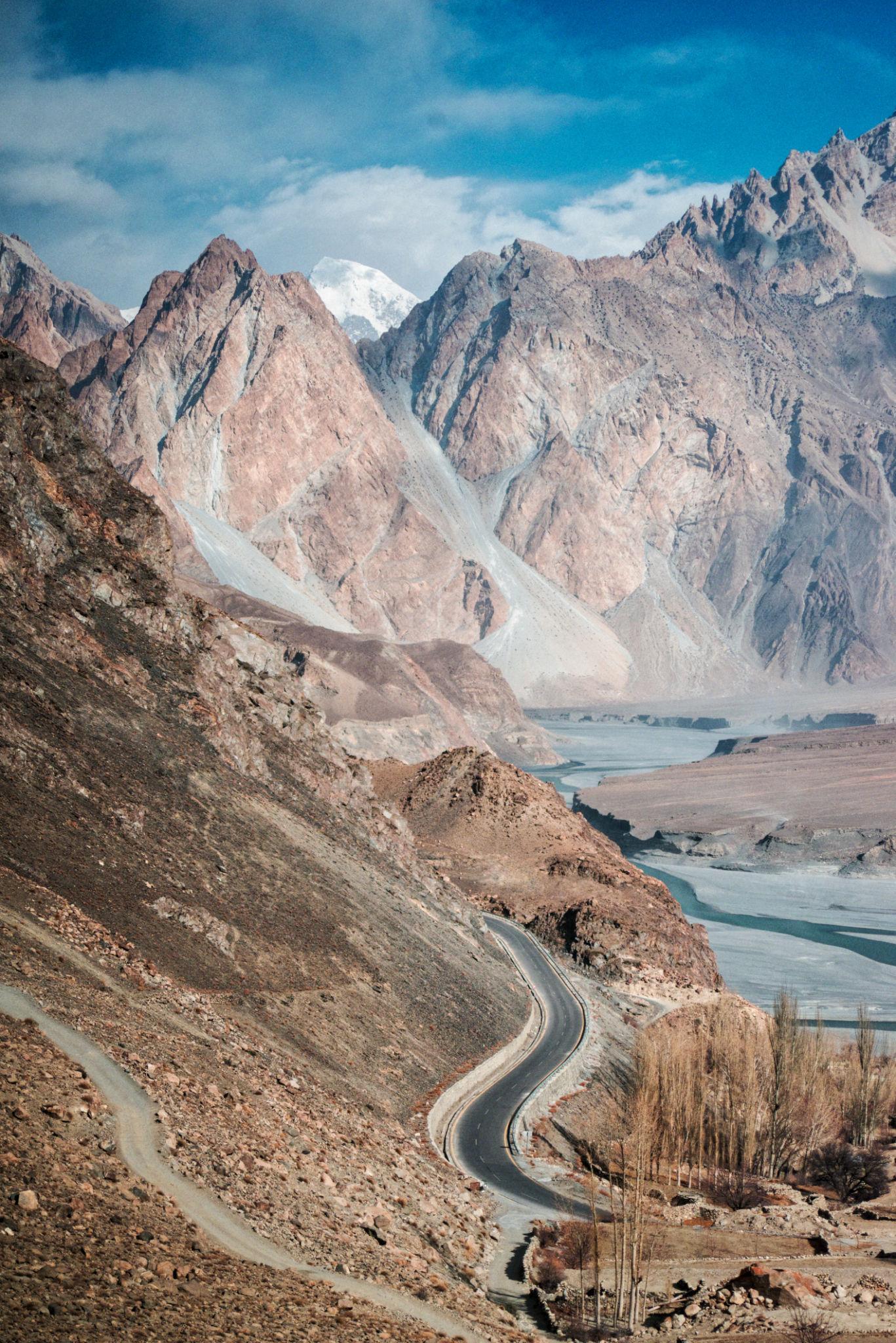
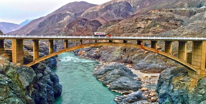
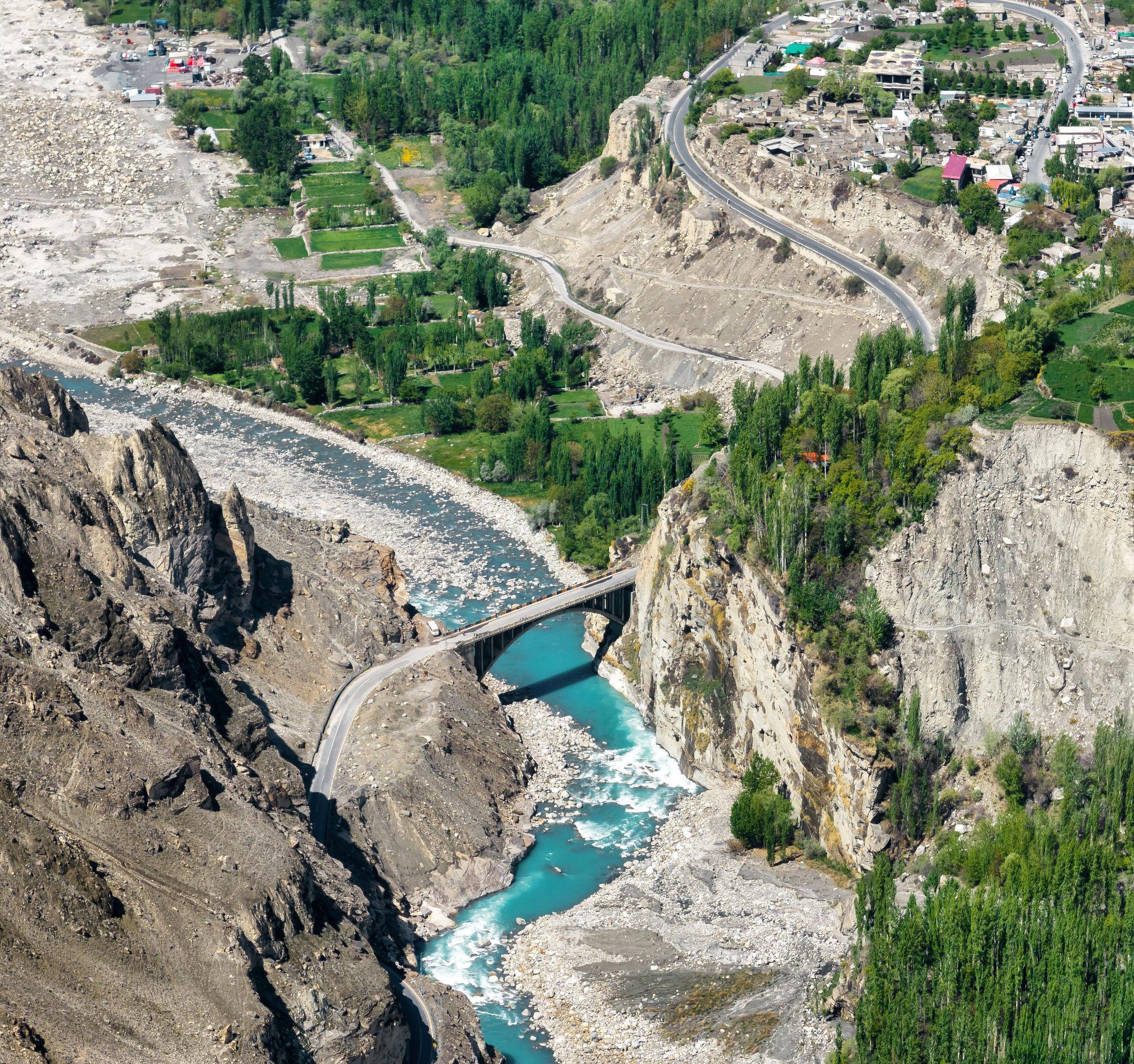
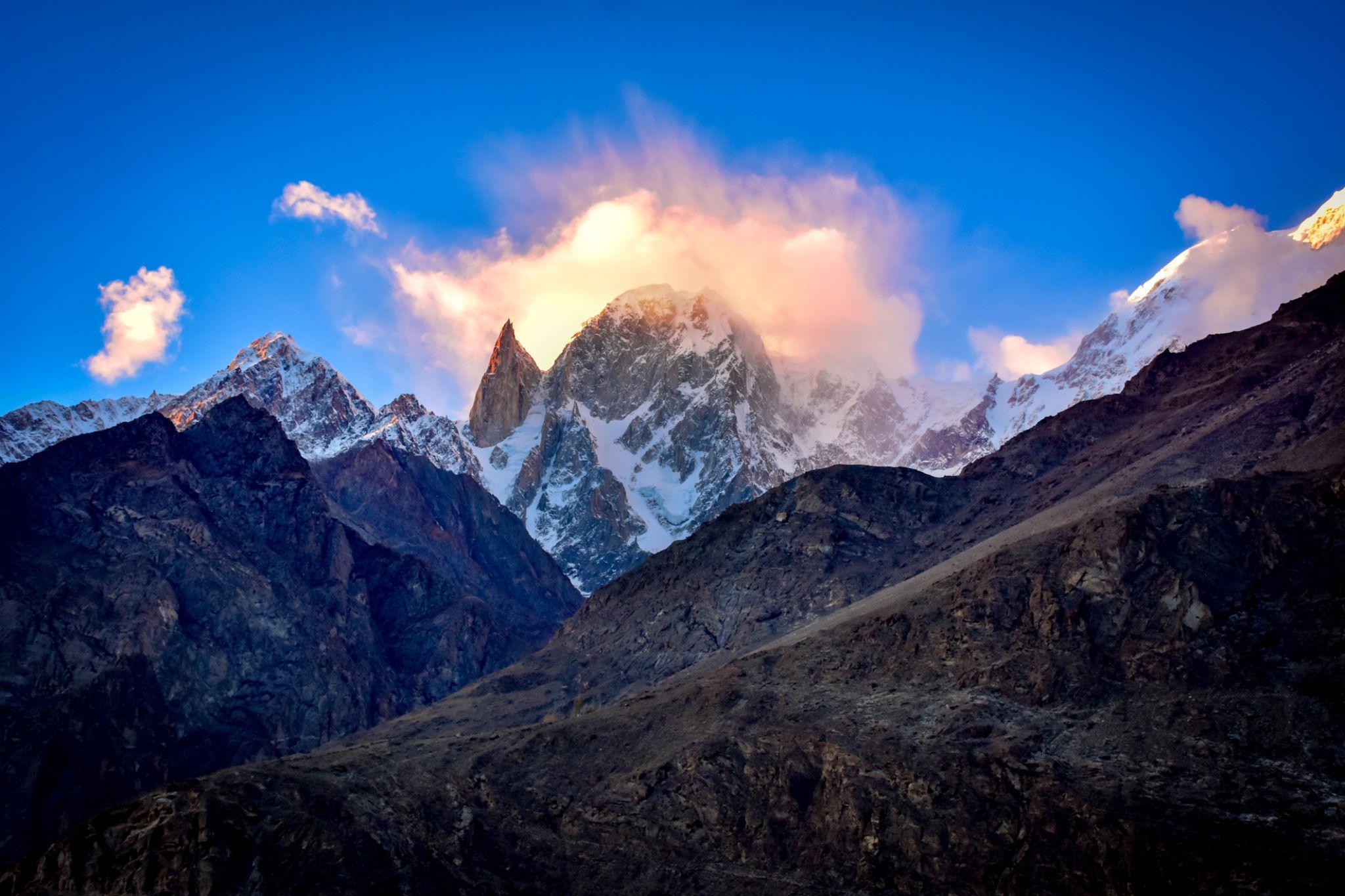
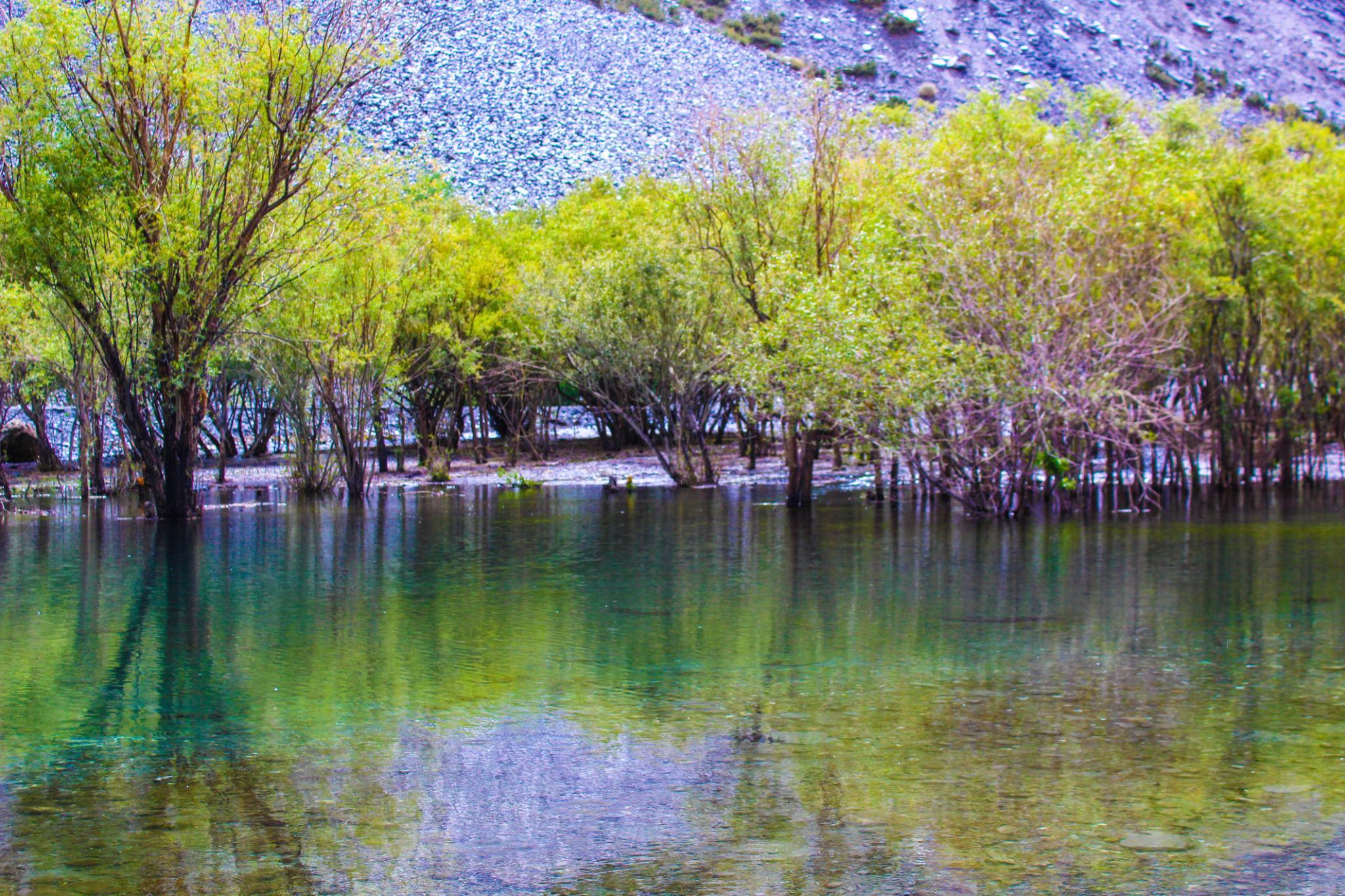
Stage 4: Karimabad to Attabad Lake and Passu
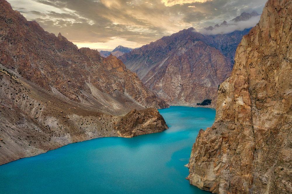
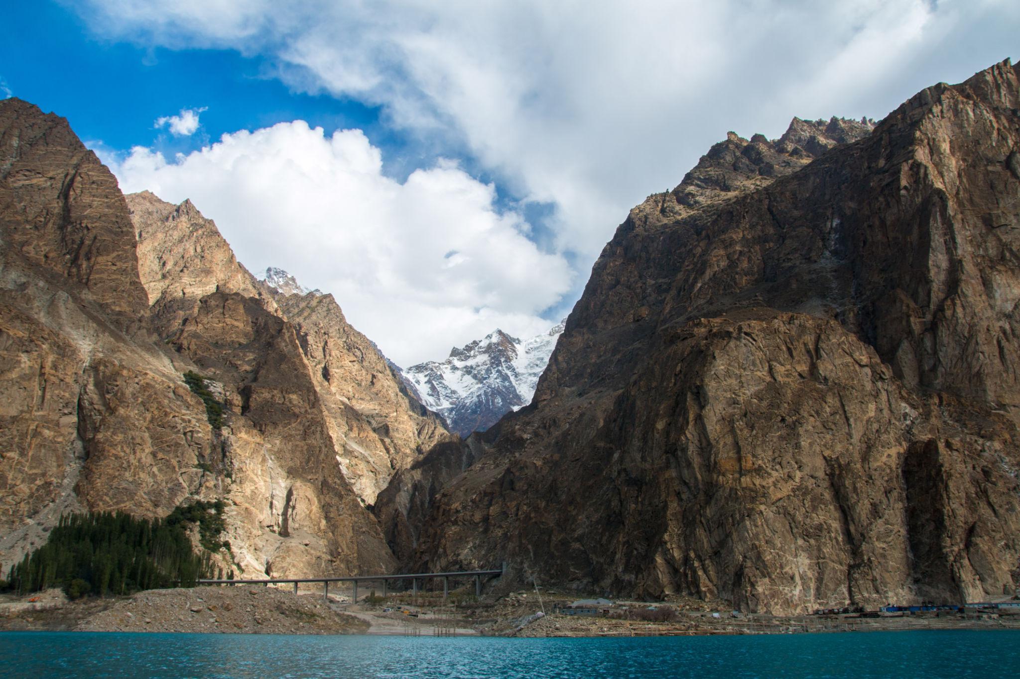
This section contains some of the most photographed landscapes along the Karakoram Highway.
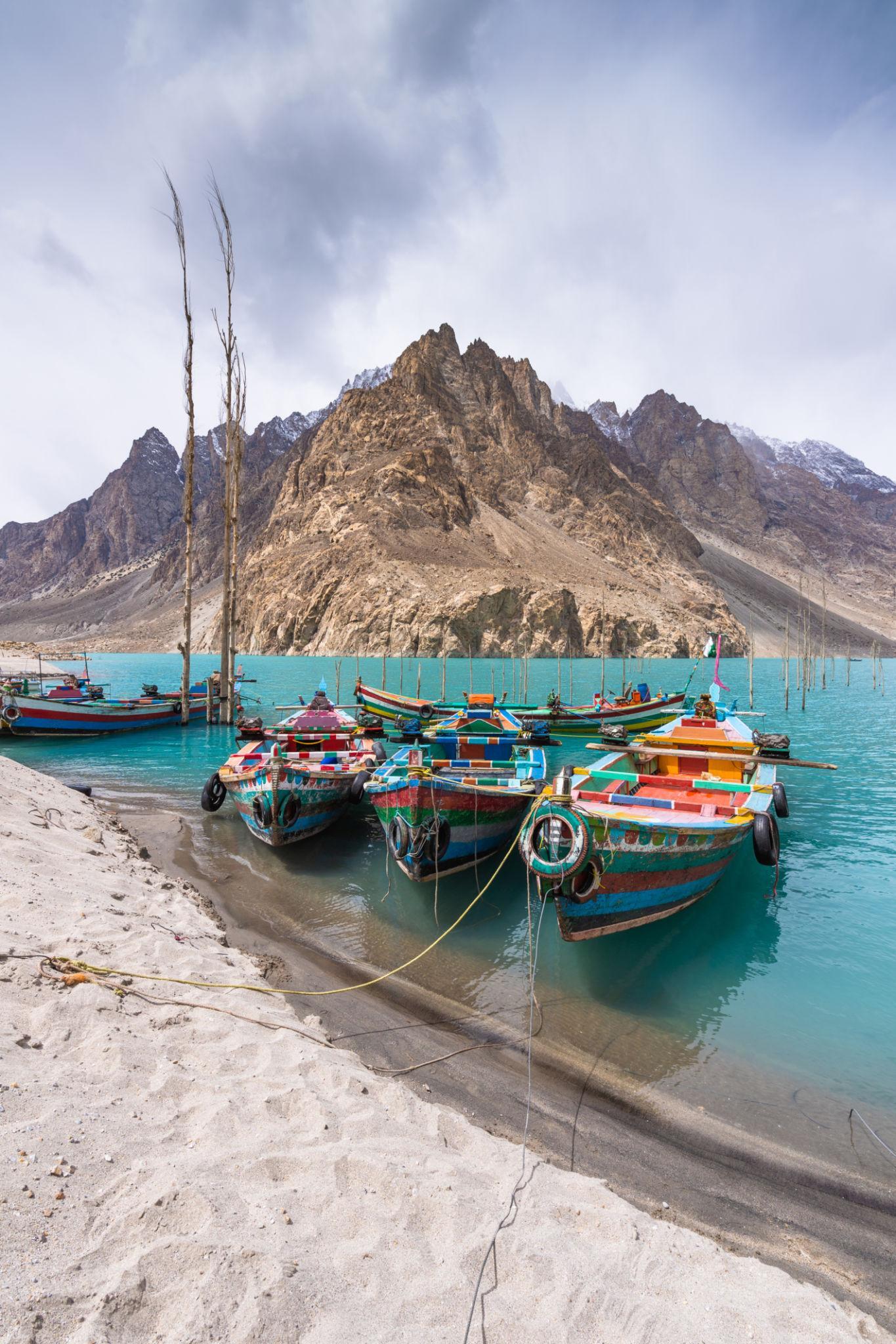
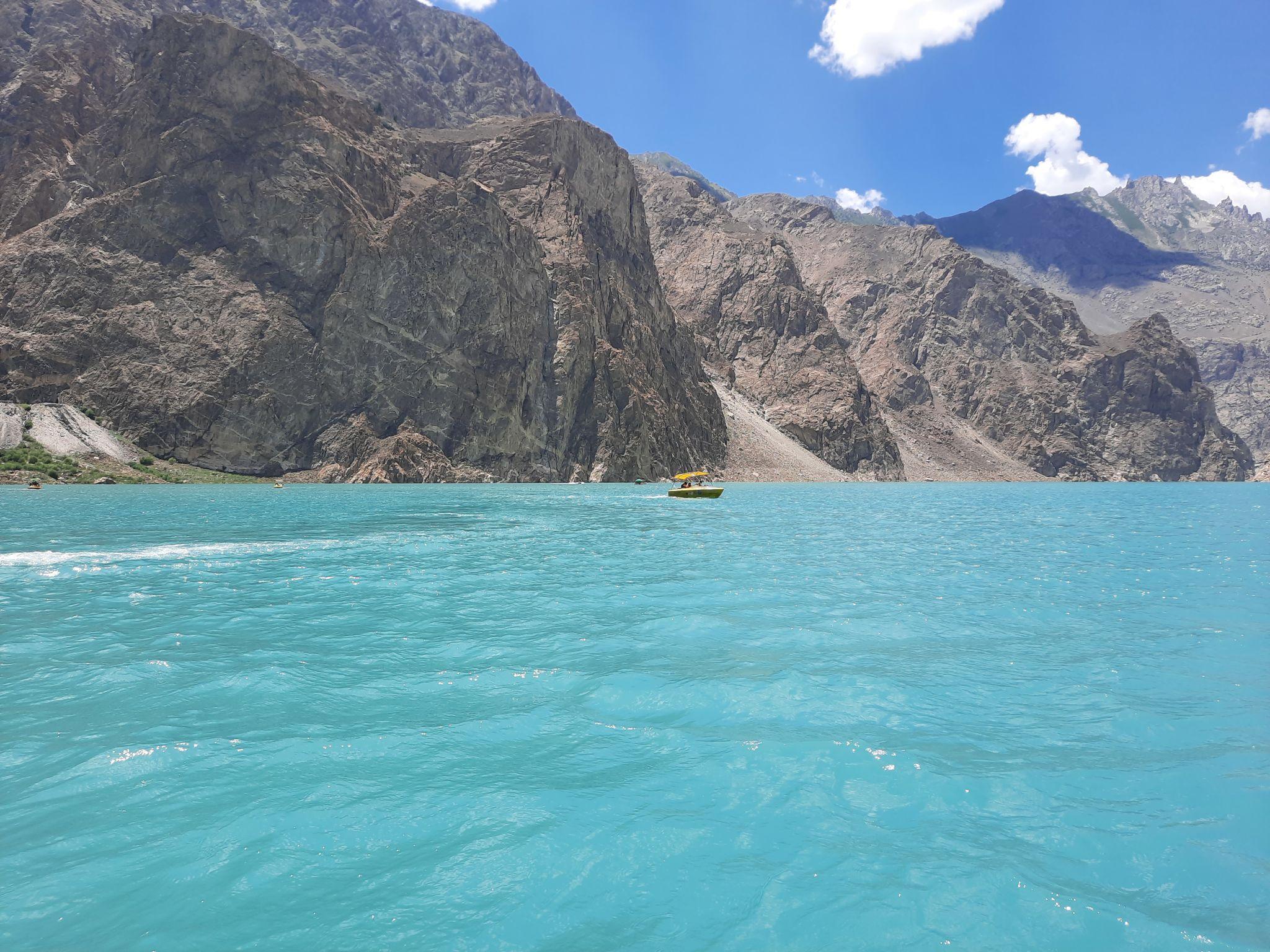
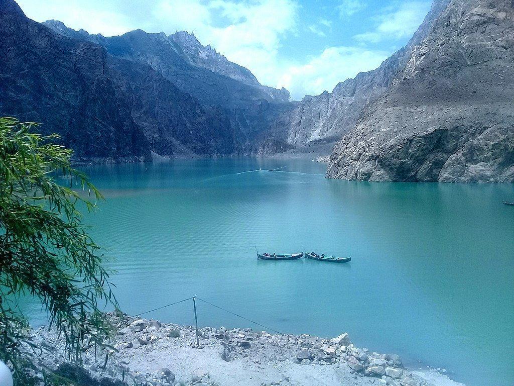
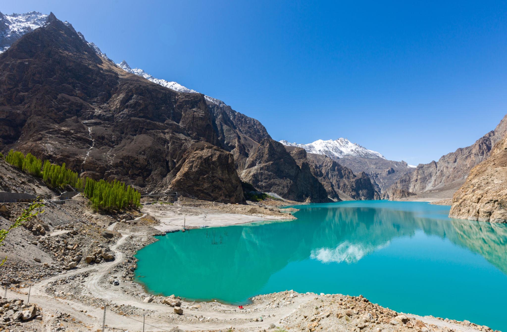
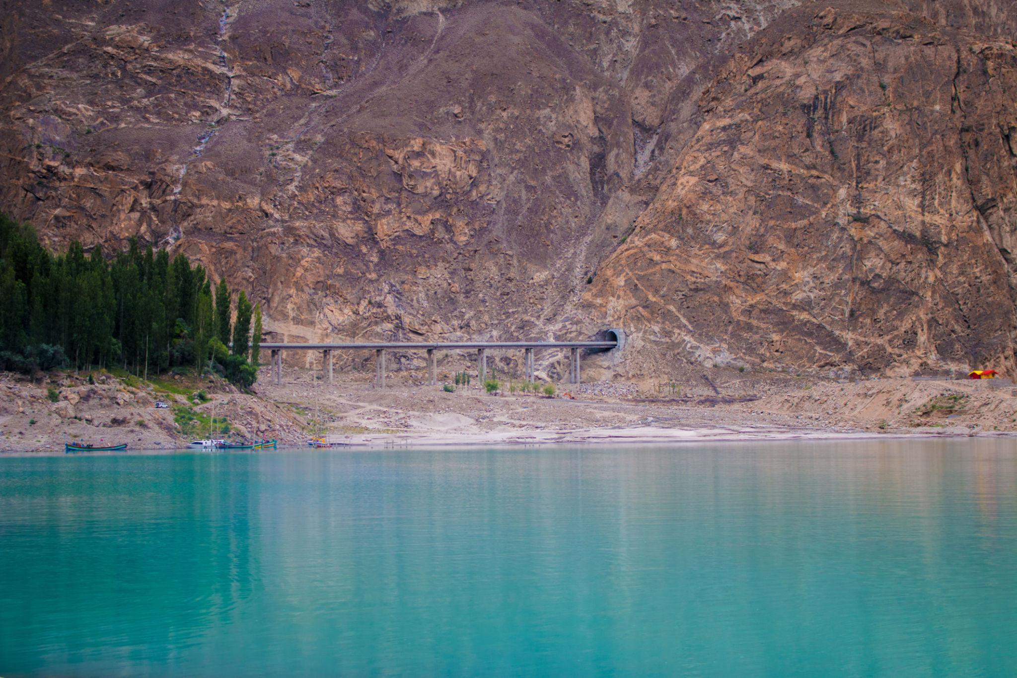
Attabad Lake
Attabad Lake formed after a massive landslide in 2010 blocked the Hunza River.
Today it is famous for:
- Turquoise water
- Boat rides
- Mountain scenery
- Tunnel sections of the KKH
Things to Do at Attabad Lake
- Boating
- Kayaking
- Photography
- Cafes and viewpoints
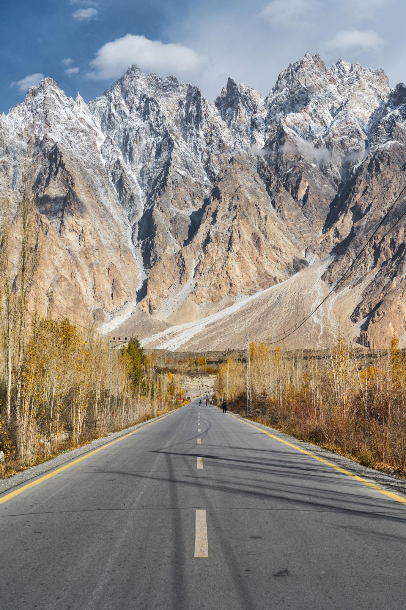
Passu Village
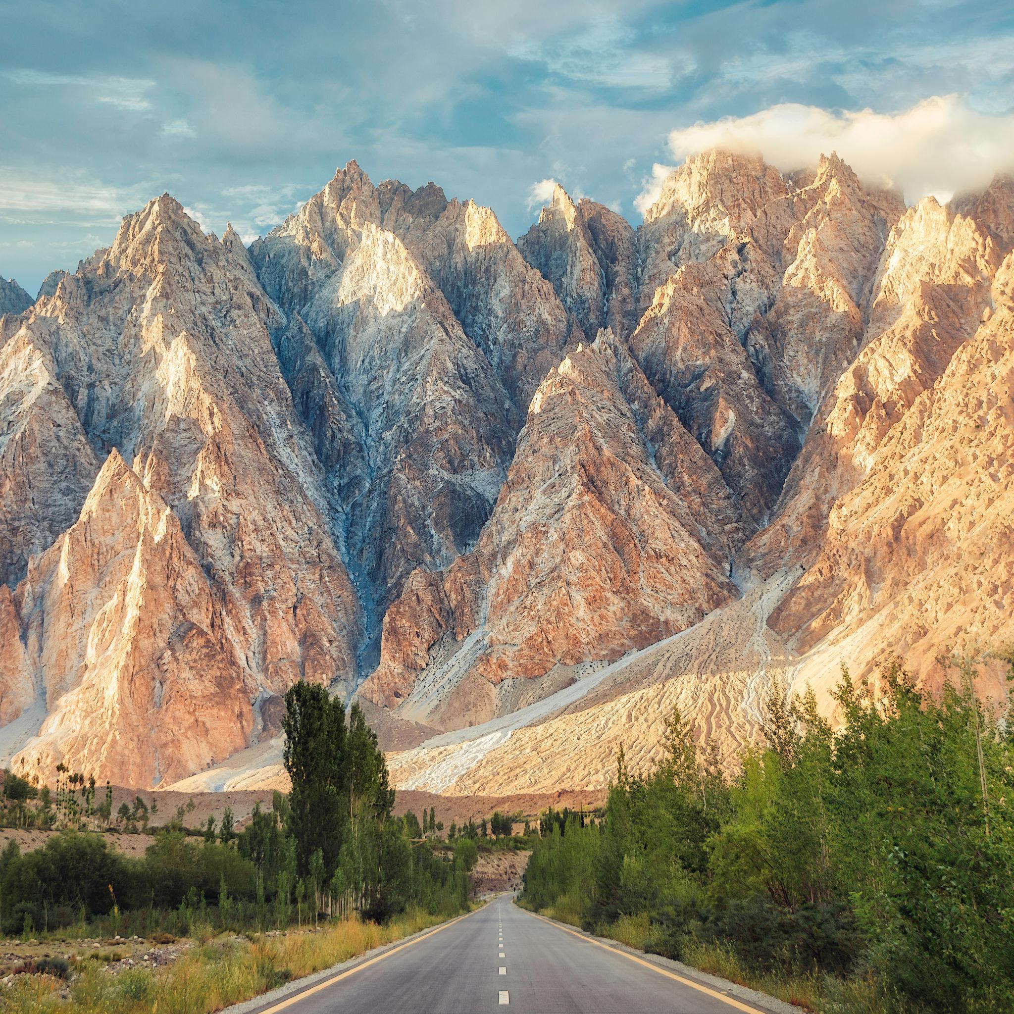
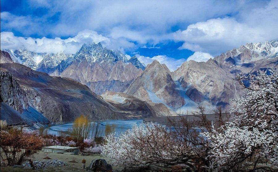
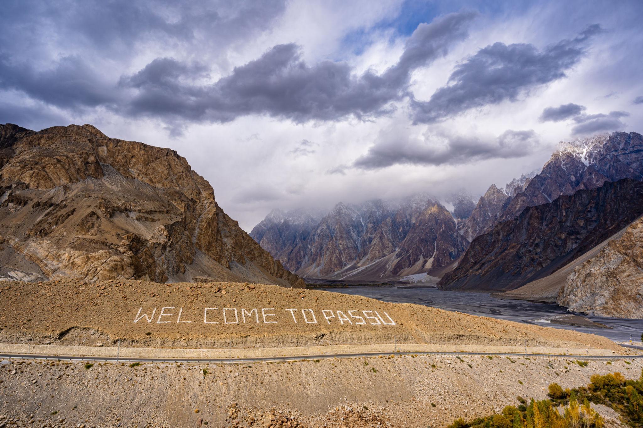
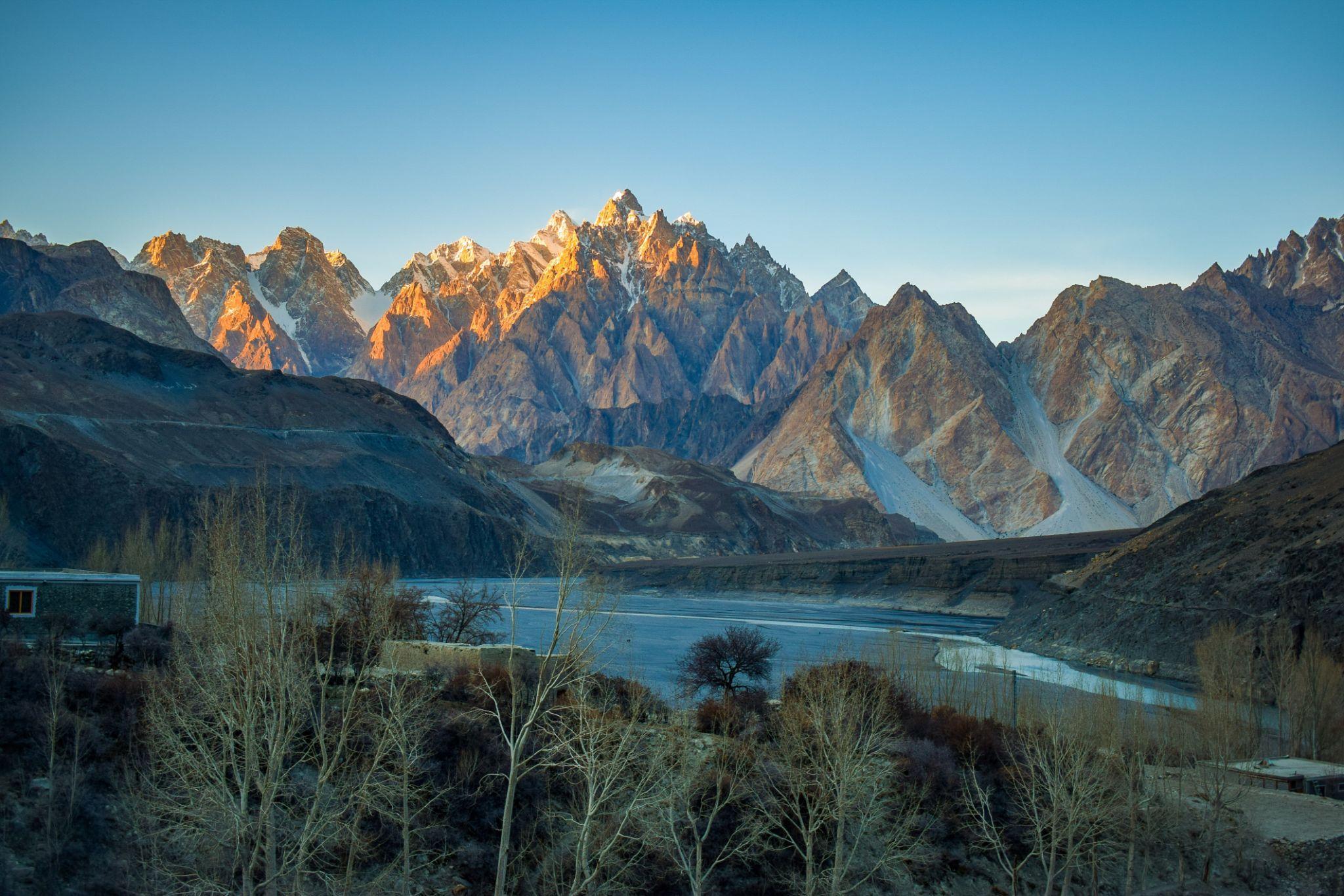
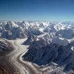
Passu is known for the dramatic Passu Cones and glacier landscapes.
Top Attractions in Passu
Passu Cones
Jagged granite peaks rising above the valley.
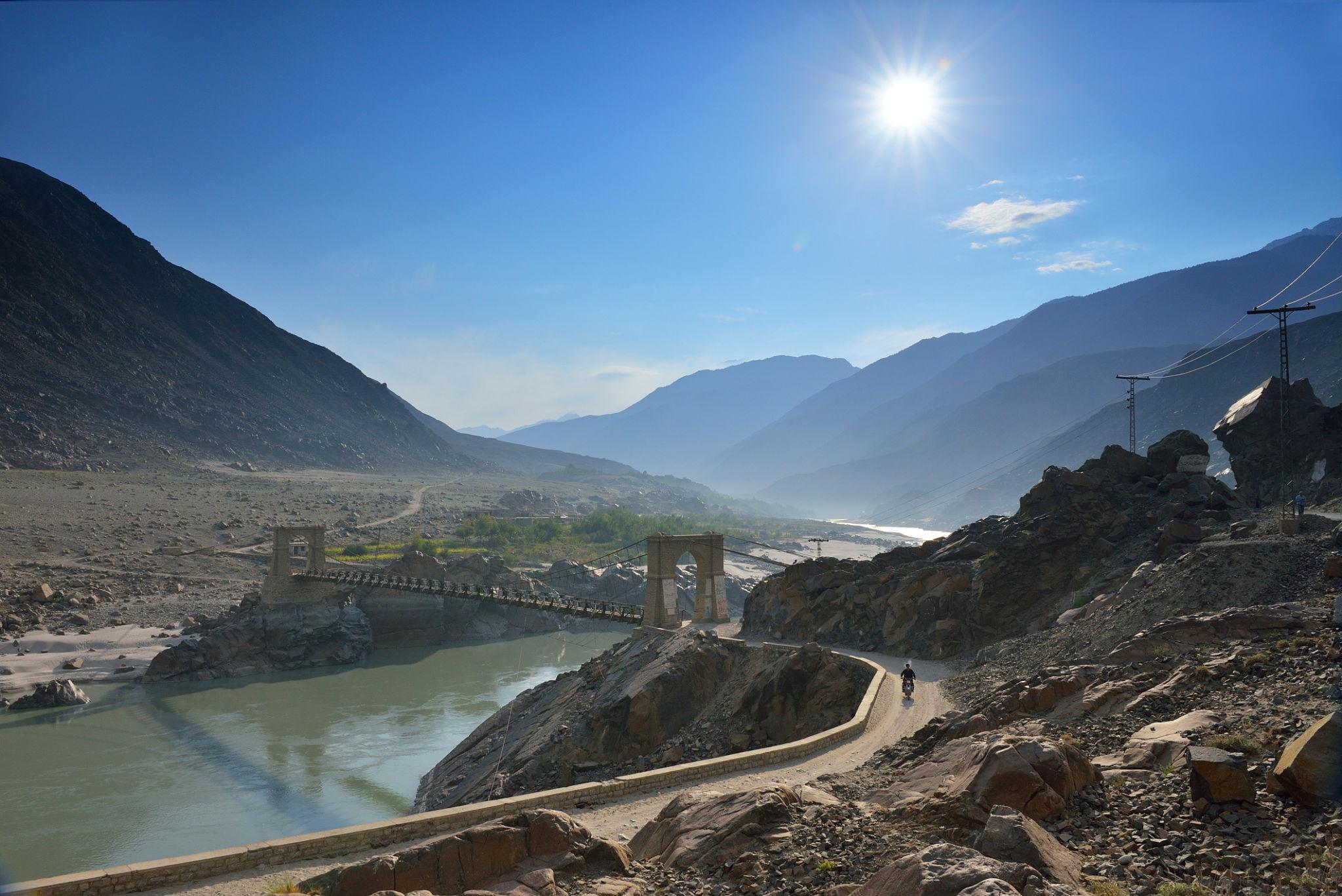
Hussaini Suspension Bridge
One of the most famous pedestrian bridges in Pakistan.
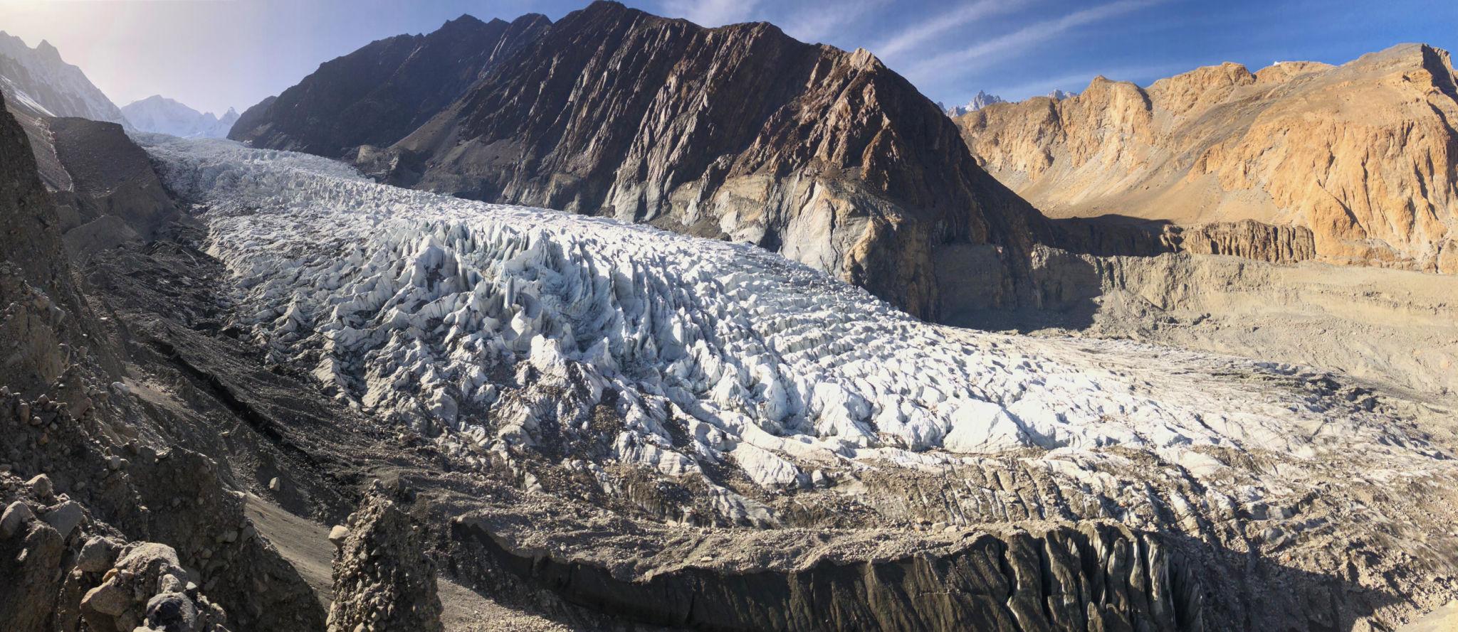
Batura Glacier
Accessible glacier trekking route.
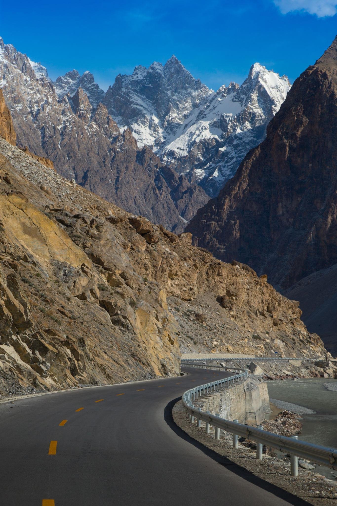
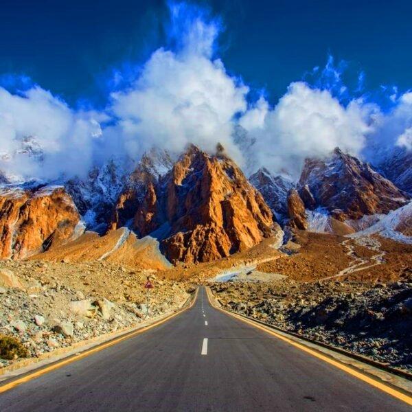
Stage 5: Sost to Khunjerab Pass
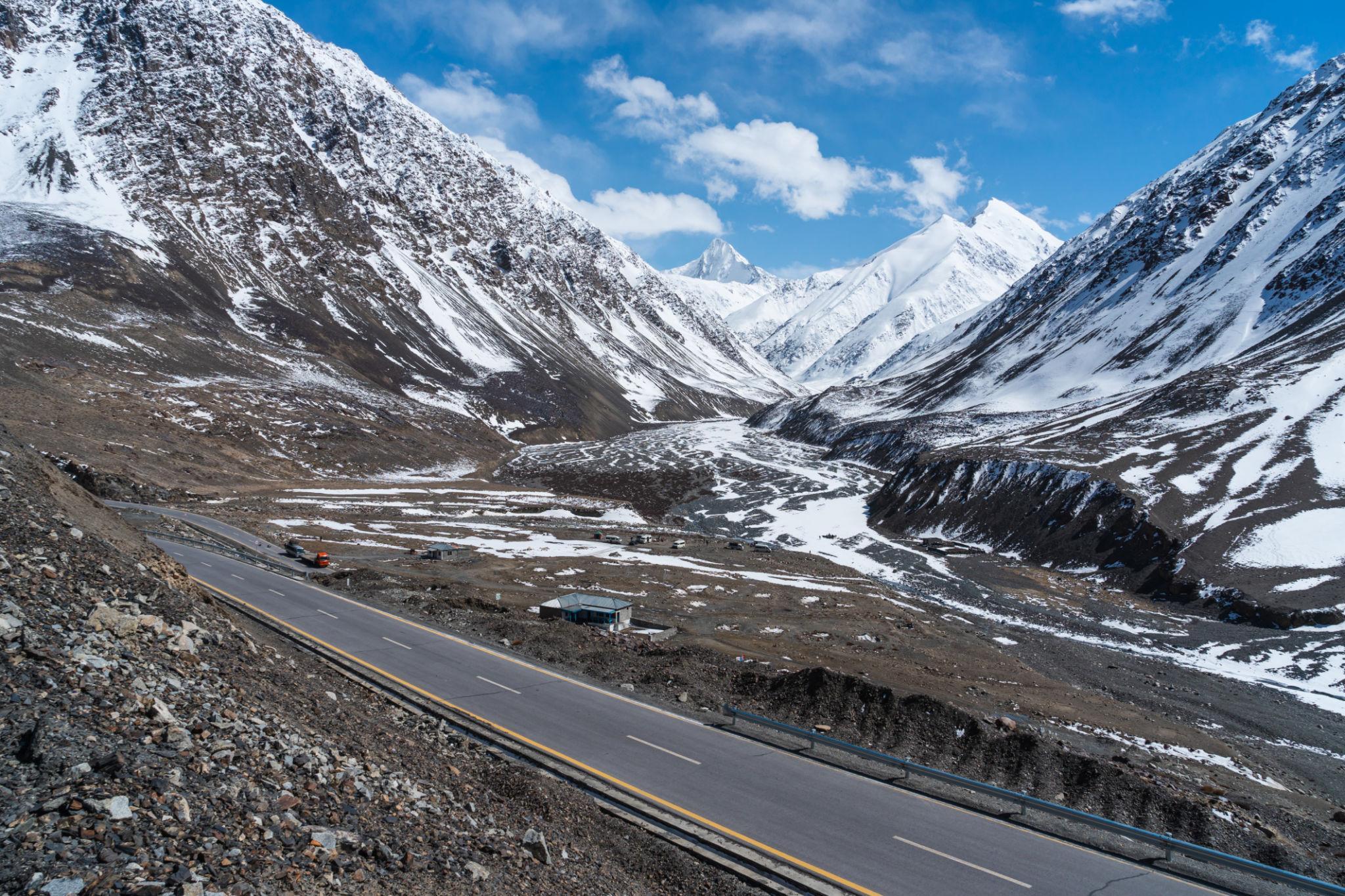
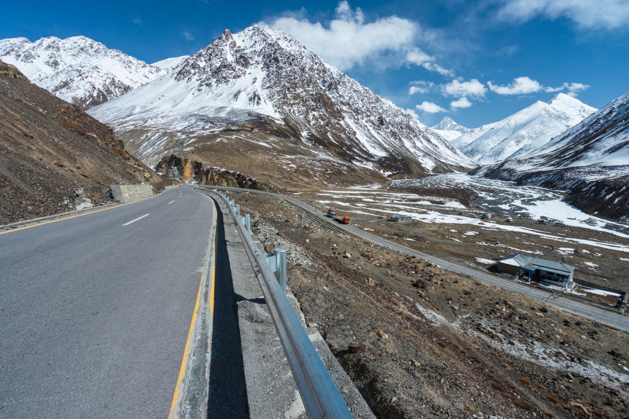
The final stage climbs steadily toward Khunjerab Pass through high altitude terrain.
Vegetation disappears gradually as the landscape transforms into:
- Rocky plateaus
- Glacial valleys
- High altitude desert landscapes
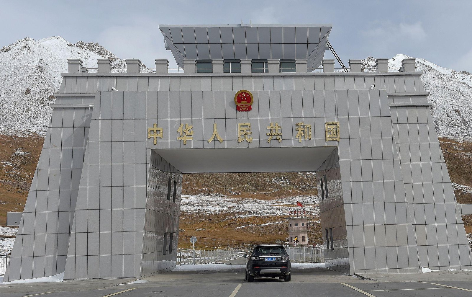
Sost
Sost is the final Pakistani town before the China border.
The town contains:
- Immigration facilities
- Fuel stations
- Basic hotels
- Restaurants
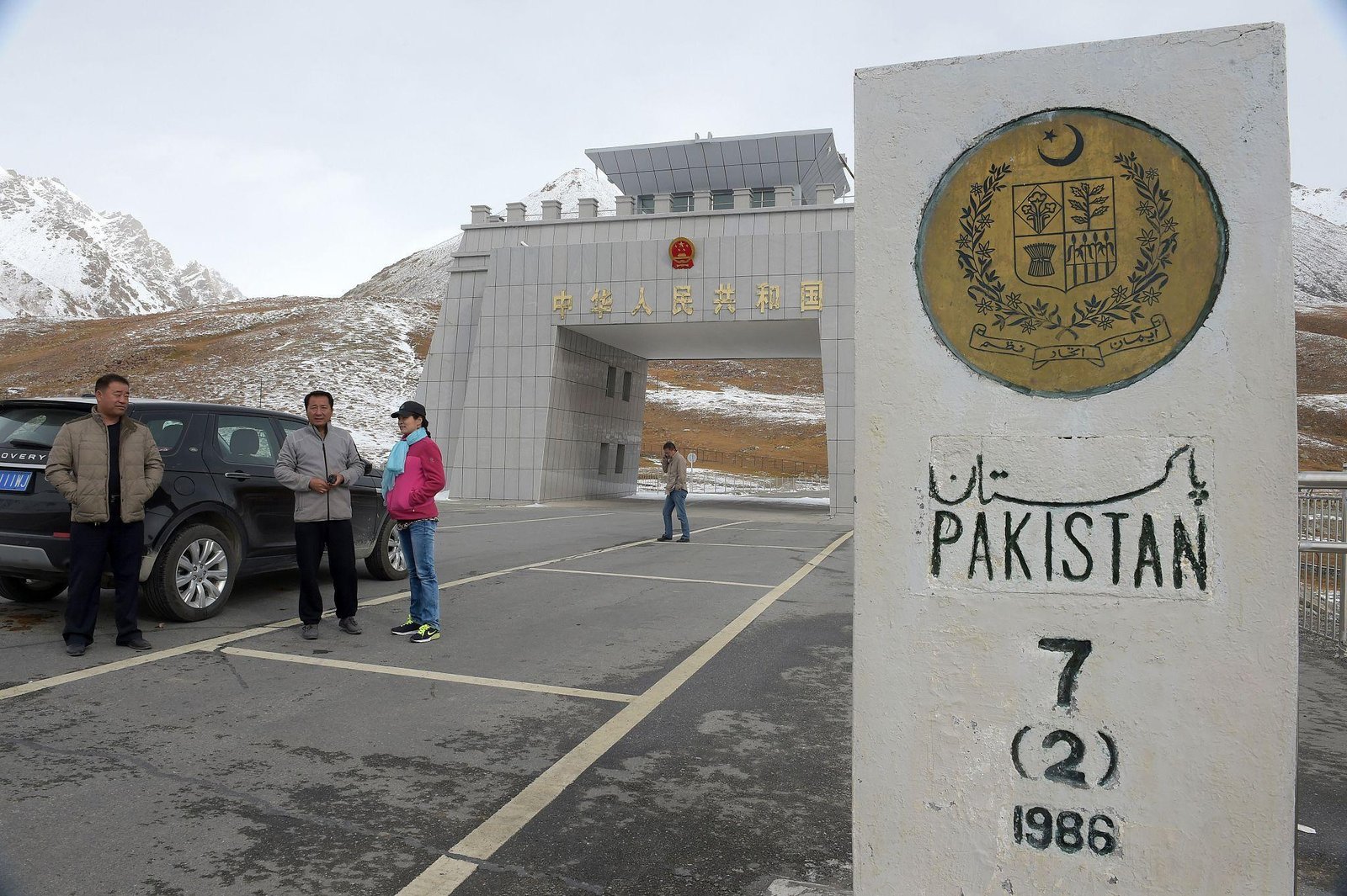
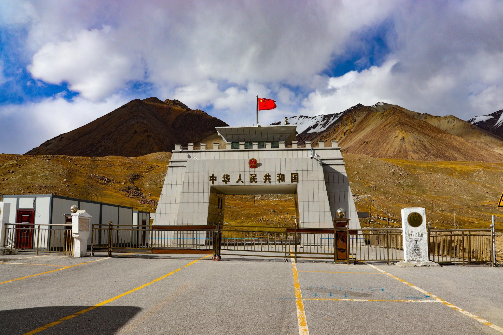
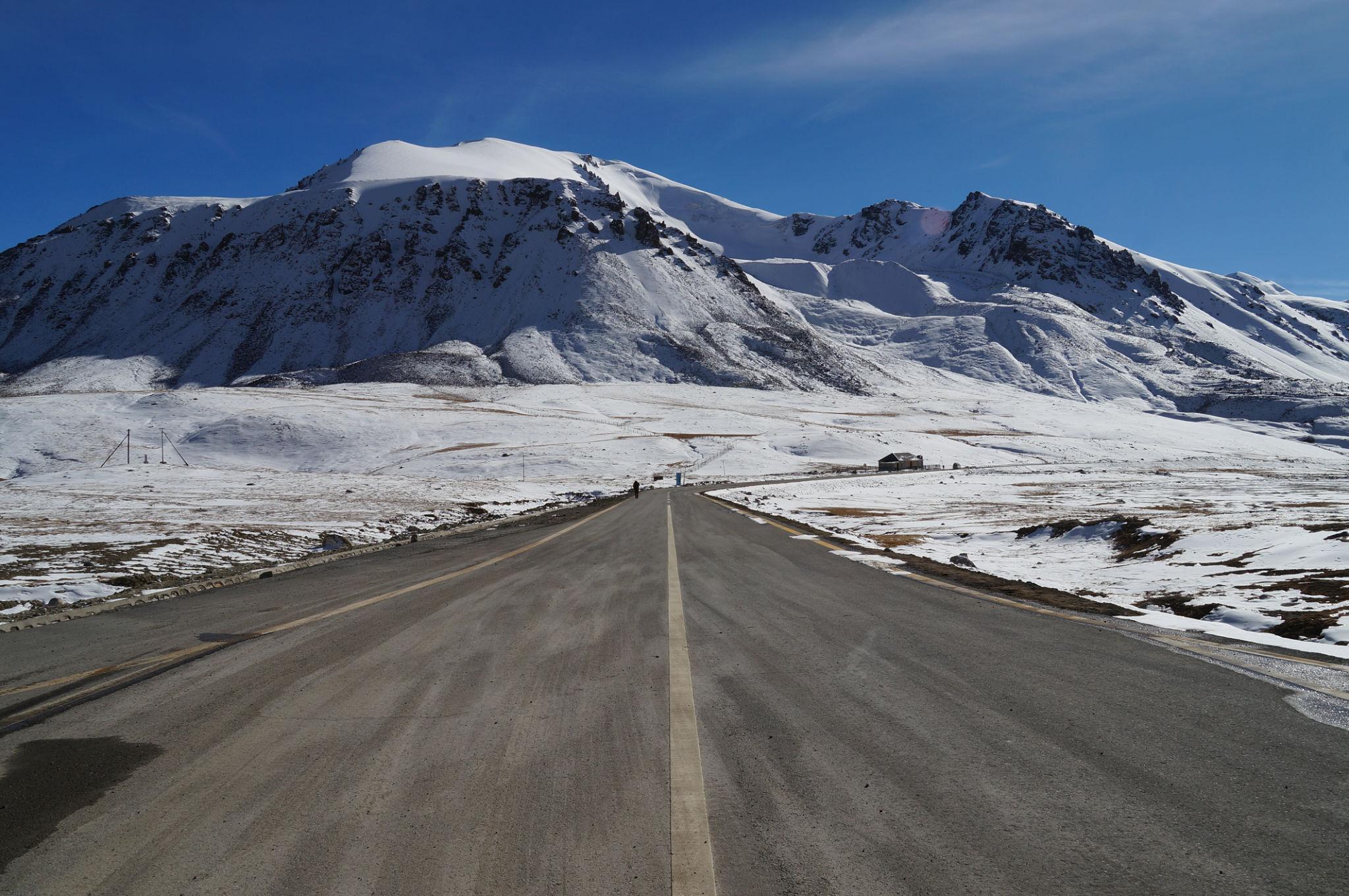
Khunjerab Pass
Khunjerab Pass sits at approximately 4,693 metres above sea level and is the highest paved international border crossing in the world.
What to Expect at Khunjerab Pass
- Thin air and cold temperatures
- Strong winds
- High altitude plateau scenery
- Border monument photography
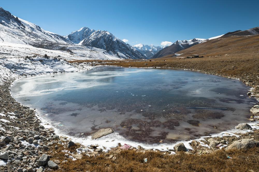
Khunjerab National Park
The highway passes through Khunjerab National Park, home to:
- Marco Polo sheep
- Himalayan ibex
- Snow leopards
- Brown bears
Wildlife sightings are most common early in the morning.
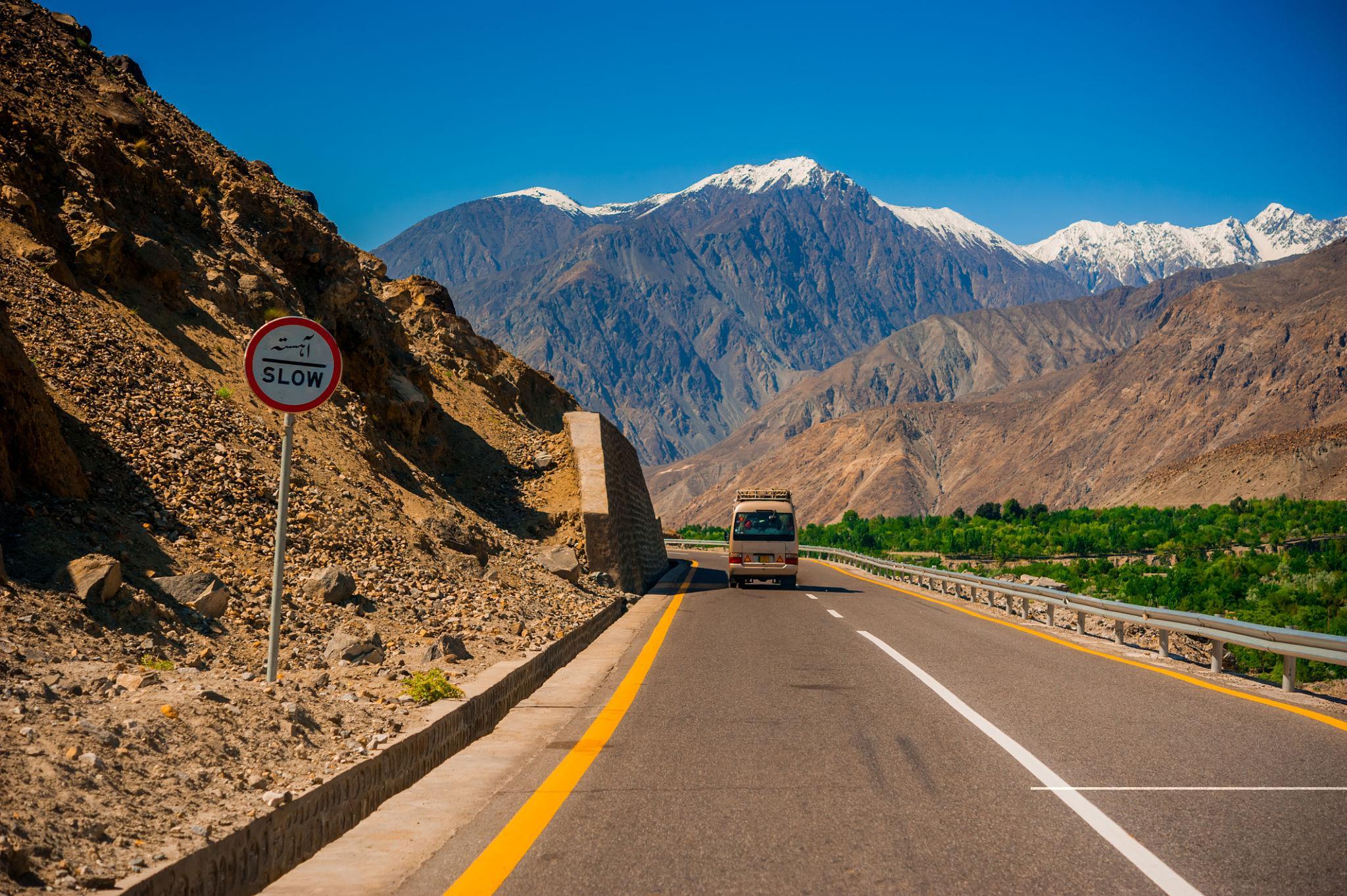
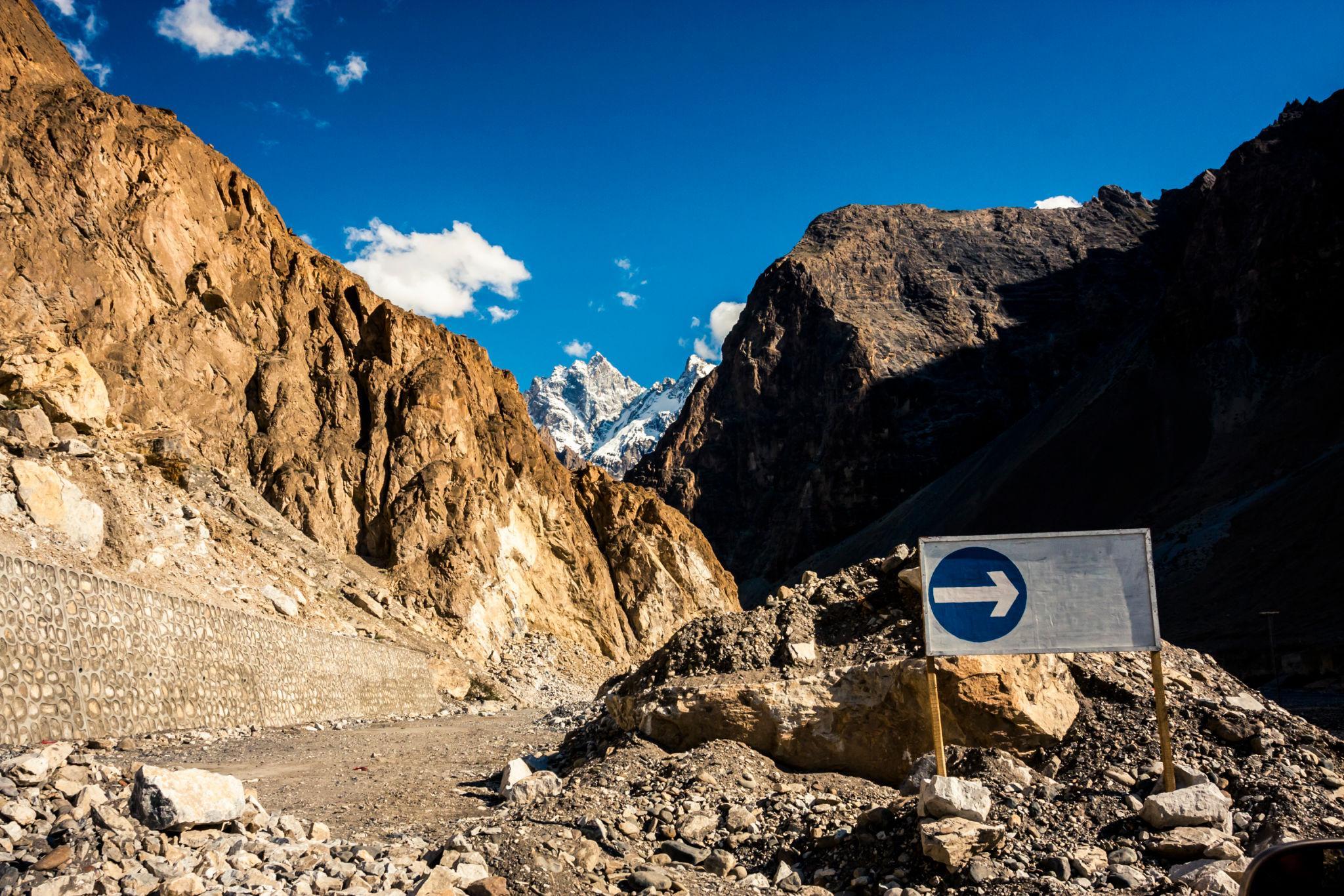
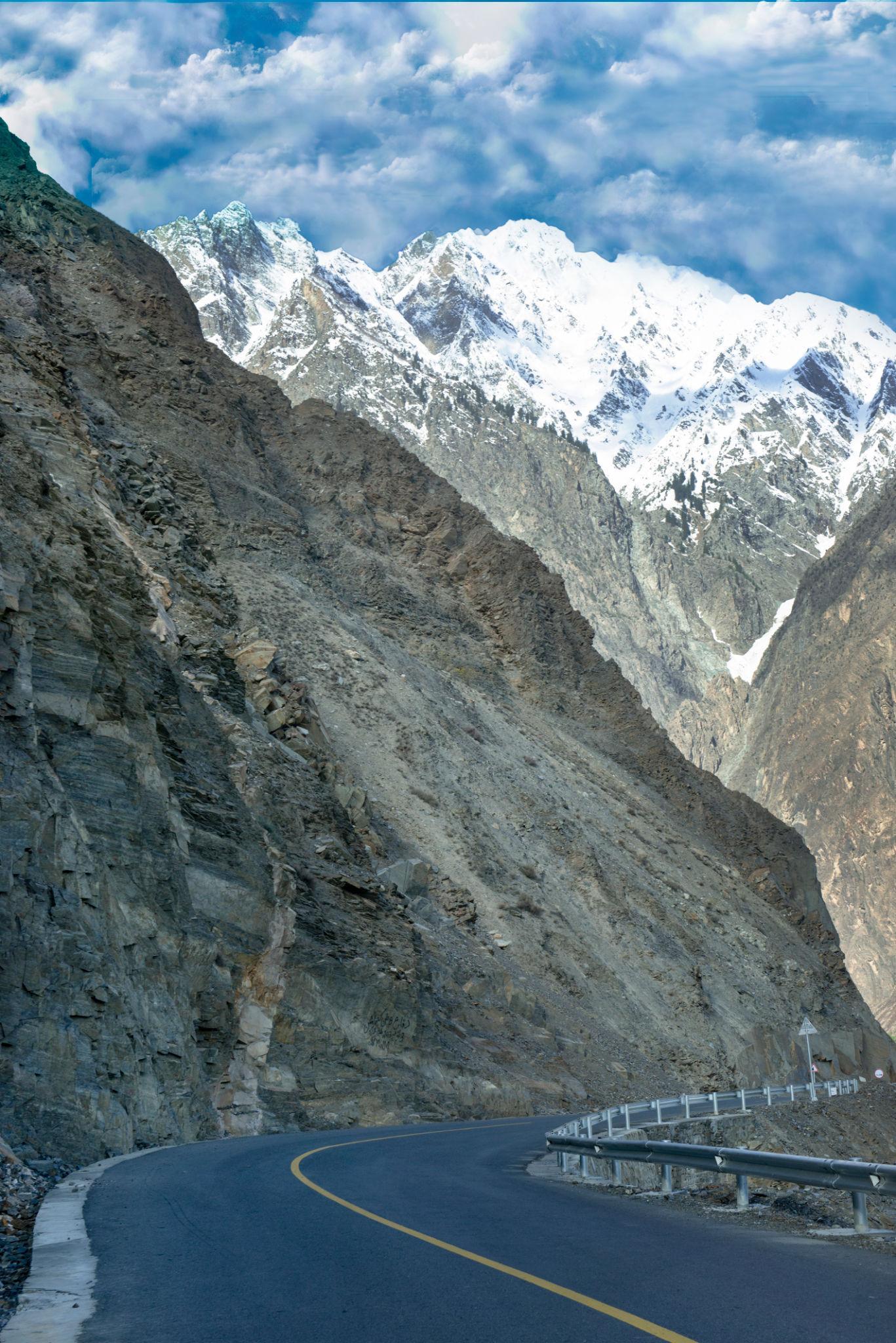
Vehicle Requirements & Road Conditions
Recommended Vehicle
A high-clearance 4x4 vehicle is strongly recommended.
Ideal options include:
- Toyota Prado
- Toyota Hilux
- Land Cruiser
Important Road Conditions
Travelers should prepare for:
- Landslides
- Narrow roads
- Rockfall zones
- Construction sections
- Unpredictable weather
Night driving should always be avoided.
Accommodation Along the Route
Chilas
- Shangrila Chilas Hotel
- PTDC Motel Chilas
Gilgit
- Serena Hotel Gilgit
- Riveria Hotel
- Jubilee Hotel
Hunza
- Serena Inn Karimabad
- Eagle’s Nest Hotel
- Old Hunza Inn
Passu
- Passu Inn
- Glacier Breeze Hotel
- Batura Inn
Essential Travel Tips
- Carry cash for remote areas
- Download offline maps
- Refuel whenever possible
- Avoid night driving
- Carry warm clothing even in summer
- Keep extra days for landslide delays
- Carry a first aid kit and power bank
Altitude Awareness
Khunjerab Pass sits above 4,600 metres.
Possible symptoms include:
- Headache
- Fatigue
- Dizziness
Stay hydrated and descend if symptoms become severe.
Frequently Asked Questions
How long does the Karakoram Highway road trip take?
A complete Islamabad to Khunjerab Pass journey usually takes 5 to 7 days.
What is the best time to drive the Karakoram Highway?
May, June, September, and October are considered the best months.
Is the Karakoram Highway safe for tourists?
Yes. The main risks are related to road conditions and weather rather than security.
Do I need a 4x4 vehicle?
A 4x4 is strongly recommended for comfort and safety, especially during unstable weather conditions.
Can foreigners travel independently on the KKH?
Yes, although registration at police checkpoints may occasionally be required north of Gilgit.
Is Khunjerab Pass open year round?
No. The pass usually opens from May to November depending on snowfall conditions.
Which is the best base in Hunza?
Karimabad is the best base for first-time visitors because of its accommodation, restaurants, and central location.
![K2 Base Camp Trek: Ultimate Guide k2 Trek 2026 [UPDATED]](https://karakoramdiaries.com/storage/ultimate-guide-to-k2-base-camp-trek-full-document-150x150.png)