World Top 10 Treks Complete Comparison & Guide
This guide presents a structured comparison of ten major trekking routes across different continents. Each trek is evaluated based on terrain, altitude profile, logistical complexity, permit systems, cost structure, physical demand, and seasonal considerations. The focus remains analytical rather than narrative.
Table of contents [Show]
1. Everest Base Camp Trek
Understanding the Trail and Region
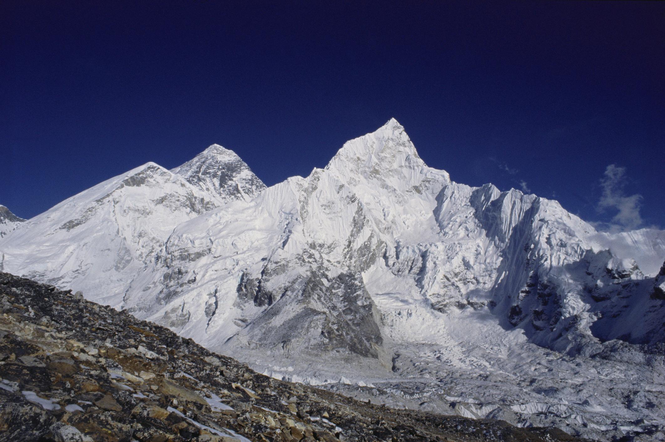
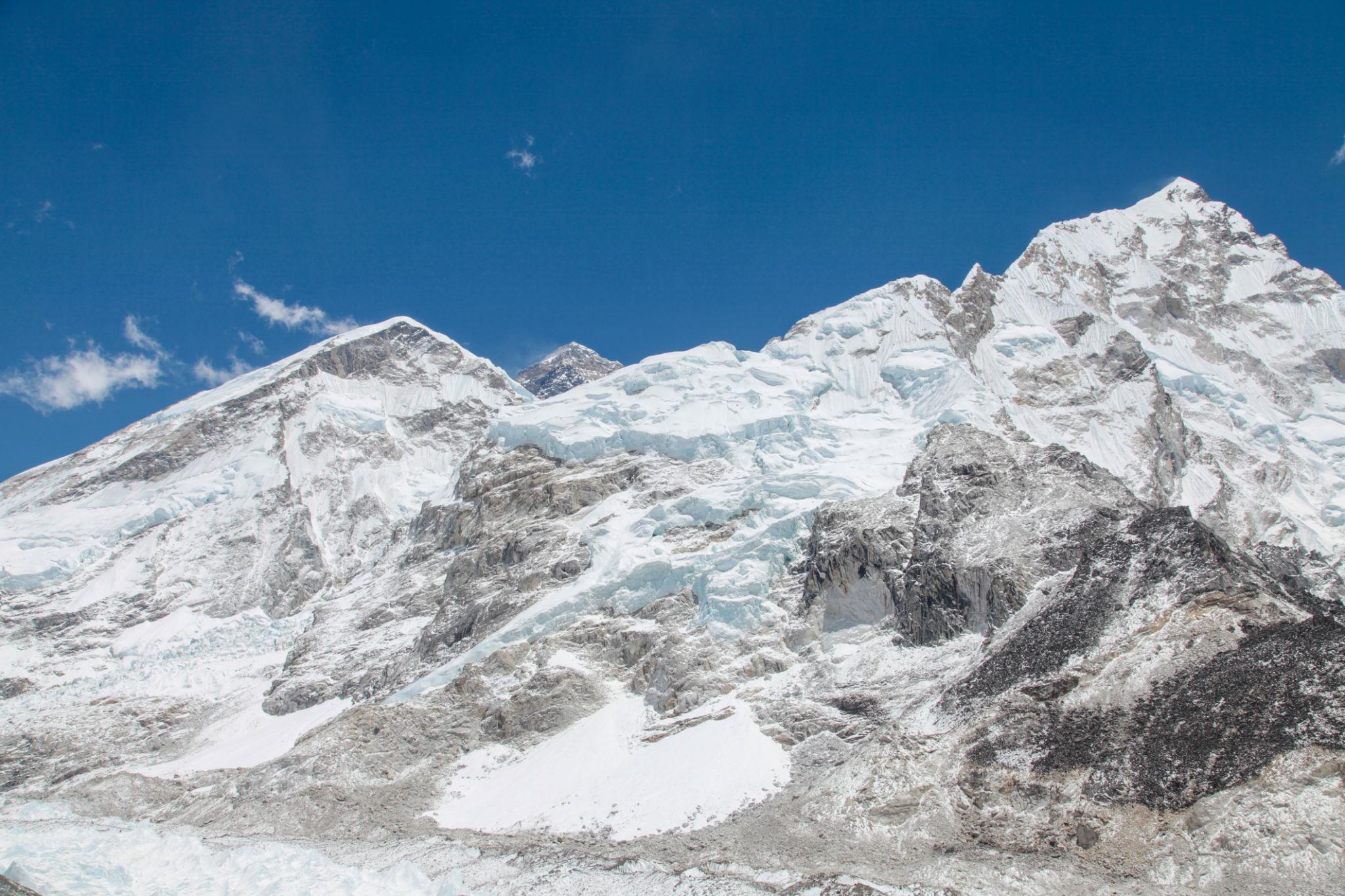
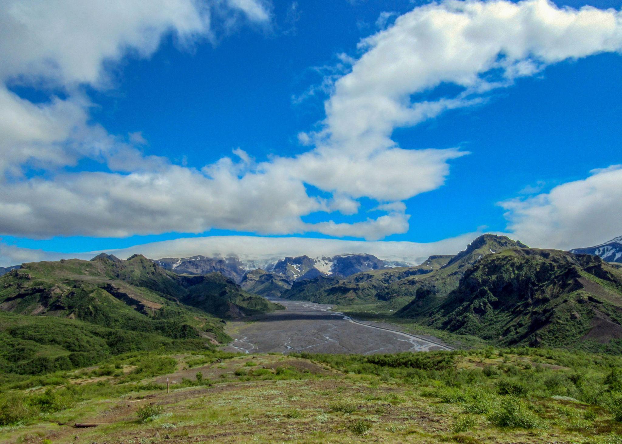
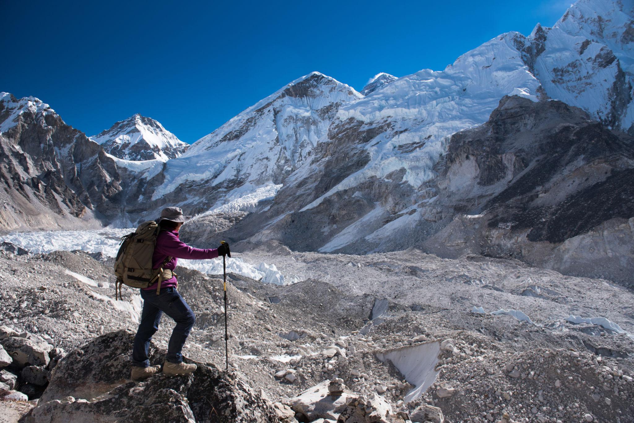
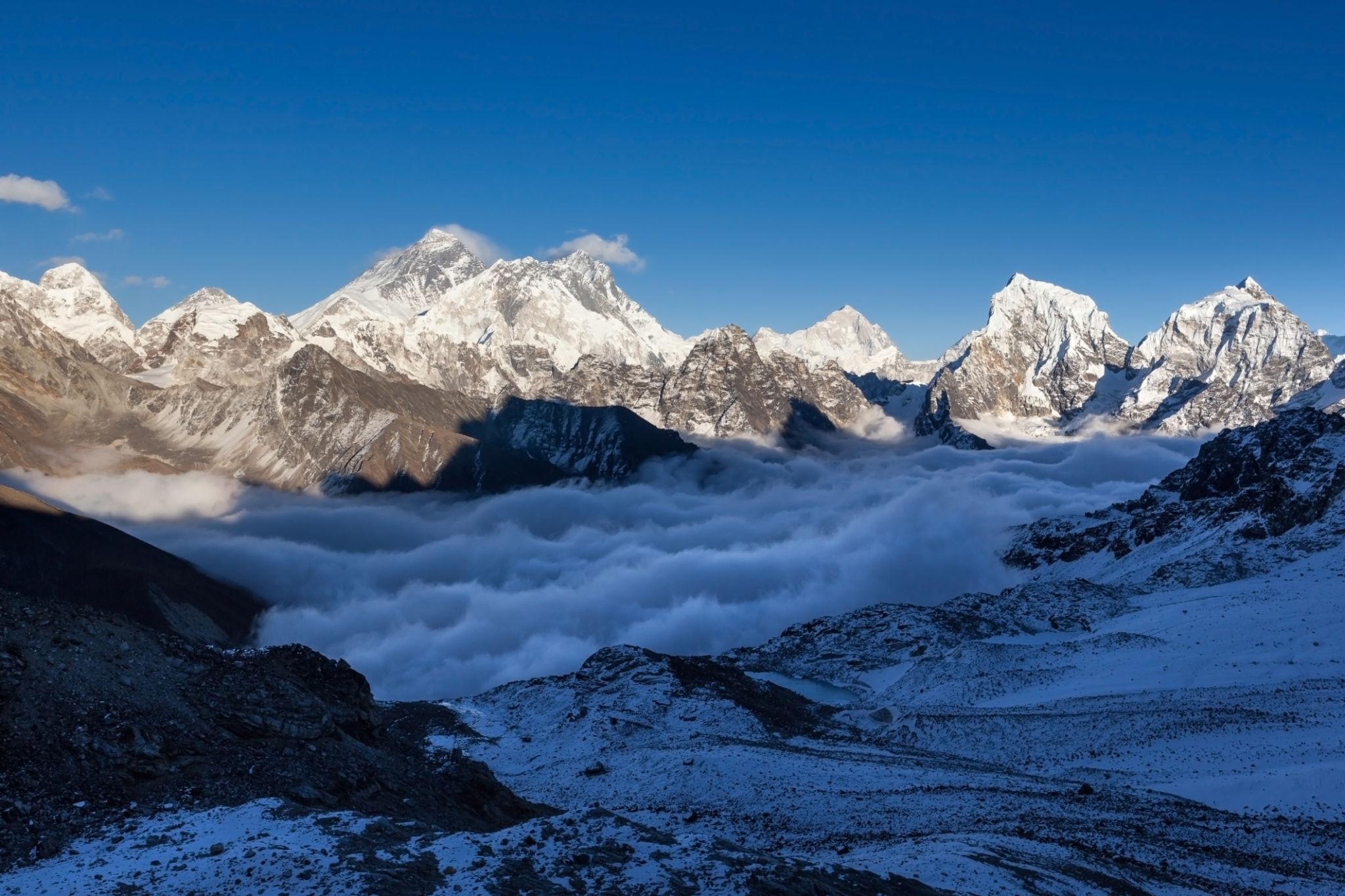
Everest Base Camp in the Khumbu region of Nepal.
Classic trekking trail in the Khumbu Valley.
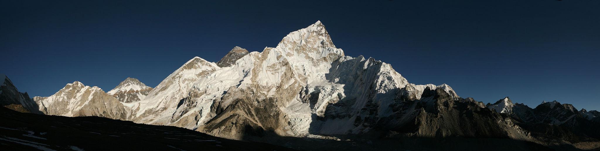
Mount Everest viewed from Kala Patthar.
Namche Bazaar, the main acclimatization town on the route.
The Everest Base Camp Trek is located in the Khumbu region of northeastern Nepal inside Sagarmatha National Park. The standard trek begins with a flight from Kathmandu to Lukla and follows the Dudh Koshi valley toward the base of Mount Everest.
The route reaches an elevation of approximately 5,364 meters at base camp. Many trekkers also ascend Kala Patthar at 5,545 meters for panoramic views. The terrain consists of stone paths, suspension bridges, glacial moraines, and high altitude valleys.
This trek is classified as high altitude trekking rather than technical mountaineering. No climbing skills are required. However, altitude exposure is significant and must be managed carefully.
Key geographical characteristics:
- Maximum altitude: 5,545 meters at Kala Patthar
- Base camp altitude: 5,364 meters
- Typical duration: 12 to 14 days
- Total walking distance: approximately 130 kilometers round trip
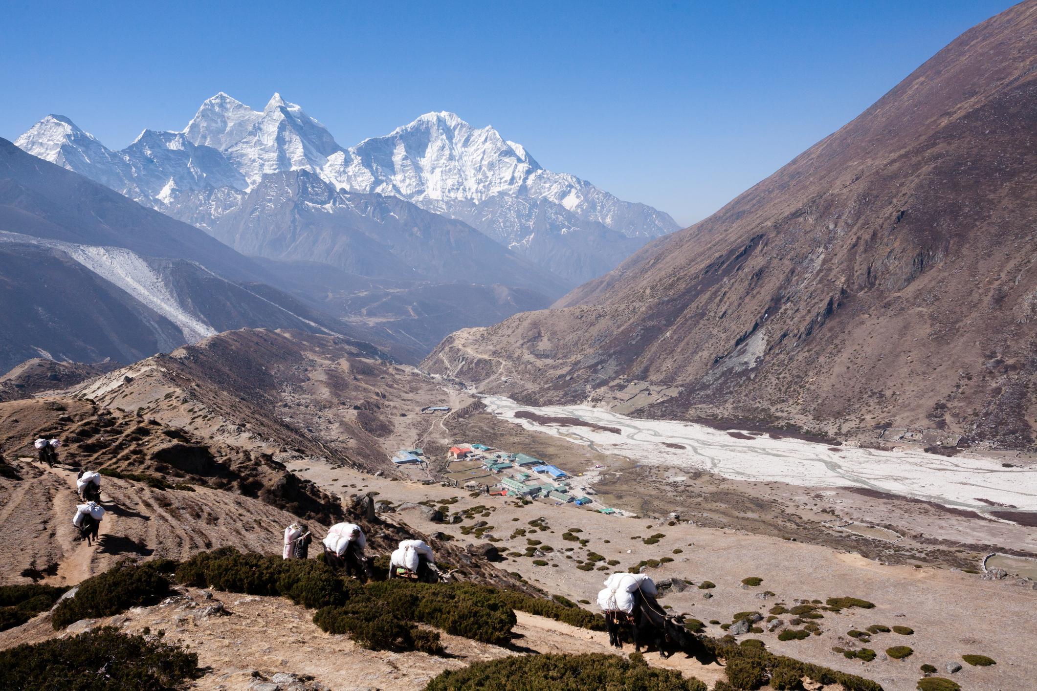
The region contains established villages such as Namche Bazaar, Tengboche, Dingboche, and Lobuche. Accommodation infrastructure is well developed compared to most high altitude trekking regions worldwide.
Access and Logistics
Access is primarily through Lukla Airport. Weather conditions frequently delay flights, especially during peak trekking seasons.
Alternative access via Jiri or Salleri exists but increases total trekking days.
Logistics include:
- Nepal tourist visa on arrival for most nationalities
- Sagarmatha National Park entry permit
- Khumbu Rural Municipality permit
Guides are not legally mandatory for Everest Base Camp as of current regulation, but solo trekking policies in Nepal may evolve. It is recommended to verify current rules before travel.
Accommodation is in teahouses. Private rooms are basic. Heating is generally limited to common dining areas.
Communication and WiFi are available at additional cost in most villages.
Complete Itinerary Breakdown
A standard 14 day itinerary includes:
Day 1: Flight to Lukla and trek to Phakding
Day 2: Phakding to Namche Bazaar
Day 3: Acclimatization in Namche
Day 4: Namche to Tengboche
Day 5: Tengboche to Dingboche
Day 6: Acclimatization in Dingboche
Day 7: Dingboche to Lobuche
Day 8: Lobuche to Everest Base Camp via Gorakshep
Day 9: Kala Patthar ascent and descend to Pheriche
Day 10 to 13: Gradual return to Lukla
Day 14: Flight to Kathmandu
Acclimatization days are essential. Skipping them increases the risk of Acute Mountain Sickness.
Physical Preparation and Fitness
The trek does not require technical climbing ability, but sustained endurance is necessary.
Daily walking time ranges from 5 to 8 hours. Elevation gain is gradual but cumulative fatigue occurs due to altitude.
Recommended preparation includes:
- Cardiovascular training for at least 8 to 10 weeks
- Stair climbing and uphill hiking practice
- Load carrying simulation with 6 to 8 kilograms
Trekkers should understand altitude symptoms such as headache, nausea, fatigue, and sleep disturbance.
Gear and Equipment Strategy
Essential equipment includes:
- Layered clothing system for temperatures ranging from 15°C to minus 15°C
- Insulated down jacket
- Four season sleeping bag rated to minus 15°C
- Trekking poles
- High quality waterproof boots
Rental equipment is available in Kathmandu but quality varies.
Weather and Objective Dangers
Primary trekking seasons:
- Pre monsoon: March to May
- Post monsoon: September to November
Winter trekking is possible but involves extreme cold and snow. Monsoon season brings heavy rain and limited mountain visibility.
Objective risks include:
- Altitude sickness
- Glacier moraine instability near base camp
- Flight cancellations due to weather
- Rare but possible rockfall in certain sections
Avalanche exposure on the standard trekking route is minimal compared to climbing routes.
Cost and Operator Selection
Estimated independent trekking costs for 12 to 14 days:
Accommodation:
USD 5 to 15 per night at lower elevations
USD 15 to 30 per night at higher elevations
Food:
USD 25 to 40 per day depending on altitude
Permits:
Approximately USD 50 combined
Flight to Lukla:
USD 180 to 220 one way
Total estimated independent budget:
USD 900 to 1,400 excluding international airfare
Guided group trek:
USD 1,200 to 2,500 depending on service level
Private guided trek:
USD 2,000 to 4,000
Porter cost:
USD 20 to 30 per day
Guided treks include permit handling, accommodation coordination, and safety management. Independent trekkers retain flexibility but assume full responsibility.
Final Professional Assessment
Everest Base Camp is one of the most accessible high altitude treks in the world. Infrastructure, rescue access, and village networks are well established. It is demanding due to altitude but does not require mountaineering skill.
In comparison with other global treks, it ranks high in altitude exposure and logistical simplicity but moderate in wilderness isolation due to heavy traffic in peak season.
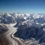
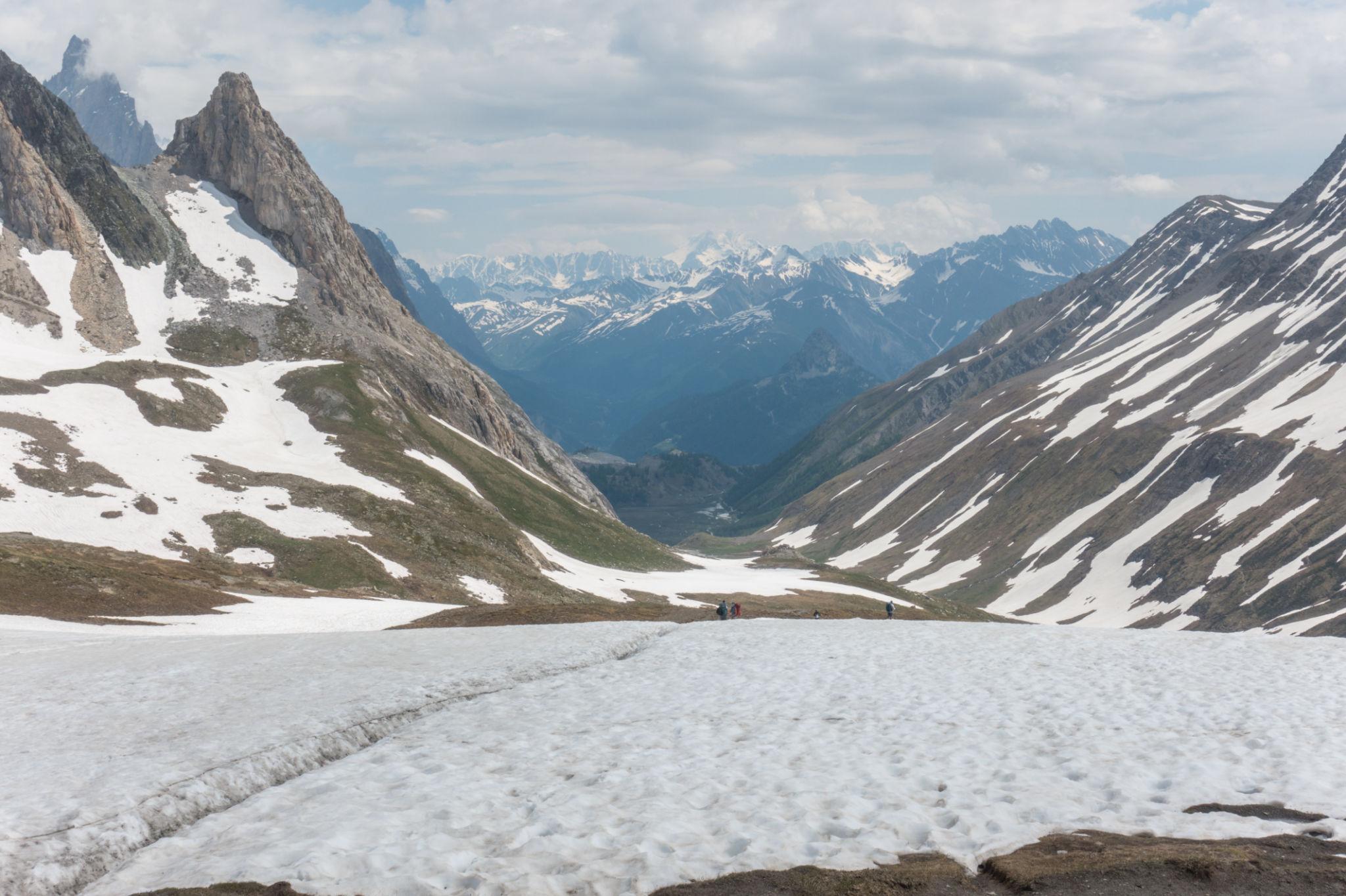
2. K2 Base Camp Trek
Understanding the Trail and Region
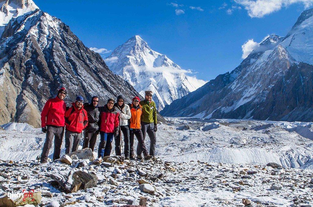
Concordia, the junction of Baltoro Glacier and Godwin Austen Glacier near K2 Base Camp.
Trekkers crossing the Baltoro Glacier in Pakistan.
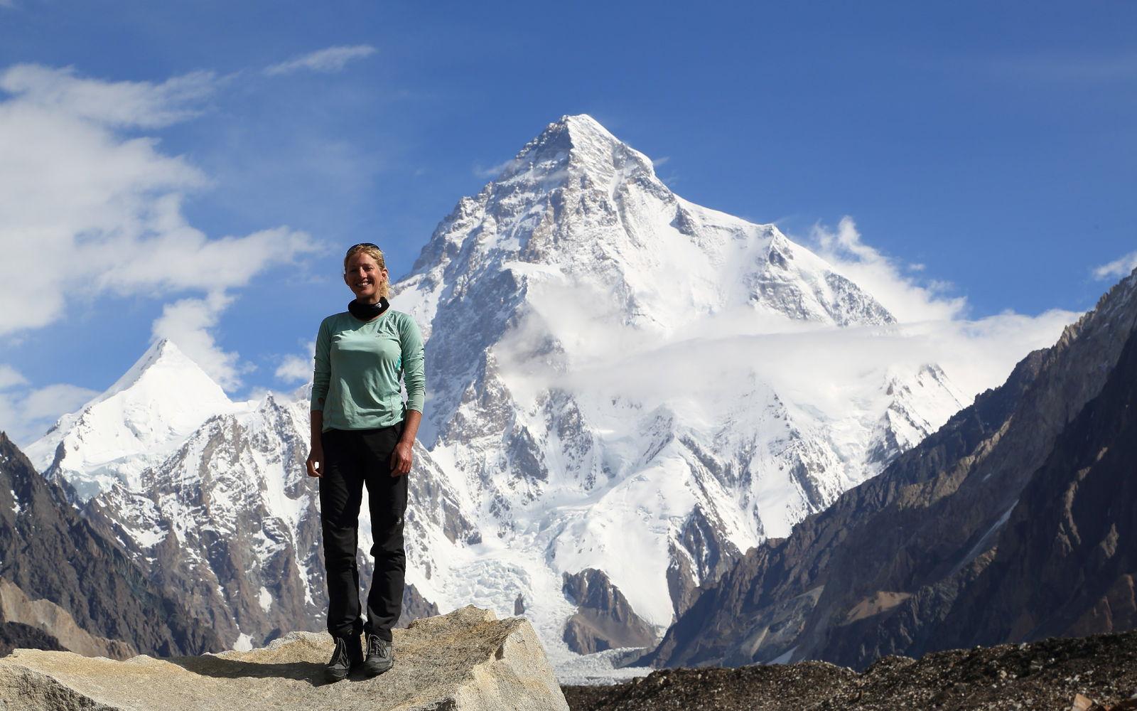
K2 viewed from the Concordia region.
Gasherbrum peaks rising above the Baltoro Glacier.
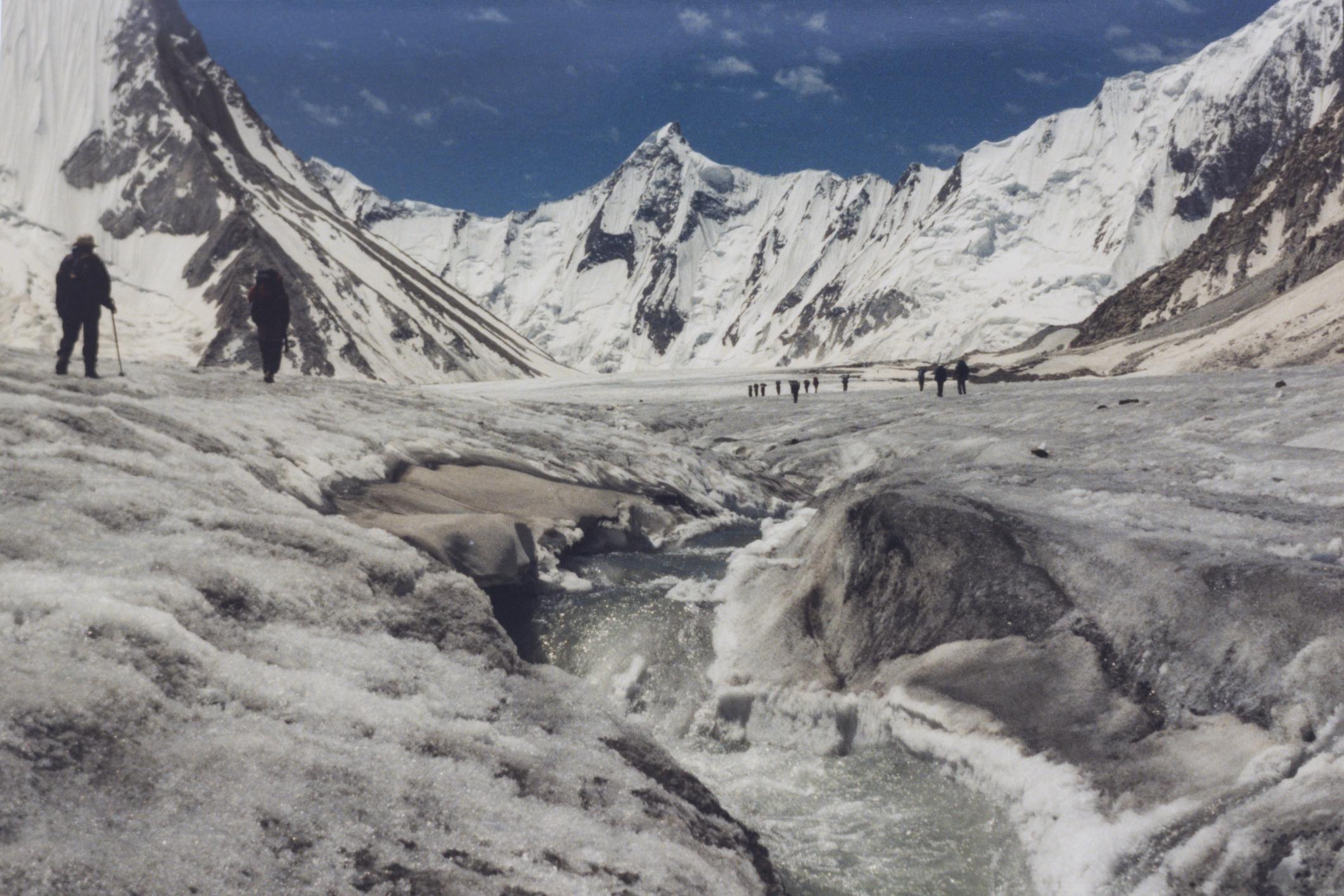
The K2 Base Camp Trek is located in the Central Karakoram range of northern Pakistan. The route follows the Baltoro Glacier to Concordia and continues to the base camp of K2 at approximately 5,150 meters.
Unlike the Everest Base Camp Trek, this route passes through a remote glacial wilderness with no permanent villages after the road head. The trek begins from the town of Skardu and requires several days of jeep travel and foot approach before reaching the main glacier.
Key geographical characteristics:
- Maximum altitude: approximately 5,150 meters at K2 Base Camp
- Concordia altitude: approximately 4,691 meters
- Typical duration: 12 to 16 days
- Total walking distance: approximately 180 to 200 kilometers round trip
The Baltoro Glacier is one of the longest non polar glaciers in the world. The surrounding peaks include K2, Broad Peak, Gasherbrum I, and Gasherbrum II. The density of 8,000 meter peaks in this area is unmatched globally.
There are no teahouses, permanent settlements, or commercial lodges along the glacier. All accommodation is in tents.
Access and Logistics
Access requires travel to Skardu, either by flight from Islamabad or by road via the Karakoram Highway.
From Skardu:
- Jeep transfer to Askole village
- Trek begins from Askole
Permit requirements include:
- Trekking permit for restricted zone
- Central Karakoram National Park entry fee
- Mandatory registered local guide
- Visa clearance and trekking clearance from Pakistani authorities
Unlike Nepal, independent trekking without a licensed guide is not permitted in the K2 region.
Logistics are expedition style. Operators arrange:
- Tents
- Kitchen staff
- Porters
- Food supplies for the full duration
There are no commercial resupply options after departure from Askole.
Complete Itinerary Breakdown
A standard 14 to 16 day itinerary includes:
Day 1: Arrival in Skardu
Day 2: Drive to Askole
Day 3: Askole to Jhola
Day 4: Jhola to Paiju
Day 5: Paiju to Urdukas
Day 6: Urdukas to Goro II
Day 7: Goro II to Concordia
Day 8: Acclimatization at Concordia
Day 9: Day trip to K2 Base Camp and return
Day 10 to 13: Return trek to Askole
Day 14: Drive to Skardu
Some itineraries include Broad Peak Base Camp extension.
Acclimatization is more gradual compared to Everest Base Camp, but terrain is more physically demanding due to moraine and glacier travel.
Physical Preparation and Fitness
The K2 Base Camp Trek is physically harder than Everest Base Camp.
Terrain factors:
- Uneven glacier surface
- Loose moraine
- Long daily walking distances
- Continuous tent camping
Daily walking time often exceeds 7 to 9 hours in certain stages.
Recommended preparation:
- Multi day backpacking experience
- Strength training for core and legs
- Glacier walking practice if possible
- Endurance training for sustained effort
Although no technical climbing is required, the isolation increases seriousness.
Gear and Equipment Strategy
Required equipment includes:
- Four season tent system provided by operator
- Sleeping bag rated to minus 20°C
- Insulated sleeping mat
- Glacier suitable trekking boots
- Gaiters for debris and ice
Unlike Everest Base Camp, there are no lodges for warmth or shelter in emergencies.
Satellite communication devices are recommended for independent expedition teams.
Weather and Objective Dangers
Primary trekking window:
- Late June to early September
Spring and autumn are generally not viable due to snow conditions and temperature extremes.
Objective risks include:
- Rockfall from surrounding slopes
- Glacier crevasses
- River crossings early in season
- Sudden snowstorms
- Limited evacuation options
Helicopter evacuation is possible but weather dependent and expensive.
The remoteness of the Karakoram increases operational risk compared to the Everest region.
Cost and Operator Selection
Independent trekking is not legally permitted in this region.
Typical fully organized 14 to 16 day trek cost:
USD 2,200 to 4,000 depending on group size and service level
Cost includes:
- Permits
- Guide
- Porters
- Camping equipment
- Food
- Transportation from Skardu
Estimated breakdown:
Park and trekking permits:
USD 200 to 300
Staff wages and logistics:
Major component of total cost
Food and supplies:
Included in package
Helicopter evacuation insurance:
Strongly recommended
Guided cost is significantly higher than Everest Base Camp due to remoteness and staffing requirements.
Final Professional Assessment
K2 Base Camp is more remote, more physically demanding, and less commercially developed than Everest Base Camp.
Comparison factors:
Altitude exposure:
Slightly lower maximum altitude than Everest Base Camp
Infrastructure:
Minimal infrastructure compared to Nepal
Isolation:
Significantly higher
Cost:
Higher overall expedition cost
Scenic concentration of high peaks:
Greater density of 8,000 meter mountains than Everest region
For trekkers seeking structured support, village infrastructure, and easier evacuation access, Everest Base Camp is more suitable.
For trekkers seeking wilderness scale, glacial terrain, and fewer crowds, K2 Base Camp provides a more isolated high mountain environment.
3. Inca Trail to Machu Picchu
Understanding the Trail and Region
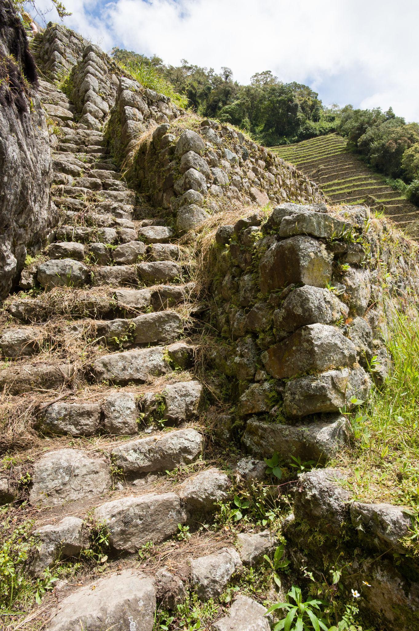
Stone-paved section of the Inca Trail in the Andes of Peru.
Dead Woman’s Pass, the highest point on the Inca Trail.
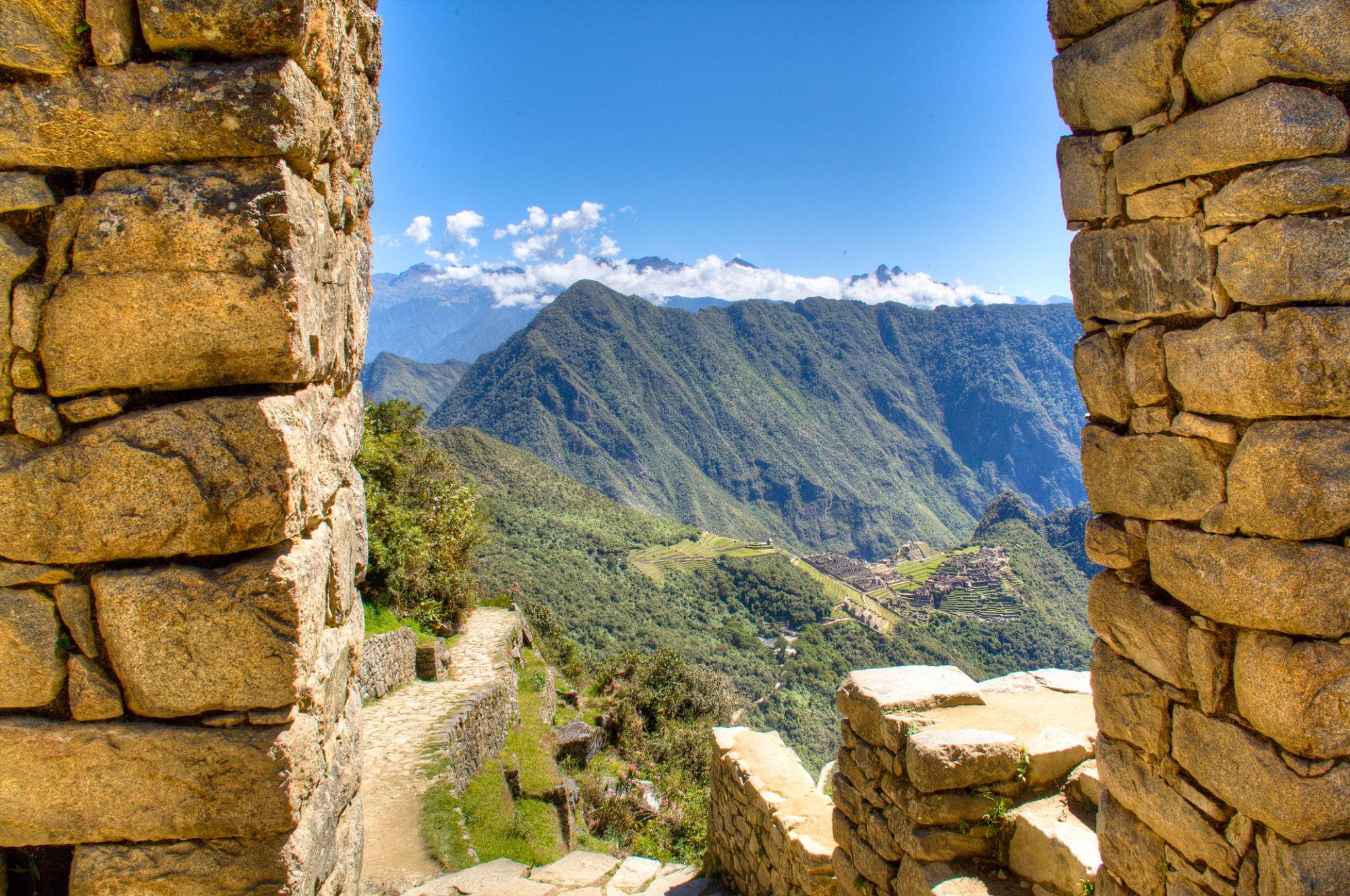
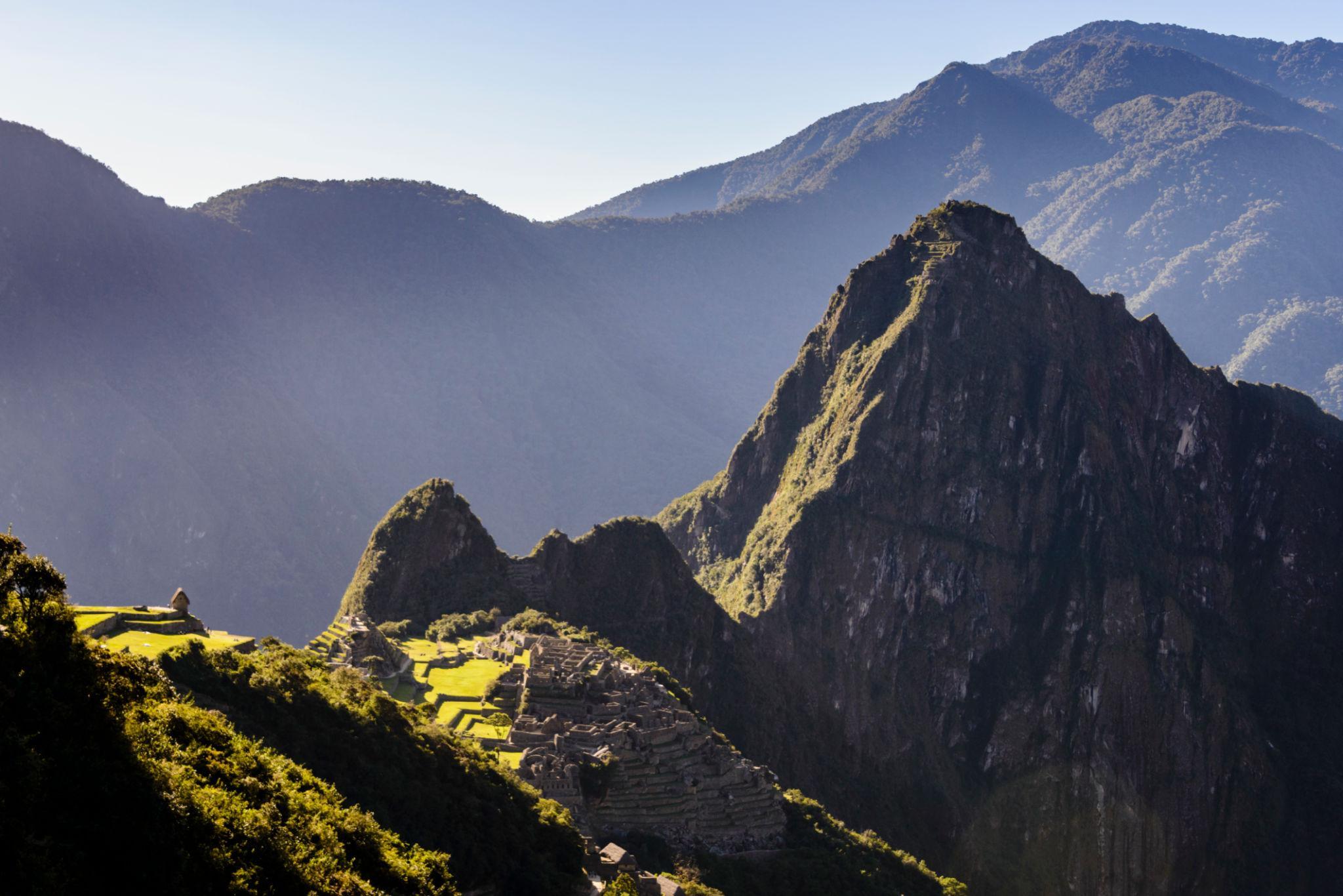
First view of Machu Picchu from the Sun Gate.
Archaeological ruins located along the Inca Trail route.
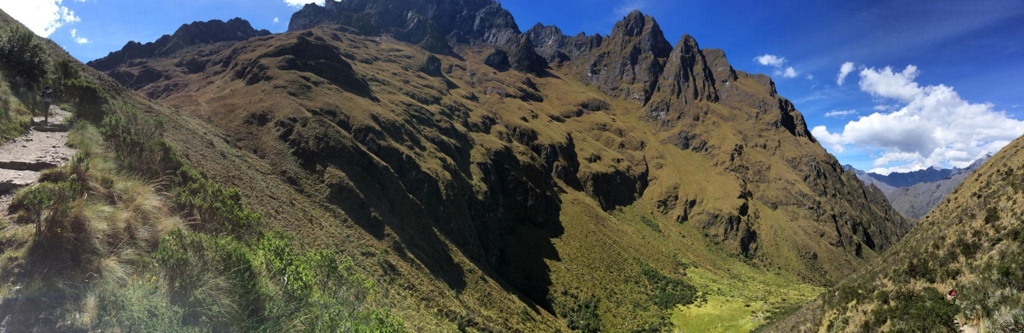
The Inca Trail is a regulated trekking route in southern Peru that leads to Machu Picchu. The trail follows original Inca stone paths through the Andes Mountains and passes multiple archaeological sites before reaching the Sun Gate above Machu Picchu.
The classic route covers approximately 42 kilometers over four days. The highest point is Dead Woman’s Pass at 4,215 meters. Compared to Himalayan treks, the altitude is moderate, but the trail includes steep ascents and descents on stone steps.
Key geographical characteristics:
- Maximum altitude: 4,215 meters
- Duration: 4 days standard itinerary
- Total distance: approximately 42 kilometers
- Region: Andes Mountains near Cusco
The trail combines mountain terrain with cultural heritage value. It is both a trekking route and an archaeological corridor.
Access and Logistics
Access begins in Cusco. Trekkers travel by road to the official trailhead at Km 82.
Permit system:
- Strict daily permit quota
- Mandatory licensed guide
- Only authorized operators can provide access
- Permits often sell out several months in advance
Independent trekking is not permitted on the Inca Trail.
Entry to Machu Picchu is included in the permit package. Passport details are required during booking.
Accommodation is camping only. Porters carry tents, cooking equipment, and food.
Complete Itinerary Breakdown
Standard four day itinerary:
Day 1: Trailhead to Wayllabamba
Day 2: Wayllabamba to Pacaymayo via Dead Woman’s Pass
Day 3: Pacaymayo to Wiñay Wayna
Day 4: Early hike to Sun Gate and descent to Machu Picchu
The second day is physically the most demanding due to steep ascent.
Some shorter two day versions exist but do not provide full high pass crossing.
Physical Preparation and Fitness
Although shorter than Himalayan treks, the Inca Trail requires strong leg endurance.
Challenges include:
- Continuous stone steps
- High humidity during rainy season
- Steep ascents and descents
Recommended preparation:
- Stair climbing training
- Multi day hiking experience
- Moderate altitude adaptation
Altitude sickness risk is lower than Everest or K2, but acclimatization in Cusco for two days before starting is recommended.
Gear and Equipment Strategy
Essential gear includes:
- Lightweight trekking boots
- Rain protection layer
- Trekking poles
- Sleeping bag rated to 0°C
- Sun protection due to high UV exposure
Operators provide tents and meals. Porters carry group equipment.
Weight restrictions apply for personal duffel bags.
Weather and Objective Dangers
Primary trekking season:
- May to September is the dry season
Rainy season:
- November to March
- Trail closure typically occurs in February for maintenance
Objective risks include:
- Slippery stone surfaces during rain
- Heat exposure at lower elevations
- Minor altitude related symptoms
The route is well maintained and monitored.
Cost and Operator Selection
Typical cost for 4 day Inca Trail:
USD 600 to 1,200 depending on operator level
Cost includes:
- Permit
- Guide
- Porters
- Food
- Camping equipment
- Machu Picchu entry
Accommodation in Cusco before and after trek:
USD 20 to 80 per night
Food in Cusco:
USD 10 to 25 per day
Estimated total 7 day Peru trekking budget including acclimatization:
USD 900 to 1,600 excluding international flights
Because permits are limited, price competition is moderate and demand driven.
Final Professional Assessment
The Inca Trail differs significantly from Everest Base Camp and K2 Base Camp.
Comparison factors:
Altitude exposure:
Lower than Himalayan treks
Cultural heritage:
Higher concentration of archaeological sites
Infrastructure:
Strictly regulated with fixed capacity
Duration:
Shorter overall
Remoteness:
Moderate, with controlled access
The Inca Trail is suitable for trekkers seeking a structured, culturally significant route with moderate altitude exposure and controlled logistics.
4. Torres del Paine W Trek
Understanding the Trail and Region
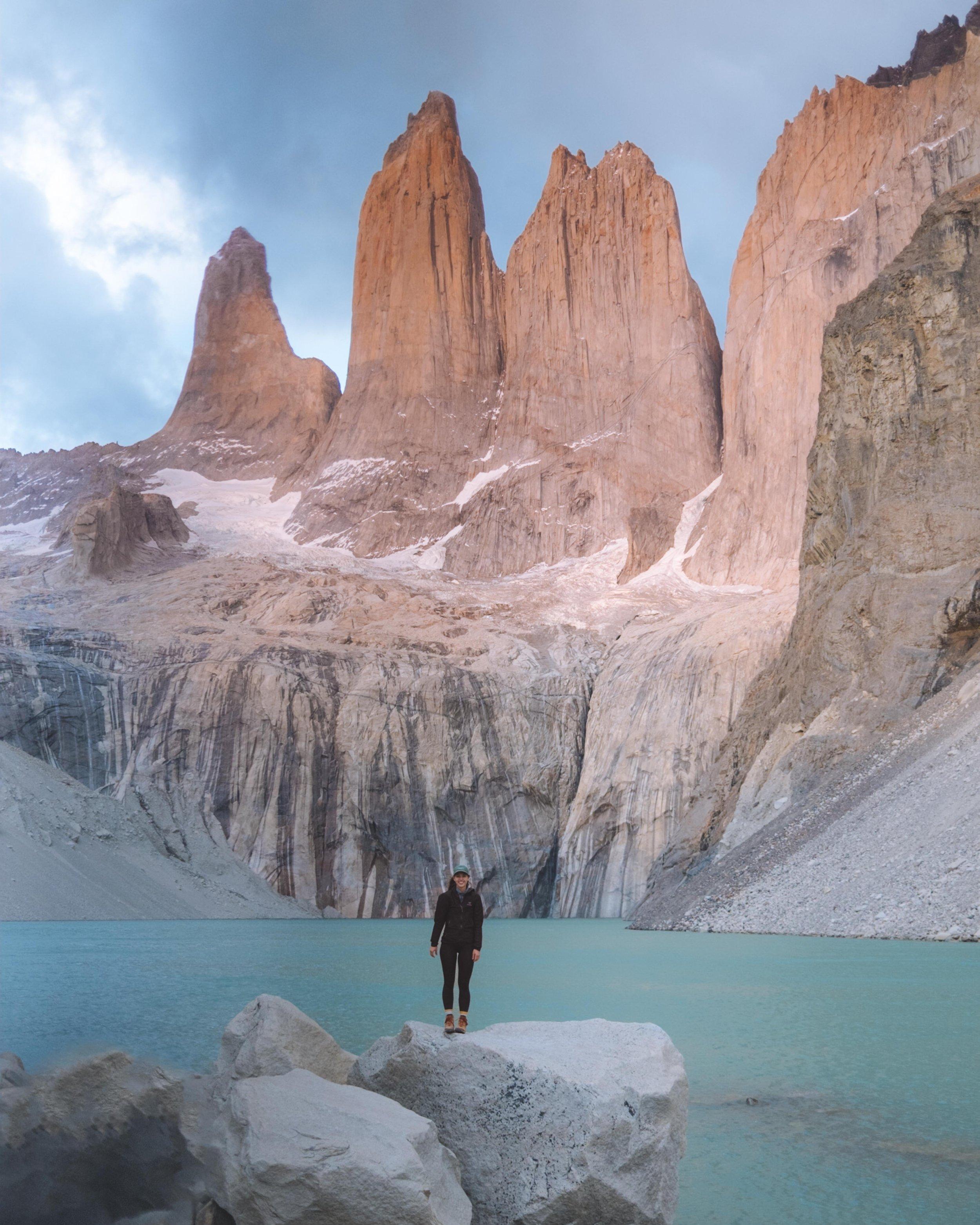
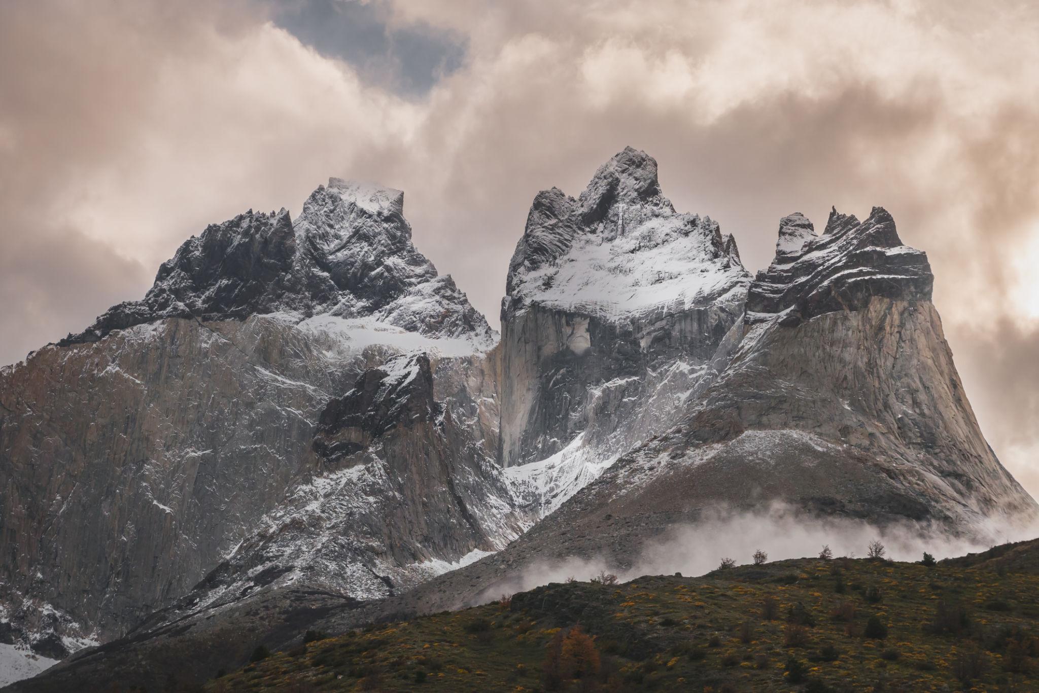
The granite towers of Torres del Paine in southern Chile.
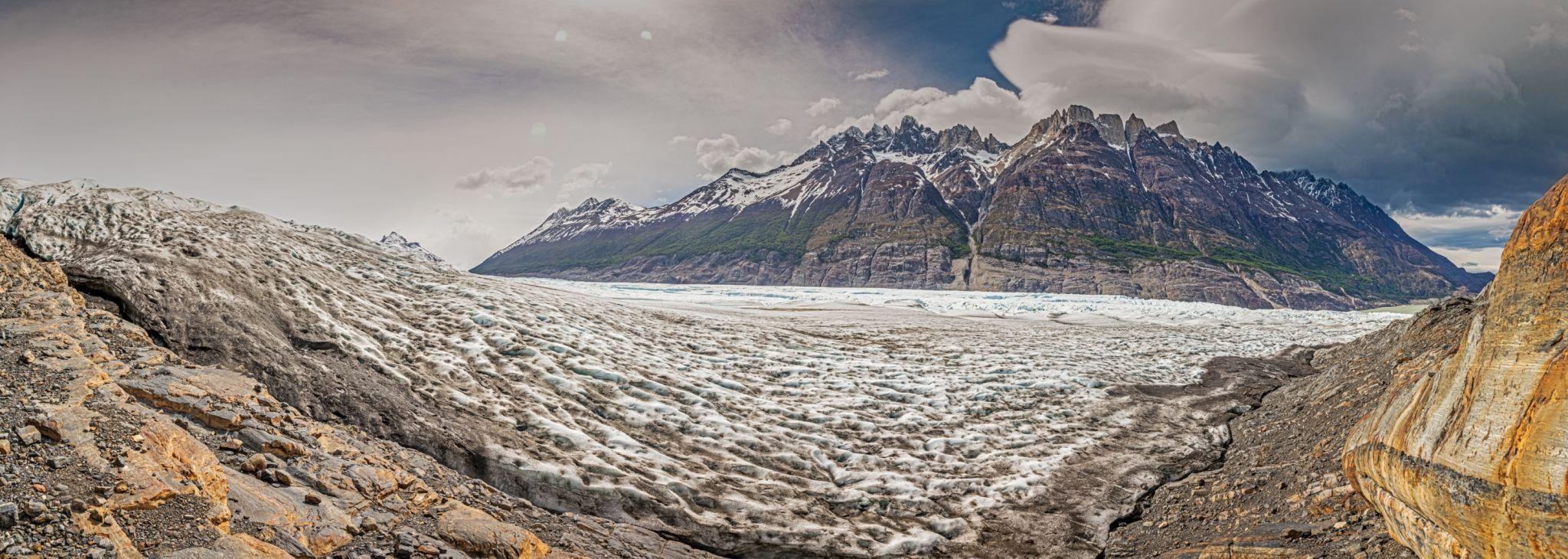
Grey Glacier within Torres del Paine National Park.
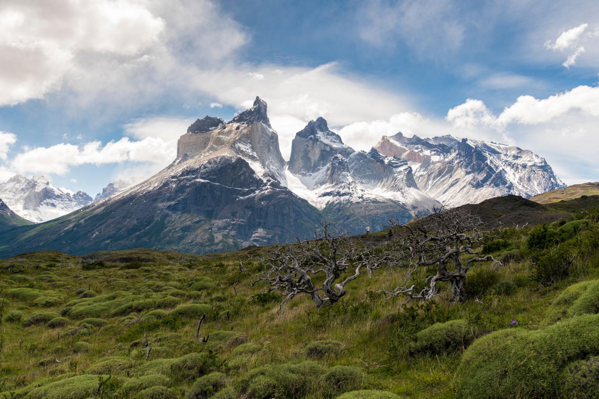
The Cuernos del Paine peaks above Lake Nordenskjöld.
Marked hiking trail in Patagonia’s Torres del Paine National Park.
The W Trek is located inside Torres del Paine National Park in southern Chilean Patagonia. The route forms a W shaped circuit that connects three major valleys: the Base of the Towers, the French Valley, and the Grey Glacier sector.
The trek ranges from 70 to 80 kilometers depending on the chosen start and finish points. Elevations are relatively low compared to Himalayan routes. The highest points are generally under 1,200 meters. The difficulty is influenced more by weather conditions and wind exposure than by altitude.
Key geographical characteristics:
- Maximum elevation: approximately 900 to 1,200 meters depending on route variation
- Duration: 4 to 5 days standard
- Total distance: approximately 70 to 80 kilometers
- Environment: Glacial lakes, granite peaks, Patagonian steppe, temperate forests
Unlike Everest or K2 Base Camp, the W Trek does not involve altitude acclimatization. Weather and wind are the primary environmental variables.
Access and Logistics
Access is via Puerto Natales. Travelers typically fly to Punta Arenas and continue by bus to Puerto Natales.
From Puerto Natales:
- Bus transfer to Torres del Paine National Park
- Ferry option for Grey Glacier sector
- Clearly marked trail system
Permit and reservation system:
- Park entrance ticket required
- Advance booking required for campsites and refugios
- Independent trekking allowed
- No mandatory guide requirement
Accommodation options include:
- Designated campsites
- Refugios with dormitory style lodging
- Full board packages in refugios
The reservation system is strict. Entry without confirmed accommodation is not allowed during peak season.
Complete Itinerary Breakdown
A standard 5 day itinerary:
Day 1: Transfer to park and hike to Base of the Towers
Day 2: Torres sector to Los Cuernos or French Valley sector
Day 3: French Valley exploration
Day 4: French Valley to Grey Glacier
Day 5: Grey Glacier return and exit
A shorter 4 day version condenses certain sections.
Trail signage is clear. Navigation is straightforward in good visibility.
Physical Preparation and Fitness
The W Trek requires moderate endurance.
Daily walking time ranges from 6 to 8 hours.
Primary challenges:
- Strong Patagonian winds
- Rapid weather changes
- Long exposed sections
Altitude is not a limiting factor. However, uneven terrain and sustained distance require preparation.
Recommended preparation:
- Multi day hiking experience
- Conditioning for wind exposure
- Training with a loaded backpack if trekking independently
Gear and Equipment Strategy
Essential equipment includes:
- Waterproof shell jacket and pants
- Wind resistant outer layer
- Layered clothing system
- Lightweight tent if camping
- Trekking poles
Weather can shift from clear to storm conditions within hours.
Gear emphasis is on wind protection rather than extreme cold protection.
Weather and Objective Dangers
Primary trekking season:
- November to March
Off season trekking is limited due to snow and facility closures.
Objective risks include:
- High wind gusts exceeding 80 kilometers per hour
- Hypothermia risk during storms
- Slippery trails during rain
- River crossings in early season
The park has ranger stations and defined evacuation routes. Compared to K2 Base Camp, evacuation access is significantly easier.
Cost and Operator Selection
Estimated independent 5 day trekking budget:
Park entrance fee:
Approximately USD 30 to 50 depending on nationality
Campsite cost:
USD 15 to 25 per night
Refugio dormitory:
USD 50 to 120 per night
Food:
USD 20 to 40 per day if self managed
Full board refugio packages increase cost significantly
Transportation:
USD 30 to 60 round trip from Puerto Natales
Estimated total 7 to 8 day Patagonia trekking budget including accommodation in Puerto Natales:
USD 700 to 1,500 depending on accommodation type
Guided package cost:
USD 1,200 to 2,500
Compared to Everest Base Camp and K2 Base Camp, overall cost is moderate and logistics are simpler.
Final Professional Assessment
Torres del Paine W Trek differs significantly from high altitude Himalayan and Karakoram routes.
Comparison factors:
Altitude exposure:
Minimal compared to Everest and K2
Infrastructure:
Well managed with strict reservation control
Weather variability:
High wind exposure and rapid storms
Remoteness:
Moderate, but with structured park oversight
Physical demand:
Moderate endurance based rather than altitude based
The W Trek is suitable for trekkers seeking glacial landscapes and mountain scenery without high altitude exposure.
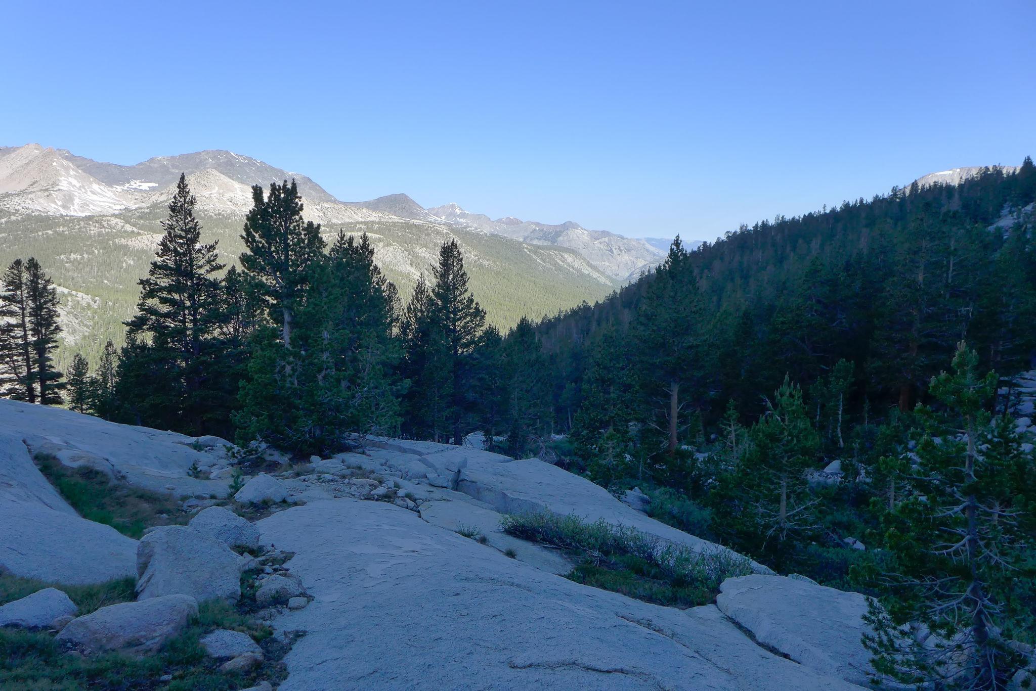
5. Annapurna Circuit Trek
Understanding the Trail and Region
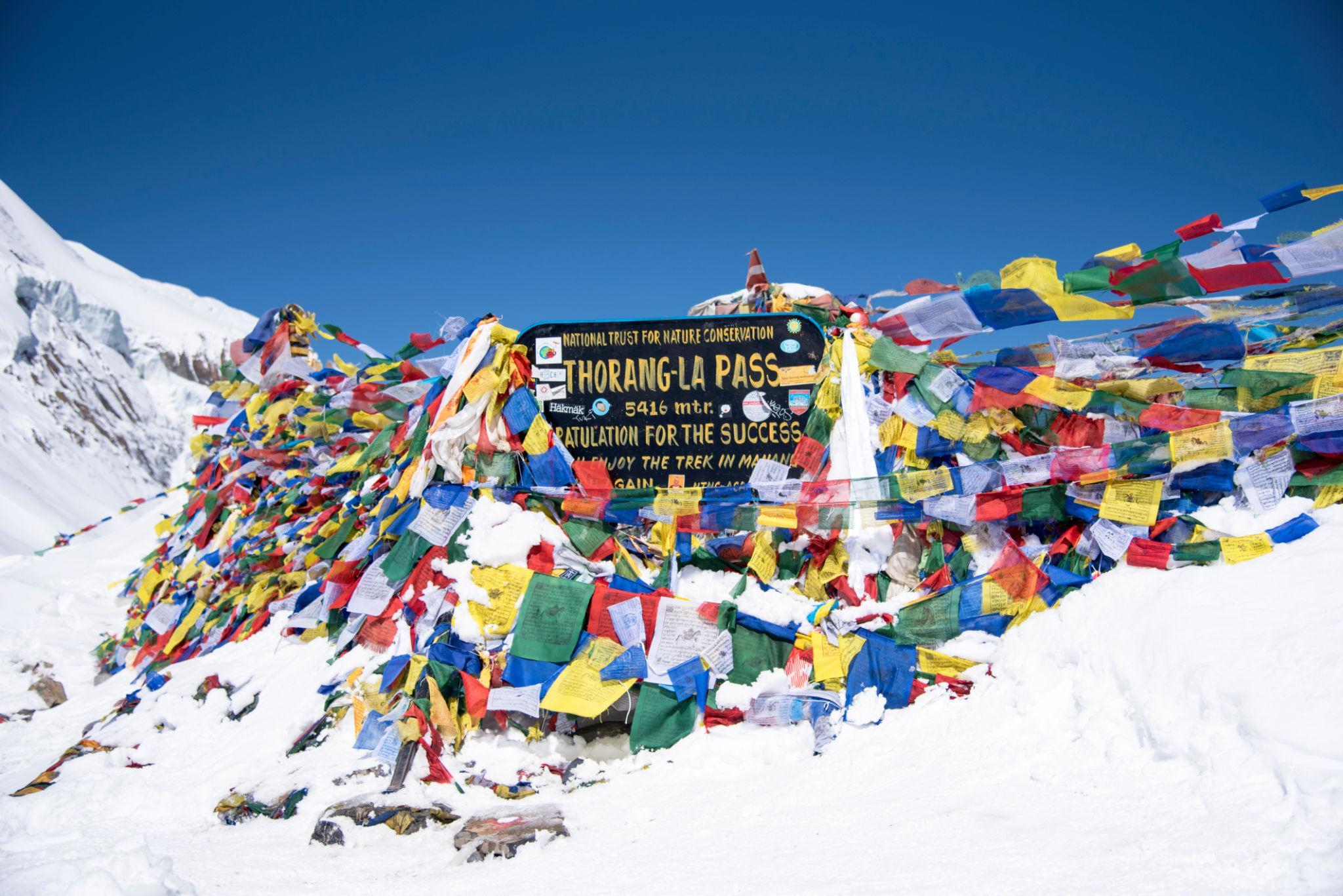
Thorong La Pass, the highest point on the Annapurna Circuit.
Manang village along the upper Annapurna Circuit.
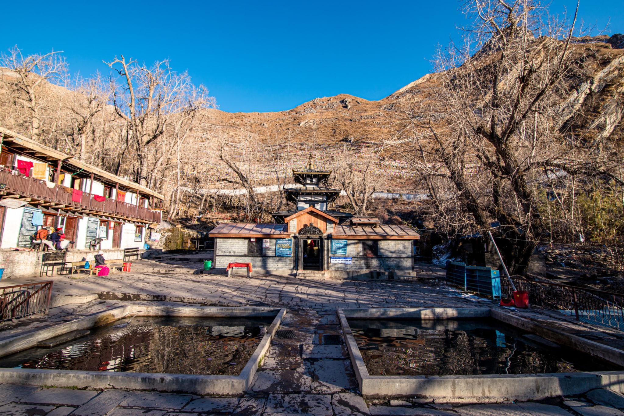
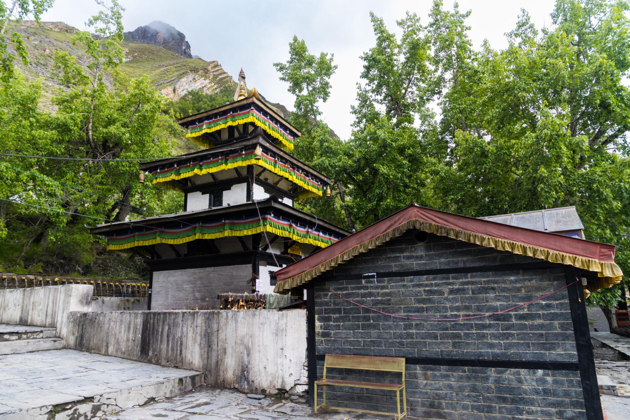
Muktinath Temple in the Mustang region.
Marshyangdi Valley in the lower Annapurna region.
The Annapurna Circuit is one of Nepal’s longest and most geographically diverse trekking routes. It circles the Annapurna Massif and crosses Thorong La Pass at 5,416 meters.
Unlike the Everest Base Camp Trek, which follows a single valley, the Annapurna Circuit transitions through multiple climatic zones. The route begins in subtropical lowlands and gradually ascends into alpine and high altitude desert terrain.
Key geographical characteristics:
- Maximum altitude: 5,416 meters at Thorong La Pass
- Typical duration: 14 to 18 days depending on road usage
- Total distance: historically 200 kilometers, now shorter due to road construction
- Region: Central Nepal, Annapurna Conservation Area
The circuit provides broader landscape variation compared to Everest Base Camp. Cultural exposure includes Gurung, Manangi, and Tibetan influenced communities.
Access and Logistics
Access begins from Kathmandu or Pokhara.
Common starting points:
- Besisahar
- Jagat
- Chame
Road expansion has reduced trekking length in lower sections. Many trekkers now start higher to avoid road walking.
Permit requirements:
- Annapurna Conservation Area Permit
- TIMS card
Guides are not strictly mandatory, but Nepal’s trekking regulations may require licensed guides depending on updated enforcement policies.
Accommodation is in teahouses throughout most of the route. Infrastructure is comparable to the Everest region, although less concentrated.
Complete Itinerary Breakdown
A standard 16 day itinerary includes:
Day 1: Drive to Besisahar
Day 2 to 6: Gradual ascent through Chame to Manang
Day 7: Acclimatization in Manang
Day 8 to 9: Manang to Thorong Phedi
Day 10: Cross Thorong La Pass to Muktinath
Day 11 to 14: Descend through Jomsom and Tatopani
Day 15 to 16: Return to Pokhara
Variations exist depending on starting and ending road access.
Acclimatization at Manang is essential before crossing Thorong La.
Physical Preparation and Fitness
The Annapurna Circuit requires sustained endurance over a longer period than Everest Base Camp.
Challenges include:
- Long daily distances
- High altitude pass crossing
- Variable weather conditions
The pass day is physically demanding due to early start and high elevation exposure.
Recommended preparation:
- Multi week endurance training
- Practice hiking at altitude if possible
- Cardiovascular conditioning
Altitude risk is significant at Thorong La. Gradual ascent profile reduces risk compared to rapid ascent routes.
Gear and Equipment Strategy
Essential equipment includes:
- Layered clothing for temperature variation
- Insulated jacket for high pass crossing
- Waterproof outer shell
- Quality trekking boots
- Trekking poles
Temperatures vary widely from lower valleys to high pass conditions.
Sleeping bags rated to minus 10°C are generally sufficient during peak seasons.
Weather and Objective Dangers
Primary trekking seasons:
- March to May
- September to November
Winter crossings are possible but risky due to snow accumulation at Thorong La.
Objective risks include:
- Altitude sickness
- Snowstorms near the pass
- Landslides in lower valleys during monsoon
Evacuation via helicopter is available in major villages.
Compared to K2 Base Camp, evacuation and infrastructure are significantly more accessible.
Cost and Operator Selection
Estimated independent 16 day trekking budget:
Accommodation:
USD 5 to 20 per night
Food:
USD 20 to 35 per day
Permits:
Approximately USD 50 combined
Transportation:
USD 30 to 80 depending on road access
Estimated total independent cost:
USD 900 to 1,400 excluding international airfare
Guided trek cost:
USD 1,200 to 2,500 depending on service level
Porter cost:
USD 20 to 30 per day
Compared to Everest Base Camp, overall costs are similar but can be slightly lower depending on itinerary length.
Final Professional Assessment
The Annapurna Circuit offers greater geographic diversity than Everest Base Camp. It includes varied ecosystems, cultural transitions, and a high altitude pass crossing.
Comparison factors:
Altitude exposure:
Comparable to Everest Base Camp at maximum elevation
Route diversity:
Greater landscape variation
Infrastructure:
Well developed but more spread out
Duration:
Longer overall
Remoteness:
Moderate, less isolated than K2 Base Camp
The Annapurna Circuit suits trekkers seeking extended duration, varied terrain, and cultural immersion with established infrastructure.
6. Tour du Mont Blanc
Understanding the Trail and Region
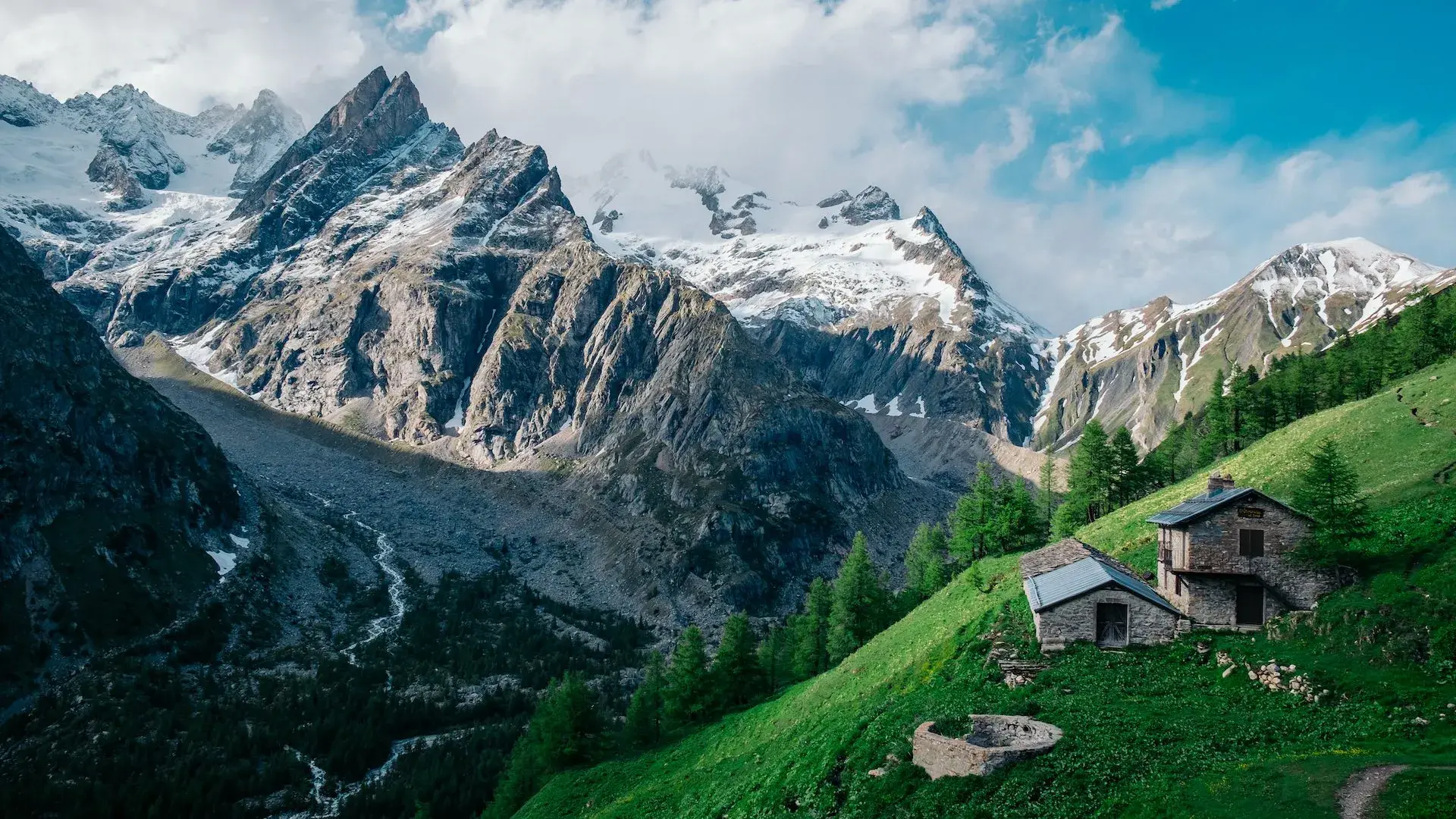
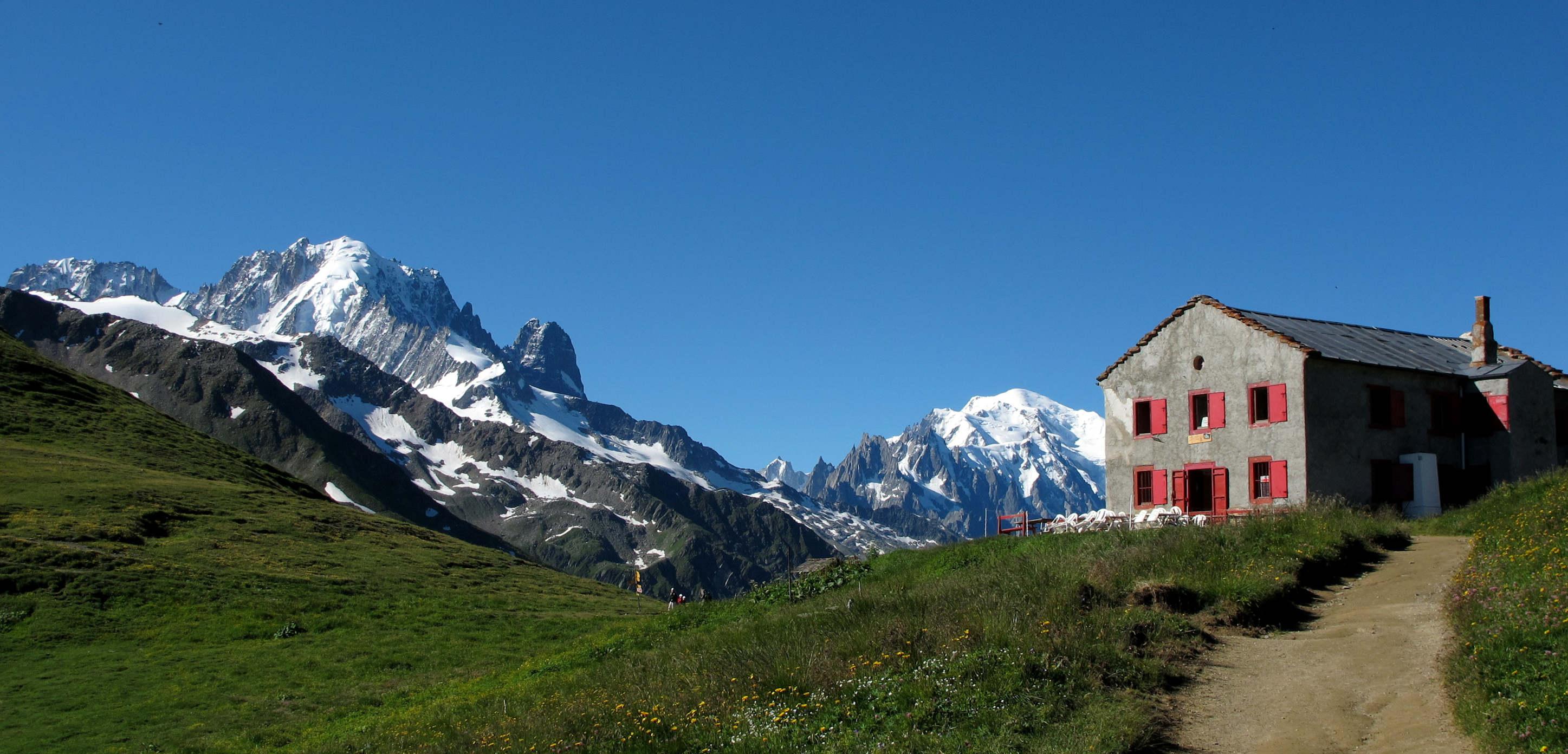
Section of the Tour du Mont Blanc trail in the Alps.
Mont Blanc massif viewed from Col de la Seigne.
Mountain refuge along the Tour du Mont Blanc route.
Chamonix, one of the main starting points for the circuit.
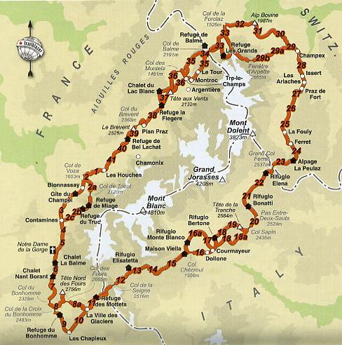
The Tour du Mont Blanc is a long distance alpine circuit that passes through France, Italy, and Switzerland. It circles the Mont Blanc massif and covers approximately 170 kilometers.
The route is not a high altitude Himalayan style trek. The maximum elevation is around 2,665 meters at Col des Fours, depending on route variation. The challenge comes from cumulative ascent and descent rather than altitude exposure.
Key geographical characteristics:
- Maximum elevation: approximately 2,500 to 2,665 meters
- Duration: 8 to 12 days
- Total distance: approximately 170 kilometers
- Region: Western European Alps
The trail crosses alpine meadows, glacial valleys, and mountain passes. It is well marked and heavily used during peak season.
Access and Logistics
Primary access towns:
- Chamonix in France
- Courmayeur in Italy
- Les Houches in France
International access is straightforward via Geneva Airport.
Permit requirements:
- No trekking permit required
- No mandatory guide requirement
- No park entry quota system
Accommodation options include:
- Mountain refuges
- Hotels in villages
- Designated campsites
Advance booking is recommended during summer.
The trail is supported by extensive infrastructure including road access points and public transport links.
Complete Itinerary Breakdown
A standard 11 day itinerary may include:
Day 1: Les Houches to Les Contamines
Day 2: Les Contamines to Les Chapieux
Day 3: Les Chapieux to Courmayeur
Day 4: Courmayeur to Refuge Bonatti
Day 5: Refuge Bonatti to La Fouly
Day 6: La Fouly to Champex
Day 7: Champex to Trient
Day 8: Trient to Argentière
Day 9: Argentière to La Flégère
Day 10: La Flégère to Les Houches
Variations exist with alternate high routes.
Daily elevation gain often exceeds 800 to 1,200 meters.
Physical Preparation and Fitness
The Tour du Mont Blanc requires consistent endurance and leg strength.
Challenges include:
- Repeated steep ascents and descents
- Long daily hiking hours
- Variable alpine weather
Altitude sickness is not a major factor due to moderate elevation.
Recommended preparation:
- Cardiovascular endurance training
- Strength conditioning for downhill walking
- Multi day hiking experience
Fitness requirement is moderate to high depending on pace.
Gear and Equipment Strategy
Essential equipment includes:
- Waterproof jacket and pants
- Lightweight insulated layer
- Hiking boots suitable for rocky alpine terrain
- Trekking poles
Extreme cold weather gear is generally unnecessary during summer.
Because villages are accessible, resupply is possible along the route.
Weather and Objective Dangers
Primary trekking season:
- Late June to September
Early season may include snow on high passes.
Objective risks include:
- Thunderstorms
- Slippery alpine trails
- Snow patches at higher passes
- Heat exposure during warm spells
Evacuation is straightforward due to road access and mountain rescue services.
Compared to Everest Base Camp and K2 Base Camp, objective risk level is significantly lower.
Cost and Operator Selection
Estimated independent 10 to 12 day trekking budget:
Accommodation in refuges:
USD 40 to 80 per night
Hotels:
USD 80 to 200 per night
Food:
USD 25 to 50 per day
Transportation:
USD 50 to 150 depending on arrival route
Estimated total independent cost:
USD 1,200 to 2,500 depending on accommodation choice
Guided tour cost:
USD 2,500 to 4,500
Compared to Himalayan treks, daily costs are higher due to European pricing structures.
Final Professional Assessment
The Tour du Mont Blanc differs from Himalayan and Karakoram treks in several key areas.
Comparison factors:
Altitude exposure:
Low compared to Everest Base Camp and Annapurna Circuit
Infrastructure:
Highly developed
International border crossing:
Three country route
Risk profile:
Lower objective hazard
Cost:
Higher daily expenses
The Tour du Mont Blanc is suitable for trekkers seeking alpine scenery, structured infrastructure, and moderate physical challenge without high altitude exposure.
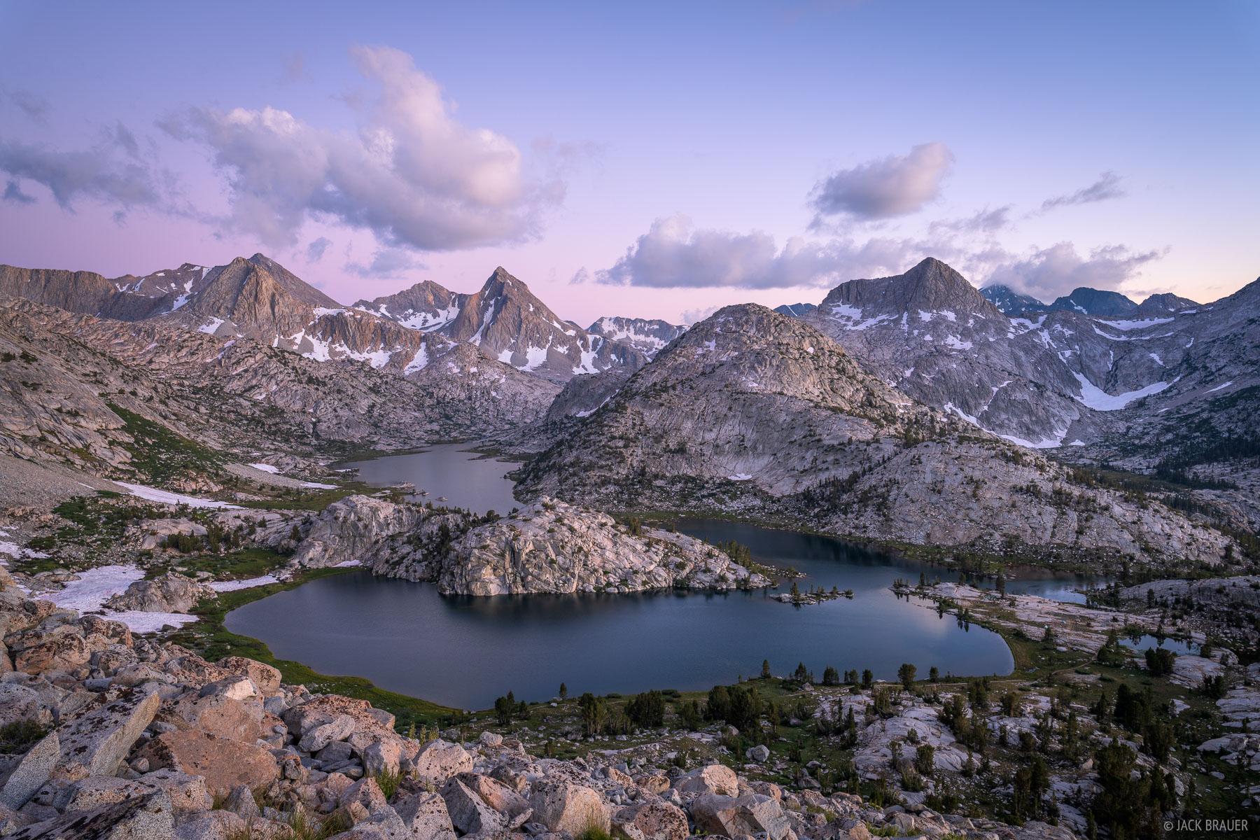
7. John Muir Trail
Understanding the Trail and Region
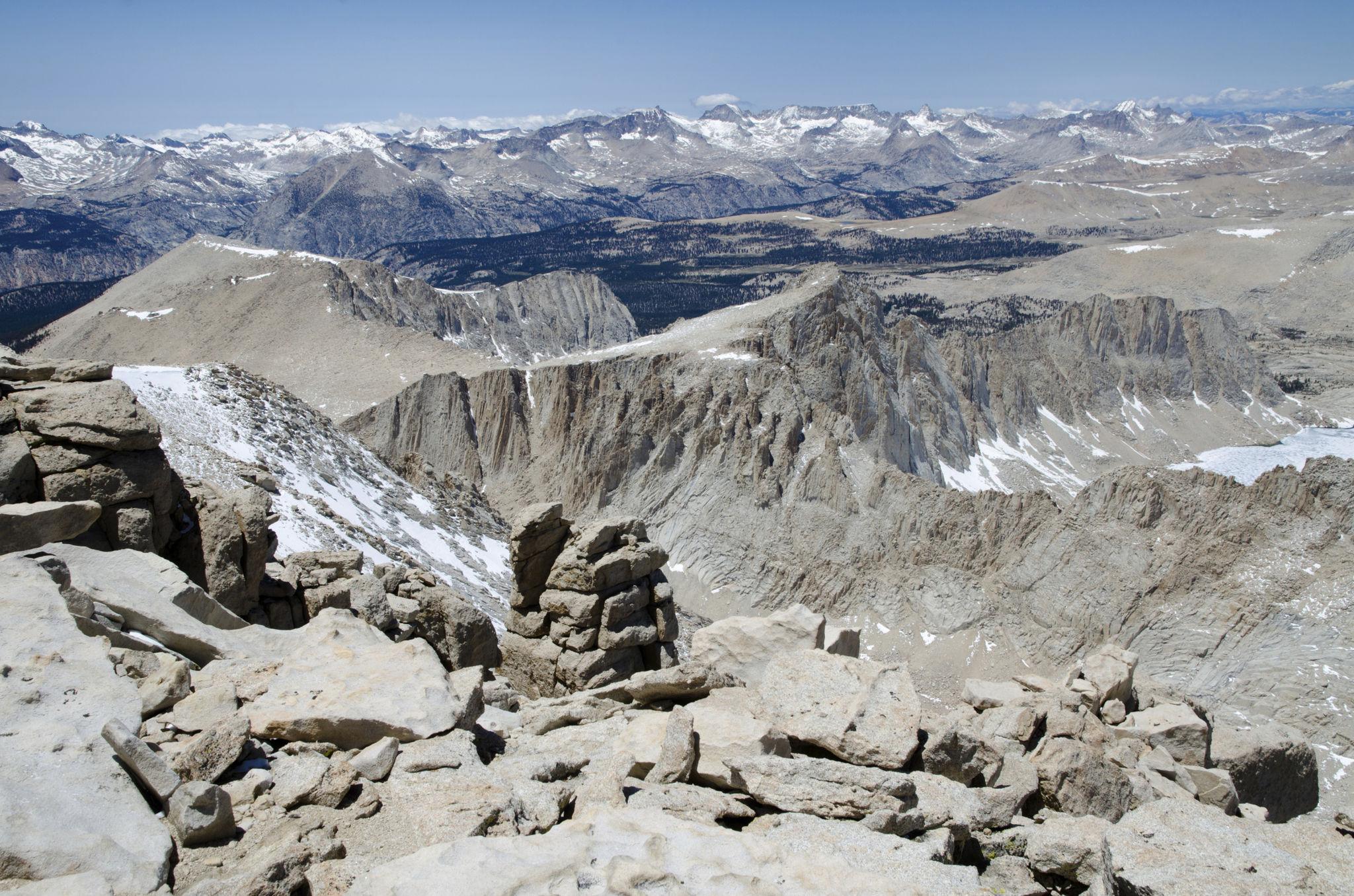
Section of the John Muir Trail in the Sierra Nevada mountains.
Mount Whitney, the highest point on the John Muir Trail.
Evolution Valley along the central section of the trail.
Backcountry trail in Yosemite National Park.
The John Muir Trail is a long distance wilderness trail in California, United States. It runs approximately 340 kilometers from Yosemite Valley to Mount Whitney. The route passes through Yosemite National Park, Kings Canyon National Park, and Sequoia National Park.
The highest point is Mount Whitney at 4,421 meters. Unlike Himalayan treks with village based infrastructure, the John Muir Trail is largely self supported and remote.
Key geographical characteristics:
- Maximum elevation: 4,421 meters
- Duration: 18 to 24 days average
- Total distance: approximately 340 kilometers
- Region: Sierra Nevada mountain range
The terrain includes alpine passes, granite basins, high mountain lakes, and forested valleys. The trail is well defined but isolated.
Access and Logistics
Common starting point:
- Yosemite Valley
Ending point:
- Mount Whitney Portal
Permit requirements:
- Wilderness permit required
- Strict quota system
- Advance reservation necessary
- Bear resistant food storage container mandatory
No mandatory guide requirement. Independent trekking is standard.
Resupply strategy is critical. Most trekkers arrange:
- Pre packed resupply boxes mailed to trail access points
- Mule assisted resupply at certain crossings
There are no permanent lodges along most of the route.
Complete Itinerary Breakdown
A standard southbound itinerary may include:
Week 1: Yosemite Valley to Reds Meadow
Week 2: Reds Meadow to Muir Trail Ranch
Week 3: Muir Trail Ranch to Mount Whitney
Daily distance typically ranges from 15 to 25 kilometers.
Major passes include:
- Donohue Pass
- Mather Pass
- Muir Pass
- Forester Pass
The cumulative elevation gain across the entire trail is significant.
Physical Preparation and Fitness
The John Muir Trail is endurance based and long duration.
Challenges include:
- Carrying multi day food weight
- Repeated high pass crossings
- Limited evacuation points
- River crossings early season
Recommended preparation:
- Long distance backpacking experience
- Strength training for loaded hiking
- Conditioning for sustained daily walking
Altitude risk exists but is generally moderate compared to Everest or Annapurna.
Gear and Equipment Strategy
Essential equipment includes:
- Lightweight backpacking tent
- Bear resistant canister
- Sleeping bag rated to minus 5°C
- Water purification system
- Durable hiking boots or trail shoes
Because of self supported nature, gear weight management is critical.
Unlike European alpine treks, there are no refuge networks.
Weather and Objective Dangers
Primary trekking season:
- July to September
Early season may involve snow on passes and strong river flow.
Objective risks include:
- Snowfields at high passes
- Lightning storms
- Wildlife encounters
- Dehydration in exposed sections
Mountain rescue exists but response times may be extended due to remoteness.
Compared to Torres del Paine, infrastructure support is lower but wilderness management is strong.
Cost and Operator Selection
Estimated independent 21 day trekking budget:
Permit:
Approximately USD 10 to 20
Resupply food:
USD 400 to 700
Transportation:
USD 100 to 300
Gear purchase or rental:
Variable
Estimated total independent cost:
USD 800 to 1,800 depending on equipment ownership
Guided expedition cost:
USD 4,000 to 7,000
Compared to Himalayan treks, permit cost is low but self support logistics require planning.
Final Professional Assessment
The John Muir Trail differs significantly from Himalayan and European treks.
Comparison factors:
Altitude exposure:
Moderate compared to Everest and Annapurna
Infrastructure:
Minimal commercial infrastructure
Self sufficiency:
High requirement
Duration:
Longer than most treks except extended circuits
Risk profile:
Moderate wilderness exposure
The John Muir Trail is suitable for experienced backpackers seeking extended wilderness immersion with independent logistics.
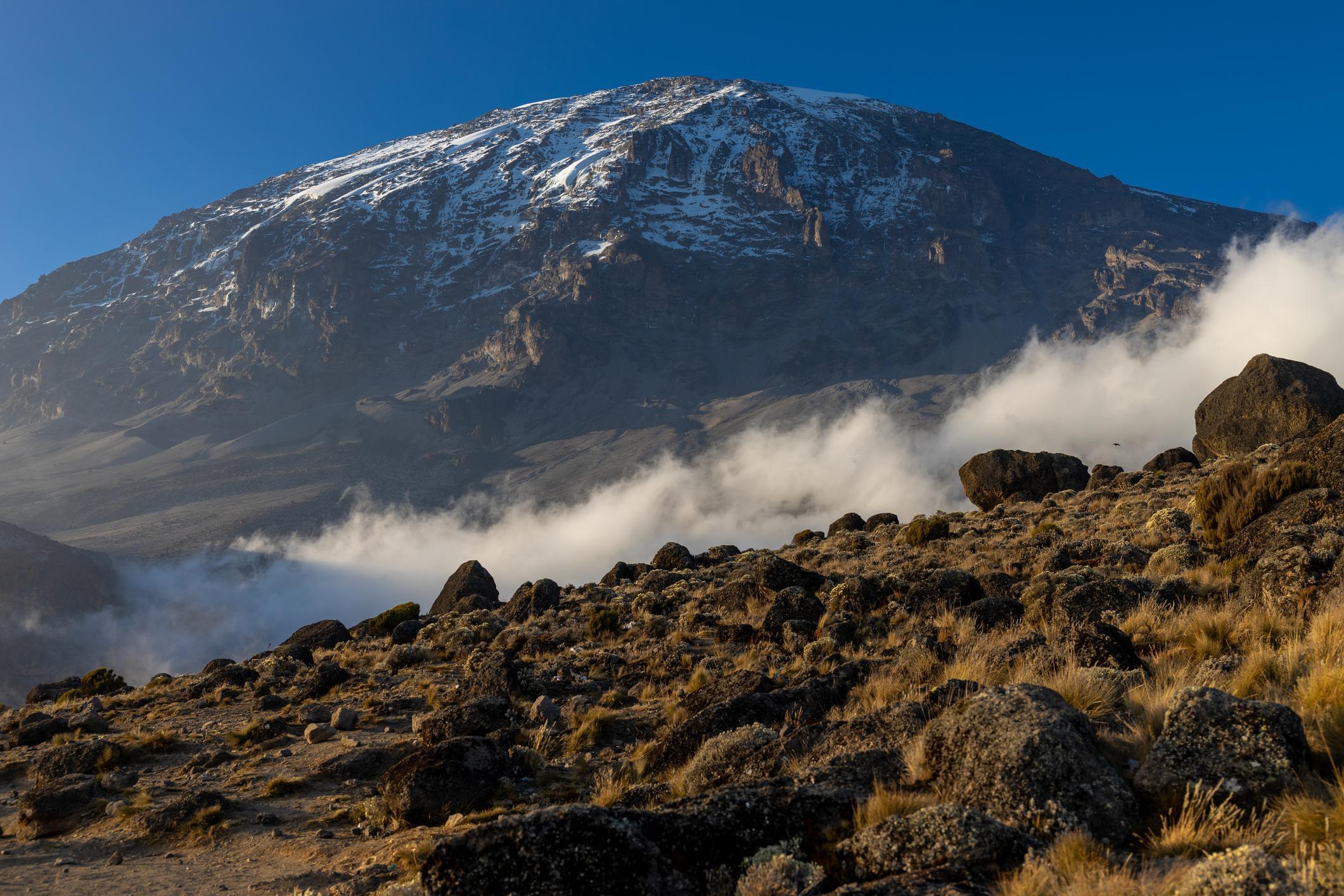
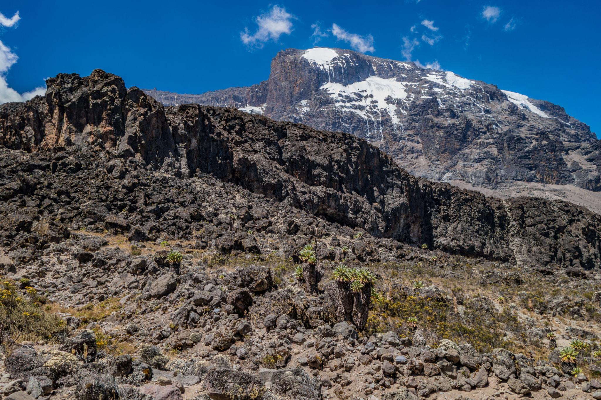
8. Mount Kilimanjaro Trek
Understanding the Trail and Region
Uhuru Peak, the highest point of Mount Kilimanjaro.
Trekkers ascending the Machame Route.
Summit crater zone near Uhuru Peak.
Barranco Wall section on the southern route.
Mount Kilimanjaro is located in northern Tanzania near the Kenyan border. It is the highest mountain in Africa at 5,895 meters. Unlike the Himalayan peaks discussed earlier, Kilimanjaro is a free standing volcanic massif rather than part of a major mountain chain.
The ascent is classified as non technical mountaineering. No rope systems or climbing equipment are required on standard routes. However, the altitude profile is aggressive and summit success depends heavily on acclimatization strategy.
Key geographical characteristics:
- Maximum elevation: 5,895 meters
- Duration: 5 to 9 days depending on route
- Environment: Rainforest, moorland, alpine desert, arctic summit zone
The mountain has several established routes:
- Marangu Route
- Machame Route
- Lemosho Route
- Rongai Route
- Northern Circuit
Longer routes provide better acclimatization and higher summit success rates.
Access and Logistics
Access is via Kilimanjaro International Airport near Arusha or Moshi.
Permit and regulation system:
- Climbing permit required
- Mandatory licensed guide
- Mandatory park rangers
- Organized operator required
- Independent trekking not permitted
Accommodation model depends on route:
- Marangu Route uses hut system
- All other major routes use tent camping
Porters carry group equipment, food, and tents. Client loads are minimal.
Unlike the self supported John Muir Trail, Kilimanjaro operates under a strictly regulated guided model.
Complete Itinerary Breakdown
Example 7 day Machame Route itinerary:
Day 1: Machame Gate to Machame Camp
Day 2: Machame Camp to Shira Camp
Day 3: Shira Camp to Barranco Camp via Lava Tower
Day 4: Barranco Camp to Karanga Camp
Day 5: Karanga Camp to Barafu Camp
Day 6: Summit attempt to Uhuru Peak and descend to Mweka Camp
Day 7: Mweka Camp to Mweka Gate
The summit day involves 6 to 8 hours ascent during early morning hours followed by long descent.
Acclimatization strategy follows climb high and sleep low principle on longer routes.
Physical Preparation and Fitness
Kilimanjaro is physically demanding due to altitude rather than terrain complexity.
Daily walking time ranges from 4 to 8 hours. The summit push is the most demanding segment.
Challenges include:
- Rapid altitude gain
- Cold temperatures near summit
- Fatigue during summit night
Recommended preparation:
- Cardiovascular endurance training
- Multi day hiking preparation
- Exposure to moderate altitude if possible
Altitude sickness is the primary risk factor. Many summit failures result from insufficient acclimatization.
Gear and Equipment Strategy
Essential equipment includes:
- Insulated down jacket
- Four season sleeping bag rated to minus 15°C
- Layered clothing system
- Headlamp for summit night
- Insulated gloves and hat
Because porters carry most equipment, pack weight for climbers is light.
Weather can range from tropical humidity at lower elevations to subzero conditions at summit.
Weather and Objective Dangers
Primary climbing seasons:
- January to March
- June to October
Rainy seasons reduce summit success and trail comfort.
Objective risks include:
- Acute Mountain Sickness
- Hypothermia during summit attempt
- Dehydration
- Gastrointestinal illness
Evacuation is possible via ranger network but depends on altitude and location.
Compared to Everest Base Camp, altitude is higher but overall expedition duration is shorter.
Cost and Operator Selection
Kilimanjaro requires guided participation.
Typical 7 day route cost:
USD 1,800 to 3,500 depending on operator standard
Cost includes:
- Park fees
- Guide and ranger
- Porters
- Food
- Tents
Park fees alone form a large portion of total cost and can exceed USD 800.
Additional expenses:
- Hotel accommodation in Moshi or Arusha: USD 40 to 120 per night
- Food outside trek: USD 15 to 30 per day
- Tips for guides and porters: commonly USD 200 to 350 per climber
Estimated 8 to 10 day total Tanzania trekking budget:
USD 2,200 to 4,000 excluding international flights
Compared to Annapurna or Everest Base Camp, Kilimanjaro has higher mandatory fee structure but shorter overall duration.
Final Professional Assessment
Mount Kilimanjaro presents a unique profile within global trekking comparisons.
Comparison factors:
Altitude exposure:
Higher summit altitude than Everest Base Camp and Annapurna Circuit
Technical requirement:
Non technical
Logistics:
Fully guided mandatory model
Duration:
Shorter expedition length
Risk factor:
Altitude related rather than terrain related
Kilimanjaro is suitable for trekkers seeking a high altitude summit without technical climbing skills but willing to operate within a regulated guided system.
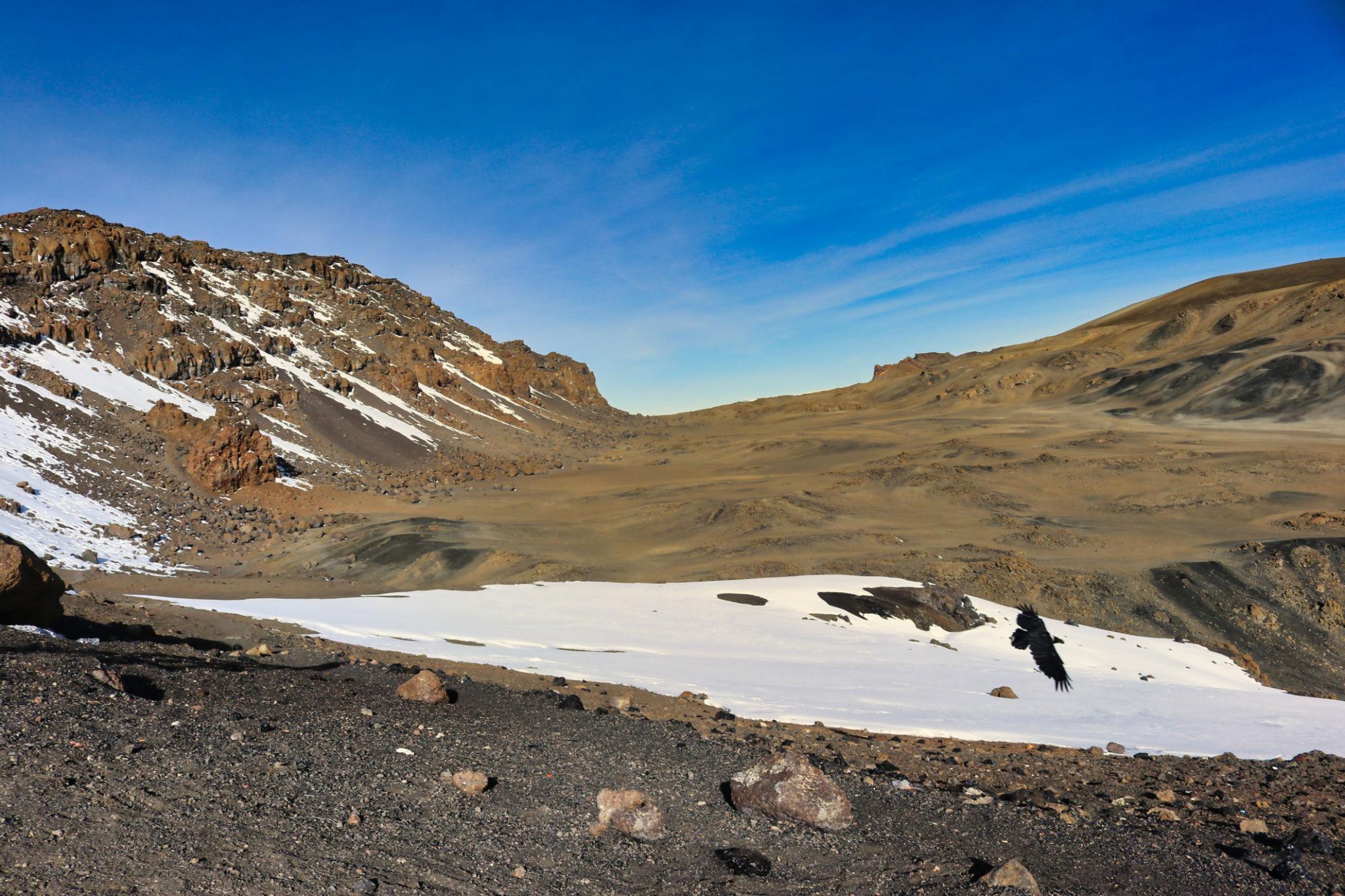
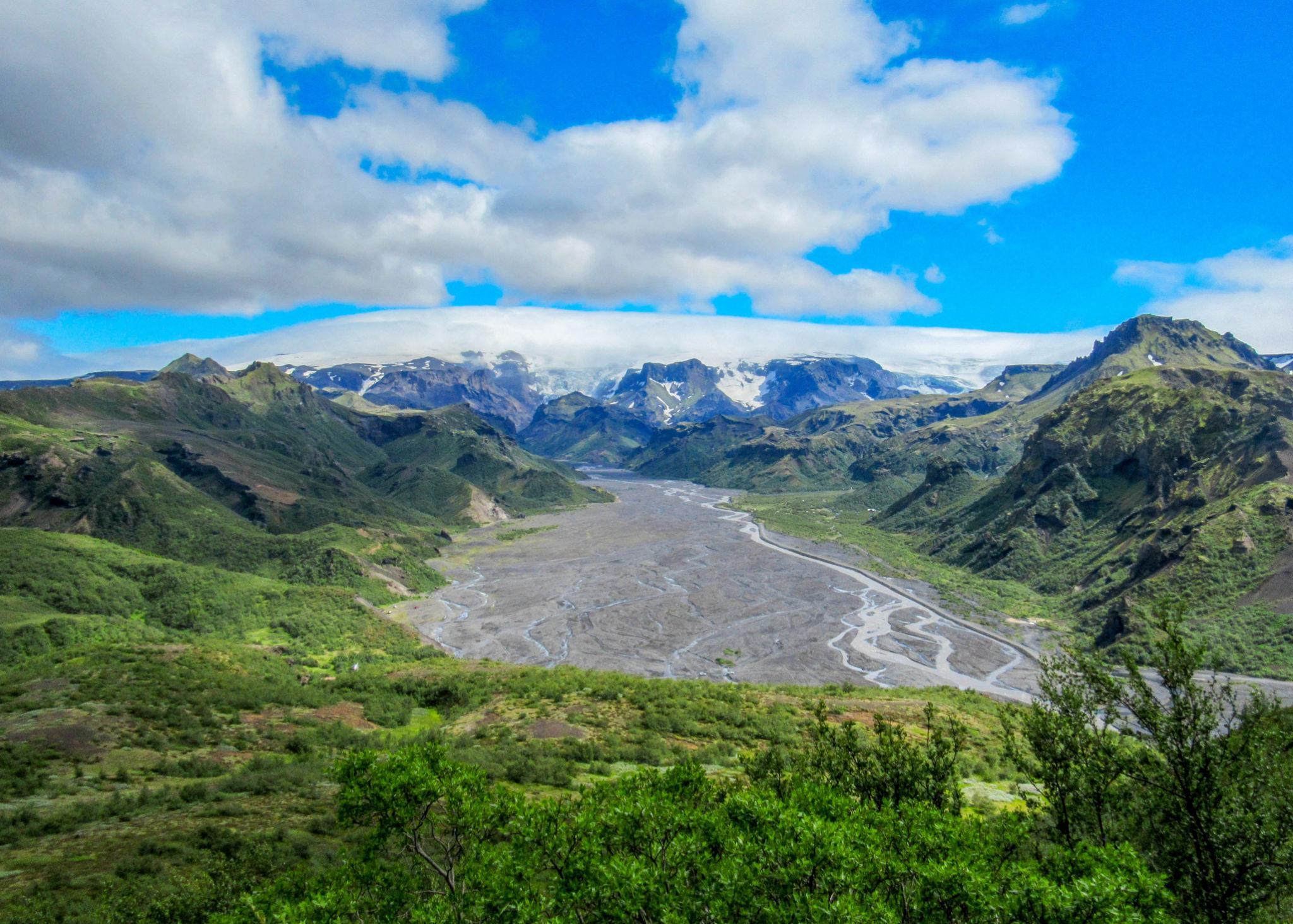
9. Laugavegur Trail
Understanding the Trail and Region
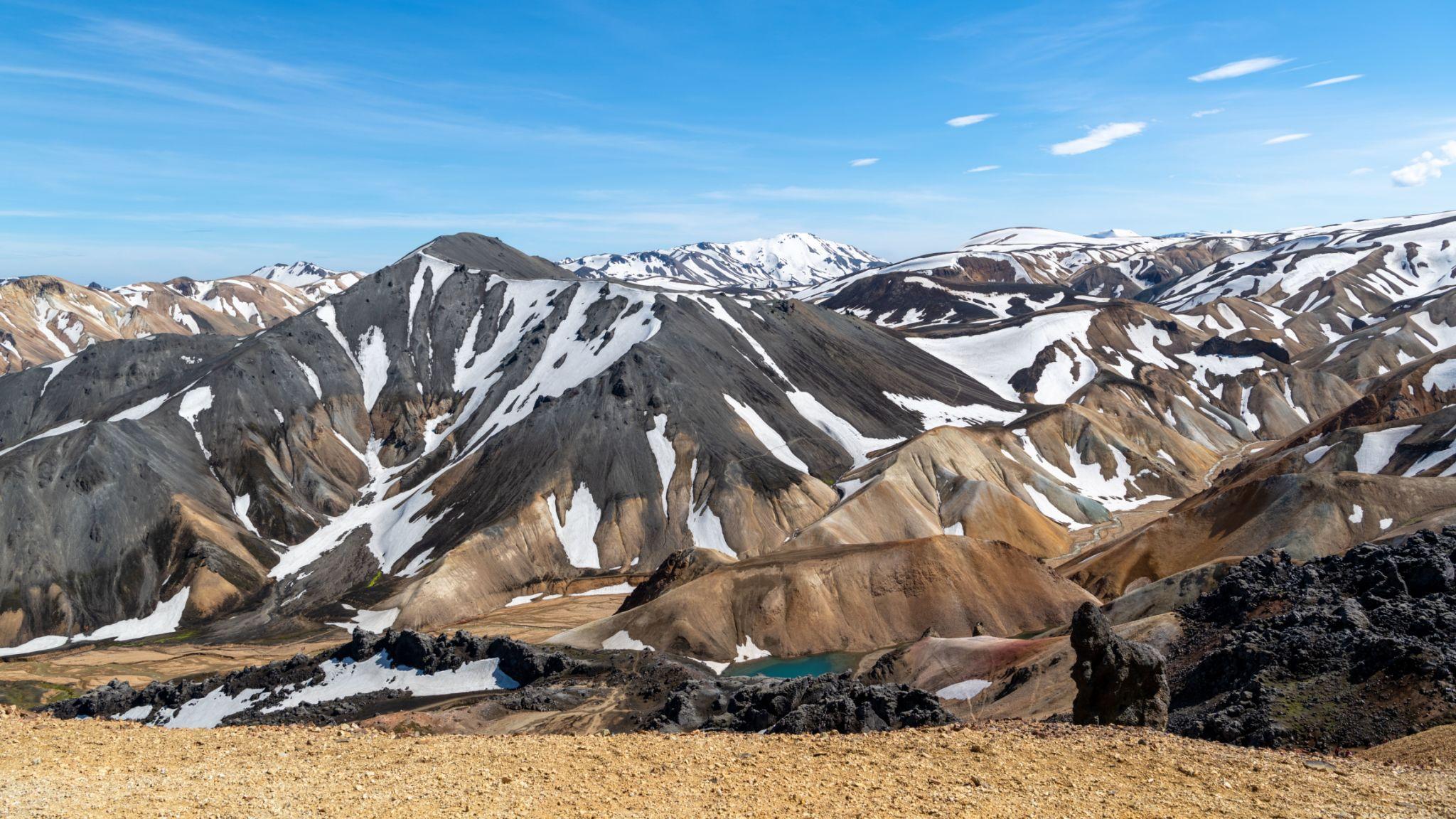
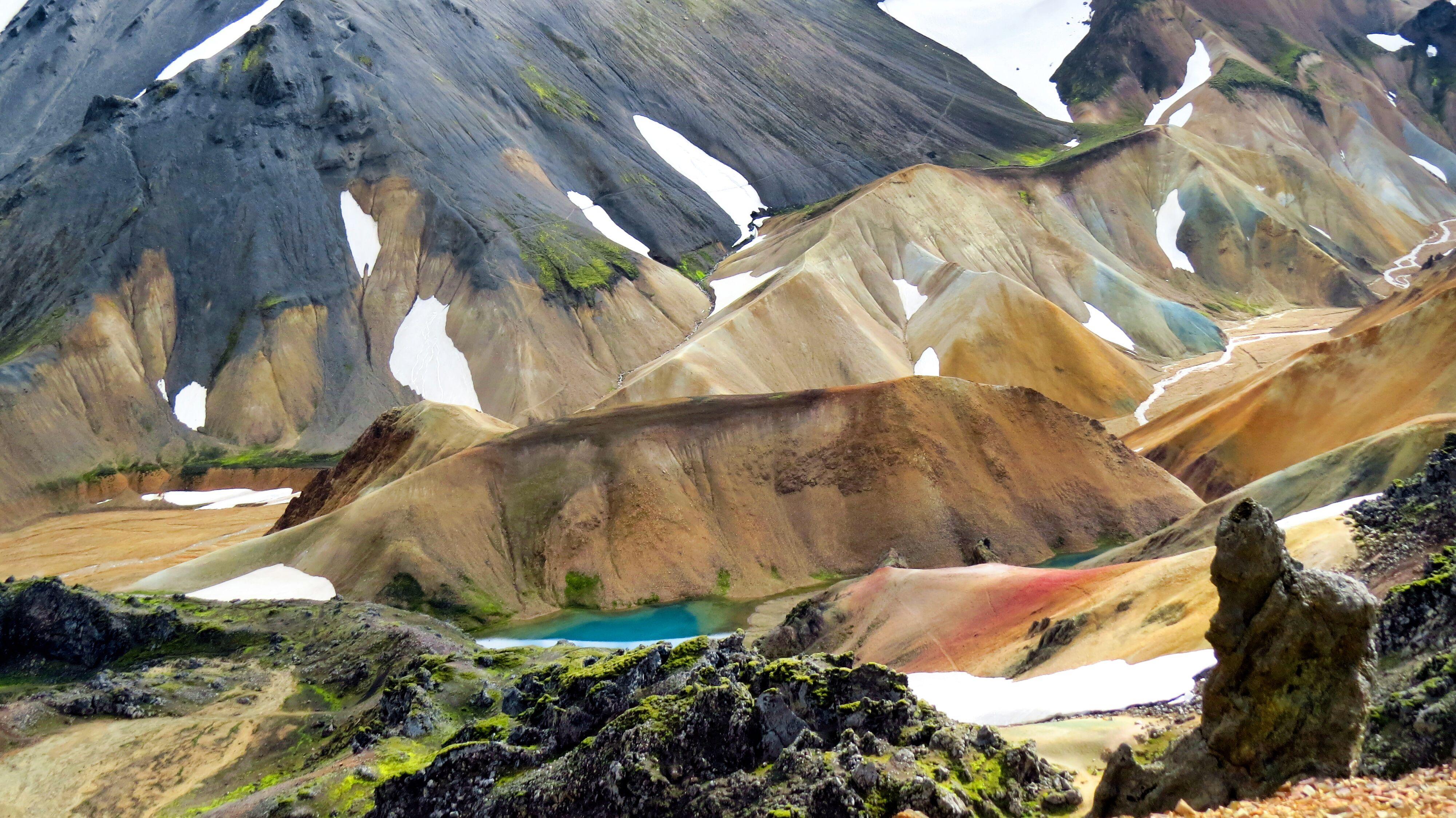
Section of the Laugavegur Trail in Iceland’s highlands.
Rhyolite mountains near Landmannalaugar.
Thorsmork valley at the southern end of the route.
Geothermal area in the Icelandic interior.
The Laugavegur Trail is located in the Icelandic Highlands and connects Landmannalaugar to Thorsmork. The route is approximately 55 kilometers long and is often extended to Skogar, increasing the total distance to around 80 kilometers.
Unlike alpine or Himalayan treks, this route crosses volcanic landscapes shaped by lava fields, geothermal vents, black sand deserts, and glacial rivers.
Key geographical characteristics:
- Maximum elevation: approximately 1,100 meters
- Duration: 3 to 5 days for standard route
- Total distance: 55 kilometers standard, 75 to 80 kilometers with Skogar extension
- Region: Icelandic Highlands
Altitude is not a limiting factor. Terrain exposure and weather variability are the primary challenges.
Access and Logistics
Access begins from Reykjavik with bus transfer to Landmannalaugar.
Permit system:
- No mandatory trekking permit for the trail itself
- Hut reservations required if using mountain huts
- Campsite fees required at designated areas
- No mandatory guide requirement
The route is seasonal. Access roads to Landmannalaugar are open only during summer.
Accommodation options:
- Mountain huts
- Designated campsites
- No permanent hotels along the interior route
Independent trekking is common.
Complete Itinerary Breakdown
A standard 4 day itinerary:
Day 1: Landmannalaugar to Hrafntinnusker
Day 2: Hrafntinnusker to Alftavatn
Day 3: Alftavatn to Emstrur
Day 4: Emstrur to Thorsmork
Optional extension:
Day 5: Thorsmork to Skogar via Fimmvorduhals Pass
Daily walking distance ranges from 12 to 25 kilometers depending on stage.
River crossings are common, especially between Alftavatn and Emstrur.
Physical Preparation and Fitness
The Laugavegur Trail requires moderate endurance.
Challenges include:
- Cold wind exposure
- Frequent rain
- River crossings without bridges
- Unstable volcanic soil
Daily elevation gain is moderate, but weather can increase perceived difficulty.
Recommended preparation:
- Multi day hiking experience
- Conditioning for wet and cold environments
- Practice walking on uneven volcanic terrain
Altitude sickness is not a concern.
Gear and Equipment Strategy
Essential equipment includes:
- Fully waterproof outer shell
- Insulated mid layer
- Waterproof boots
- Trekking poles for river crossings
- Tent resistant to strong wind if camping
Weather protection is the primary gear priority.
Food must be carried for the full duration as there are no resupply points.
Weather and Objective Dangers
Primary trekking season:
- Late June to early September
Outside this period, access is generally not possible due to snow and road closure.
Objective risks include:
- Sudden weather changes
- Hypothermia due to cold wind and rain
- Strong gusts in exposed areas
- High river levels after rain
Compared to Kilimanjaro or Everest Base Camp, the risk is environmental rather than altitude related.
Rescue response is possible but may be delayed due to terrain and weather.
Cost and Operator Selection
Estimated independent 5 to 7 day Iceland trekking budget:
Bus transfer:
USD 60 to 120 round trip
Campsite fees:
USD 15 to 25 per night
Mountain huts:
USD 60 to 100 per night
Food:
USD 20 to 40 per day
Accommodation in Reykjavik:
USD 80 to 200 per night
Estimated total budget:
USD 700 to 1,500 depending on accommodation choice
Guided tour cost:
USD 1,500 to 3,000
Compared to Himalayan treks, Iceland has higher daily living costs but shorter duration.
Final Professional Assessment
The Laugavegur Trail differs substantially from mountain treks in Asia, Africa, and North America.
Comparison factors:
Altitude exposure:
Minimal
Terrain type:
Volcanic and geothermal
Infrastructure:
Limited but organized seasonal system
Weather:
Primary risk factor
Duration:
Shorter compared to most global high profile treks
The Laugavegur Trail is suitable for trekkers seeking unique geological landscapes and moderate duration hiking without altitude exposure.
10. Everest Three Passes Trek
Understanding the Trail and Region
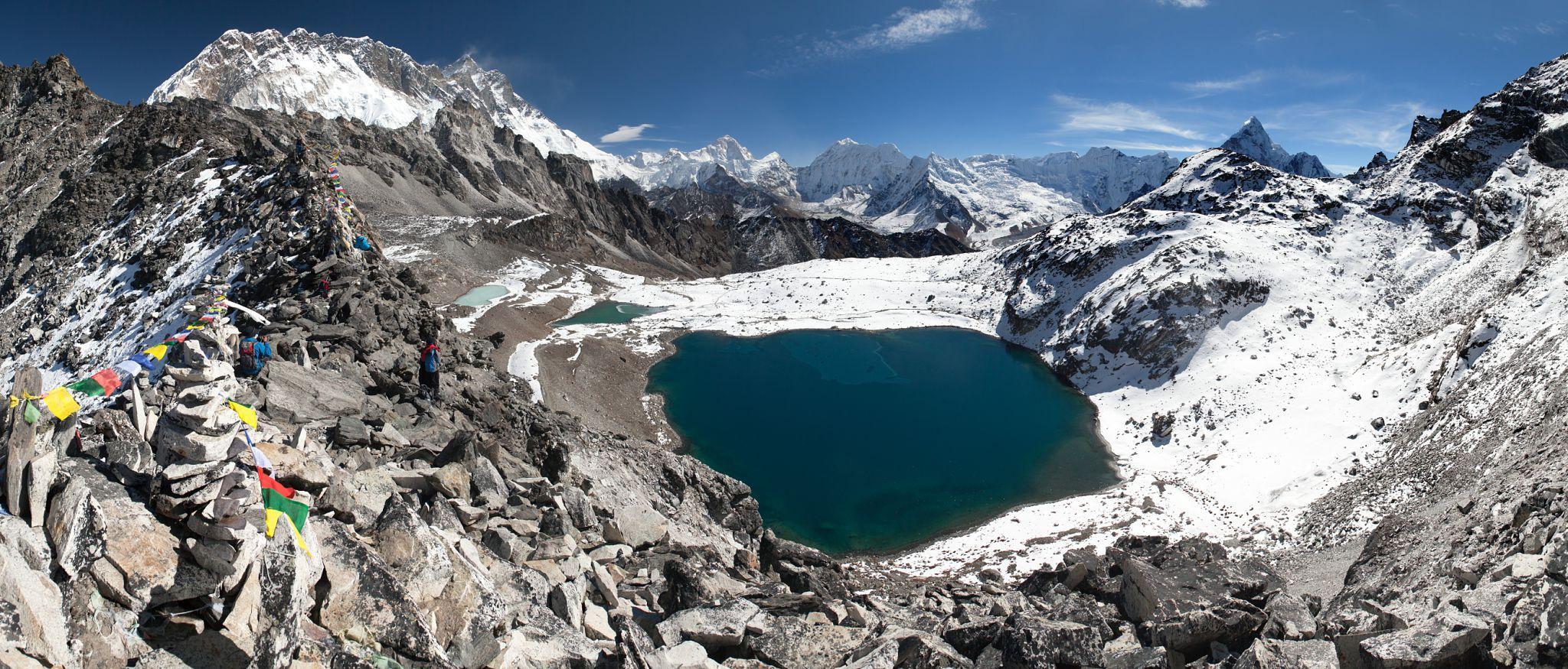
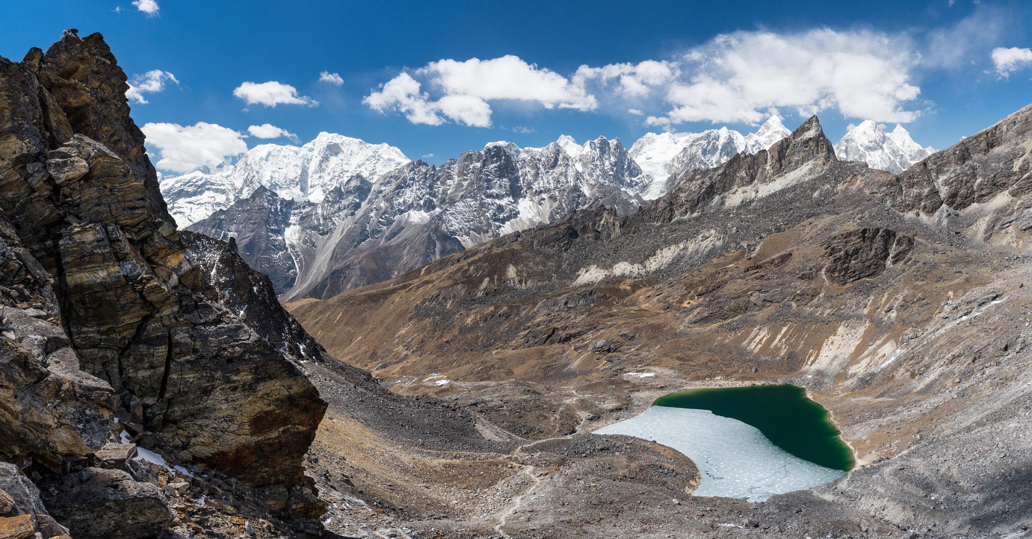
Cho La Pass on the Everest Three Passes route.
Kongma La Pass, one of the highest crossings in the Khumbu.
View from Renjo La Pass overlooking the Everest region.
Gokyo Lakes along the western section of the circuit.
The Everest Three Passes Trek is an extended high altitude circuit in Nepal’s Khumbu region. It connects the standard Everest Base Camp route with three major high passes: Kongma La, Cho La, and Renjo La.
This trek is more demanding than the standard Everest Base Camp itinerary. It includes multiple crossings above 5,300 meters and links the Gokyo Valley with the Everest Base Camp corridor.
Key geographical characteristics:
- Maximum elevation: approximately 5,535 meters at Kongma La
- Duration: 18 to 21 days
- Total distance: approximately 160 to 170 kilometers
- Region: Sagarmatha National Park, Nepal
Unlike the standard Everest Base Camp route, this trek forms a loop rather than a return path along the same valley.
Access and Logistics
Access follows the same entry point as Everest Base Camp:
- Flight from Kathmandu to Lukla
Permit requirements:
- Sagarmatha National Park permit
- Khumbu local permit
Guides are recommended due to complex route navigation and glacier sections, although independent trekking may be allowed depending on Nepal’s current regulations.
Accommodation is in teahouses throughout most of the route. However, some pass days involve long stretches without facilities.
Because this is a circular route, logistical planning must account for food availability and acclimatization timing.
Complete Itinerary Breakdown
A standard 20 day itinerary may include:
Days 1 to 3: Lukla to Namche Bazaar
Day 4: Acclimatization in Namche
Day 5 to 6: Namche to Chukhung
Day 7: Cross Kongma La Pass
Day 8: Lobuche and Everest Base Camp
Day 9: Kala Patthar ascent
Day 10: Cross Cho La Pass into Gokyo Valley
Day 11: Gokyo Lakes exploration
Day 12: Cross Renjo La Pass
Day 13 to 18: Return to Namche and Lukla
The sequence may vary depending on operator and acclimatization strategy.
All three passes require stable weather and early departure.
Physical Preparation and Fitness
The Everest Three Passes Trek requires a higher fitness level than standard Everest Base Camp.
Challenges include:
- Multiple high altitude pass crossings
- Glacier travel sections near Cho La
- Long daily distances
- Repeated elevation gain above 5,000 meters
Recommended preparation:
- Prior high altitude trekking experience
- Endurance training for multi week effort
- Strength conditioning for steep ascents
Acclimatization must be carefully structured. The risk of Acute Mountain Sickness increases with repeated high pass exposure.
Gear and Equipment Strategy
Essential equipment includes:
- Down jacket suitable for subzero temperatures
- Sleeping bag rated to minus 15°C
- Microspikes for icy pass sections
- Trekking poles
- Layered clothing system
Weather windows are important for pass crossings. Snow accumulation can block sections temporarily.
Weather and Objective Dangers
Primary trekking seasons:
- March to May
- September to November
Objective risks include:
- Snow and ice on high passes
- Rockfall in steep sections
- Altitude related illness
- Sudden weather changes
Compared to standard Everest Base Camp, this route has higher exposure to unstable conditions due to repeated high elevation crossings.
Helicopter evacuation is possible but weather dependent.
Cost and Operator Selection
Estimated independent 20 day trekking budget:
Accommodation:
USD 10 to 30 per night depending on altitude
Food:
USD 25 to 40 per day
Permits:
Approximately USD 50
Flight to Lukla:
USD 180 to 220 one way
Estimated total independent cost:
USD 1,300 to 1,900 excluding international flights
Guided trek cost:
USD 2,000 to 4,000
Porter cost:
USD 20 to 30 per day
Cost is higher than standard Everest Base Camp due to longer duration and additional acclimatization days.
Final Comparative Assessment of All Ten Treks
The ten treks analyzed represent different models of mountain travel.
High altitude Himalayan and Karakoram model:
- Everest Base Camp
- Annapurna Circuit
- Everest Three Passes
- K2 Base Camp
These emphasize altitude management and remote terrain.
Regulated guided summit model:
- Mount Kilimanjaro
Self supported wilderness model:
- John Muir Trail
European alpine infrastructure model:
- Tour du Mont Blanc
Strict quota cultural heritage model:
- Inca Trail
Weather driven subarctic model:
- Laugavegur Trail
Park managed scenic trekking model:
- Torres del Paine W Trek
In terms of maximum altitude exposure:
Kilimanjaro and Everest Three Passes rank highest.
In terms of remoteness:
K2 Base Camp ranks highest.
In terms of infrastructure support:
Tour du Mont Blanc ranks highest.
In terms of cultural heritage density:
Inca Trail ranks highest.
In terms of wilderness self sufficiency:
John Muir Trail ranks highest.
Each trek represents a different operational structure, cost model, and risk profile. Selection should depend on altitude tolerance, desired duration, logistical preference, and environmental conditions rather than popularity alone.
This concludes the complete comparative analysis of the world’s top ten trekking routes under structured evaluation criteria.
The information in this guide is intended for general planning purposes only. Trail conditions, permit requirements, costs, and access routes can change due to weather, seasonal closures, or local regulations. The itinerary provided is a suggested framework and may need to be adjusted based on your fitness level, acclimatization, and conditions on the ground. Always consult a local guide or trekking agency before departing and verify current conditions with authorities or affiliated company.
![K2 Base Camp Trek: Ultimate Guide k2 Trek 2026 [UPDATED]](https://karakoramdiaries.com/storage/ultimate-guide-to-k2-base-camp-trek-full-document-150x150.png)